
Čunovo
Čunovo | ||
|---|---|---|
Borough | ||
 Local baroque church, built in the 18th century | ||
|
Car plate BA, BL, BT | | |
| Website | www | |
 | ||
Čunovo (
History
Čunovo was first mentioned as a village in 1232 under the name Chun. In the 16th century, Croats fleeing from the Ottomans in the south settled in the village. Until 1947, Čunovo, along with Jarovce and Rusovce, was part of Hungary and was annexed that year with the two others to Czechoslovakia, to enable construction of the Port of Bratislava. It became an official part of Bratislava on January 1, 1972. Some of the inhabitants still use the Croatian language and preserve folk traditions.
Tourism
In 2000, a new art museum called Danubiana was opened. Dunajské luhy Protected Landscape Area comprises some parts of the borough. It is home to Čunovo Water Sports Centre an artificial whitewater facility built in 1996 which attracts paddlers from around the world.
Transport
Čunovo is close to the international
Since 21 December 2007, all border controls have been lifted as Hungary and Slovakia became part of the Schengen Area.
Demographics
According to the 2011
Gallery
-
 The Danubian Meulensteen Art Museum, near Čunovo.
 -
 Tripoint with Austria-Hungary-Slovakia near Čunovo.
 -
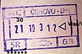 Passport enty stamp via road from Čunovo.


References
- ^ Obce Narodnost Archived 14 November 2012 at the Wayback Machine
External links
| International | |
|---|---|
| National | |