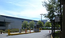
133rd Street (Manhattan)
Lenox Avenue/Malcolm X Boulevard (Manhattan)Locust Avenue (Bronx) |
133rd Street is a street in
History
The street has historical significance during the Prohibition era when there were many speakeasies operating on the street and it was known as "Swing Street".[3][4] The street also gained a reputation as "Jungle Alley" because of "inter-racial mingling" on the street.[2][4]
During the
The street began to lose its attraction following the repeal of Prohibition in 1933, and the
Landmarks

Numerous mills sprang up along the street on the eastern side but many of the former derelict buildings have been razed to the ground and new buildings erected. The
See also
References
- ^ Google (December 6, 2013). "133rd Street (Manhattan)" (Map). Google Maps. Google. Retrieved December 6, 2013.
- ^ ISBN 978-0-8147-2763-8.
- ISBN 978-1-4525-7377-9.
- ^ a b c "Saxman Finds Place For Jazz History". New York City News Service. Archived from the original on December 20, 2021. Retrieved December 6, 2013.
- ISBN 978-1-118-26854-4.
- ^ Garber, Eric. "A Spectacle in Color: The Lesbian and Gay Subculture of Jazz Age Harlem". University of Virginia. Archived from the original on April 17, 2011. Retrieved November 13, 2010.
- ISBN 978-1-4411-0789-3.
- ISBN 978-0-8108-8351-2.
- ISBN 978-0-8147-2789-8.
- ISBN 978-1-60750-694-2.
- ISBN 978-1-59670-206-6.
