
1939 Chillán earthquake
This article needs additional citations for verification. (January 2011) |
 Chillán | |
| UTC time | 1939-01-25 03:32:14 |
|---|---|
| ISC event | 901785 |
| USGS-ANSS | ComCat |
| Local date | January 24, 1939 |
| Local time | 23:32 |
| Magnitude | 8.3 Ms[1] |
| Depth | 60;[1] 80–100[2] km |
| Epicenter | 36°12′00″S 72°12′00″W / 36.20000°S 72.20000°W[1] |
| Areas affected | Chillán, Chile |
| Max. intensity | MMI X (Extreme)[3] |
| Casualties | ~28,000 |
The 1939 Chillán earthquake occurred in south-central
Earthquake
At 23:32, the earth began to shake strongly underneath Chillán, destroying more than half of it, including around 3,500 homes and the recently constructed Casa Rabié which then was in the city. Aftershocks followed although they were less intense, which left the city completely destroyed. Until then, the Cathedral of Chillán had been one of the principal buildings of the area, but it was completely destroyed. The church that was built to replace it was designed specifically to withstand future earthquakes.
At 23:35, Concepción was violently hit. Almost all of the buildings (around 95% of the houses) were completely destroyed. There was a show going on in the theater where the large chandelier started to swing. The people inside were terrified, so they fled down the stairs, but the spiral staircase cracked, causing many people to fall into the gap. In the intersection of O’Higgins and Aníbal Pinto avenue, the bodies accumulated, which were later brought to the cemetery, and interred in large strips of land.
The electricity was cut in all of the city and tens of fires were reported in various points of the city. The
Geology
The community of Chillán is situated in the continental territory of Chile. The city of Chillán was built on a tectonic structure at the end of the
Response

At the start of February 1939, Major
In the aftermath, the Chilean government created CORFO (Spanish acronym for Production Development Corporation) to help in the reconstruction of the country and to industrialize the country, mechanize the agriculture and help mining to develop.[8][9]
Gallery
-
 Concepción
 -
 "El Mirador Alemán", in Concepción
 -
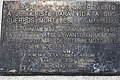 A memorial placard next to the cathedral in Chillán commemorates the victims 50 years later


See also
References
- ^ a b c d Servicio Sismológico Universidad de Chile, "Sismos importantes y/o destructivos desde (1570 – a la fecha) – Important and/or destructive earthquakes (1570–present) (in Spanish)
- ISSN 0895-9811.
- doi:10.7289/V5TD9V7K
- USGS Earthquake.usgs.gov. 30 November 2012. Archived from the originalon 14 January 2013. Retrieved 9 January 2013.
- ^ "The Largest Earthquake in the World – Articles". U.S. Geological Survey. Archived from the original on 7 January 2007. Retrieved 9 January 2012.
- ^ "Emergency & Disasters Data Base". Centre for Research on the Epidemiology of Disasters (CRED). Archived from the original on 21 June 2007. Retrieved 9 January 2012. (Exact data location missing from URL)
- ^ Special to the New York Times (February 15, 1939). "U.S. Flier Is Decorated for His Aid to Chile; Major Haynes Took Medicines to Quake Area". New York Times. Retrieved 6 June 2023.
- ^ "Ley que crea la CORFO", Memoria histórica cámara de diputados (in Spanish), retrieved June 30, 2013
- ^ "Cordporación de Fomento a la Producción (1939–1952)", Memoria chilena (in Spanish), retrieved June 30, 2013
Further reading
- Dauer, Quinn (2012). Natural Disasters and Comparative State-Formation and Nation-Building: Earthquakes in Argentina and Chile (1822–1939) (PhD). FIU Electronic Theses and Dissertations. .
External links
- The International Seismological Centre has a bibliography and/or authoritative data for this event.