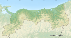
2000 Tottori earthquake
 | |
| UTC time | 2000-10-06 04:30:20 |
|---|---|
| ISC event | 1839998 |
| USGS-ANSS | ComCat |
| Local date | October 6, 2000 |
| Local time | 13:30:20 JST |
| Magnitude | 6.7 Mw [1] |
| Depth | 10 km (6.2 mi) [1] |
| Epicenter | 35°16′N 133°19′E / 35.27°N 133.31°E [1] |
| Type | Strike-slip[2] |
| Areas affected | Japan |
| Total damage | $150 million (US) [2] |
| Max. intensity | MMI VIII (Severe)[3] JMA 6+ |
| Landslides | Yes [2] |
| Casualties | 130-182 injuries [2][4] |
The 2000 Tottori earthquake (
. About $150 million in damage was caused (with 104 buildings destroyed) and between 130-182 people were injured.See also
References
- ^ a b c ISC (2015), ISC-GEM Global Instrumental Earthquake Catalogue (1900–2009), Version 2.0, International Seismological Centre
- ^ a b c d USGS (September 4, 2009), PAGER-CAT Earthquake Catalog, Version 2008_06.1, United States Geological Survey
- ^ USGS. "M6.7 - western Honshu, Japan". United States Geological Survey.
- doi:10.1029/2004JB003194.)
{{cite journal}}: CS1 maint: multiple names: authors list (link
Further reading
- Ohmi, S.; Watanabe, K.; Shibutani, T.; Hirano, N.; Nakao, S. (2002), "The 2000 Western Tottori Earthquake—Seismic activity revealed by the regional seismic networks—", Earth, Planets and Space, 54 (8): 819–830,
- Umeda, K.; Asamori, K.; Negi, T.; Kusano, T. (2011), "A large intraplate earthquake triggered by latent magmatism", Journal of Geophysical Research, 116 (B1): B01207,
External links
- The International Seismological Centre has a bibliography and/or authoritative data for this event.

