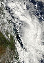
2007–08 Australian region cyclone season
| 2007–08 Australian region cyclone season | |
|---|---|
 Season summary map | |
| Seasonal boundaries | |
| First system formed | 29 July 2007 |
| Last system dissipated | 26 April 2008 |
| Strongest storm | |
| Name | Pancho |
| • Maximum winds | 165 km/h (105 mph) (10-minute sustained) |
| • Lowest pressure | 938 hPa (mbar) |
| Seasonal statistics | |
| Tropical lows | 14 |
| Tropical cyclones | 10 |
| Severe tropical cyclones | 3 |
| Total fatalities | 149 |
| Total damage | $93.8 million (2008 USD) |
| Related articles | |
The 2007–08 Australian region cyclone season was a slightly below-average
Tropical Cyclone Lee also formed on 13 November and was named by
Tropical Cyclone Helen was the first tropical cyclone to form in 2008, in the Southern Hemisphere, forming in
In April 2008, Tropical Cyclones Rosie and Durga were the first tropical depressions to be monitored within
Seasonal summary

Systems
Tropical Cyclone 01U
| Category 1 tropical cyclone (Australian scale) | |
| Tropical storm (SSHWS) | |
| Duration | 29 July (entered basin) – 1 August |
|---|---|
| Peak intensity | 75 km/h (45 mph) (10-min); 992 hPa (mbar) |
On 29 July, an area of low pressure, close to the edge of RSMC La Reunion's Area of responsibility, was designated as Tropical Disturbance 01R. However, this number was withdrawn in RSMC La Reunion's post–storm analysis.
During post–storm analysis, The Bureau of Meteorology upgraded the tropical low to a tropical cyclone in its post-storm analysis, with maximum 10-min sustained winds of 75 km/h (47 mph), based on QuikSCAT observations. The cyclone was estimated to have reached tropical cyclone intensity from 29 to 30 July.[2]
The tropical cyclone is the second on record to exist in the Western Australian region in July, the other being Cyclone Lindsay in 1996.[2]
Tropical Cyclone Lee–Ariel
| Category 2 tropical cyclone (Australian scale) | |
| Tropical storm (SSHWS) | |
| Duration | 11 November – 15 November (Exited basin) |
|---|---|
| Peak intensity | 95 km/h (60 mph) (10-min); 984 hPa (mbar) |
On 13 November, the
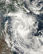
Severe Tropical Cyclone Guba
| Category 3 severe tropical cyclone (Australian scale) | |
| Category 1 tropical cyclone (SSHWS) | |
| Duration | 13 November – 20 November |
|---|---|
| Peak intensity | 120 km/h (75 mph) (10-min); 971 hPa (mbar) |
The
Flooding in Papua New Guinea led to at least 150 deaths.
Tropical Low 04U (Dama)
| Tropical low (Australian scale) | |
| Duration | 21 December – 22 December |
|---|---|
| Peak intensity | 55 km/h (35 mph) (10-min); 998 hPa (mbar) |
On 18 December, a Tropical Depression in the south-west Indian Ocean was named Moderate Tropical Storm Dama, monitored by
Tropical Cyclone Melanie
| Category 2 tropical cyclone (Australian scale) | |
| Tropical storm (SSHWS) | |
| Duration | 28 December – 2 January |
|---|---|
| Peak intensity | 110 km/h (70 mph) (10-min); 962 hPa (mbar) |
On 27 December, the
Tropical Cyclone Helen
| Category 2 tropical cyclone (Australian scale) | |
| Tropical storm (SSHWS) | |
| Duration | 28 December – 6 January |
|---|---|
| Peak intensity | 95 km/h (60 mph) (10-min); 975 hPa (mbar) |
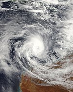
In late December a tropical low formed over the Top End which was slow moving in the eastern Top End on 29 December, which began moving west during 1 January at the base of the Top End. By the evening of 2 January the Tropical low moved into the
The strongest wind gust recorded was at Charles Point Lighthouse with 120 kilometres an hour recorded during the Tropical Cyclone with Darwin Airport recording 102 kilometres an hour around 2 am ACST making it the first time since April 1985 for Darwin to experience Category 1 or more since Cyclone Gretel passed Darwin on 12 April 1985.[25][34][35] Damages from the storm amounted to an estimated A$21.5 million (US$15 million).[36]
Tropical Low 07U
| Tropical low (Australian scale) | |
| Duration | 31 December – 2 January |
|---|---|
| Peak intensity | 55 km/h (35 mph) (10-min); 994 hPa (mbar) |
On 31 December, the
Tropical Low (17S)
| Tropical low (Australian scale) | |
| Tropical storm (SSHWS) | |
| Duration | 4 February – 10 February |
|---|---|
| Peak intensity | 55 km/h (35 mph) (10-min); 990 hPa (mbar) |
On 4 February, the
Severe Tropical Cyclone Nicholas
| Category 3 severe tropical cyclone (Australian scale) | |
| Category 1 tropical cyclone (SSHWS) | |
| Duration | 10 February – 20 February |
|---|---|
| Peak intensity | 150 km/h (90 mph) (10-min); 948 hPa (mbar) |
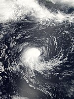
On 10 February, the
Tropical Cyclone Ophelia
| Category 2 tropical cyclone (Australian scale) | |
| Category 1 tropical cyclone (SSHWS) | |
| Duration | 27 February – 7 March |
|---|---|
| Peak intensity | 100 km/h (65 mph) (10-min); 985 hPa (mbar) |
On 27 February 2008 the
Tropical Low 20P
| Tropical low (Australian scale) | |
| Tropical storm (SSHWS) | |
| Duration | 29 February – 29 February |
|---|---|
| Peak intensity | 55 km/h (35 mph) (10-min); 999 hPa (mbar) |
Early on 28 February, Tropical Cyclone Warning Center Brisbane identified a Tropical low which was located about 100 nmi (190 km) north-east of
Severe Tropical Cyclone Pancho
| Category 4 severe tropical cyclone (Australian scale) | |
| Category 3 tropical cyclone (SSHWS) | |
| Duration | 25 March – 29 March |
|---|---|
| Peak intensity | 175 km/h (110 mph) (10-min); 934 hPa (mbar) |
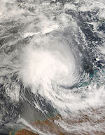
On 23 March a Tropical low formed south-west of Christmas Island.[62] The next day TCWC Perth, began issuing shipping warnings on the Tropical low.[63] Later that day the JTWC issued a Tropical Cyclone Formation Alert, on the tropical low. They then started issuing warnings that day designating it as Tropical Cyclone 26S.[64][65] The low then intensified into a Tropical Cyclone and was named Pancho by TCWC Perth early on 25 March.[66]
The next day, Pancho became a severe tropical cyclone on the Australian scale,[67] with Pancho rapidly intensified into a minimal Category four cyclone on the Australian scale on 27 March. However, during the 28th, Tropical Cyclone Pancho entered an area of increasing vertical wind shear and cooler sea surface temperatures and within a few hours it was downgraded back to a Category 2 cyclone on the Australian scale.[68] The cyclone then weakened back to a tropical low about 300 kilometres south-west of the Western Australian Gascoyne coast with gale-force winds remaining south of the low. with both TCWC Perth and the JTWC issuing their final warnings on Pancho that day.[69][70]
The remnants of Pancho produced much needed rains over the drought-stricken areas of SW Western Australia. Mandurah, Garden Island, and Rottnest recorded the highest rainfall totals during the event at 56.4 mm (2.22 in), 49.8 and 49.4 mm (1.96 and 1.94 in) respectively.[71] The heavy rains caused some flooding along several roads, forcing officials to temporarily shut them down. Large swells from the storm also washed rocks onto the roads near Exmouth.[72]
Tropical Cyclone Rosie
| Category 2 tropical cyclone (Australian scale) | |
| Tropical storm (SSHWS) | |
| Duration | 20 April – 24 April |
|---|---|
| Peak intensity | 95 km/h (60 mph) (10-min); 988 hPa (mbar) |
Late on 20 April, the JTWC, TCWC Jakarta and TCWC Perth all started to monitor a tropical low that had developed within the monsoon trough, about 1,030 km (640 mi), to the south-west of Jakarta, Indonesia.[73][74] During 21 April, convection surrounding the system rapidly developed in generally favourable conditions and organized around a low level circulation centre.[75] TCWC Jakarta and TCWC Perth then reported at 1500 UTC (2300 WST), that the low had developed into a category 1 tropical cyclone, before six hours later the JTWC followed suit and assigned it the designation 28S.[75][76] However the cyclone was not named as Rosie, until early the next day after it had moved out of TCWC Jakarta's area of responsibility and moved into Perth's.[75] As Rosie moved into TCWC Perth's area of responsibility, both TCWC Perth and the JTWC reported that the system had peaked with windspeeds of 95 km/h (59 mph), which meant that it was a category two tropical cyclone on the Australian scale and equivalent to a tropical storm on the SSHS.[74][75]
After it had been named, Rosie weakened into a category one tropical cyclone with the low level circulation centre became devoid of convection as it moved towards the south-southeast towards Christmas Island.
Tropical Cyclone Durga
| Category 2 tropical cyclone (Australian scale) | |
| Tropical storm (SSHWS) | |
| Duration | 20 April – 26 April |
|---|---|
| Peak intensity | 95 km/h (60 mph) (10-min); 984 hPa (mbar) |
On 20 April, TCWC Perth and TCWC Jakarta both started to monitor a Tropical Low that was located within the South-West Indian Ocean about 2,847 km (1,769 mi) to the west of Jakarta, Indonesia. The low had developed within a monsoon trough of low pressure, however a moderate amount of northerly wind shear located over the system was hampering any further development of the system. Over the next few days as the low moved towards the southeast, the wind shear gradually decreased, which meant that convection was able to wrap around the system's low level circulation centre and help it develop into a category one tropical cyclone on 22 April. As the system developed into a category one tropical cyclone, it moved into TCWC Jakarta's area of responsibility who named it Durga.
Storm names
At the start of the Tropical Cyclone Year in July, tropical lows that developed into tropical cyclones were named by one of the four tropical cyclone warning centres, which each had their own list of names.
Lists
TCWC Perth
- Lee
- Melanie
- Nicholas
- Ophelia
- Pancho
- Rosie
TCWC Darwin
- Helen
TCWC Jakarta
- Durga
TCWC Port Moresby
- Guba
Season effects
| Name | Dates | Peak intensity | Areas affected | Damage (USD) |
Deaths | Refs | |||
|---|---|---|---|---|---|---|---|---|---|
| Category | Wind speed | Pressure | |||||||
| 01U | 27–31 July | Category 1 tropical cyclone | 75 km/h (45 mph) | 992 hPa (29.29 inHg) | None | None | None | ||
| Lee-Ariel | 11 - 15 November 2007 | Category 2 tropical cyclone | 95 km/h (60 mph) | 984 hPa (29.06 inHg) | None | None | None | [82] | |
| Guba | 13–19 November | Category 3 tropical cyclone | 140 km/h (87 mph) | 970 hPa (28.64 inHg) | Papua New Guinea, Queensland | $76.7 million | $71.4 million | 149 | |
| 04U (Dama) | 21–22 December | Tropical Low | 55 km/h (34 mph) | 998 hPa (29.47 inHg) | None | None | None | None | |
| Melanie | 28 December–2 January | Category 2 tropical cyclone | 110 km/h (70 mph) | 962 hPa (28.41 inHg) | None | None | None | ||
Helen |
31 December - 7 January | Category 2 tropical cyclone | 95 km/h (60 mph) | 975 hPa (28.79 inHg) | Northern Australia | $22.4 million | None | ||
| 07U | 31 December- 2 January | Tropical Low | 55 km/h (34 mph) | 994 hPa (29.35 inHg) | None | None | None | ||
| Low (17S) | 2–10 February | Tropical Low | 55 km/h (34 mph) | 990 hPa (29.23 inHg) | None | None | None | ||
| Nicholas | 10–20 February | Category 3 tropical cyclone | 130 km/h (81 mph) | 956 hPa (28.23 inHg) | Western Australia | None | None | None | |
| Ophelia | 29 February - 7 March 2008 | Category 2 tropical cyclone | 100 km/h (65 mph) | 985 hPa (29.09 inHg) | Northern Territory, Western Australia | None | None | [83] | |
| 20P | 29 February | Tropical Low | 55 km/h (34 mph) | 999 hPa (29.5 inHg) | None | None | None | ||
| Pancho | 25–29 March | Category 4 tropical cyclone | 165 km/h (103 mph) | 938 hPa (27.70 inHg) | Christmas Island, Western Australia | None | None | ||
| Rosie | 20 - 24 April 2008 | Category 2 tropical cyclone | 95 km/h (60 mph) | 988 hPa (29.18 inHg) | Christmas Island | Unknown | None | [84] | |
| Durga | 20 - 26 April 2008 | Category 2 tropical cyclone | 95 km/h (60 mph) | 988 hPa (29.18 inHg) | None | None | None | [85] | |
| Season aggregates | |||||||||
| 12 | 27 July – 24 April | 175 km/h (109 mph) | 934 hPa (27.58 inHg) | ||||||
See also
- Tropical cyclones in 2007 and 2008
- Atlantic hurricane seasons: 2007, 2008
- Pacific hurricane seasons: 2007, 2008
- Pacific typhoon seasons: 2007, 2008
- North Indian Ocean cyclone seasons: 2007, 2008
References
- ^ "Hurricane Season 2008:Tropical Cyclone Helen (Indian)". NASA. Retrieved 20 August 2008.
- ^ a b c d e "Monthly Global Tropical Cyclone Summary". Gary Padgett. Retrieved 4 July 2008.
- ^ "Archived copy". Archived from the original on 20 September 2012. Retrieved 7 November 2007.
{{cite web}}: CS1 maint: archived copy as title (link) - ^ http://listserv.uiuc.edu/wa.cgi?A2=ind0707e&L=wx-tropl&T=0&P=12004[permanent dead link]
- ^ JTWC Advisory 2
- ^ Gale Warning for the Western Area: Tropical Low[permanent dead link]. Bureau of Meteorology (13 November 2007). Retrieved 15 November 2007.
- ^ Storm Force Wind Warning for the Western Area: Tropical Cyclone Lee[permanent dead link]. Bureau of Meteorology 14 November 2007. Retrieved 15 November 2007.
- ^ Tropical Cyclone Formation Alert. Joint Typhoon Warning Center (14 November 2007). Retrieved 15 November 2007.
- ^ Tropical Cyclone 03S NR 001. Joint Typhoon Warning Center (14 November 2007). Retrieved 15 November 2007.
- ^ Storm Force Wind Warning for the Western Area: Tropical Cyclone Lee[permanent dead link]. Bureau of Meteorology (15 November 2007). Retrieved 19 November 2007.
- ^ Warning Number: 001/02 (South-West Indian Ocean)[permanent dead link]. Météo-France (15 November 2007). Retrieved 19 November 2007.
- Bureau of Meteorology(13 November 2007). Retrieved 15 November 2007.
- ^ Tropical Cyclone Formation Alert. Joint Typhoon Warning Center (13 November 2007). Retrieved 15 November 2007.
- JTWC(13 November 2007). Retrieved 15 November 2007.
- Bureau of Meteorology(14 November 2007). Retrieved 15 November 2007.
- ^ "At least 150 dead in PNG floods", BBC, 21 November 2007. Retrieved 21 November 2007.
- ^ a b "Guba kills three in Papua New Guinea". Australian Associated Press. 2007. Retrieved 16 November 2007.
- ^ "At least 71 dead in PNG floods say officials[permanent dead link]", Agence France-Presse, 19 November 2007. Retrieved 19 November 2007.
- ^ Most recent disaster declaration: Papua New Guinea cyclone. United States Agency for International Development. ReliefWeb. Retrieved 22 November 2007.
- ^ "Cyclone Guba stews under southery drift", Brisbane Times, 15 November 2007. Retrieved 16 November 2007.
- ^ ftp://ftp.met.fsu.edu/pub/weather/tropical/Australia/2007122708.WTAUT[permanent dead link]
- ^ ftp://ftp.met.fsu.edu/pub/weather/tropical/Australia/2007122807.WTAUT[permanent dead link]
- ^ ftp://ftp.met.fsu.edu/pub/weather/tropical/Australia/2007122901.WTAUT[permanent dead link]
- ^ ftp://ftp.met.fsu.edu/pub/weather/tropical/Australia/2008010200.WTAUT[permanent dead link]
- ^ a b c d e "2008 Pacific typhoon season#Typhoon Kalmaegi .28Helen.29". Bureau of Meteorology, Northern Territory Regional Office. Retrieved 3 April 2008.
- ^ ftp://ftp.met.fsu.edu/pub/weather/tropical/Australia/2008010302.WTAUT[permanent dead link]
- ^ WebCite query result
- ^ WebCite query result
- ^ ftp://ftp.met.fsu.edu/pub/weather/tropical/Australia/2008010401.WTAUT[permanent dead link]
- ^ ftp://ftp.met.fsu.edu/pub/weather/tropical/Australia/2008010413.WTAUT[permanent dead link]
- ^ ftp://ftp.met.fsu.edu/pub/weather/tropical/Australia/2008010501.WTAUT[permanent dead link]
- ^ WebCite query result
- ^ ftp://ftp.met.fsu.edu/pub/weather/tropical/Australia/2008010617.WTAUT[permanent dead link]
- ^ "Tropical Cyclone Helen:NT". Emergency Management Australia. Archived from the original on 24 August 2008. Retrieved 3 April 2008.
- ^ "Tropical Cyclone Helen — January 2008". Northern Territory Emergency Service. Archived from the original on 18 September 2008. Retrieved 3 April 2008.
- ^ Angela Macdonald-Smith and Rebecca Keenan (12 January 2008). "Tropical Storm Brings Gales, Rain to North Queensland (Update2)". Bloomberg News. Retrieved 5 March 2009.
- ^ ftp://ftp.met.fsu.edu/pub/weather/tropical/Australia/2007123100.WTAUT[permanent dead link]
- ^ ftp://ftp.met.fsu.edu/pub/weather/tropical/Australia/2008010207.WTAUT[permanent dead link]
- ^ ftp://ftp.met.fsu.edu/pub/weather/tropical/Australia/2008020403.WTAUT[permanent dead link]
- ^ a b c "Monthly Global Tropical Cyclone Summary (February 2008)". Gary Padgett. Retrieved 4 July 2008.
- ^ "Archived copy". Archived from the original on 8 February 2008. Retrieved 7 February 2008.
{{cite web}}: CS1 maint: archived copy as title (link) - ^ http://listserv.uiuc.edu/wa.cgi?A2=ind0802b&L=wx-tropl&T=0&P=30197[permanent dead link]
- Bureau of Meteorology(10 February 2008). Retrieved 14 February 2008.
- ^ Tropical Cyclone Formation Alert. Joint Typhoon Warning Center (12 February 2008). Retrieved 14 February 2008.
- ^ Tropical Cyclone 19S Warning NR 001. Joint Typhoon Warning Center (12 February 2008). Retrieved 14 February 2008.
- Bureau of Meteorology(13 February 2008). Retrieved 14 February 2008.
- ^ "Severe Tropical Cyclone Nicholas". Bureau of Meteorology, Western Australian Regional Office. Retrieved 3 April 2008.
- ^ ftp://ftp.met.fsu.edu/pub/weather/tropical/Australia/2008021612.WTAUT[permanent dead link]
- ^ ftp://ftp.met.fsu.edu/pub/weather/tropical/Australia/2008021807.WTAUT[permanent dead link]
- ^ A Thomson Reuters Foundation Service. AlertNet. Retrieved 16 December 2010.
- ^ ftp://ftp.met.fsu.edu/pub/weather/tropical/Australia/2008022007.WTAUT[permanent dead link]
- ^ Exmouth prepares for Tropical Cyclone Nicholas – ABC News (Australian Broadcasting Corporation). Abc.net.au (18 February 2008). Retrieved 16 December 2010.
- ^ http://listserv.uiuc.edu/wa.cgi?A2=ind0802d&L=wx-tropl&T=0&P=61043[permanent dead link]
- ^ Tropical Cyclone Formation Alert. Joint Typhoon Warning Center (29 February 2008). Retrieved 1 March 2008.
- ^ "Archived copy". Archived from the original on 4 March 2008. Retrieved 1 March 2008.
{{cite web}}: CS1 maint: archived copy as title (link) - ^ ftp://ftp.met.fsu.edu/pub/weather/tropical/Australia/2008030112.WTAUT[permanent dead link]
- ^ "Tropical Cyclone Ophelia". Bureau of Meteorology, Western Australian Regional Office. Retrieved 3 April 2008.
- ^ https://www.webcitation.org/5VxYsDmnK?url=http://205.85.40.22/jtwc/warnings/sh9608web.txt [dead link]
- ^ https://www.webcitation.org/5VyCMjSlA?url=https://metocph.nmci.navy.mil/jtwc/warnings/sh2008web.txt [dead link]
- ^ https://www.webcitation.org/5VyrwET0L?url=http://metocph.nmci.navy.mil/jtwc/warnings/sh2008web.txt [dead link]
- ^ Padgett, Gary. "Monthly Global Tropical Cyclone Tracks February 2008". Retrieved 23 March 2008.
- ^ BOM. "Severe Tropical Cyclone Pancho". Retrieved 21 July 2008.
- ^ ftp://ftp.met.fsu.edu/pub/weather/tropical/Australia/2008032403.WTAUT[permanent dead link]
- ^ https://www.webcitation.org/5WYUkiehV?url=https://metocph.nmci.navy.mil/jtwc/warnings/sh9708web.txt [dead link]
- ^ "Archived copy". Archived from the original on 12 October 2012. Retrieved 26 March 2008.
{{cite web}}: CS1 maint: archived copy as title (link) - ^ ftp://ftp.met.fsu.edu/pub/weather/tropical/Australia/2008032507.WTAUT[permanent dead link]
- ^ ftp://ftp.met.fsu.edu/pub/weather/tropical/Australia/2008032613.WTAUT[permanent dead link]
- ^ http://listserv.uiuc.edu/wa.cgi?A2=ind0803d&L=wx-tropl&T=0&P=73043[permanent dead link]
- ^ BOM. "TCWC Perth Advisory 29/3/2008 03Z". Retrieved 21 July 2008.[permanent dead link]
- ^ JTWC. "Tropical Cyclone 26s (Pancho) Warning Number 11". Archived from the original on 3 April 2008. Retrieved 21 July 2008.
- ^ Narelle Towie (31 March 2008). "Rain-starved Perthites rejoice over downpour". Sunday Times (Perth Now). Retrieved 17 March 2009.
- ^ Staff Writer (28 March 2008). "Pancho's Rain Down on Exmouth". ABC News. Retrieved 17 March 2009.
- ^ Unattributed (10 December 2011). "Database of past Tropical Cyclone tracks". Bureau of Meteorology. Retrieved 10 December 2011.
- ^ a b Unattributed (9 August 2008). "JTWC Tropical Cyclone 28S (Rosie) Best Track Analysis". Joint Typhoon Warning Center. United States Navy. Archived from the original on 17 September 2012. Retrieved 10 December 2011.
- ^ a b c d e f g h Courtney, Joe (28 August 2008). Tropical Cyclone Rosie (PDF). Perth Tropical Cyclone Warning Center (Report). Australian Bureau of Meteorology. Retrieved 10 December 2011.
- ^ Unattributed (21 April 2008). "JTWC Tropical Cyclone 28S (Rosie) advisory 2008-04-21". Joint Typhoon Warning Center. United States Navy. Archived from the original on 21 April 2008. Retrieved 11 December 2011.
- ^ Unattributed (2008). Tropical Cyclone Rosie. Perth Tropical Cyclone Warning Center (Report). Australian Bureau of Meteorology. Retrieved 10 December 2011.
- ^ RA V Tropical Cyclone Committee (8 August 2007). "Tropical Cyclone Operational Plan (2006)" (PDF). World Meteorological Organization. pp. 18–21. Archived (PDF) from the original on 30 October 2008. Retrieved 11 December 2011.
- ^ Padgett. Gary (29 August 2008). "Monthly Global Tropical Cyclone Summary April 2008". Australian Severe Weather. Retrieved 11 December 2011.
- ^ Padgett. Gary (13 July 2008). "Monthly Global Tropical Cyclone Summary November 2007 Part A". Australian Severe Weather. Retrieved 11 December 2011.
- ^ "Tropical Cyclone Names". Bureau of Meteorology. 2010.
- ^ Tropical Cyclone Lee (PDF) (Report). Australian Bureau of Meteorology. 16 July 2008. Retrieved 30 May 2022.
- ^ Courtney, Joseph B (20 March 2008). Tropical Cyclone Ophelia (PDF) (Report). Australian Bureau of Meteorology. Retrieved 30 May 2022.
- ^ Courtney, Joseph B (28 August 2008). Tropical Cyclone Rosie (PDF) (Report). Australian Bureau of Meteorology. Retrieved 30 May 2022.
- ^ Paterson, Linda A (1 October 2008). Tropical Cyclone Durga (PDF) (Report). Australian Bureau of Meteorology. Retrieved 30 May 2022.


