2007 Kuril Islands earthquake
| UTC time | 2007-01-13 04:23:21 |
|---|---|
| ISC event | 10385751 |
| USGS-ANSS | ComCat |
| Local date | 13 January 2007 |
| Local time | 13:23 JST |
| Magnitude | 8.1 Mw |
| Depth | 5.7 kilometres (4 mi)[1] |
| Epicenter | 46°05′N 154°31′E / 46.08°N 154.51°E[1] |
| Type | Dip-slip[2] |
| Areas affected | Kuril Islands Japan |
| Max. intensity | MMI VI (Strong)[3] JMA 3 |
| Tsunami | 0.32 m (1 ft 1 in)[2] |
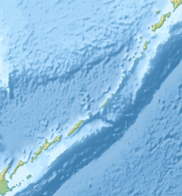
The 2007 Kuril Islands earthquake occurred east of the Kuril Islands on 13 January at 1:23 p.m. (JST). The shock had a moment magnitude of 8.1 and a maximum Mercalli intensity of VI (Strong). A non-destructive tsunami was generated, with maximum wave amplitudes of 0.32 meters (1 ft 1 in). The earthquake is considered a doublet of the 8.3 magnitude 2006 Kuril Islands earthquake which occurred two months prior on 15 November 2006 approximately 95 km to the southeast.
See also
- 1963 Kuril Islands earthquake
- 1994 Kuril Islands earthquake
- List of earthquakes in 2007
- List of earthquakes in Japan
- Kamchatka earthquakes
- Okhotsk Plate
References
- ^ a b ISC (2014), ISC-GEM Global Instrumental Earthquake Catalogue (1900–2009), Version 1.05, International Seismological Centre
- ^ a b USGS (4 September 2009), PAGER-CAT Earthquake Catalog, Version 2008_06.1, United States Geological Survey, archived from the original on 4 October 2016
- ^ USGS. "M8.1 - east of the Kuril Islands". United States Geological Survey.
- Bibliography
- Lay, T.; .
- Rabinovich, A. B.; Lobkovsky, L. I.; Fine, I. V.; Thomson, R. E.; Ivelskaya, T. N.; Kulikov1, E. A. (2008), "Near-source observations and modeling of the Kuril Islands tsunamis of 15 November 2006 and 13 January 2007" (PDF), Advances in Geosciences, 14 (14): 105–116, doi:10.5194/adgeo-14-105-2008).
{{citation}}: CS1 maint: numeric names: authors list (link - Ammon, Charles J.; S2CID 4317389.
External links
- The International Seismological Centre has a bibliography and/or authoritative data for this event.


