
23rd Street station (IRT Lexington Avenue Line)
23 Street | ||||||||||||||||||||||||||||||||||||||||||||||||||||||||||||||||||||
|---|---|---|---|---|---|---|---|---|---|---|---|---|---|---|---|---|---|---|---|---|---|---|---|---|---|---|---|---|---|---|---|---|---|---|---|---|---|---|---|---|---|---|---|---|---|---|---|---|---|---|---|---|---|---|---|---|---|---|---|---|---|---|---|---|---|---|---|---|
| Structure | Underground | |||||||||||||||||||||||||||||||||||||||||||||||||||||||||||||||||||
| Platforms | 2 side platforms | |||||||||||||||||||||||||||||||||||||||||||||||||||||||||||||||||||
| Tracks | 4 | |||||||||||||||||||||||||||||||||||||||||||||||||||||||||||||||||||
| Other information | ||||||||||||||||||||||||||||||||||||||||||||||||||||||||||||||||||||
| Opened | October 27, 1904[4] | |||||||||||||||||||||||||||||||||||||||||||||||||||||||||||||||||||
| Accessible | ||||||||||||||||||||||||||||||||||||||||||||||||||||||||||||||||||||
| Opposite- direction transfer | No | |||||||||||||||||||||||||||||||||||||||||||||||||||||||||||||||||||
| Traffic | ||||||||||||||||||||||||||||||||||||||||||||||||||||||||||||||||||||
| 2023 | 5,409,296[5] | |||||||||||||||||||||||||||||||||||||||||||||||||||||||||||||||||||
| Rank | 39 out of 423[5] | |||||||||||||||||||||||||||||||||||||||||||||||||||||||||||||||||||
| ||||||||||||||||||||||||||||||||||||||||||||||||||||||||||||||||||||
| ||||||||||||||||||||||||||||||||||||||||||||||||||||||||||||||||||||
| ||||||||||||||||||||||||||||||||||||||||||||||||||||||||||||||||||||
| ||||||||||||||||||||||||||||||||||||||||||||||||||||||||||||||||||||
| ||||||||||||||||||||||||||||||||||||||||||||||||||||||||||||||||||||
| ||||||||||||||||||||||||||||||||||||||||||||||||||||||||||||||||||||


The 23rd Street station is a local
The 23rd Street station was constructed for the Interborough Rapid Transit Company (IRT) as part of the city's first subway line, which was approved in 1900. Construction of the line segment that includes the 23rd Street station started on September 12 of the same year. The station opened on October 27, 1904, as one of the original 28 stations of the New York City Subway. The station's platforms were lengthened in the late 1940s.
The 23rd Street station contains two
History
Construction and opening
Planning for a subway line in New York City dates to 1864.[7]: 21 However, development of what would become the city's first subway line did not start until 1894, when the New York State Legislature passed the Rapid Transit Act.[7]: 139–140 The subway plans were drawn up by a team of engineers led by William Barclay Parsons, the Rapid Transit Commission's chief engineer. It called for a subway line from New York City Hall in lower Manhattan to the Upper West Side, where two branches would lead north into the Bronx.[8]: 3 A plan was formally adopted in 1897,[7]: 148 and all legal conflicts concerning the route alignment were resolved near the end of 1899.[7]: 161 The Rapid Transit Construction Company, organized by John B. McDonald and funded by August Belmont Jr., signed the initial Contract 1 with the Rapid Transit Commission in February 1900,[9] in which it would construct the subway and maintain a 50-year operating lease from the opening of the line.[7]: 165 In 1901, the firm of Heins & LaFarge was hired to design the underground stations.[8]: 4 Belmont incorporated the Interborough Rapid Transit Company (IRT) in April 1902 to operate the subway.[7]: 182
The 23rd Street station was constructed as part of the route segment from Great Jones Street to 41st Street. Construction on this section of the line began on September 12, 1900. The section from Great Jones Street to a point 100 feet (30 m) north of 33rd Street was awarded to Holbrook, Cabot & Daly Contracting Company, while the remaining section to 41st Street was done by Ira A. Shaker.: 186
Service changes and station renovations
After the first subway line was completed in 1908,
To address overcrowding, in 1909, the
In December 1922, the Transit Commission approved a $3 million project to lengthen platforms at 14 local stations along the original IRT line, including 23rd Street and seven other stations on the Lexington Avenue Line. Platform lengths at these stations would be increased from 225 to 436 feet (69 to 133 m).[16][17] The commission postponed the platform-lengthening project in September 1923, at which point the cost had risen to $5.6 million.[18][19]
The city government took over the IRT's operations on June 12, 1940.[20][21] In January 1947, the New York City Board of Transportation awarded a $4.003 million contract for the lengthening of platforms at the 23rd Street, 28th Street, and 33rd Street stations.[22] The platform extensions at all three stations opened on April 13, 1948, after which they could accommodate ten-car trains.[23]
In 1981, the
The station's token booths were shuttered in May 2005, after fare tokens were replaced with
Station layout
| Ground | Street level | Entrances/exits |
| Platform level | Side platform | |
| Northbound local | ← ← | |
| Northbound express | ← | |
| Southbound express | | |
| Southbound local | | |
| Side platform | ||
Like other local stations, 23rd Street has four tracks and two
Design


As with other stations built as part of the original IRT, the station was constructed using a
The original decorative scheme consisted of black tile station-name tablets, violet and white tile bands, a grey faience cornice, blue faience plaques, and marble wainscoting.[35]: 34 The mosaic tiles at all original IRT stations were manufactured by the American Encaustic Tile Company, which subcontracted the installations at each station.[35]: 31 The decorative work was performed by tile contractor Manhattan Glass Tile Company and faience contractor Rookwood Pottery Company.[35]: 34 The ceilings of the original platforms and fare control areas contain plaster molding.[35]: 10
There are no open crossovers or crossunders between the platforms.[
| 8th Av | 7th Av | 6th Av | 5th Av & Broadway |
Park Av | |||||||
| A / C / E | 1 / 2 / 3 | FM↓ | PATH | FM↑ | N / Q / R / W | 6 / <6> | |||||
| underpass | underpass | ||||||||||
Exits
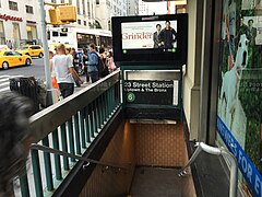
Each platform has exits to both 22nd and 23rd Streets; the northbound platform's exits are on the eastern side of Park Avenue South while the southbound platform's exits are on the western side. At 23rd Street, each control area contains two stairs to the southern side of 23rd Street, and a stair and an elevator to the northern side. The northwestern corner stair, for the southbound platform, is within the One Madison Avenue office tower and contains a passageway into the basement of the same building.[39] The elevators provide ADA-accessibility for the whole station.[40]
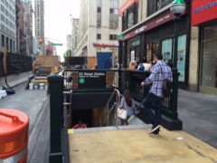
At 22nd Street, each control area contains two exits, one each to the north and south sides of that street. The southwestern corner stair, for the southbound platform, is inside a building. The northeastern corner stair is outside the United Charities Building and the southeastern corner stair is outside the Church Missions House.[39]
When the station was built, the IRT had made an agreement to construct an exit from the southbound platform into the Mercantile Building (now 304 Park Avenue South), at the southwestern corner of 23rd Street and Park Avenue South. A marble passageway, about 14 feet (4.3 m) wide by 165 feet (50 m) long, provided an exit to the building and to the southern side of 23rd Street between Park Avenue South and Madison Avenue, connecting to that building's elevators.[41]: 29, 31 [42] The passageway was slightly higher than the southbound platform, so a broad, curved flight of stairs was built on the southern side of the southbound fare control area.[41]: 31 There were store windows on the southern side of the passageway, overlooking the Mercantile Building's basement storefront. When opened, the passageway was advertised as New York City's first underground sidewalk.[41]: 33, 35 [42] While the broad flight of stairs still exists, the passageway has been sealed. Another sealed passageway leads from the northbound platform to the lobby of 303 Park Avenue South, at the northeast corner with 23rd Street.
-
 Original entrance kiosks
 -
 Mercantile Building entrance
 -
 The former narrow entrance on the northeastern corner of 23rd St and Park Avenue South to the northbound platform
 -
 Relocated northeastern corner entrance under construction in July 2015
 -
 Relocated northeastern corner entrance, with construction of the elevator in the background


In popular culture
In the
Notes
- ^ The New York Times and the New York City Department of City Planning consider Park Avenue South to be a small micro-neighborhood between Gramercy and Flatiron. Park Avenue South is also the name of the street on which the 23rd Street station is located.[1][2]
References
- ^ C.J. Hughes (January 31, 2018). "Living In / Park Avenue South: The Other Park Avenue Comes Into Its Own". New York Times. Archived from the original on August 4, 2018. Retrieved August 4, 2018.
Mail was occasionally delivered to the wrong addresses — to that other Park Avenue, residents said — and the street appeared to be trapped in real-estate limbo. It was neither here nor there, brushing by brand-name enclaves like Gramercy Park and Flatiron, but not belonging to them, and never really developing a personality of its own. ... With the 6 train directly under Park Avenue South, subway service is never far, although the trains can get jammed. Stops are at East 28th Street and East 23rd Street, and just outside the neighborhood at East 33rd Street and 14th Street‑Union Square, where other lines meet.
- ^ "Chapter 1: Project Description". Hudson Square Rezoning: Final Environmental Impact Statement (PDF). New York City Department of Buildings. Archived (PDF) from the original on December 1, 2018. Retrieved July 24, 2018.
- ^ "Glossary". Second Avenue Subway Supplemental Draft Environmental Impact Statement (SDEIS) (PDF). Vol. 1. Metropolitan Transportation Authority. March 4, 2003. pp. 1–2. Archived from the original (PDF) on February 26, 2021. Retrieved January 1, 2021.
- ^ from the original on December 13, 2021. Retrieved April 21, 2020.
- ^ a b "Annual Subway Ridership (2018–2023)". Metropolitan Transportation Authority. 2023. Retrieved April 20, 2024.
- ^ "Annual Subway Ridership (2018–2023)". Metropolitan Transportation Authority. 2023. Retrieved April 20, 2024.
- ^ a b c d e f g h Walker, James Blaine (1918). Fifty Years of Rapid Transit — 1864 to 1917. New York, N.Y.: Law Printing. Retrieved November 6, 2016.
- ^ a b c d "Interborough Rapid Transit System, Underground Interior" (PDF). New York City Landmarks Preservation Commission. October 23, 1979. Archived (PDF) from the original on September 21, 2020. Retrieved November 19, 2019.
- ^ a b Report of the Board of Rapid Transit Railroad Commissioners for the City of New York For The Year Ending December 31, 1904 Accompanied By Reports of the Chief Engineer and of the Auditor. Board of Rapid Transit Railroad Commissioners. 1905. pp. 229–236.
- ISSN 0362-4331. Retrieved May 10, 2022.
- ^ "Our First Subway Completed At Last — Opening of the Van Cortlandt Extension Finishes System Begun in 1900 — The Job Cost $60,000,000 — A Twenty-Mile Ride from Brooklyn to 242d Street for a Nickel Is Possible Now". The New York Times. August 2, 1908. p. 10. Archived from the original on December 23, 2021. Retrieved November 6, 2016.
- ^ Herries, William (1916). Brooklyn Daily Eagle Almanac. Brooklyn Daily Eagle. p. 119. Archived from the original on May 11, 2021. Retrieved December 24, 2020.
- ^ a b Hood, Clifton (1978). "The Impact of the IRT in New York City" (PDF). Historic American Engineering Record. pp. 146–207 (PDF pp. 147–208). Archived (PDF) from the original on January 17, 2021. Retrieved December 20, 2020.
 This article incorporates text from this source, which is in the public domain.
{{cite web}}: CS1 maint: postscript (link) - ^ a b Report of the Public Service Commission for the First District of the State of New York For The Year Ending December 31, 1910. Public Service Commission. 1911. Archived from the original on January 20, 2021. Retrieved January 7, 2021.
- ^ "Open New Subway Lines to Traffic; Called a Triumph — Great H System Put in Operation Marks an Era in Railroad Construction — No Hitch in the Plans — But Public Gropes Blindly to Find the Way in Maze of New Stations — Thousands Go Astray — Leaders in City's Life Hail Accomplishment of Great Task at Meeting at the Astor" (PDF). The New York Times. August 2, 1918. p. 1. Archived (PDF) from the original on February 21, 2021. Retrieved November 6, 2016.
- ISSN 0362-4331. Retrieved June 21, 2022.
- ProQuest 573974563.
- ISSN 0362-4331. Retrieved June 21, 2022.
- ProQuest 1237290874.
- from the original on January 7, 2022. Retrieved May 14, 2022.
- ProQuest 1248134780.
- ISSN 0362-4331. Retrieved May 5, 2023.
- ^ .
- from the original on March 31, 2019. Retrieved August 13, 2016.
- from the original on April 25, 2022. Retrieved May 4, 2023.
- ^ ISSN 2574-5298. Retrieved May 5, 2023.
- from the original on April 28, 2022. Retrieved May 5, 2023.
- from the original on May 29, 2015. Retrieved August 19, 2016.
- ^ Metropolitan Transportation Authority (May 27, 2014). 23rd Street & Park Avenue South ADA - Presentation to Manhattan Community Board 5 Transportation Committee (PDF) (Report). Archived (PDF) from the original on September 19, 2019. Retrieved September 4, 2020.
- ^ "ADA Accessibility at 23 St Station on the Lexington Ave Line". web.mta.info. Metropolitan Transportation Authority. Archived from the original on September 4, 2020. Retrieved September 4, 2020.
- ^ a b "6 Subway Timetable, Effective August 12, 2023". Metropolitan Transportation Authority. Retrieved August 26, 2023.
- ^ "4 Subway Timetable, Effective December 4, 2022". Metropolitan Transportation Authority. Retrieved August 26, 2023.
- OCLC 49777633 – via Google Books.
- ^ "Subway Map" (PDF). Metropolitan Transportation Authority. September 2021. Retrieved September 17, 2021.
- ^ a b c d e f g h i Framberger, David J. (1978). "Architectural Designs for New York's First Subway" (PDF). Historic American Engineering Record. pp. 1–46 (PDF pp. 367–412). Archived (PDF) from the original on January 17, 2021. Retrieved December 20, 2020. This article incorporates text from this source, which is in the public domain.
{{cite web}}: CS1 maint: postscript (link) - ^ "MTA Accessible Stations". MTA. May 20, 2022. Retrieved July 5, 2022.
- ^ Scott, Charles (1978). "Design and Construction of the IRT: Civil Engineering" (PDF). Historic American Engineering Record. pp. 208–282 (PDF pp. 209–283). Archived (PDF) from the original on January 17, 2021. Retrieved December 20, 2020. This article incorporates text from this source, which is in the public domain.
{{cite web}}: CS1 maint: postscript (link) - ^ "23rd Street - Valerie Jaudon - Long Division, 1988". web.mta.info. Metropolitan Transportation Authority. Archived from the original on September 4, 2020. Retrieved September 4, 2020.
- ^ a b "MTA Neighborhood Maps: 23 St (6)". Metropolitan Transportation Authority. 2018. Archived from the original on February 18, 2020. Retrieved December 25, 2020.
- ^ "MTA Accessible Stations". mta.info. Metropolitan Transportation Authority. Archived from the original on September 16, 2020. Retrieved September 16, 2020.
- ^ a b c "New York's First Underground Sidewalk". Architects' and Builders' Magazine. 37: 29–37. October 1904 – via HathiTrust.
- ^ OCLC 9829395.
External links
- nycsubway.org – IRT East Side Line: 23rd Street
- Station Reporter — 6 Train
- Forgotten NY — Original 28 - NYC's First 28 Subway Stations
- MTA's Arts For Transit — 23rd Street (IRT Lexington Avenue Line)
- 23rd Street entrance from Google Maps Street View
- 22nd Street entrance from Google Maps Street View
- Platforms from Google Maps Street View
| Lexington Ave. Line |
|
|---|---|
| |