
40th parallel north
.svg)
The 40th parallel north is a circle of latitude that is 40 degrees north of the Earth's equatorial plane. It crosses Europe, the Mediterranean Sea, Asia, the Pacific Ocean, North America, and the Atlantic Ocean.
At this latitude the sun is visible for 15 hours, 1 minute and 28 seconds during the summer solstice and 9 hours, 20 minutes during the winter solstice.[1] On 21 June, the maximum altitude of the sun is 73.44 degrees, while it's 26.56 degrees on 21 December.[citation needed]
The maximum altitude of the Sun is > 35.00º in October and > 28.00º in November.
The 40th parallel north is the southern baseline for Canada's National Topographic System.
Around the world
Starting in Spain at the
Notable cities and towns on 40°N
- Philadelphia, Pennsylvania, United States
- Columbus, Ohio, United States
- Beijing, China
- Ankara, Turkey
United States


The parallel 40° north formed the boundary between the Kansas and Nebraska territories, as per the Kansas–Nebraska Act of 1854. It remains the boundary between the modern states of Kansas and Nebraska.
The parallel 40° north formed the original northern boundary of the
.jpg)
The parallel 40° north passes through the cities of
Baseline Road in Boulder, Colorado, traces the parallel 40° north.
Thistle, Utah, a ghost town since 1983, is slightly (30 seconds or 956 metres (0.594 mi)) below 40° north.
Japan
Gallery
-
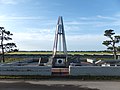
 Monument of North latitude 40 degrees at Nyudouzaki in Oga, Akita
 -
 Nyudozaki Monument
 -
 40°N and 140°E Crossing Point inOgata, Akita
 -
 Globe Monument in Fudai, Iwate


See also
- 40th parallel south
- 39th parallel north
- 41st parallel north
- Baseline (surveying)
- Geological Exploration of the Fortieth Parallel
References
- ^ "Duration of Daylight/Darkness Table for One Year". U.S. Naval Observatory. 2019-09-24. Archived from the original on 2019-10-12. Retrieved 2021-03-10.

|