
Acre (state)
Acre | |
|---|---|
State | |
| Estado do Acre State of Acre | |
|
UTC−5 (ACT) | |
| Postal Code | 69900-000 to 69999-000 |
| ISO 3166 code | BR-AC |
| License Plate Letter Sequence | MZN to NAG, NXR to NXT, OVG, OXP, QLU to QLZ, QWM to QWQ |
| Website | www |
Acre (
Intense extractive activity in the rubber industry, which reached its height in the early 20th century, attracted Brazilians from many regions to the state. From the mixture of
Fluvial transport, concentrated on the
Etymology
The name, which was given to the territory in 1904, is derived from one of the local rivers, and to the state in 1962, perhaps originates from the Tupi word a'kir ü "green river", or from the form a'kir, of the Tupi word ker, "to sleep, to rest". It is believed more likely to be derived from Aquiri, a transliteration by European explorers of the term Umákürü, or Uakiry, from the Ipurinã dialect. Another hypothesis is that Acquiri derives from Yasi'ri, or Ysi'ri, meaning "flowing or swift water".
According to one account, agriculturist João Gabriel de Carvalho Melo wrote during an 1878 trip on the
Acre possesses some nicknames: the End of Brazil, The Rubber Tree State, the Latex State (from when it was a center of rubber production) and the Western End.
The native inhabitants of Acre are called acrianos, in the singular acriano. Until the entry according to the
Geography

The state of Acre occupies an area of 152,581 km2 (58,912 sq mi) (58,911 mi2) in the extreme west of Brazil. It is located at
Practically all of the
The
The
), cross the state with almost parallel courses which converge only outside of its territory.The largest recorded

The Amazon represents over half of the planet's remaining rainforests and comprises the largest and most species-rich tract of tropical rainforest in the world. Wet tropical forests are the most species-rich biome, and tropical forests in the Americas are consistently more species-rich than the wet forests in Africa and Asia.[5] As the largest tract of tropical rainforest in the Americas, the Amazonian rainforests have unparalleled biodiversity. More than 1/3 of all species in the world live in the Amazon Rainforest.[6]
Statistical and legal subdivisions
Acre is divided into twenty-two municipalities, five immediate regions and two intermediate regions:

2 Mesoregion of Vale do Juruá
Rio Branco
- Immediate Region of Brasileia
- Immediate Region of Rio Branco
- Microregion of Sena Madureira
Cruzeiro do Sul
- Immediate Region of Cruzeiro do Sul
- Immediate Region of Tarauacá
History
 Peru-Bolivian Confederation 1836–18391903–present
Bolivia 1839–1899
First Republic of Acre 1899–1900
Third Republic of Acre 1903
Brazil

.jpg)
.JPG)
.jpg)
The region of present-day Acre is thought to have been inhabited by
In the mid-18th century, the region was colonized by the Spanish and became part of the Viceroyalty of Peru. Following the Peruvian and Bolivian wars of independence, which ended in 1826, the region and large portions around it became part of Bolivia, but independent of Spain. It was a territory of the short-lived Peru–Bolivian Confederation (1836–1839), until the two countries separated and the region returned to Bolivian control.
The discovery of rubber tree groves in the region in the mid-19th century attracted numerous immigrants, especially from Brazil and Europe, seeking to build on the rubber boom. Despite the increased numbers of Brazilians, the Treaty of Ayacucho (1867) determined that the region belonged to Bolivia. By 1877, Acre's population was composed almost entirely of Brazilians coming from the Northeast.
In 1899, Brazilian settlers from Acre created an independent state in the region called the Republic of Acre. Bolivians tried to gain control of the area, but Brazilians revolted and there were border confrontations. This resulted in what was known as the Acre War. On November 17, 1903, with the signing over and sale in the Treaty of Petrópolis, Brazil received final possession of the region. Acre was integrated into Brazil as a territory divided into three departments. The territory was acquired by Brazil for two million pounds sterling. The land was taken from Mato Grosso in accordance with terms for the construction of the Madeira-Mamoré railway.
Acre was united in 1920. On June 15, 1962, it was elevated to the category of state, and was the first to be governed by a woman, Iolanda Fleming, a teacher.
During the early twentieth century, rubber seedlings were taken to Southeast Asia, where competitive plantations were established, reducing the importance of the Amazon in production. But during the
Acre was called on to produce rubber for the Allied war effort. The
Acre's decisive contribution to the Allied victory may have helped Brazil attract North American investment to form the National Steel Company (Companhia Siderúrgica Nacional) in the postwar era. This company aided in the industrialization of the Central-south, which did not yet possess basic heavy industries.
On April 4, 2008, Acre won a judicial debate with the state of Amazonas in relation to the dispute surrounding the Cunha Gomes Line. It annexed part of the municipalities of Envira, Guajará, Boca do Acre, Pauini, Eirunepé and Ipixuna. The territorial redefinition consolidated the incorporation of 1.2 million hectares of the Liberdade, Gregório, and Mogno forest complex to the territory of Acre, which corresponds to 11,583.87 km2 (4,472.56 sq mi).
Initial settlement

Since the 1970s, numerous
During the 17th century, Portuguese expeditions reached many of the far ends of present-day Brazil. The expansion of the exploration to the west followed, and they reached lands under control by the Spanish colonies. The two nations negotiated to establish their territories, under the Treaties of
The Portuguese created the new royal captaincy of Mato Grosso (1751), stimulating settlement toward the frontier. New centers developed: Vila Bela (1752)[12] on the banks of the Guaporé, Vila Maria (1778)[13] on the Paraguay River, and Casalvasco (1783).[14] Until the mid-19th century, there was little effort to settle the area systematically. At that time, the great virgin source of rubber attracted commercial interest, and development followed.
The empire was directed towards agricultural exports, based on coffee as the most important commodity. The territories of the extreme west were unknown and usually overlooked. For example, although Cândido Mendes de Almeida's Atlas of the Empire of Brazil (1868), was considered a model of its time, geographers knew nothing of the Acre River and its principal tributaries, which did not appear at all in the atlas.
Some few armed bands of Brazilian explorers exploited the rural and unpopulated region,[15] not knowing and little interested in whether they were "controlled" by Brazil, Peru, or Bolivia.
But the rubber boom of the mid-19th century, stimulated exploration by various expeditions to survey this resource and develop a plan for colonial settlement. At that time, João Rodrigues Cametá initiated the conquest of the
Exploitative activities, the industrial importance of the rubber reserves, and the penetration of Brazilian colonists in the region raised the attention of
Northeast occupation
As the price of rubber rose in the market,
In the second half of the 19th century, disturbances were registered in the demographic and geo-economic balance of the empire. The coffee boom in the south attracted financial resources and workers, to detriment of the northeast.[20] The growing impoverishment of that region stimulated migratory waves to the states of Rio de Janeiro, Minas Gerais, and São Paulo.[20] The movement of population became particularly active during the prolonged drought of the northeastern interior, from 1877 to 1880. Hundreds of Ceará indigenous people headed for the rubber plantations in search of work.[21]
The Cearense migration reached the banks of the
The
Land dispute
In 1890,
In 1895 a new commission to define the borders was created.
Distant from the diplomatic process, the rubber workers judged their interests to have been cheated, and initiated insurrection movements. Some of this was in response to brutal treatment and abuse by forces managed by the major rubber companies. In the same year that Bolivia established administration in Puerto Alonso (1899), two serious uprisings occurred.[29]
In April, a
Bolivians, reinstated in the region, suffered in 1900 from the assault of the so-called Floriano Peixoto expedition, or "expedition of the poets".[30] It was made up of intellectual bohemians from Manaus.[30] Following brief fighting in the area surrounding Puerto Alonso, the expedition was completely scattered.[30] Ultimately, the Bolivian government signed a contract with the Bolivian Syndicate (July 1901).[24] The Brazilian congress, shocked by the arbitrariness of the act, took measures, canceling commercial accords and navigation between the two countries, and suspending the right of travel to Bolivia.
At the same time, Brazilians organized a large armed assault on the disputed area.[24] The operations were led by a former student of the Military School of Rio Grande do Sul (Escola Militar do Rio Grande do Sul), José Plácido de Castro. The rubber gatherers occupied the village of Xapuri in Alto Acre (August 1902), and took Bolivian officials into custody.[24] Finally, Plácido de Castro's forces besieged Puerto Alonso, proclaiming the Independent State of Acre, after the capitulation of Bolivian troops (February 1903).[24]
Diplomatic intervention
.jpg)
The simplest problem, with the Bolivian Syndicate, was resolved by Brazil paying one hundred and ten thousand pounds to renounce the contract (February 1903).[34] Next, commercial relations were reestablished with Bolivia,[24] while a part of the territory on the upper Purús and Juruá, militarily occupied in March 1903, was declared litigious.
Bolivia finally agreed to cede to Brazil an area of 142,800 km2 (55,100 sq mi), in exchange for two million
Peru had also claimed sovereignty over the entire territory of Acre and part of the state of Amazonas, based on historic colonial titles.[35] After armed conflicts between Brazilians and Peruvians on the upper Purús and Juruá, a joint administration was established in those regions (1904).[21] The studies to determine the borders proceeded until the end of 1909, when a treaty was signed that completed the political integration of Acre into Brazilian territory.
Development from territory to statehood
.jpg)
Exercising a prominent role in national exports until 1913,[36] when rubber was introduced to European and North American markets, Acre enjoyed a period of great prosperity. At the start of the 20th century, in a period of less than ten years, it grew to have more than 50,000 inhabitants.
From 1946 on, the federal government undertook actions to revive the economy of the
Attending to the judicial arrangements of the

During the
In the 1960s, the second cycle of efforts to accelerate the progress of the Amazon area was begun with the Superintendency of the Development of the Amazon (Superintendência do Desenvolvimento da Amazônia or SUDAM, 1966).[41] Better networking of regional sub-sectors within the state was sought out, thus connecting the branch lines of the Transamazônica, which connected Rio Branco and Brasiléia, on the upper course of the Acre River, and Cruzeiro do Sul, on the banks of the Juruá, crossing the valleys of the Purús and the Tarauacá. Planning politics developed, therefore, destined to correct the demographic, economic, and political distortions of national integration.
Demographics
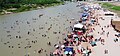
-
 Rio Branco in the afternoon
 -
 Saint Sebastian Festivities in Xapuri
 -

-
-
 Opening ceremony of the ExpoAcre Field Day
.jpg)
.jpg)
.jpg)


According to the IBGE of 2022, there were 830,018 people residing in the state. making Acre the third least populated state. The population density was 4.5 inh./km2.
Urbanization: 69.6% (2006); Population growth: 3.3% (1991–2000); Houses: 162,000 (2006).[42]
The last Census in 2022 revealed the following numbers: 549,889
Largest cities
Largest cities or towns in Acre (state)
(2010 census by the Brazilian Institute of Geography and Statistics)[44] | |||||||||
|---|---|---|---|---|---|---|---|---|---|
| Rank | Mesoregion | Pop. | Rank | Mesoregion | Pop. | ||||
 Rio Branco  Cruzeiro do Sul |
1 | Rio Branco | Vale do Acre | 335,796 | 11 | Epitaciolândia | Vale do Acre | 15,126 |  Sena Madureira  Tarauacá |
| 2 | Cruzeiro do Sul | Vale do Juruá | 78,444 | 12 | Porto Acre | Vale do Acre | 14,806 | ||
| 3 | Sena Madureira | Vale do Acre | 37,993 | 13 | Rodrigues Alves | Vale do Juruá | 14,334 | ||
| 4 | Tarauacá | Vale do Juruá | 35,526 | 14 | Marechal Thaumaturgo | Vale do Juruá | 14,200 | ||
| 5 | Feijó | Vale do Juruá | 32,311 | 15 | Acrelândia | Vale do Acre | 12,538 | ||
| 6 | Brasiléia | Vale do Acre | 21,438 | 16 | Porto Walter | Vale do Juruá | 9,172 | ||
| 7 | Senador Guiomard | Vale do Acre | 20,153 | 17 | Capixaba, Acre | Vale do Acre | 8,810 | ||
| 8 | Plácido de Castro | Vale do Acre | 17,203 | 18 | Bujari | Vale do Acre | 8,474 | ||
| 9 | Xapuri | Vale do Acre | 16,016 | 19 | Manoel Urbano | Vale do Acre | 7,989 | ||
| 10 | Mâncio Lima | Vale do Juruá | 15,246 | 20 | Jordão | Vale do Juruá | 6,531 | ||
Education
Portuguese is the official national language, and thus the primary language taught in schools. English and Spanish are also part of the official high school curriculum.
Educational institutions
- Universidade Federal do Acre (Ufac) (Federal University of Acre);
- Faculdade da Amazônia Ocidental (Faao) (College of Western Amazon);
- Faculdade de Ciências Jurídicas e Sociais Applicadas Rio Branco (Firb);
- Instituto de Educação, Ciência e Tecnologia do Vale do Juruá (Ieval);
- Instituto de Ensino Superior do Acre (Iesacre);
- União Educacional do Norte (Uninorte).
Economy

The
Share of the Brazilian economy: 0.2% (2005).
Infrastructure
Airports


Rio Branco International Airport is located in a rural zone of the municipality of Rio Branco, in the state of Acre. It was opened on November 2, 1999, with a unique characteristic: it moved 22 kilometers away from the previous airport site. Rio Branco Airport serves domestic and international flights (by scheduled carriers and air taxi firms) along with general and military aviation. The terminal can receive 270 thousand passengers a year and serves an average of 14 daily operations.
Cruzeiro do Sul International Airport is located 18 kilometers away from the city center, which helps access to the Alto Juruá region. It was opened on October 28, 1970, and absorbed by Infraero on March 31, 1980. The airport infrastructure was built in 1976 by the municipal government. In 1994, the runway was completely renovated.
Domestic airports at Tarauaca, Sena Madureira and Brasiléia.
Highways
- BR-364 (Rio Branco to Southeastern Brazil);
- BR-317 (Rio Branco to south of Acre);
- AC-040 (Rio Branco to Plácido de Castro);
- AC-401 (Plácido de Castro to Acrelândia);
- AC-010 (Rio Branco to Porto Acre).
Two roads to Peru:
- at Boqueirão
- BR-317 from Assis Brasil to Highway 30C to Iñapari and Highway 26 to Cuzco.
Three roads to Bolivia:
- from Rio Branco at Plácido de Castro,
- from Rio Branco to Santa Rosa,
- from BR-317 in Brasileia to Ruta 13 in Cobija.
One road to Amazonas:
- BR-317, plus BR-364 passes through Amazonas.
One road to Rondônia:
- BR-364 (via Amazonas).
Sports

Rio Branco provides visitors and residents with various sport activities.
Stadiums
- Arena da Floresta stadium;
- José de Melo stadium;
- Federação Acreana de Futebol stadium;
- Dom Giocondo Maria Grotti stadium;
- Adauto de Brito stadium;
- and many others.
The Arena da Floresta stadium in Rio Branco was one of the 18 candidates to host games in the 2014 FIFA World Cup, which was held in Brazil, but did not make it to the final 12 chosen.
Culture
.jpg)
Despite being the only state that fought to be Brazilian (Acre War), Acre's culture is similar to that of other Northern Brazilian states, however, there is a high consumption of Northeastern Brazilian culture. In Rio Branco, there is a religious community called Alto Santo (Universal Christian Enlightenment Center) that practices the Santo Daime Ritual, typical of Acre, of indigenous origin, which uses Daime, a natural tea made with leaves and vines, used by the Indigenous peoples as a way of approaching God. The ritual implies in drinking a tea, including children and the elderly. The members wear uniforms and sing the hymnal.[45]
The best-known dish consumed by Acreans is called Baixaria. The typical food uses duck, tucupi, cassava flour and pirarucu fish, in addition to the huge variety of Amazonian fruits inherited from the Indigenous peoples.[46]
Some singers and artists from Acre: João Donato, Sansão Campos Pereira, Sergio Souto and Tião Natureza.[47]
Flag
The flag was adopted on March 15, 1921. It is a variation of the flags used by the secessionist state of Acre, with the yellow and green parts exchanged and mirrored. The yellow color symbolizes peace, green hope, and the star symbolizes the light which guided those who worked to make Acre a state of Brazil.
See also
- Acre War
- Republic of Acre
- Flag of Acre
- List of rivers of Acre
- Amazon rubber cycle
- List of municipalities in Acre
- List of governors of Acre
References
- ^ "IBGE | Portal do IBGE | IBGE".
- ^ "PIB por Unidade da Federação, 2021". ibge.gov.br.
- ^ "Atlas do Desenvolvimento Humano no Brasil. Pnud Brasil, Ipea e FJP, 2022". www.atlasbrasil.org.br. Retrieved June 11, 2023.
- ^ PIB do Acre teve segunda pior variação do país em 2018, diz IBGE
- ISBN 0-521-80183-4
- ^ Amazon Rainforest, Amazon Plants, Amazon River Animals
- ^ Simon Romero (January 14, 2012). "Once Hidden by Forest, Carvings in Land Attest to Amazon's Lost World". The New York Times.
- S2CID 55741813.
- ^ a b "Unnatural Histories - Amazon". BBC Four.
- ^ Junior, Gonçalo (October 2008). "Amazonia lost and found". Pesquisa (Ed.220). FAPESP. Archived from the original on August 12, 2014.
- ^ Treaty of Madrid "Tratado de Madri" Archived April 11, 2015, at the Wayback Machine
- ^ FERREIRA, João Carlos Vicente. "História da Vila Bela da Santíssima Trindade" Archived August 22, 2010, at the Wayback Machine
- ^ "Cáceres" Archived July 8, 2011, at the Wayback Machine BrasilViagem.com. Page visited on October 5, 2010
- ^ "Fixação e consolidação da fronteira" Archived July 6, 2011, at the Wayback Machine Official Site of the Legislative Assembly of Mato Grosso. Accessed October 5, 2010.
- ^ Pertiñez, Dom Joaquín. "O Acvre, o Nordeste e os nordestinos" Archived July 6, 2011, at the Wayback Machine. Official site of the Diocese of Rio Branco. Page visited on October 5, 2010
- ^ a b SILVA, Hiram Reis and (July 7, 2009) "João Rodrigues Cametá" Archived July 15, 2011, at the Wayback Machine
- ^ "Tarauacá: Ontem, hoje e amanhã" Tarauacá.com. Page visited on October 5, 2010.
- ^ "O Tratado de Madrid e o Tratado de Ayacucho" GrupoEscolar.com Page visited on October 6, 2010
- ^ "A queda do Ciclo da Borracha". Official site of the Municipality of Porto Velho (October 27, 2006). Page visited on October 6, 2010
- ^ a b FURTADO, Celso. "A evolução da economia na República Velha". Marcilio.com. Page visited on October 6, 2010
- ^ a b TOSCANO, Fernando. "Estados Brasileiros: Acre" Portal Brasil. Page visited October 6, 2010
- ^ "História de Ipixuna". Official site of the Public Library of Amazonas. Page visited on October 6, 2010.
- ^ "As Casas Aviodoras", WEB High School. Page visited on October 6, 2010.
- ^ a b c d e f g h i j k l m n GURGEL, Rodrigo. "Revolução Acreana: Bolívia e Brasil disputam o Acre". UOL Education. Page visited on October 6, 2010.
- ^ ILVA CASTRO, Jamerson. "História das Bandeiras de Portugal e do Brasil[permanent dead link] Official site of the city councilman. Page visited on October 9, 2010
- ^ "Tratado de Ayacucho" Wikisource in Portuguese (March 27, 1867). Page visited on October 9, 2010.
- ^ ALBUQUERQUE, Kátya Fernandez. "A Questão do Acre" Official site of the Fluminense Society of Philologic and Linguistic Studies. Page visited on October 9, 2010.
- ^ SILVA, Hiram Reis e (June 20, 2009). "Tenente-Coronel Gregório Taumaturgo de Azevedo" Archived July 15, 2011, at the Wayback Machine Roraima in Foucus. Page visited on October 9, 2010.
- ^ a b "História de Porto Acre IBGE Library. Page visited on October 9, 2010.
- ^ a b c SCILLING, Voltaire. "A Expedição dos Poetas" Archived May 14, 2011, at the Wayback Machine Earth Education:History. Page visited on October 9, 2010.
- ^ "Plácido de Castro" UOL Education. Page visitetd on October 9, 2010.
- ^ SILVA, Leo. "Plácido de Castro, Rio Branco e a Questão do Acre Archived February 25, 2010, at the Wayback Machine Official site of the Secretary of Education of the State of Rio de Janeiro. Page visited on October 9, 2010.
- ^ "José Maria da Silva Paranhos Junior" Archived July 6, 2011, at the Wayback Machine. Official site of the Ministry of Foreign Relations of Brazil. Page visited on October 9, 2010.
- ^ FREITAS, Newton. "Nacionalização Boliviana" Archived March 4, 2010, at the Wayback Machine. Official site of the author. Page visited on October 9, 2010.
- ^ "A História do Estado do Acre, região Norte do Brasil - fotos e dados que ilustram este tema". Hjobrasil.com. Page visited on October 9, 2010.
- ^ "O Ciclo da Borracha". Suapesuisa.com. Pge visited on October 9, 2010.
- ^ "Governador Binho Marques fará revista às tropas da PMAC". Official site of the State of Acre (May 24, 2007). Page visited on October 9, 2010.
- ^ LOUREIRO, Antonio José Souto (2008). "Histórico do Grande Oriente do Amazonas"[permanent dead link]. Official site of Masonry in Amazonas. Page visited on October 9, 2010.
- ^ ANDRADA, Antônio Carlos Ribeiro de (16 de julho de 1934). "Constituição da República dos Estados Unidos do Brasil de 1934" Official site of the Presidency of the Federal Republic of Brazil.
- ^ VIANA, Fernando de Mello (September 18, 1946). "Constituição da República dos Estados Unidos do Brasil de 1946" Official site of the Presidency of the Federal Republic of Brazil. Page visited on October 9, 2010.
- ^ FRIGOLETTO DE MENEZES, Eduardo. "A Sudam – Superintendência do Desenvolvimento da Amazônia". Official site of the author. Page visited on October 9, 2010.
- ^ Source: PNAD.
- ]
- ^ "Estimativa de 2009 do Instituto Brasileiro de Geografia e Estatística". Brazilian Institute of Geography and Statistics. March 30, 2010. Retrieved June 26, 2010.
- ^ "Mestre Irineu: A Black Man Who Changed the History of Ayahuasca". chacruna.net. Chacruna. August 20, 2020. Retrieved August 20, 2020.
- ^ "Culinária do Acre esbanja identidade e orgulho em cada prato; conheça". uol.com.br (in Portuguese). Uol Brasil. June 14, 2021. Retrieved June 14, 2021.
- ^ "Sansão Pereira: o eterno poeta das telas". agencia.ac.gov.br (in Portuguese). Governo do Estado do Acre [Government of Acre State]. December 12, 2014. Retrieved December 12, 2014.