
Archipelago Sea

The Archipelago Sea (Finnish: Saaristomeri, Swedish: Skärgårdshavet) is a part of the Baltic Sea between the Gulf of Bothnia, the Gulf of Finland and the Sea of Åland, within Finnish territorial waters. By some definitions it contains the largest archipelago in the world by the number of islands, although many of the islands are very small and tightly clustered.
The larger islands are inhabited and connected by ferries and bridges.
The Guardian's journalist Tristan Parker wrote an article praising the Turku Archipelago on July 29, 2021, mentioning that "nowhere has the gentle magic of the smaller islands – or their wildlife."[1][2]
Geography and geology

The Archipelago Sea covers a roughly triangular area with the cities of Mariehamn, Uusikaupunki, and Hanko at the corners. The archipelago can be divided into inner and outer archipelagos, with the outer archipelago consisting mainly of smaller, uninhabited islands. The total surface area is 8,300 square kilometres (3,205 square miles), of which 2,000 square kilometres (772 square miles) is land.[3]
The archipelago has a very large number of islands. The exact number depends on the definition of the term "island", as the size of the patches of dry land in the area varies from small rocks peeking out of the water to large islands with several villages or even small towns. The number of the larger islands of over 1 square kilometre (0.4 sq mi) within the Archipelago Sea (in provinces of
The islands began emerging from the sea shortly after the last ice age. Due to the post-glacial rebound the process is still going on, with new skerries and islands being slowly created and old ones enlarged or merged. The current rate of rebound is between 4 and 10 millimetres a year.[6] Because the islands are made of mainly granite and gneiss, two very hard types of rock, erosion is significantly slower than rebound. However, due to its southern location, the effect of postglacial rebound is smaller than for example than in Kvarken (Finnish: Merenkurkku) further north.
The sea area is shallow, with a mean depth of 23 m.[7] Most of the channels are not navigable for large ships.
There are three crater-like formations in the archipelago. One of them,
Administration
The islands are divided between the region of Southwest Finland and the autonomous region of Åland. The border between the regions runs roughly along Skiftet (Kihti in Finnish), a relatively open sea area. Together with the islands near the coast of Sweden the area forms a Euroregion. The main ports in the area are Turku on the continent, and Mariehamn on Åland.
Åland
The Åland region is autonomous and demilitarized. It has its own regional parliament and has Swedish as its sole official language. The regional parliament has power over wide-ranging matters, including health services, education, environment, and postal services. Monetary and foreign policy are handled by the Parliament of Finland. The president of Finland has, in theory, right to veto the laws passed by the Åland regional parliament.[10]
Defence
The eastern part of the archipelago is defended by the
Municipalities
The archipelago is divided into 30 municipalities, grouped in the autonomous region of Åland and in the historical provinces of Varsinais-Suomi and Uusimaa. The municipalities in Åland tend to be quite small, with the municipality of Sottunga having only approximately 100 residents.
Island municipalities in Varsinais-Suomi:
Coastal municipalities in Varsinais-Suomi which also include some islands:
Island municipalities in Åland:
Coastal municipalities in Uusimaa which also include some islands:
The archipelago continues further to the east in Uusimaa, but Hanko is traditionally seen as a dividing point between the Archipelago Sea and the Gulf of Finland.
Demographics

The number of permanent residents on the islands is roughly 60,000, with 27,000 of them living in Åland. Also outside Åland most of the area has been more or less monolingually Swedish-speaking, now officially bilingual with a Swedish-speaking majority. The northern part of the area is monolingually Finnish-speaking.
Throughout its history the population of the Archipelago Sea has varied significantly. The population increased until the first half of the 16th century. After that the population went into decline as the carrying capacity of the environment was reached and wars and pestilence took their toll on the people. In the 19th century the population increased sharply as new, more efficient fishing methods were introduced. In the 20th century the population went into decline again, especially on smaller islands, due to rapid urbanization. Many smaller islands became completely uninhabited. During the recent decades increasing number of summer residences in the archipelago have revitalized some areas.[12]
Many Finns have summer residences on the islands in the area, known for its natural beauty. Due to this the population of many islands can double or more during the summer. Although having a summer cottage in the archipelago is more common among the Swedish-speaking, the Swedish-speaking are a small minority on the mainland, and so most summer residents are Finnish-speaking, in contrast to the permanent residents. Kultaranta, the official summer residence of the president of Finland is on the island of Luonnonmaa in Naantali.[13]
An anomalous feature in the
Economy and communications


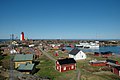
The islands generally enjoy a high standard of living comparable to that of continental Finland. Fishing and fish processing are major industries. The archipelago is well known for its Baltic herring and rainbow trout products. Agriculture is limited by the small size and rocky nature of the islands. However, the climate is more favourable than in continental Finland and some islands, particularly Rymättylä, are famous in the nearby continental areas for producing the first new potatoes of the summer. The significance of tourism to the economy of the islands is constantly increasing.
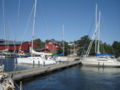
The islands are linked by bridges and ferries, and in case of Åland, a small airport. The ferries are divided into two categories: "road ferries" (landsvägsfärja or simply färja in Swedish, lautta or lossi in Finnish) are free of charge and operate mostly on short routes between adjacent (large) islands. They are raft-like in construction and usually operated by the road administration. The small ones are cable ferries (kabelfärja in Swedish, lossi in Finnish), bigger ones do not use cables (and are called lautta in Finnish). The other ferries (förbindelsefartyg in Swedish, yhteysalus in Finnish) are more ship-like in construction, are operated by the maritime administration and may charge a small fee. They operate on longer routes covering several smaller or more distant islands. There are also large commercially operated cruiseferries connecting the Finnish cities of Turku and Helsinki to Åland and Sweden.
During cold winters official ice roads are established between some islands. It is also common to drive on ice to islands lacking official ice roads. This greatly eases transportation, as it makes it possible to simply drive a car (or even a heavy van if ice is very thick, usually every few years) from the continent to the islands. On the other hand, during spring and autumn there is a period of thaw (menföre in Swedish, kelirikko in Finnish) when the ice is too weak even for walking, but too thick for boating. This can leave some islands lacking a pier for large ships isolated for days or weeks. Access is only by hydrocopter, hovercraft or helicopter.
Many important
Archipelago Ring Road
The most inhabited islands in the eastern archipelago in Southwest Finland are connected by the Archipelago Ring Road. There are approximately 160 to 190 kilometres (99–118 miles) of public roads and 30 to 50 kilometres (19–31 miles) of waterways along the Ring Road. The city of Turku is usually considered the starting point of the road. The route goes through following municipalities, villages, islands and island groups:
There is also a shorter version of the route, the so-called "Small Ring Road", which utilizes a ferry connection between Rymättylä (part of Naantali) and Nagu, skipping numbers 4–11 in the list above. The length of the "Small Ring Road" is approximately 125 km (78 mi).[15]
The ring road is usually traveled by car or by bicycle. Most of the ferries along the road are free, but ferries between Houtskär and Iniö charge a small fee. It is possible to cover the Ring Road in one day by car, but usually travellers spend at least one night along the way. Approximately 20 000 tourist travel the Ring Road every year. The main tourist season is from June to August. The principal tourist attraction is scenery and nature along the way, but significant sights also include the Louhisaari manor and several medieval churches.
Culture

The culture of the archipelago resembles that of the Swedish-speaking coastal areas of Finland. Many features of typically Finnish culture, such as the popularity of sauna, have become ingrained in the culture of the islands. There are, however, several subtle differences. Maypoles are an essential part of the Midsummer festival in the archipelago but not in continental Finland. On the other hand, the continental Finnish Midsummer tradition of lighting bonfires has been introduced to the archipelago relatively recently.
Based on the languages spoken the archipelago can be divided into three parts. The Åland archipelago in the west is almost completely Swedish-speaking, the Åboland archipelago in the south is mostly Swedish-speaking and the northern archipelago is Finnish-speaking.
Because Christianity spread to the islands before the mainland, the churches on the major islands tend to be relatively old; dating from the 13th, 14th and 15th centuries, with the oldest ones in Åland. More than 80% of Finns are members of the
The culinary culture of the archipelago resembles continental
Nature and conservation


The islands provide a unique and diverse environment for wildlife. The bigger islands resemble the coastal regions of continental Finland whereas skerries have a radically different environment. Smaller islands are devoid of trees, but still harbour a rich plantlife. The environment is sunny, has a relatively long growing season and is fertilised by guano. On the other hand, nearly constant wind and thin or non-existent soil limit plant growth. The very low salinity of the Baltic Sea makes splashes of seawater more benign for plant life. While most of the islands are rocky, some are actually extensions of the Salpausselkä ridge system, and thus composed of terminal moraine. Such islands include Örö and Jurmo. The flora and fauna in these islands is more diverse than in their rocky neighbours.
The conditions can vary radically even within one small island, due to the features of the rock on which the islands are based.[16] There may be small patches of fresh-water bogs, ponds of fresh water, ponds of brackish water, bushes, meadows, barren rocks, wind-beaten shores and sheltered coves on an island only a few tens of meters in diameter. Many plants have altered phenotypes due to the environment. For example, junipers on small islands grow only to a height less than 0.5 metres (1.6 feet), but can cover several square meters.
In contrast to the terrestrial and coastal ecosystems of the islands, the sea itself has a relatively low biodiversity. The reason for this is the brackish nature of the water. The salinity is only 0.6% in the Archipelago. The salinity has also varied greatly during the past, making it difficult for species to adapt. However, the great number of individuals indicates a favourable environment. Typical fish species are the Baltic herring, pike, white-fish, perch and flounder.[17]
The area is home to many species which are not found elsewhere in Finland.
The islands are a haven for
The greatest threat to the environment is
Many areas of the archipelago are protected from human activity by their sheer inaccessibility. The southern part of the Archipelago Sea belong to the cooperation area of the Archipelago National Park and there are many small nature conservation areas, where landing is prohibited in spring and summer.
History

Prehistory
The islands began
Swedish rule
During the 12th and 13th centuries
According to legend, the notorious
In 1808 the
Grand Duchy of Finland
This section needs expansion. You can help by adding to it. (March 2009) |
During the
Independent Finland
Finland gained its independence from
In 1939 the Soviet Union attacked Finland in the Winter War. At the end of the war in 1940 Finland was forced to rent Hanko at the eastern extreme of the Archipelago Sea to Soviet Union as a military base. In 1941 the Continuation War broke out. Finland sent troops to Åland to guard against a possible Soviet invasion, which didn't materialize. The Finnish army also laid siege on Hanko, which was evacuated by the Soviet Union later that year. Finnish troops remained in Åland until the end of the war in 1944.
In 1995 Finland became a member of the European Union. The referendum on the membership was held separately in Åland, leading to the possibility of different outcomes. A rejection of the EU membership by the Ålanders would have created a situation similar to that of Greenland, which is an autonomous region of Denmark but is not part of the EU. However, the membership was accepted in both referendums.
Image gallery
-
 Nagu church dating from the 15th century
 -
 The Isokari lighthouse in Kustavi
 -
-
 TheUtö Island of the Pargasmunicipality
 -
 Rocky islets of the outer archipelago in Gullkrona
 -
 Isokari maritime pilot station, responsible for guiding ships to the harbour of Uusikaupunki.
 -
-
 Sheep and cattle are keeping the landscape open in the national park


See also
References
- ^ Parker, Tristan (29 July 2021). "Away from it all: island hopping around Finland's Turku archipelago". The Guardian. Retrieved 31 July 2021.
- ^ Oleander-Turja, Jaakko (29 July 2021). "The Guardian hehkuttaa Turun saaristoa: "Missään muualla ei voi kokea vastaavaa"". Iltalehti (in Finnish). Retrieved 31 July 2021.
- ^ "Vihreäpolku.info :: What kind of area is Archipelago sea". Vihreapolku.info. Retrieved 10 October 2009.
- ^ Saarten ja vetten maa Archived 5 December 2013 at the Wayback Machine
- ^ "Geography of Indonesia". Asianinfo.org.
- ^ "The website of Finland's environmental administration". Ymparisto.fi. 18 July 2005. Archived from the original on 13 May 2013. Retrieved 25 February 2013.
- ^ "The website of Finland's environmental administration". Ymparisto.fi. 18 July 2005. Archived from the original on 13 May 2013. Retrieved 25 February 2013.
- ^ "Lumparn in the Earth Impact Database". Unb.ca. Retrieved 25 February 2013.
- ^ "A study about the geology of the archipelago conducted by the Geological Survey of Finland" (PDF). Archived from the original (PDF) on 16 February 2012. Retrieved 25 February 2013.
- ^ PBS Composer, www.pbs-composer.com. "The official pages of Åland". Aland.ax. Retrieved 25 February 2013.
- ^ "The Archipelao Sea Naval Command in Finnish" (in Finnish). Mil.fi. Archived from the original on 22 October 2008. Retrieved 25 February 2013.
- ^ History of the archipelago at the website of the Archipelago Sea National Park in Finnish Archived 19 February 2009 at the Wayback Machine
- ^ The summer residence of the president of Finland Archived 28 September 2007 at the Wayback Machine
- S2CID 204999252
- ^ "Map of the Small Ring Road". Mapmytracks.com. Retrieved 25 February 2013.
- ^ Special characteristics of the archipelago nature at the website of the Archipelago Sea National Park (in Finnish) Archived 18 February 2009 at the Wayback Machine
- ^ a b "The Archipelago Sea page at the website of the Natura 2000 programme". Natura.org. Retrieved 25 February 2013.
- ^ FIN. "Information about Harbour Porpoises in the Finnish-language website of the World Wide Fund for Nature". Wwf.fi. Archived from the original on 4 May 2011. Retrieved 25 February 2013.
- ^ Article about eutrophication in the website of Finland's environmental administration Archived 20 May 2011 at the Wayback Machine
- ^ 01.11.2011 08:30 Leena Laurila. "Geological history of the archipelago at the website of the Department of Geology at the University of Turku in Finnish". Sci.utu.fi. Archived from the original on 8 June 2011. Retrieved 25 February 2013.
{{cite web}}: CS1 maint: numeric names: authors list (link) - ^ Suikkari, Riikka (19 August 2022). "Pahamaineinen merirosvosakki herätti keskiajalla kauhua Suomen rannikolla – Katso kartasta, missä vitaaliveljet ryöstelivät ja majailivat". Yle (in Finnish). Retrieved 21 August 2022.
External links
![]() Archipelago Trail travel guide from Wikivoyage
Archipelago Trail travel guide from Wikivoyage
- Archipelago National Park
- Turku Archipelago
- Steamship s/s Ukkopekka cruise Naantali-Turku
- Interactive map of the ferries in Finland
- All guest harbors in the Archipelago of Turku and Aland
- Archipelago Research at University of Turku (In English)
- The official webpage of Åland (in English)
| History |  | ||||||
|---|---|---|---|---|---|---|---|
| Geography |
| ||||||
| Politics |
| ||||||
| Economy | |||||||
| Culture |
| ||||||