
Aurès Mountains
| Aures Mountains جبال الأوراس | |
|---|---|
Atlas Mountain System |
The Aures Mountains (
Geography
The Aures mountains are the eastern continuation of the Saharan Atlas. The highest peak in the Aurès mountain range is Djebel Chélia in Khenchela Province, which sits at 2,328 metres (7,638 ft).
The Belezma Range is a northwestern prolongation of the Aures Mountains located where the Tell Atlas and the Saharan Atlas come together. Its main summits are 2,178 m (7,146 ft) high Djebel Refaâ and 2,136 m (7,008 ft) high Djebel Tichaou.[2] The Atlas chain of mountains extends over 1000 kilometers in total over Northern Africa.
History
Historically, the Aures served as a refuge and bulwark for the
The mountain area was also a district of
Population
In eastern Algeria, the Aures is a large Berber-speaking region, home of the Chaoui people. The Chaoui eastern Berber population practices traditional transhumance, farming fixed stone terraces in the mountains where they grow sorghum, as well as other grains and vegetables. Seasonally they move their cattle to relatively warm areas in the lowland valleys where they pitch tents or live in other temporary structures and tend livestock through the winter.[4]
Features
-
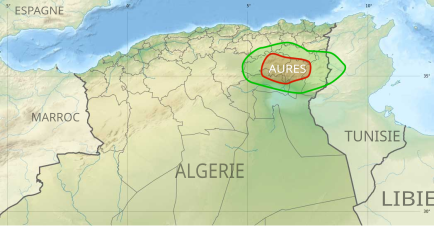 Location of theAuresregion in Algeria
 -
 View of one of the mountains of the Belezma Range, a western subrange of the Aures
 -
 Landscape of southern area of the range


See also
- Aures region
- Geography of Algeria
References
- ^ "Aurès - mountains, Algeria". Encyclopedia Britannica. 20 Jul 1998. Retrieved 8 Apr 2023.
- ^ Belezma National Park - Travel to Algeria
- ISBN 0521196973.
- ^ La vie économique du Chaouia de l'Aures
External links
- Les Aurès - Algérie (French). Includes many photos of the region.