
Aurangabad
Aurangabad | |
|---|---|
| Chhatrapati Sambhaji Nagar | |
From top, then left to right:
AIMIM) | |
| • Mayor | Vacant (Administrator Rule) |
| • MLAs |
|
| Area | |
| • US dollar[6](2019-20) | |
| Website | aurangabadmahapalika |


Aurangabad (ⓘ),[7][8] officially known as Chhatrapati Sambhaji Nagar,[9] or Chhatrapati Sambhajinagar,[10] is a city in the Indian state of Maharashtra. It is the administrative headquarters of Aurangabad district and is the largest city in the Marathwada region.[11] Located on a hilly upland terrain in the Deccan Traps, Aurangabad is the fifth-most populous urban area in Maharashtra after Mumbai, Pune, Nagpur and Nashik with a population of 1,175,116. The city is known as a major production center of cotton textile and artistic silk fabrics. Several prominent educational institutions, including Dr. Babasaheb Ambedkar Marathwada University, are located in the city. The city is also a popular tourism hub, with tourist destinations like the Ajanta and Ellora caves lying on its outskirts, both of which have been designated as UNESCO World Heritage Sites since 1983.[12] Other tourist attractions include the Aurangabad Caves, Devagiri Fort, Grishneshwar Temple, Jama Mosque, Bibi Ka Maqbara, Himayat Bagh, Panchakki and Salim Ali Lake. Historically, there were 52 Gates in Aurangabad, some of them extant, because of which Aurangabad is nicknamed as the "City of Gates". In 2019, the Aurangabad Industrial City (AURIC) became the first greenfield industrial smart city of India under the country's flagship Smart Cities Mission.[13][14]
History

.jpg)
Khaḍkī was the original name of the village which was made a capital city by Malik Ambar, the Prime Minister of Murtaza Nizam Shah II, Sultan of Ahmednagar. Within a decade, Khaḍkī grew into a populous and imposing city. Malik Ambar died in 1626.[15] He was succeeded by his son Fateh Khan, who changed the name of Khaḍkī to Fatehnagar. With the capture of Devagiri Fort by the imperial troops in 1633, the Nizam Shahi dominions, including Fatehnagar, came under the possession of the Mughals.[16]
In 1653, when Mughal prince Aurangzeb was appointed the Viceroy of the Deccan for the second time, he made Fatehnagar his capital and renamed it Aurangabad. Aurangabad is sometimes referred to as Khujista Bunyad by the chroniclers of Aurangzeb's reign.[17]
In 1667 Muazzam, son of Aurangzeb became governor of this province. Before him Mirza Rajah Jai Singh was in-charge of this province for some time.[18]
In 1681, after Aurangzeb's coronation as emperor, he shifted his court from the capital city of Delhi to Aurangabad in order to conduct his military campaigns in the Deccan. The presence of Mughal elites in the city led to urban development, as numerous public and private buildings were constructed. Though Aurangzeb chose not to reside in the city after 1684, the city retained importance as the primary military outpost of the Mughal Deccan, attracting wealth and turning Aurangabad into a centre of trade; the manufacture of embroidered silks emerged during this period and is still practised in Aurangabad today. Mughal Aurangabad was also a cultural hub, serving as an important centre of Persian and Urdu literature. During the Mughal era, Aurangabad had an estimated population of 200,000 people, living in 54 suburbs.[19]
In 1724,
In 1816, the British established a cantonment outside Aurangabad (as they did in other parts of the Nizam's dominions), but were discouraged from entering the city proper by the Nizam's officials.[24] As a princely state under British suzerainty, the Nizam's Hyderabad State was quasi-autonomous, meaning that Aurangabad's culture was somewhat free of colonial influence.[25][26]
Aurangabad began to industrialise in the late 19th century, with the city's first cotton mill being opened in 1889.[27] The population of the city was 30,000 in 1881, growing to 36,000 over the next two decades. Aurangabad was particularly affected by Deccan famines in 1899-1900, 1918, and 1920, causing surges in crime.[28][29]
Following Indian independence, Hyderabad State was annexed into the Indian Union in 1948, and consequently Aurangabad became a part of the Indian Union's Hyderabad State. In 1956, it passed into the newly formed bilingual Bombay State, and in 1960 it became a part of Maharashtra state.[30]
Bal Thackeray in 1988 proposed the city to be renamed as Sambhajinagar. The local governing body i.e., City Corporation passed a resolution on name change in 1995.[31] On 29 June 2022, the Shiv Sena-led Maharashtra cabinet approved the renaming of Aurangabad to Sambhaji Nagar, after Sambhaji Bhosale, second Chhatrapati of the Maratha Empire.[32]
Geography
The co-ordinates for Aurangabad are N 19° 53' 47" – E 75° 23' 54". The city is surrounded by hills on all directions.
Climate
Aurangabad features a
Most of the rainfall occurs in the monsoon season from June to September. Thunderstorms occur between November and April. Average annual rainfall is 710 mm. The city is often cloudy during the monsoon season and the cloud cover may remain together for days. The daily maximum temperature in the city often drops to around 22 °C due to the cloud cover and heavy rains.[34]
| Climate data for Aurangabad (Aurangabad Airport) 1991–2020, extremes 1952–2012 | |||||||||||||
|---|---|---|---|---|---|---|---|---|---|---|---|---|---|
| Month | Jan | Feb | Mar | Apr | May | Jun | Jul | Aug | Sep | Oct | Nov | Dec | Year |
| Record high °C (°F) | 34.2 (93.6) |
37.8 (100.0) |
40.6 (105.1) |
43.6 (110.5) |
43.8 (110.8) |
43.0 (109.4) |
37.1 (98.8) |
35.6 (96.1) |
37.0 (98.6) |
37.6 (99.7) |
34.6 (94.3) |
33.6 (92.5) |
43.6 (110.5) |
| Mean daily maximum °C (°F) | 29.2 (84.6) |
31.8 (89.2) |
35.6 (96.1) |
38.7 (101.7) |
39.6 (103.3) |
34.6 (94.3) |
30.1 (86.2) |
29.2 (84.6) |
30.2 (86.4) |
31.8 (89.2) |
30.5 (86.9) |
29.1 (84.4) |
32.5 (90.5) |
| Daily mean °C (°F) | 21.0 (69.8) |
23.8 (74.8) |
27.9 (82.2) |
31.5 (88.7) |
32.7 (90.9) |
28.8 (83.8) |
26.0 (78.8) |
25.3 (77.5) |
25.8 (78.4) |
25.6 (78.1) |
23.3 (73.9) |
20.9 (69.6) |
26.1 (78.9) |
| Mean daily minimum °C (°F) | 12.4 (54.3) |
14.9 (58.8) |
19.0 (66.2) |
23.1 (73.6) |
25.1 (77.2) |
23.6 (74.5) |
22.4 (72.3) |
21.8 (71.2) |
21.5 (70.7) |
19.1 (66.4) |
15.6 (60.1) |
12.5 (54.5) |
19.2 (66.6) |
| Record low °C (°F) | 1.2 (34.2) |
1.9 (35.4) |
7.1 (44.8) |
10.2 (50.4) |
14.2 (57.6) |
18.2 (64.8) |
18.4 (65.1) |
17.2 (63.0) |
12.6 (54.7) |
8.3 (46.9) |
1.9 (35.4) |
1.2 (34.2) |
1.2 (34.2) |
| Average rainfall mm (inches) | 2.6 (0.10) |
2.2 (0.09) |
11.4 (0.45) |
6.0 (0.24) |
17.4 (0.69) |
155.6 (6.13) |
178.0 (7.01) |
171.5 (6.75) |
172.4 (6.79) |
68.2 (2.69) |
17.5 (0.69) |
8.9 (0.35) |
811.7 (31.96) |
| Average rainy days | 0.3 | 0.2 | 0.9 | 0.6 | 1.2 | 8.0 | 10.9 | 10.0 | 8.4 | 3.9 | 1.1 | 0.5 | 46.1 |
| Average relative humidity (%) (at 17:30 IST )
|
40 | 35 | 28 | 27 | 29 | 55 | 71 | 73 | 69 | 53 | 49 | 44 | 48 |
| Average ultraviolet index | 6 | 7 | 8 | 8 | 8 | 7 | 6 | 6 | 7 | 6 | 6 | 6 | 7 |
| Source 1: India Meteorological Department[35][36][37] | |||||||||||||
| Source 2: Weather Atlas,[38] Tokyo Climate Center (mean temperatures 1991–2020)[39] | |||||||||||||
Geology

The entire area is covered by the
Demographics

| Year | Pop. | ±% |
|---|---|---|
| 1901 | 10,000 | — |
| 1911 | 34,902 | +249.0% |
| 1921 | 36,876 | +5.7% |
| 1931 | 36,870 | −0.0% |
| 1941 | 50,924 | +38.1% |
| 1951 | 66,636 | +30.9% |
| 1961 | 97,701 | +46.6% |
| 1971 | 165,253 | +69.1% |
| 1981 | 301,000 | +82.1% |
| 1991 | 592,000 | +96.7% |
| 2001 | 902,179 | +52.4% |
| 2011 | 1,421,879 | +57.6% |
| Source: Census of India[4][41] | ||
According to the
Religion
The majority of the population in Aurangabad are
Language
Marathi is the official language of the city.[5] Marathi is also the most commonly spoken language in the city, followed by Urdu and Hindi.[43]
Administration and politics
Local administration
Aurangabad Municipal Corporation (AMC) is the local civic body. It is divided into six zones. The Municipal Council was established in 1936, the Municipal Council area was about 54.5 km2. It was elevated to the status of Municipal Corporation from 8 December 1982, and simultaneously including eighteen peripheral villages, making the total area under its jurisdiction to 138.5 km2 extended its limits.
The city is divided in 115 electoral wards called as Prabhag, and each ward is represented by a Corporator elected by the people from each ward. There are two Committees, General Body and Standing Committee headed by the Mayor and the chairman respectively. AMC is responsible for providing basic amenities like drinking water, drainage facility, road, street lights, healthcare facilities, primary schools, etc. AMC collects its revenue from the urban taxes which are imposed on citizens. The administration is headed by the Municipal Commissioner; an IAS Officer, assisted by the other officers of different departments. Aurangabad Metropolitan Region Development Authority (AMRDA) is being Formed for the Allover Development of the Region.[44]
State and central administration
Aurangabad also contributes three
-
 Himroo Shawl
 -
 Bombay High Court Aurangabad Bench,ITC Welcomgroup'sThe Rama International, Ajanta Ambassador & Cidco Town Center – Aerial view


Economy
Aurangabad is considered to be a classic example of efforts of state government towards balanced industrialisation of state.
Aurangabad is surrounded by the industrial areas (
Culture/Cityscape
Culture
The culture of Aurangabad city is heavily influenced by the culture of
- better source needed] Other prominent poets from Aurangabad include Siraj Aurangabadi, Azad Bilgrami and Sikandar Ali Wajd.
- Jamaat-e-Islami, the Islamic revivalist party.[57]
Tourist attractions
Aurangabad is a historical city along with its surrounding towns and villages.[58]
Indian religions
Indian rock-cut architecture
- Aurangabad Caves
-

-
 Various sculptors next to an entrance at Aurangabad Caves.


- Aurangabad Caves: These are situated at a distance of 5 km (3 mi), nestled amidst the hills are 12 Buddhist caves dating back to 3 A.D. Of particular interest are the Tantric influences evident in the iconography and architectural designs of the caves.
Hindu and Jain temples
- Kachner Jain Temple: This is a 250 years old temple dedicated to Parshvanath. The idol here is called Chintamani Parshvanath.[59]
Gates and forts

- Gate: The city is also known for the 52 gates built during Mughal era which gives it the name of "City of Gates".[60]
Mughal architecture
_2.jpg)
- Bibi Ka Maqbara: Aurangabad is known for the Bibi Ka Maqbara situated about 3 km (2 mi) from the city, which is the burial mausoleum of Emperor Aurangzeb's wife Dilras Banu Begum, also known as Rabia-ud-Daurani. It is an imitation of the Taj Mahal at Agra and due to its similar design, it is popularly known as the "Taj of the Deccan".[61] Aurangabad also has the remains of the palace built by Aurangzeb, including the royal mosque.[62]
Other
-
 Panchakki, was designed to generate energy via water brought down from a spring on a mountain. It displays the scientific thought process put in medieval Indian architecture.
 -

-
 Siddharth Garden near bus stand Aurangabad


- Panchakki: Panchakki, which literally means water mill, is a 17th-century watermill situated within the old city is known for its underground water channel, which traverses more than 8 km from nearby hills. The channel culminates into an artificial waterfall that powers the mill.
- Salim Ali. It also has a bird Sanctuary and a garden maintained by the Aurangabad Municipal Corporation.
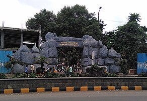
- Siddharth Garden and Zoo: is a park and zoo situated in near of the central bus station in Aurangabad. This is the only zoo in
Mashru and Himroo
- Himroo: The fabric is said to have originated in Persia, though not conclusively proved, Himroo is associated with the times of Mohammad Tughlaq who ruled in the 14th century. Fabrics and shawls from Aurangabad are much in demand for their unique style and design.[66]
- Kaghzipura: A place situated near Daulatabad made first handmade paper in India after the technology was brought here by Mongol invaders. However, the use of paper was not widespread there until the 12th century. [citation needed]
Cuisine
Aurangabadi food is much like Mughlai or Hyderabadi cuisine with its fragrant pulao and biryani. Meat cooked in fresh spices and herbs is a speciality, as are the delectable sweets. The local cuisine is a blend of Mughlai and Hyderabadi cuisine, with an influence of the spices and herbs of the Marathwada region.[67]
- (Hot furnace) while Qalia is a mixture of mutton and various spices.
- Aurangabad/Marathwada/Dakhni cuisine is a blend of the Puneri and the Hyderabadi cuisine (which blends the use of typical South Indian ingredients such as curry leaves, tamarind and coconut into their celebrated culinary practices).[68]
Transport


Air
Rail
Aurangabad railway station is the major railway station under Nanded railway division of the South Central Railway zone. It is located on the Kacheguda-Manmad section and has rail connectivity with major cities such as Delhi, Hyderabad, Latur Road, Manmad, Mumbai, Nagpur, Nanded, Nashik Road, Nizamabad and Pune. The work of DPR preparation is ongoing for metro in Aurangabad from Shendra and Waluj.[71] The work of surveys and DPR is also ongoing for high speed rail line from Mumbai to Nagpur, which will have a halt in Aurangabad.
Road
Central Bus Stand and CIDCO bus stand, Aurangabad of MSRTC are the main public transport centres. Buses are available to every major bus depots of Maharashtra. Ola Cabs service is available in city. Major long route Aurangabad buses reach Delhi, Jaipur, Gandhinagar and Hyderabad in 2–3 days. MSRTC buses are also available for all district of Maharashtra and neighbouring State's cities like Indore, Ujjain, Surat, Vadodara, Khandwa, Burhanpur, Khargone, Bhopal. There are Smart City Bus service in Aurangabad as the part of public transport in Aurangabad Metro City.
-
 Aurangabad Airport
 -
 Aurangabad Railway Station


Education

Dr. Babasaheb Ambedkar Marathwada University (BAMU) is located in Aurangabad city. Many colleges in the region are affiliated to it. The university has 101 Colleges affiliated in Aurangabad and 99 Colleges in Beed, 53 & 55 Colleges affiliated in Jalna & Osmanabad.[72]
Government College of Engineering, Aurangabad is an autonomous engineering college. It was affiliated to the Dr. Babasaheb Ambedkar Marathwada University and was established in 1960. The construction of the college was started in 1957 and was completed in 1960. Marathwada Institute of Technology and Jawaharlal Nehru Engineering College are two other engineering colleges in Aurangabad.
Maharashtra National Law University, Aurangabad is a state university[73] located in Aurangabad. It was established in 2017 by the Government of Maharashtra, the third and final university to be installed through the Maharashtra National Law University Act, 2014.[74]
Aurangabad has schools run by the Aurangabad Municipal Corporation (AMC) and private schools owned and run by trusts and individuals. Government Polytechnic Aurangabad is one of the polytechnic institutions in Marathwada region.
Institute of Hotel Management, Aurangabad, is affiliated to University of Huddersfield. Students have internships in the Vivanta, Taj in Aurangabad.[75]
In 1903, a treaty was signed between British and the Nizam to train the
Sports
Garware Stadium is the municipal stadium in the city.
Notable people
- Malik Ambar, a Siddi military leader and founder of Khadki (former name of city)
- Siraj Aurangabadi, 18th-century Indian Urdu and Persian poet
- Prashant Bamb, MLA from the Gangapur constituency, member of the Bharatiya Janata Party
- Ankit Bawne, cricketer
- Sandipanrao Bhumre, MLA from Paithan constituency, member of Shiv Sena
- Rajendra Darda, former MLA from Aurangabad East constituency, member of the Indian National Congress
- Tarang Jain, businessman
- Imtiyaz Jaleel, Indian politician and member of the All India Majlis-e-Ittehadul Muslimeen
- Mayuri Kango, film actress
- Chandrakant Khaire, Indian politician and member of Shiv Sena
- Aurangabadi Mahal, wife of Mughal emperor Aurangzeb
- Abul A'la Maududi, Pakistani theologian and philosopher of Islam
- Bashar Nawaz, Indian Urdu poet and lyricist
- Dulari Qureshi, art historian
- Iqbal Siddiqui, cricketer
- Nikki Tamboli, film actress
- Vineet Verma, film director
- Wali Mohammed Wali, father of Urdu poetry
- Rafiq Zakaria, Indian politician
See also
References
- ^ "Collectors of Aurangabad District | District Aurangabad | India". Archived from the original on 3 March 2022. Retrieved 4 April 2022.
- ^ "City Police". aurangabadcitypolice.gov.in. Archived from the original on 17 May 2022. Retrieved 4 April 2022.
- ^ a b "Census of India: Aurangabad". censusindia.gov.in. Archived from the original on 25 September 2021. Retrieved 1 October 2019.
- ^ a b "Census of India : Provisional Population Totals Paper 2 of 2011 : India (Vol II)". Archived from the original on 1 November 2011. Retrieved 29 October 2011.
- ^ a b "52nd Report of the Commissioner for Linguistic Minorities in India" (PDF). nclm.nic.in. Ministry of Minority Affairs. p. 108. Archived from the original (PDF) on 25 May 2017. Retrieved 14 January 2019.
- ^ Records, Official. "District Domestic Product of Maharashtra 2011-12 to 2019-20" (PDF). Planning Department, Government of Maharashtra, India. Directorate of Economics and Statistics. Archived (PDF) from the original on 6 November 2021. Retrieved 6 November 2021.
- ^ "Eknath Shinde renames Aurangabad as Sambhajinagar again, says 'legal' this time". Hindustan Times. 16 July 2022. Archived from the original on 20 July 2022. Retrieved 20 July 2022.
- ^ Dodhiya, K. A. Y (25 April 2023). "It's Aurangabad for now, says HC". Hindustan Times. Archived from the original on 17 May 2023. Retrieved 31 January 2024.
- ^ "Aurangabad and Osmanabad finally renamed as Chhatrapati Sambhaji Nagar and Dharashiv". The Indian Express. 24 February 2023. Archived from the original on 25 February 2023. Retrieved 25 February 2023.
- ^ "Will changing names of places resolve issues like unemployment, asks AIMIM leader". ThePrint. 25 February 2023. Archived from the original on 25 February 2023. Retrieved 25 February 2023.
- ISBN 9788184957020.
- ^ Gopal, Madan (1990). K.S. Gautam (ed.). India through the ages. Publication Division, Ministry of Information and Broadcasting, Government of India. p. 174.
- ^ "India's first industrial integrated smart city set for inauguration". The Times of India. 6 September 2019. Archived from the original on 1 October 2019. Retrieved 6 September 2019.
- ^ "PM Modi opens first greenfield industrial smart city in Aurangabad". India Today. 7 September 2019. Archived from the original on 8 September 2019. Retrieved 7 September 2019.
- ^ Qureshi Dulari, "Tourism Potential in Aurangabad," p.6
- ISBN 9788184957020.
- ^ "Kujista Bunyad". The Times of India. 1 August 2019. Archived from the original on 13 June 2021. Retrieved 1 August 2019.
- ^ Sarkar, Jadunath (1920). Shivaji And His Times. New York, USA: Longmass, Green and co. p. 180.
- OCLC 77080828.
- from the original on 7 February 2024. Retrieved 30 December 2021.
- ISBN 9780203483282, archivedfrom the original on 7 February 2024, retrieved 30 December 2021
- from the original on 7 February 2024. Retrieved 16 December 2021.
- ^ Green, Nile (2004). "Stories of saints and sultans remembering history at the Sufi shrines of Aurangabad" (PDF). p. 422. Archived from the original (PDF) on 17 September 2016. Retrieved 7 September 2016.
- ISBN 9780511576867, archivedfrom the original on 7 February 2024, retrieved 30 December 2021
- ISBN 978-0-19-022253-6. Archivedfrom the original on 7 February 2024. Retrieved 31 December 2021.
- ISBN 9780511576867, archivedfrom the original on 7 February 2024, retrieved 30 December 2021
- ISBN 978-0-19-022253-6, archivedfrom the original on 7 February 2024, retrieved 30 December 2021
- ISBN 9780511576867, archivedfrom the original on 7 February 2024, retrieved 31 December 2021
- OCLC 77080828.
- ^ "Aurangabad | City & History | Britannica". www.britannica.com. Archived from the original on 30 December 2021. Retrieved 30 December 2021.
- ^ Shaikh, Zeeshan (1 July 2022). "Explained: Why has the Maharashtra government renamed Aurangabad city as Sambhajinagar?". The Indian Express. Archived from the original on 13 July 2022. Retrieved 14 July 2022.
- ^ "Maharashtra cabinet approves renaming of Aurangabad to Sambhaji Nagar". The Times of India. 29 June 2022. Archived from the original on 29 June 2022. Retrieved 29 June 2022.
- ^ Maharashtra government web site Archived 9 August 2011 at the Wayback Machine
- ^ "Marathwada – SANDRP". Archived from the original on 14 April 2019. Retrieved 14 April 2019.
- ^ "Station: Aurangabad (Chikalthana)(A) Climatological Table 1981–2010" (PDF). Climatological Normals 1981–2010. India Meteorological Department. January 2015. pp. 55–56. Archived from the original (PDF) on 5 February 2020. Retrieved 3 April 2020.
- ^ "Extremes of Temperature & Rainfall for Indian Stations (Up to 2012)" (PDF). India Meteorological Department. December 2016. p. M137. Archived from the original (PDF) on 5 February 2020. Retrieved 3 April 2020.
- ^ "Climatological Tables 1991-2020" (PDF). India Meteorological Department. p. 21. Archived from the original (PDF) on 1 January 2023. Retrieved 1 January 2023.
- ^ "Climate and monthly weather forecast Aurangabad, India". Weather Atlas. Archived from the original on 20 July 2022. Retrieved 20 July 2022.
- ^ "Normals Data: Aurangabad Chikalthana - India Latitude: 19.85°N Longitude: 75.40°E Height: 585 (m)". Japan Meteorological Agency. Retrieved 29 February 2020.
- ^ Aher K.R. 'Groundwater Quality studies of Chikalthana area of Aurangabad', PhD Thesis, Dr.B.A.M.University, Aurangabad(Maharashtra State), India,2012 page-38
- ^ [Govt of Maharashtra Aurangabad Gazetteer. Section – The People (population)]
- ^ a b "C-1 Population By Religious Community - Maharashtra". census.gov.in. Archived from the original on 23 September 2015. Retrieved 1 May 2022.
- ^ a b "C-16 Population By Mother Tongue - Town Level – Maharashtra". Census. Archived from the original on 8 December 2019. Retrieved 29 December 2019.
- ^ "AMRDA will soon get office, administrative officer - www.lokmattimes.com". Lokmat Times. 3 September 2021. Retrieved 1 April 2024.
- ^ "AIMIM's Jaleel wins Aurangabad seat, beats Khaire". The Asian Age. 24 May 2019. Archived from the original on 25 May 2019. Retrieved 25 May 2019.
- ^ "Map of Aurangabad Loksabha and Assembly seats" (PDF). Archived from the original (PDF) on 30 September 2011. Retrieved 5 July 2018.
- ^ Election Commission of India Archived 21 May 2009 at the Wayback Machine
- ^ TOI (12 April 2009). "History revisited at Aurangabad". The Times of India. Archived from the original on 6 May 2009. Retrieved 20 January 2010.
- ^ "Hyderabad" by Mirza Mehdy Khan, Imperial Gazetteer of India, Government Printing Press, Calcutta, 1909.
- ^ "Maharashtra Centre For Entrepreneurship Development". mced.in. Archived from the original on 27 May 2019. Retrieved 26 May 2019.
- ^ a b "Economy of Aurangabad, Business and Economy in Aurangabad". www.aurangabadlive.in. Archived from the original on 27 June 2021. Retrieved 27 June 2021.
- ^ Ashar, Sandeep (15 October 2011). "Share on emailShare on printShare on redditMore Sharing Services Four mega industrial towns". The Times of India. Archived from the original on 1 May 2013. Retrieved 31 May 2012.
- ^ Sharad, Arpita (31 January 2020). "Russian investment in Auric to generate 2,000 jobs | Aurangabad News - Times of India". The Times of India. Archived from the original on 16 January 2022. Retrieved 22 February 2022.
- ^ a b "Dakhni – The Language of India's Composite Culture". Archived from the original on 2 October 2011. Retrieved 19 September 2009.
- Jamaat-e-Islami. Archived 15 March 2010 at the Wayback Machine
- ^ Adams, p.100-101
- ^ "Founder of Jamaat-e-Islami". jamaat.org. Archived from the original on 20 August 2011. Retrieved 26 June 2022.
- ^ "Tourist Places | District Aurangabad". Archived from the original on 14 April 2019. Retrieved 14 April 2019.
- ^ Akhef, Mohammed (12 February 2023). "Aurangabad cops return 1.7kg gold stolen from temple". The Times of India. Archived from the original on 6 March 2023. Retrieved 6 March 2023.
- ^ Banerjee, Rajiv (12 April 2009). "History revisited at Aurangabad the 'city of gates'". The Economic Times. Archived from the original on 24 March 2014. Retrieved 27 February 2014.
- ^ P., Bhaskar. "The Taj of Deccan". Deccan Herald. Archived from the original on 3 March 2014. Retrieved 27 February 2014.
- from the original on 11 September 2023. Retrieved 13 November 2023.
- ^ "Aurangabad News: Promise trees, wild animals - वृक्ष, वन्यप्राण्यांचे सवंर्धन करा | Maharashtra Times". Archived from the original on 12 January 2019. Retrieved 12 January 2019.
- ^ "औरंगाबादच्या सिद्धार्थ उद्यानातील प्राणी संग्रहालय बंद होणार !". ABP (in Marathi). 1 December 2018. Archived from the original on 8 March 2023. Retrieved 30 May 2022.
- ^ "Siddharth Garden Zoo". Archived from the original on 6 January 2016. Retrieved 29 October 2015.
- ISBN 978-81-86050-44-6.
- ^ The cuisine of Auguranbad Archived 27 August 2007 at the Wayback Machine
- ^ "Upper Crust ::: India's food, wine and style magazine". Archived from the original on 17 July 2011. Retrieved 15 September 2009.
- ^ "Direct Haj flights from Aurangabad". Daily News and Analysis. 22 November 2008. Archived from the original on 16 September 2012. Retrieved 14 August 2014.
- ^ "Aurangabad Airport AAI website". Archived from the original on 5 July 2017. Retrieved 5 July 2018.
- ^ "Aurangabad Metro: शेंद्रा डीएमआयसी ते वाळूजपर्यंत डबल डेकर पुलावरून धावणार मेट्रो !". Lokmat. 12 January 2022. Archived from the original on 15 April 2022. Retrieved 7 April 2022.
- ^ "List of Affiliated Colleges and Institutions". Archived from the original on 2 December 2011. Retrieved 13 December 2011.
- ^ "List of State Universities as on 18.09.2017" (PDF). University Grants Commission. 18 September 2017. Archived (PDF) from the original on 28 September 2017. Retrieved 27 September 2017.
- ^ "Maharashtra National Law University Act, 2014" (PDF). Maharashtra Gazette. Government of Maharashtra. 20 March 2014. Archived from the original (PDF) on 28 September 2017. Retrieved 28 September 2017.
- ^ "National Institute of Electronics and Information Technology, Aurangabad". Aurangabad.nielit.gov.in. Archived from the original on 5 May 2015. Retrieved 29 May 2015.
- ^ "Aurangabad". Aurangabad Cantonment Board. Archived from the original on 25 February 2012. Retrieved 31 May 2012.
- ^ "Garware stadium set for a facelift". The Times of India. 25 February 2017. Archived from the original on 8 March 2023. Retrieved 1 June 2023.
External links
 Aurangabad travel guide from Wikivoyage
- . Encyclopædia Britannica. Vol. 2 (11th ed.). 1911. p. 922.
- Aurangabad District website
- Gazetteer of Aurangabad. Bombay: Times of India. 1884.
Places adjacent to Aurangabad | ||||||||||||||||
|---|---|---|---|---|---|---|---|---|---|---|---|---|---|---|---|---|
| ||||||||||||||||
Aurangabad district topics | ||
|---|---|---|
| History | .svg) | |
| Geography | ||
| Monuments |
| |
| Culture |
| |
| Education | ||
| Transport |
| |
| Cities and towns | ||
| Neighbourhoods | ||
| Industrial projects | ||
| Lok Sabha constituencies |
| |
| Assembly constituencies |
| |
| Judiciary | ||
| Sports | ||
| Other topics |
| |
| Topics | |||||||||||||
|---|---|---|---|---|---|---|---|---|---|---|---|---|---|
| Regions | |||||||||||||
| Divisions and Districts |
| ||||||||||||
| Million-plus cities in Maharashtra | |||||||||||||
| Other cities with municipal corporations | |||||||||||||
| Governmant | |||||||||||||
| International | |
|---|---|
| National | |