
Bến Tre
Bến Tre
Thành phố Bến Tre | |
|---|---|
| Bến Tre City | |
 Skyline of Bến Tre | |
|
ICT) | |
| Climate | Aw |
| Website | https://bentre.gov.vn/ |
Bến Tre (Vietnamese pronunciation: Bến Tre Province, in the Mekong Delta region of southern Vietnam. Located 85 kilometers (53 mi) southwest of Ho Chi Minh City, the city covers an area of 65.75 km2 (25.39 sq mi) and has a population of 124,499 at the 2019 census.[1] Bến Tre is connected to the surrounding provinces by the Rạch Miễu Bridge.
History
The
nearly destroyed by bombing
.
-
 Map of Bến Tre in 1882.
 -
 Bến Tre Market after the Tet Offensive in 1968.


Geography
Bến Tre is located on Bảo Island, with the districts of
Ba Tri
. The city is oriented in a triangular layout and is bordered by the following:
- North and East by Châu Thành district.
- South by Giồng Trôm district.
- West by Mỏ Cày Bắc district.
Administration
The city of Bến Tre has 8 wards: 4, 5, 6, 7, 8, An Hội, Phú Khương and Phú Tân, and 6 communes: Bình Phú, Mỹ Thạnh An, Nhơn Thạnh, Phú Hưng, Phú Nhuận and Sơn Đông.
Schools
- Bến Tre High School for the Gifted
- Nguyen Dinh Chieu High School Archived 2022-02-28 at the Wayback Machine
Notable people
- Chân Không - Buddhist nun who worked closely with Zen master Thích Nhất Hạnh for more than fifty years
- Nguyễn Phương Khánh - Miss Earth 2018 winner
Gallery
-
 Tourist boat on the Bến Tre River.
 -
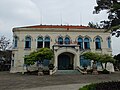 Bến Tre Museum
 -
 Bến Tre Market
 -
 Trúc Giang Lake


References
- ^ "Completed results of the 2019 Vietnam population and housing census" (PDF). General Statistics Office. Retrieved 7 July 2022.
- ^ Thạch Phương, Tứ Đoàn, Phương Thảo Nguyễn Địa chí Bến Tre 1991 "Only in Bao and Minh islets, there had been 70 schools of Chinese characters in 152 villages until the French occupied Ben Tre (1867). That was a very rare proportion at that time. The list of the Ben Tre successful candidates written in the...."
Wikimedia Commons has media related to Ben Tre City.
External links
Wikivoyage has a travel guide for Ben Tre.
- Ben Tre - The third Coconut Festival 2012[permanent dead link]
- Bến Tre Hôm Nay
- Official website of Ben Tre province (English ver.)
- Michael D. Miller. Saving Ben Tre: American veteran's account of Bến Tre during the Tet Offensive
10°14′N 106°23′E / 10.233°N 106.383°E
Districts of the Mekong Delta | ||
|---|---|---|
| Cần Thơ city |  | |
| An Giang province |
| |
| Bạc Liêu province | ||
| Bến Tre province | ||
| Cà Mau province | ||
| Đồng Tháp province | ||
| Hậu Giang province |
| |
| Kiên Giang province | ||
| Long An province | ||
| Sóc Trăng province | ||
| Tiền Giang province |
| |
| Trà Vinh province | ||
| Vĩnh Long province | ||
※ denotes provincial seat. | ||
| International | |
|---|---|
| National | |
| Geographic | |