
Baicheng
Baicheng
白城市 | ||
|---|---|---|
Postal code 137000 | ||
| Area code | 0436 | |
| ISO 3166 code | CN-JL-08 | |
| Licence plates | 吉G | |
| Website | www | |
Baicheng (Chinese: 白城; pinyin: Báichéng; lit. 'White City') is a prefecture-level city in the northwestern part of Jilin province, People's Republic of China, bordering Inner Mongolia to the north and west and Heilongjiang to the east and northeast. At the 2010 census, 2,033,058 people lived within its administrative area of 25,683 km2 (9,916 sq mi).[2]
History
The area around present day Baicheng was a nomadic area which was inhabited by several nomad tribes in
Baicheng's importance started to increase after a railway from
Geography
Topography
Baicheng is located in the eastern part of the Horqin Grassland, and situated in the northwestern part of Jilin Province. Bordering prefecture cities are:
- Songyuan (SE)
- Qiqihar (N)
- Xingan League (W)
The city's metro area is located 333 kilometres (207 mi) from the provincial capital of Changchun, 218 kilometres (135 mi) from Qiqihar, 448 kilometres (278 mi) from Siping, and 83 kilometres (52 mi) from Ulanhot. The city is located at latitude 44° 13′—46° 18′ N and longitude 121° 38′—124° 22' E. At its greatest width, the city spans 230 kilometres (142.9 mi) from north to south and 211 kilometres (131 mi) from east to west. The total area of the city is 25,683 square kilometres (9,916 sq mi), occupying a mere 13.7% of the provincial area. The eastern part of the Greater Khingan Mountains lies in the northwest of Baicheng. Grassland and wetlands are prominent throughout the city's southeastern part.
Climate
.jpg)
Baicheng has a rather dry,
| Climate data for Baicheng (1991–2020 normals, extremes 1971–2010) | |||||||||||||
|---|---|---|---|---|---|---|---|---|---|---|---|---|---|
| Month | Jan | Feb | Mar | Apr | May | Jun | Jul | Aug | Sep | Oct | Nov | Dec | Year |
| Record high °C (°F) | 5.9 (42.6) |
12.8 (55.0) |
26.6 (79.9) |
33.3 (91.9) |
40.0 (104.0) |
40.7 (105.3) |
38.0 (100.4) |
37.7 (99.9) |
34.0 (93.2) |
29.8 (85.6) |
19.3 (66.7) |
7.2 (45.0) |
40.7 (105.3) |
| Mean daily maximum °C (°F) | −8.8 (16.2) |
−3.0 (26.6) |
5.4 (41.7) |
15.6 (60.1) |
23.1 (73.6) |
27.7 (81.9) |
29.2 (84.6) |
27.7 (81.9) |
22.7 (72.9) |
13.7 (56.7) |
1.3 (34.3) |
−7.5 (18.5) |
12.3 (54.1) |
| Daily mean °C (°F) | −15.7 (3.7) |
−10.3 (13.5) |
−1.6 (29.1) |
8.6 (47.5) |
16.6 (61.9) |
21.8 (71.2) |
24.0 (75.2) |
22.0 (71.6) |
15.9 (60.6) |
6.9 (44.4) |
−4.8 (23.4) |
−13.7 (7.3) |
5.8 (42.4) |
| Mean daily minimum °C (°F) | −21.4 (−6.5) |
−16.9 (1.6) |
−8.6 (16.5) |
1.1 (34.0) |
9.6 (49.3) |
15.8 (60.4) |
19.0 (66.2) |
16.6 (61.9) |
9.3 (48.7) |
0.8 (33.4) |
−10.1 (13.8) |
−18.9 (−2.0) |
−0.3 (31.4) |
| Record low °C (°F) | −38.1 (−36.6) |
−36.7 (−34.1) |
−26.0 (−14.8) |
−13.6 (7.5) |
−4.4 (24.1) |
3.7 (38.7) |
8.0 (46.4) |
6.6 (43.9) |
−2.9 (26.8) |
−19.6 (−3.3) |
−29.3 (−20.7) |
−35.1 (−31.2) |
−38.1 (−36.6) |
| Average precipitation mm (inches) | 1.0 (0.04) |
2.0 (0.08) |
4.2 (0.17) |
16.0 (0.63) |
38.0 (1.50) |
81.9 (3.22) |
105.3 (4.15) |
70.2 (2.76) |
44.0 (1.73) |
12.9 (0.51) |
4.2 (0.17) |
2.7 (0.11) |
382.4 (15.07) |
| Average precipitation days (≥ 0.1 mm) | 2.1 | 1.6 | 2.7 | 3.9 | 7.4 | 11.6 | 11.6 | 9.3 | 6.6 | 4.0 | 3.1 | 3.4 | 67.3 |
| Average snowy days | 4.1 | 2.9 | 4.0 | 1.2 | 0 | 0 | 0 | 0 | 0 | 1.0 | 4.0 | 5.1 | 22.3 |
| Average relative humidity (%)
|
58 | 48 | 40 | 37 | 45 | 59 | 73 | 73 | 62 | 52 | 54 | 59 | 55 |
| Mean monthly sunshine hours | 212.4 | 229.0 | 272.9 | 264.2 | 266.0 | 249.1 | 240.5 | 247.1 | 246.9 | 227.2 | 190.8 | 187.0 | 2,833.1 |
| Percent possible sunshine | 75 | 78 | 73 | 65 | 58 | 53 | 51 | 57 | 67 | 68 | 68 | 69 | 65 |
| Source 1: China Meteorological Administration[6][7] | |||||||||||||
| Source 2: Weather China[8] | |||||||||||||
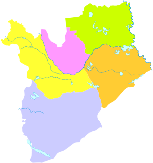
Administrative divisions
| Map | ||||||
|---|---|---|---|---|---|---|
| # | Name | Hanzi
|
Hanyu Pinyin
|
Population (2003 est.) | Area (km2) | Density (/km2) |
| 1 | Taobei District
|
洮北区 | Táoběi Qū | 490,000 | 2,525 | 194 |
| 2 | Da'an City | 大安市 | Dà'ān Shì | 420,000 | 4,879 | 86 |
| 3 | Taonan City | 洮南市 | Táonán Shì | 440,000 | 5,108 | 86 |
| 4 | Zhenlai County | 镇赉县 | Zhènlài Xiàn | 310,000 | 4,695 | 66 |
| 5 | Tongyu County | 通榆县 | Tōngyú Xiàn | 350,000 | 8,476 | 41 |
Economy
Textile industry is one of the main pillars of the economy. Agriculture of the area is centred on plantation of soy beans and oil plants. It is home to the Baicheng Weapons Test Centre.[9]
Transportation
Railway

Baicheng railway station is a railway hub in western Jilin Province. It is the terminus of the Changchun–Baicheng railway. There are multiple daily departures to other cities including Beijing, Harbin, Changchun, Shenyang, Dalian, Qiqihar, Ulanhot and several other cities in northern provinces of China.
Road
Expressways:
National Highway (GXXX):
Air
Sister cities
 Barnaul, Altai Krai, Russia
References
- ^ a b c d Ministry of Housing and Urban-Rural Development, ed. (2019). China Urban Construction Statistical Yearbook 2017. Beijing: China Statistics Press. p. 50. Archived from the original on 18 June 2019. Retrieved 11 January 2020.
- ^ a b 2010年吉林省第六次全国人口普查主要数据公报 (in Chinese (China)). Jilin Province People's Government. May 2011. Archived from the original on 2011-11-05. Retrieved 2012-01-01.
- ISBN 978-7-5037-7899-5. Archived from the originalon 2018-04-28. Retrieved 2017-06-05.
- ISBN 7-5043-2568-6.
- ^ "Baicheng - China". Encyclopedia Britannica.
- ^ 中国气象数据网 – WeatherBk Data (in Simplified Chinese). China Meteorological Administration. Retrieved 7 July 2023.
- ^ 中国气象数据网 (in Simplified Chinese). China Meteorological Administration. Retrieved 7 July 2023.
- ^ 白城 - 气象数据 -中国天气网 (in Chinese). Weather China. Retrieved 28 November 2022.
- Jane's Information Group.
Images have emerged showing what appears to be a new Chinese 8×8 assault gun equipped with a 105 mm main armament and a remote-controlled weapon station reportedly being trialled at what local media identified as the Baicheng Weapons Test Centre in northeastern China.
- ^ 白城新空港:长安机场 [A Baicheng Airport: Changan airport]. Government of Jilin Province. 2012-10-30. Archived from the original on 2013-02-15. Retrieved 2013-01-22.
- ^ 白城新空港:长安机场. Government of Jilin Province. 2012-10-30. Archived from the original on 2013-02-15. Retrieved 2013-01-22.
- ^ a b 吉林白城长安机场正式通航. Xinhua. 1 April 2017.