
Baikal–Amur Mainline
| Baikal–Amur Mainline | |||||||||||||||||||||||||||||||||||||||||||||||||||||||||||||||||||||||||||||||||||||||||||||||||||||||||||||||||||||||||||||||||||||||||||||||||||||||||||||||||||||||||||||||||||||||||||||||||||||||||||||||||||||||||||||||||||||||||||||||||||||||||||||||||||||||||||||||||||||||||||||||||||||||||||||||||||||||||||||||||||||||||||||||||||||||||||||||||||||||||||||||||||||||||||||||||||||||||||||||||||||||||||||||||||||||||||||||||||||||||||||||||||||||||||||||||||||||||||||||||||||||||||||||||||||||||||||||||||||||||||||||||||||||||||||||||||||||||||||||||||||||||||||||||||||||||||||||||||||||||||||||||||||||||||||||||||||||||||||||||||||||||||||||||||||||||||||||||||||||||||||||||||||||||||||||||||||||||||||||||||||||||||||||||||||||||||||||||||||||||||||||||||||||||||||||||||||||||||||||||||||||||||||||||||||||||||||||||||||||||||||||||||||||||||||||||||||||||||||||||||||||||||||||||||||||||||||||||||||||||||||||||||||||||||||||||||||||||||||||||||||||||||||||||||||||||||||||||||||||
|---|---|---|---|---|---|---|---|---|---|---|---|---|---|---|---|---|---|---|---|---|---|---|---|---|---|---|---|---|---|---|---|---|---|---|---|---|---|---|---|---|---|---|---|---|---|---|---|---|---|---|---|---|---|---|---|---|---|---|---|---|---|---|---|---|---|---|---|---|---|---|---|---|---|---|---|---|---|---|---|---|---|---|---|---|---|---|---|---|---|---|---|---|---|---|---|---|---|---|---|---|---|---|---|---|---|---|---|---|---|---|---|---|---|---|---|---|---|---|---|---|---|---|---|---|---|---|---|---|---|---|---|---|---|---|---|---|---|---|---|---|---|---|---|---|---|---|---|---|---|---|---|---|---|---|---|---|---|---|---|---|---|---|---|---|---|---|---|---|---|---|---|---|---|---|---|---|---|---|---|---|---|---|---|---|---|---|---|---|---|---|---|---|---|---|---|---|---|---|---|---|---|---|---|---|---|---|---|---|---|---|---|---|---|---|---|---|---|---|---|---|---|---|---|---|---|---|---|---|---|---|---|---|---|---|---|---|---|---|---|---|---|---|---|---|---|---|---|---|---|---|---|---|---|---|---|---|---|---|---|---|---|---|---|---|---|---|---|---|---|---|---|---|---|---|---|---|---|---|---|---|---|---|---|---|---|---|---|---|---|---|---|---|---|---|---|---|---|---|---|---|---|---|---|---|---|---|---|---|---|---|---|---|---|---|---|---|---|---|---|---|---|---|---|---|---|---|---|---|---|---|---|---|---|---|---|---|---|---|---|---|---|---|---|---|---|---|---|---|---|---|---|---|---|---|---|---|---|---|---|---|---|---|---|---|---|---|---|---|---|---|---|---|---|---|---|---|---|---|---|---|---|---|---|---|---|---|---|---|---|---|---|---|---|---|---|---|---|---|---|---|---|---|---|---|---|---|---|---|---|---|---|---|---|---|---|---|---|---|---|---|---|---|---|---|---|---|---|---|---|---|---|---|---|---|---|---|---|---|---|---|---|---|---|---|---|---|---|---|---|---|---|---|---|---|---|---|---|---|---|---|---|---|---|---|---|---|---|---|---|---|---|---|---|---|---|---|---|---|---|---|---|---|---|---|---|---|---|---|---|---|---|---|---|---|---|---|---|---|---|---|---|---|---|---|---|---|---|---|---|---|---|---|---|---|---|---|---|---|---|---|---|---|---|---|---|---|---|---|---|---|---|---|---|---|---|---|---|---|---|---|---|---|---|---|---|---|---|---|---|---|---|---|---|---|---|---|---|---|---|---|---|---|---|---|---|---|---|---|---|---|---|---|---|---|---|---|---|---|---|---|---|---|---|---|---|---|---|---|---|---|---|---|---|---|---|---|---|---|---|---|---|---|---|---|---|---|---|---|---|---|---|---|---|---|---|---|---|---|---|---|---|---|---|---|---|---|---|---|---|---|---|---|---|---|---|---|---|---|---|---|---|---|---|---|---|---|---|---|---|---|---|---|---|---|---|---|---|---|---|---|---|---|---|---|---|---|---|---|---|---|---|---|---|---|---|---|---|---|---|---|---|---|---|---|---|---|---|---|---|---|---|---|---|---|---|---|---|---|---|---|---|---|---|---|---|---|---|---|---|---|---|---|---|---|---|---|---|---|---|---|---|---|---|---|---|---|---|---|---|---|---|---|---|---|---|---|---|---|---|---|---|---|---|---|---|---|---|---|---|---|---|---|---|---|---|---|---|---|---|---|---|---|---|---|---|---|---|---|---|---|---|---|---|---|---|---|---|---|---|---|---|---|---|---|---|---|---|---|---|---|---|---|---|---|---|---|---|---|---|---|---|---|---|---|---|---|---|---|---|---|---|---|---|---|---|---|---|---|---|---|---|---|---|---|---|---|---|---|---|---|---|---|---|---|---|---|---|---|---|---|---|---|---|---|---|---|---|---|---|---|---|---|---|---|---|---|---|---|---|---|---|---|---|---|---|---|---|---|---|---|---|---|---|---|---|---|---|---|---|---|---|---|---|---|---|---|---|---|---|---|---|---|---|---|---|---|---|---|---|---|---|---|---|---|---|---|---|---|---|---|---|---|---|---|---|---|---|---|---|---|---|---|---|---|---|---|---|---|---|---|---|---|---|---|---|---|---|---|---|---|---|---|---|---|---|---|---|---|---|---|---|---|---|---|---|---|---|---|---|---|---|---|---|---|---|---|---|---|---|---|---|---|---|---|---|---|---|---|---|---|---|---|---|---|---|---|---|---|---|---|---|---|---|---|---|---|---|---|---|
Freight rail | |||||||||||||||||||||||||||||||||||||||||||||||||||||||||||||||||||||||||||||||||||||||||||||||||||||||||||||||||||||||||||||||||||||||||||||||||||||||||||||||||||||||||||||||||||||||||||||||||||||||||||||||||||||||||||||||||||||||||||||||||||||||||||||||||||||||||||||||||||||||||||||||||||||||||||||||||||||||||||||||||||||||||||||||||||||||||||||||||||||||||||||||||||||||||||||||||||||||||||||||||||||||||||||||||||||||||||||||||||||||||||||||||||||||||||||||||||||||||||||||||||||||||||||||||||||||||||||||||||||||||||||||||||||||||||||||||||||||||||||||||||||||||||||||||||||||||||||||||||||||||||||||||||||||||||||||||||||||||||||||||||||||||||||||||||||||||||||||||||||||||||||||||||||||||||||||||||||||||||||||||||||||||||||||||||||||||||||||||||||||||||||||||||||||||||||||||||||||||||||||||||||||||||||||||||||||||||||||||||||||||||||||||||||||||||||||||||||||||||||||||||||||||||||||||||||||||||||||||||||||||||||||||||||||||||||||||||||||||||||||||||||||||||||||||||||||||||||||||||||||
| System |
| ||||||||||||||||||||||||||||||||||||||||||||||||||||||||||||||||||||||||||||||||||||||||||||||||||||||||||||||||||||||||||||||||||||||||||||||||||||||||||||||||||||||||||||||||||||||||||||||||||||||||||||||||||||||||||||||||||||||||||||||||||||||||||||||||||||||||||||||||||||||||||||||||||||||||||||||||||||||||||||||||||||||||||||||||||||||||||||||||||||||||||||||||||||||||||||||||||||||||||||||||||||||||||||||||||||||||||||||||||||||||||||||||||||||||||||||||||||||||||||||||||||||||||||||||||||||||||||||||||||||||||||||||||||||||||||||||||||||||||||||||||||||||||||||||||||||||||||||||||||||||||||||||||||||||||||||||||||||||||||||||||||||||||||||||||||||||||||||||||||||||||||||||||||||||||||||||||||||||||||||||||||||||||||||||||||||||||||||||||||||||||||||||||||||||||||||||||||||||||||||||||||||||||||||||||||||||||||||||||||||||||||||||||||||||||||||||||||||||||||||||||||||||||||||||||||||||||||||||||||||||||||||||||||||||||||||||||||||||||||||||||||||||||||||||||||||||||||||||||||||
| Operator(s) | Russian Railways | ||||||||||||||||||||||||||||||||||||||||||||||||||||||||||||||||||||||||||||||||||||||||||||||||||||||||||||||||||||||||||||||||||||||||||||||||||||||||||||||||||||||||||||||||||||||||||||||||||||||||||||||||||||||||||||||||||||||||||||||||||||||||||||||||||||||||||||||||||||||||||||||||||||||||||||||||||||||||||||||||||||||||||||||||||||||||||||||||||||||||||||||||||||||||||||||||||||||||||||||||||||||||||||||||||||||||||||||||||||||||||||||||||||||||||||||||||||||||||||||||||||||||||||||||||||||||||||||||||||||||||||||||||||||||||||||||||||||||||||||||||||||||||||||||||||||||||||||||||||||||||||||||||||||||||||||||||||||||||||||||||||||||||||||||||||||||||||||||||||||||||||||||||||||||||||||||||||||||||||||||||||||||||||||||||||||||||||||||||||||||||||||||||||||||||||||||||||||||||||||||||||||||||||||||||||||||||||||||||||||||||||||||||||||||||||||||||||||||||||||||||||||||||||||||||||||||||||||||||||||||||||||||||||||||||||||||||||||||||||||||||||||||||||||||||||||||||||||||||||||
| Technical | |||||||||||||||||||||||||||||||||||||||||||||||||||||||||||||||||||||||||||||||||||||||||||||||||||||||||||||||||||||||||||||||||||||||||||||||||||||||||||||||||||||||||||||||||||||||||||||||||||||||||||||||||||||||||||||||||||||||||||||||||||||||||||||||||||||||||||||||||||||||||||||||||||||||||||||||||||||||||||||||||||||||||||||||||||||||||||||||||||||||||||||||||||||||||||||||||||||||||||||||||||||||||||||||||||||||||||||||||||||||||||||||||||||||||||||||||||||||||||||||||||||||||||||||||||||||||||||||||||||||||||||||||||||||||||||||||||||||||||||||||||||||||||||||||||||||||||||||||||||||||||||||||||||||||||||||||||||||||||||||||||||||||||||||||||||||||||||||||||||||||||||||||||||||||||||||||||||||||||||||||||||||||||||||||||||||||||||||||||||||||||||||||||||||||||||||||||||||||||||||||||||||||||||||||||||||||||||||||||||||||||||||||||||||||||||||||||||||||||||||||||||||||||||||||||||||||||||||||||||||||||||||||||||||||||||||||||||||||||||||||||||||||||||||||||||||||||||||||||||||
| Line length | 4,324 km (2,687 mi) | ||||||||||||||||||||||||||||||||||||||||||||||||||||||||||||||||||||||||||||||||||||||||||||||||||||||||||||||||||||||||||||||||||||||||||||||||||||||||||||||||||||||||||||||||||||||||||||||||||||||||||||||||||||||||||||||||||||||||||||||||||||||||||||||||||||||||||||||||||||||||||||||||||||||||||||||||||||||||||||||||||||||||||||||||||||||||||||||||||||||||||||||||||||||||||||||||||||||||||||||||||||||||||||||||||||||||||||||||||||||||||||||||||||||||||||||||||||||||||||||||||||||||||||||||||||||||||||||||||||||||||||||||||||||||||||||||||||||||||||||||||||||||||||||||||||||||||||||||||||||||||||||||||||||||||||||||||||||||||||||||||||||||||||||||||||||||||||||||||||||||||||||||||||||||||||||||||||||||||||||||||||||||||||||||||||||||||||||||||||||||||||||||||||||||||||||||||||||||||||||||||||||||||||||||||||||||||||||||||||||||||||||||||||||||||||||||||||||||||||||||||||||||||||||||||||||||||||||||||||||||||||||||||||||||||||||||||||||||||||||||||||||||||||||||||||||||||||||||||||||
| Number of tracks | 2–1 | ||||||||||||||||||||||||||||||||||||||||||||||||||||||||||||||||||||||||||||||||||||||||||||||||||||||||||||||||||||||||||||||||||||||||||||||||||||||||||||||||||||||||||||||||||||||||||||||||||||||||||||||||||||||||||||||||||||||||||||||||||||||||||||||||||||||||||||||||||||||||||||||||||||||||||||||||||||||||||||||||||||||||||||||||||||||||||||||||||||||||||||||||||||||||||||||||||||||||||||||||||||||||||||||||||||||||||||||||||||||||||||||||||||||||||||||||||||||||||||||||||||||||||||||||||||||||||||||||||||||||||||||||||||||||||||||||||||||||||||||||||||||||||||||||||||||||||||||||||||||||||||||||||||||||||||||||||||||||||||||||||||||||||||||||||||||||||||||||||||||||||||||||||||||||||||||||||||||||||||||||||||||||||||||||||||||||||||||||||||||||||||||||||||||||||||||||||||||||||||||||||||||||||||||||||||||||||||||||||||||||||||||||||||||||||||||||||||||||||||||||||||||||||||||||||||||||||||||||||||||||||||||||||||||||||||||||||||||||||||||||||||||||||||||||||||||||||||||||||||||
| Track gauge | 1,520 mm (4 ft 11+27⁄32 in) Russian gauge | ||||||||||||||||||||||||||||||||||||||||||||||||||||||||||||||||||||||||||||||||||||||||||||||||||||||||||||||||||||||||||||||||||||||||||||||||||||||||||||||||||||||||||||||||||||||||||||||||||||||||||||||||||||||||||||||||||||||||||||||||||||||||||||||||||||||||||||||||||||||||||||||||||||||||||||||||||||||||||||||||||||||||||||||||||||||||||||||||||||||||||||||||||||||||||||||||||||||||||||||||||||||||||||||||||||||||||||||||||||||||||||||||||||||||||||||||||||||||||||||||||||||||||||||||||||||||||||||||||||||||||||||||||||||||||||||||||||||||||||||||||||||||||||||||||||||||||||||||||||||||||||||||||||||||||||||||||||||||||||||||||||||||||||||||||||||||||||||||||||||||||||||||||||||||||||||||||||||||||||||||||||||||||||||||||||||||||||||||||||||||||||||||||||||||||||||||||||||||||||||||||||||||||||||||||||||||||||||||||||||||||||||||||||||||||||||||||||||||||||||||||||||||||||||||||||||||||||||||||||||||||||||||||||||||||||||||||||||||||||||||||||||||||||||||||||||||||||||||||||||
| Electrification | 25kV 50Hz AC overhead lines | ||||||||||||||||||||||||||||||||||||||||||||||||||||||||||||||||||||||||||||||||||||||||||||||||||||||||||||||||||||||||||||||||||||||||||||||||||||||||||||||||||||||||||||||||||||||||||||||||||||||||||||||||||||||||||||||||||||||||||||||||||||||||||||||||||||||||||||||||||||||||||||||||||||||||||||||||||||||||||||||||||||||||||||||||||||||||||||||||||||||||||||||||||||||||||||||||||||||||||||||||||||||||||||||||||||||||||||||||||||||||||||||||||||||||||||||||||||||||||||||||||||||||||||||||||||||||||||||||||||||||||||||||||||||||||||||||||||||||||||||||||||||||||||||||||||||||||||||||||||||||||||||||||||||||||||||||||||||||||||||||||||||||||||||||||||||||||||||||||||||||||||||||||||||||||||||||||||||||||||||||||||||||||||||||||||||||||||||||||||||||||||||||||||||||||||||||||||||||||||||||||||||||||||||||||||||||||||||||||||||||||||||||||||||||||||||||||||||||||||||||||||||||||||||||||||||||||||||||||||||||||||||||||||||||||||||||||||||||||||||||||||||||||||||||||||||||||||||||||||||
| |||||||||||||||||||||||||||||||||||||||||||||||||||||||||||||||||||||||||||||||||||||||||||||||||||||||||||||||||||||||||||||||||||||||||||||||||||||||||||||||||||||||||||||||||||||||||||||||||||||||||||||||||||||||||||||||||||||||||||||||||||||||||||||||||||||||||||||||||||||||||||||||||||||||||||||||||||||||||||||||||||||||||||||||||||||||||||||||||||||||||||||||||||||||||||||||||||||||||||||||||||||||||||||||||||||||||||||||||||||||||||||||||||||||||||||||||||||||||||||||||||||||||||||||||||||||||||||||||||||||||||||||||||||||||||||||||||||||||||||||||||||||||||||||||||||||||||||||||||||||||||||||||||||||||||||||||||||||||||||||||||||||||||||||||||||||||||||||||||||||||||||||||||||||||||||||||||||||||||||||||||||||||||||||||||||||||||||||||||||||||||||||||||||||||||||||||||||||||||||||||||||||||||||||||||||||||||||||||||||||||||||||||||||||||||||||||||||||||||||||||||||||||||||||||||||||||||||||||||||||||||||||||||||||||||||||||||||||||||||||||||||||||||||||||||||||||||||||||||||||
The Baikal–Amur Mainline (
The Soviet Union built the BAM as a strategic alternative route to the Trans–Siberian Railway, seen as vulnerable especially along the sections close to the border with China. The BAM cost $14 billion, and it was built with special, durable tracks since much of it ran over permafrost. Due to the severe terrain, weather, length and cost, Soviet general secretary Leonid Brezhnev described BAM in 1974 as "the construction project of the century".[1]
If the permafrost layer that supports the BAM railway line were to melt, the railway would collapse and sink into peat bog layers that cannot bear its weight. In 2016 and 2018 there were reports about climate change and damage to buildings and infrastructure as a result of thawing permafrost.[2][3]
Route
The BAM departs from the Trans-Siberian railway at
Of the whole route, only the western Tayshet-
At Tynda the route is crossed by the Amur–Yakutsk Mainline, which runs north to Neryungri and Tommot, with an extension to Nizhniy Bestyakh opened in 2019.[5] The original section of the AYaM connecting the Trans-Siberian at Bamovskaya with the BAM at Tynda is also referred to as the "Little BAM".
During the winter the passenger trains go from Moscow past Tayshet and Tynda to Neryungri and Tommot and there are also a daily trains from Tynda to Komsomolsk-on-Amur and from Komsomolsk-on-Amur to Sovetskaya Gavan on the Pacific Ocean via Vanino ("Vladivostok-Sovetskaya Gavan" train No.351Э). Travel time from Tayshet to Tynda is 48 hours.[6] Travel time from Tynda to Komsomolsk-on-Amur is 36 hours.[6] Travel time from Komsomolsk-on-Amur to Sovetskaya Gavan is 13 hours.[6]
There are ten tunnels along the BAM railway, totaling 30 kilometres (19 miles) of route. They include:[7]
- Baikalsky tunnel 6,685 metres (4.154 mi)[8]
- Severomuysky Tunnel 15,343 metres (9.534 mi)
- Kodar Tunnell 1,981 metres (1.231 mi)
- Dusse Alin Tunnel 1,852 metres (1.151 mi)
- Korshunovsky tunnel 950 metres (3,120 ft)
These are among the longest tunnels in Russia.
In addition, the route crosses 11 full-flowing rivers (including the
In total, 2230 large and small bridges were built on it.History
Early plans and start of construction
The route of the present-day BAM first came under consideration in the 1880s as an option for the eastern section of the planned Trans-Siberian railway.
In the 1930s
Nineteen forty-five saw the finalisation of plans for upgrading the BAM for diesel or electric instead of steam traction, and for the heavier axle-loads of eight-axle oil tankers to carry new-found oil[10] from Western Siberia. The upgrading required 25 years and 3,000 surveyors and designers, although much of the redesign work (particularly as regards the central section) took place between 1967 and 1974.[9]
Construction project of the century
In March 1974, Soviet
By the end of 1974 perhaps 50,000 young people of the 156,000 young people who applied had moved to the BAM service area. In 1975 and 1976, 28 new settlements were inaugurated and 70 new bridges, including the Amur and Lena bridges, were erected. And while 110 miles (180 km) of track was laid, the track-laying rate would have needed to nearly triple to meet the 1983 deadline.[9]
In September 1984, a "golden spike" was hammered into place, connecting the eastern and western sections of the BAM. The Western media was not invited to attend this historic event as Soviet officials did not want any comments about the line's operational status. In reality, only one third of the BAM's track was fully operational for civilians, due to military reasons.[11]
The BAM was again declared complete in 1991. By then, the total cost to build the line was
).Crisis
Beginning in the mid-1980s, the BAM project attracted increasing criticism for having been poorly planned. Infrastructure and basic services like running water were often not in place when workers arrived. At least 60 boomtowns developed along the route, but today many of these places are deserted ghost towns and unemployment in the area is high. The building of the BAM has also been criticised for its complete lack of environmental protection.[12]
When the Soviet Union was dissolved, numerous mining and industrial projects in the region were cancelled and the BAM was greatly underutilized until the late 1990s, running at a large operational deficit.[citation needed]
In 1996, the BAM as a single operational body was dissolved, with the western section from Tayshet to Khani becoming the East Siberian Railway, the rest transferred to the management of the Far Eastern Railway.[citation needed]
During the Russo-Ukrainian War, on November 30 2023, an explosion occurred in the Severomuysky Tunnel. A second explosion happened soon thereafter, on the bypass used as backup for the tunnel. The Security Service of Ukraine claiming responsibility for the explosions.[13]
Current situation and future prospects
This section needs to be updated. (June 2019) |
Baikal Amur Mainline extension | |||||||||||||||||||||||||||||||||||||||||||||||||||||||||||||||||||||||||||||||||||||||||||||||||||||||||||||||||||||||||||||||||||||||||||||||||||||||||||||||||||||||||||||||||||||||||||||||||||||||||||||||||||||||||||||||||||||||||||||||||||||||||||||||||||||||||||||||||||||||||||||||||||||||||||||||||||||||||||||||||||||||||||||||||||||||||||||||||||
|---|---|---|---|---|---|---|---|---|---|---|---|---|---|---|---|---|---|---|---|---|---|---|---|---|---|---|---|---|---|---|---|---|---|---|---|---|---|---|---|---|---|---|---|---|---|---|---|---|---|---|---|---|---|---|---|---|---|---|---|---|---|---|---|---|---|---|---|---|---|---|---|---|---|---|---|---|---|---|---|---|---|---|---|---|---|---|---|---|---|---|---|---|---|---|---|---|---|---|---|---|---|---|---|---|---|---|---|---|---|---|---|---|---|---|---|---|---|---|---|---|---|---|---|---|---|---|---|---|---|---|---|---|---|---|---|---|---|---|---|---|---|---|---|---|---|---|---|---|---|---|---|---|---|---|---|---|---|---|---|---|---|---|---|---|---|---|---|---|---|---|---|---|---|---|---|---|---|---|---|---|---|---|---|---|---|---|---|---|---|---|---|---|---|---|---|---|---|---|---|---|---|---|---|---|---|---|---|---|---|---|---|---|---|---|---|---|---|---|---|---|---|---|---|---|---|---|---|---|---|---|---|---|---|---|---|---|---|---|---|---|---|---|---|---|---|---|---|---|---|---|---|---|---|---|---|---|---|---|---|---|---|---|---|---|---|---|---|---|---|---|---|---|---|---|---|---|---|---|---|---|---|---|---|---|---|---|---|---|---|---|---|---|---|---|---|---|---|---|---|---|---|---|---|---|---|---|---|---|---|---|---|---|---|---|---|---|---|---|---|---|---|---|---|---|---|---|---|---|---|---|---|---|---|---|---|---|---|---|---|---|---|---|---|---|---|---|---|---|---|---|---|---|---|---|---|
| |||||||||||||||||||||||||||||||||||||||||||||||||||||||||||||||||||||||||||||||||||||||||||||||||||||||||||||||||||||||||||||||||||||||||||||||||||||||||||||||||||||||||||||||||||||||||||||||||||||||||||||||||||||||||||||||||||||||||||||||||||||||||||||||||||||||||||||||||||||||||||||||||||||||||||||||||||||||||||||||||||||||||||||||||||||||||||||||||||
Selikhino– Nakhodka line | |||||||||||||||||||||||||||||||||||||||||||||||||||||||||||||||||||||||||||||||||||||||||||||||||||||||||||||||||||||||||||||||||||||||||||||||||||||||||||
|---|---|---|---|---|---|---|---|---|---|---|---|---|---|---|---|---|---|---|---|---|---|---|---|---|---|---|---|---|---|---|---|---|---|---|---|---|---|---|---|---|---|---|---|---|---|---|---|---|---|---|---|---|---|---|---|---|---|---|---|---|---|---|---|---|---|---|---|---|---|---|---|---|---|---|---|---|---|---|---|---|---|---|---|---|---|---|---|---|---|---|---|---|---|---|---|---|---|---|---|---|---|---|---|---|---|---|---|---|---|---|---|---|---|---|---|---|---|---|---|---|---|---|---|---|---|---|---|---|---|---|---|---|---|---|---|---|---|---|---|---|---|---|---|---|---|---|---|---|---|---|---|---|---|---|---|
| |||||||||||||||||||||||||||||||||||||||||||||||||||||||||||||||||||||||||||||||||||||||||||||||||||||||||||||||||||||||||||||||||||||||||||||||||||||||||||
A major improvement was the opening of the 15.34-kilometre (9.53 mi) Severomuysky Tunnel on 5 December 2003. It is up to 1.5 kilometres (nearly 1 mile) deep. Construction took 27 years to complete. Prior to this, the corresponding route segment was 54 km (34 mi) long, with heavy slopes necessitating the use of auxiliary bank engine locomotives.
With the resources boom of recent years and improving economic conditions in Russia, use of the line is increasing. Plans exist for the development of mining areas such as
In January 2012 the Russian mining company
Currently under discussion is the construction of a
The BAM now also attracts the interest of Western railway enthusiasts, with some tourist activity on the line.[4]
Also, the BAM itself extension from Komsomolsk-on-Amur to Magadan (Okhotsk coastal route), full length electrification, full length track doubling, and double-stacking under the overhead wires on the Russian gauge tracks (with well cars to make 6.15m height) are proposed.
| Tayshet diversion line (Tayshet bypass) |
Severo-Sibirskaya Mainline | Lena-Kamchatka Mainline | |||||||||||||||||||||||||||||||||||||||||||||||||||||||||||||||||||||||||||||||||||||||||||||||||||||||||||||||||||||||||||||||||||||||||||||||||||||||||||||||||||||||||||||||||||||||||||||||||||||||||||||||||||||||||||||||||||||||||||||||||||||||||||||||||||||||||||||||||||||||||||||||||||||||||||||||||||||||||||||||||||||||||||||||||||||||||||||||||||||||||||||||||||||||||||||||||||||||||||||||||||||||||||||||||||||||||||||||||||||||||||||||||||||||||||||||||||||||||||||||||||||||||||||||||||||||||||||||||||||||||||||||||||||||||||||||||||||||||||||||||||||||||||||||||||||||||||||||||||||||||||||||||||||||||||||||||||||||||||||||||||||||||||||||||||||||||||||||||||||||||||||||||||||||||||||||||||||||||||||||||||||||||||||||||||||||||||||||||||||||||||||||||||||||||||||||||||||
|---|---|---|---|---|---|---|---|---|---|---|---|---|---|---|---|---|---|---|---|---|---|---|---|---|---|---|---|---|---|---|---|---|---|---|---|---|---|---|---|---|---|---|---|---|---|---|---|---|---|---|---|---|---|---|---|---|---|---|---|---|---|---|---|---|---|---|---|---|---|---|---|---|---|---|---|---|---|---|---|---|---|---|---|---|---|---|---|---|---|---|---|---|---|---|---|---|---|---|---|---|---|---|---|---|---|---|---|---|---|---|---|---|---|---|---|---|---|---|---|---|---|---|---|---|---|---|---|---|---|---|---|---|---|---|---|---|---|---|---|---|---|---|---|---|---|---|---|---|---|---|---|---|---|---|---|---|---|---|---|---|---|---|---|---|---|---|---|---|---|---|---|---|---|---|---|---|---|---|---|---|---|---|---|---|---|---|---|---|---|---|---|---|---|---|---|---|---|---|---|---|---|---|---|---|---|---|---|---|---|---|---|---|---|---|---|---|---|---|---|---|---|---|---|---|---|---|---|---|---|---|---|---|---|---|---|---|---|---|---|---|---|---|---|---|---|---|---|---|---|---|---|---|---|---|---|---|---|---|---|---|---|---|---|---|---|---|---|---|---|---|---|---|---|---|---|---|---|---|---|---|---|---|---|---|---|---|---|---|---|---|---|---|---|---|---|---|---|---|---|---|---|---|---|---|---|---|---|---|---|---|---|---|---|---|---|---|---|---|---|---|---|---|---|---|---|---|---|---|---|---|---|---|---|---|---|---|---|---|---|---|---|---|---|---|---|---|---|---|---|---|---|---|---|---|---|---|---|---|---|---|---|---|---|---|---|---|---|---|---|---|---|---|---|---|---|---|---|---|---|---|---|---|---|---|---|---|---|---|---|---|---|---|---|---|---|---|---|---|---|---|---|---|---|---|---|---|---|---|---|---|---|---|---|---|---|---|---|---|---|---|---|---|---|---|---|---|---|---|---|---|---|---|---|---|---|---|---|---|---|---|---|---|---|---|---|---|---|---|---|---|---|---|---|---|---|---|---|---|---|---|---|---|---|---|---|---|---|---|---|---|---|---|---|---|---|---|---|---|---|---|---|---|---|---|---|---|---|---|---|---|---|---|---|---|---|---|---|---|---|---|---|---|---|---|---|---|---|---|---|---|---|---|---|---|---|---|---|---|---|---|---|---|---|---|---|---|---|---|---|---|---|---|---|---|---|---|---|---|---|---|---|---|---|---|---|---|---|---|---|---|---|---|---|---|---|---|---|---|---|---|---|---|---|---|---|---|---|---|---|---|---|---|---|---|---|---|---|---|---|---|---|---|---|---|---|---|---|---|---|---|---|---|---|---|---|---|---|---|---|---|---|---|---|---|---|---|---|---|---|---|---|---|---|---|---|---|---|---|---|---|---|---|---|---|---|---|---|---|---|---|---|---|---|---|---|---|---|---|---|---|---|---|---|---|---|---|---|---|---|---|---|---|---|---|---|---|---|---|---|---|---|---|---|---|---|---|---|---|---|---|---|---|---|---|---|---|---|---|---|---|---|---|---|---|---|---|---|---|---|---|---|---|---|---|---|---|---|---|---|---|---|---|---|---|---|---|---|---|---|---|---|---|---|---|---|---|---|---|---|---|---|---|---|---|---|---|---|---|---|---|---|---|---|---|---|---|---|---|---|---|---|---|---|---|---|---|---|---|---|---|---|---|---|---|---|---|---|---|---|---|---|---|---|---|---|---|---|---|---|---|---|---|---|---|---|---|---|---|---|---|---|---|---|---|---|---|---|---|---|---|---|
|
|
| |||||||||||||||||||||||||||||||||||||||||||||||||||||||||||||||||||||||||||||||||||||||||||||||||||||||||||||||||||||||||||||||||||||||||||||||||||||||||||||||||||||||||||||||||||||||||||||||||||||||||||||||||||||||||||||||||||||||||||||||||||||||||||||||||||||||||||||||||||||||||||||||||||||||||||||||||||||||||||||||||||||||||||||||||||||||||||||||||||||||||||||||||||||||||||||||||||||||||||||||||||||||||||||||||||||||||||||||||||||||||||||||||||||||||||||||||||||||||||||||||||||||||||||||||||||||||||||||||||||||||||||||||||||||||||||||||||||||||||||||||||||||||||||||||||||||||||||||||||||||||||||||||||||||||||||||||||||||||||||||||||||||||||||||||||||||||||||||||||||||||||||||||||||||||||||||||||||||||||||||||||||||||||||||||||||||||||||||||||||||||||||||||||||||||||||||||||||
Along the BAM


Tayshet to Lake Baikal 1,064 kilometres (661 mi):[4]
| 0 | M53 highway to Irkutsk
|
| 129 | Sosnovye Rodniki: timber port; Chuna River
|
| 142 | Chuna |
| 269 | Vikhorevka: railway administration |
| 282 | Anzebi: 20-kilometre (12 mi) spur line to Bratsk |
| 330 | Railway runs across the top of the Bratsk Dam
|
| 463 | Vidim |
| 546 | Sredneilimskaya on the Ust-Ilimsk reservoir |
| 554 | Zheleznogorsk-Ilimsky: mining town |
| 575 | Khrebetovaya: branch line north to Kuta River
|
| 715 | Lena River where goods are loaded onto boats for transport north; end of the line until 1974
|
| 736 | Lena Vostochnaya: east of the Lena, start of the BAM proper from 1974; route turns east southeast |
| 786 | Zvyozdnaya: first new town built on the BAM |
| 890 | Kirenga: 12 kilometres (7.5 miles) east is the larger town of Magistralnyy; Kirenga River and bridge
|
| 931 | Ul'kan: on the Ulkan branch of the Kirenga |
| 1,005 | Delbichenda: last stop before the 6.7-kilometre (4.2 mi) Baikal Mountain Tunnel (between 1979 and 1984 there was a 15-kilometre (9.3 mi) bypass over the mountain) |
| 1,014 | Daben |
| 1,064 | Lake Baikal |
Lake Baikal to Tynda 1,300 kilometres (810 mi):
| 1,064 | Severobaykalsk; four small tunnels along the lake |
| 1,104 | Upper Angara River
valley |
| 1,257 | Novy Uoyan: there is talk of building a railroad south from here to the Trans-Siberian; enters Severomuysk Mountains; much permafrost from here to Tynda |
| 1,385–1,400 | Severomuysky Tunnel: 15.7 kilometres (9.8 mi) long, very difficult construction; leaves mountain; scenic section with mountains to north and south; much fog |
| 1,484 | Muya River
|
| 1,548 | Shivery: leaves Buryat Republic; Vitim River
|
| 1,577 | Kuanda: official 'completion' of the BAM was celebrated here in September 1984; valley into mountains |
| 1,664 | Kodar: Kodar mountains, 1.9 kilometres (1.2 mi) tunnel |
| 1,734 | Novaya Chara |
| 1,879 | Khani: the only BAM town in the Olyokma River ; enters Amur basin
|
Tynda to Komsomolsk 1,473 kilometres (915 mi):
| 2,364 | highway M56 north to Yakutsk; little BAM south to the Trans-Siberian
|
| 2,704 | Bridge over Zeya Reservoir ; route heads southeast
|
| 3,205 | Bureya River bridge
|
| 3,315 | Novy Urgal: Branch south to Trans-Siberian |
| 3,403 | east to Amgun River
|
| 3,633 | Postyshevo: east |
| 3,697 | Evoron Lake; southeast to km 3,837: Komsomolsk-on-Amur
|
Komsomolsk to Sovetskaya Gavan 486 kilometres (302 mi):
This section was completed by prisoners during World War II, except for the 19-kilometre (12 mi) section east of Komsomolsk which was completed in 1974.
| 3,819 | Komsomolsk; 1,734-metre (5,689 ft) Amur River Bridge
|
| 0 | Pivan (new zero point) |
| 51 | Selikhin: Branch |
| 95–340 | Sikhote Alin Mountains
|
| 403 | Mongokhto
|
| 441 | train ferry to Sakhalin Island , practical end of passenger service
|
| 467 | Sovetskaya Gavan: naval base |
In April 2008 the state-owned Bamtonnelstroy corporation started work on the new 3.91-kilometre (2.43 mi) single-track Kuznetsovsky Tunnel to bypass an older tunnel built in 1943–1945.[17] It was opened in December 2012. The old tunnel had difficult gradients; building the new tunnel relieved a bottleneck on the BAM.[18] The 59.8 bn roubles (about $1.93 bn) project included 20 kilometres (12 mi) of new track. In 2010, Yakunin had said, the stretch between Komsomolsk and Sovetskaya Gavan was the weakest link on the BAM, which, he said, could be carrying 100 million tons of freight a year in 2050.[19]
Branches
- 575: Khrebtovaya to Ust-Ilimsk, 214 kilometres (133 mi): opened in 1970, it runs northeast to serve the Ust-Ilimsk Dam.
- 1,257: Novy Uoyan: possible start of line south on east side to Lake Baikal.
- 2,364: Tynda to the Trans-Siberian at Bamovskaya, 180 kilometres (110 mi) (the 'Little BAM'): this branch was built by prisoners in 1933–37, torn up in 1942 and its rails shipped to the front and rebuilt in 1972–75.
- 2,364: Tynda to Yakutsk: see Amur–Yakutsk Mainline.
- 3,315: Novy Urgal to the Trans-Siberian at Izvestovskaya, 328 kilometres (204 mi): in the Bureya River basin, it was built mostly by Japanese POWs. There is a 32 kilometres (20 mi) branch north from Novy Urgal to the Chegdomyncoal fields.
- 3,837: Komsomolsk south to Khabarovsk, 374 kilometres (232 mi); on east side (flood plain) of the Amur. 99 kilometres (62 mi) south: Lake Bolon.
- 51 (line km restart at Komsomolsk): Selikhin to Cherny Mys, 122 kilometres (76 mi): north along the Amur. Built 1950–53, it was planned to extend this to a tunnel to Sakhalin Island. There is talk of restarting it.
The BAM road
Running approximately alongside the railway track is the BAM road, a railway service track. It is said to be in a very poor state, with collapsed bridges, dangerous river crossings, severe potholes and "unrelenting energy-sapping bogs". The narrow, dilapidated Vitim River Bridge (aka Kuandinsky Bridge)[20] that crosses the Vitim river has attracted attention since its first appearance on social media in 2009.[21] The passage of the bridge is forbidden since 2016 but remains a common road for individuals to reach the town of Koanda.[22]
The road is passable only by the most extreme off-road vehicles and adventure motorcycles. In 2009, a group of three experienced motorcycle riders took a whole month to travel from Komsomolsk (in the east) to Lake Baikal.[23][24]
Honors
Gallery
-
 Railway station at Tynda
 -
 Railway station at Vikhorevka
 -
 Railway station at Fevralsk
 -
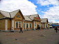
 Old station building at Tayshet
 -
 Railway troops on the construction of BAM-2. July 2022


References
- ^ ISBN 0-8094-5327-4.
- ^
"Slow-motion wrecks: how thawing permafrost is destroying Arctic cities". The Guardian. 14 October 2016. Retrieved 18 October 2019.
Valery Grebenets of Moscow State University's department of cryolithology and glaciology teaches his students 13 'horror stories' about thawing permafrost, including buckling roads and railways [...]
- ^ "Permafrost thaw threatens millions of Arctic residents and their infrastructure". Arctic Today. 14 December 2018. Retrieved 18 October 2019.
The study found that in the long list of vulnerable manmade structures, railroads carry some of the highest risks for damage from permafrost thaw.
- ^ ISBN 1-873756-18-6.
- ^ "Siberia's amazing new railway - the 'Permafrost Express' - opens to passengers this month". The Siberian Times. 22 July 2019. Retrieved 25 January 2023.
- ^ a b c "Новости компании" [company's news] (in Russian). Archived from the original on 2012-12-25. Retrieved 2014-02-05.
- ^ a b "Baikal-Amur Main Line | Russian Railways". Archived from the original on 2017-04-18. Retrieved 2020-05-01.[dead link]
- ^ "BAM! How to get the most out of a journey on Siberia's other railroad". www.rbth.com. 15 January 2016. Retrieved 6 December 2023.
- ^ ISBN 0-470-99040-6.
- ^
Compare:
ISBN 9780815731153. Retrieved 2015-12-05.
The first oil well in Western Siberia was opened in September 1953.73 Large-scale geological discoveries came in the period 1961-65 [...].
- S2CID 129139539.
- ISBN 9780521414180.
- ^ "Ukraine's Security Service blows up railway linking Russia and China". Ukrainska Pravda. 2023-12-01. Retrieved 2023-12-01.
- ^ "Mechel Reports Finishing Laying Railway Tracks to Elga Coal Complex". www.mechel.com. Retrieved 16 August 2017.[permanent dead link]
- ^ "Mechel Reports Obtaining Federal Railway Transport Agency's Approval for Operating Elga Deposit Railway". www.mechel.com. Retrieved 16 August 2017.[permanent dead link]
- ^ PrimaMedia: Президент России хочет остров Сахалин соединить с материком (Russian)
- ^ Construction of the new Kuznetsovsky tunnel, Bamtonnelstroy press service, undated Archived 2014-03-06 at the Wayback Machine. Retrieved: 31 March 2011].
- ^ "Kuznetsovsk tunnel shortens the BAM corridor". Railway Gazette International. Retrieved 2 February 2013.
- ^ Freight volumes via BAM to reach 100m tons a year by 2050, Portnews.ru, St Petersburg, 24 March, 2010. Retrieved: 31 March 2011].
- ^ Maronese, Nicholas (2018-01-25). "Watching an SUV cross this narrow, no-guardrail bridge is nerve-wracking". Driving.ca. Postmedia Network. Retrieved 2022-01-14.
- ^ Holderith, Peter (2021-07-16). "This Rotting Siberian Bridge Is One of the World's Sketchiest River Crossings". Thedrive.com. Brookline Media. Retrieved 2022-01-14.
- ^ Вода из реки, отопление дровами, самый опасный мост в России Archived 2024-02-13 at the Wayback Machine, novayagazeta.eu, 13 February 2024
- ^ "MCN Adventure". August 2011. Retrieved 6 December 2023.
- ^ "The BAM Road - ultimate test of man and machine - Adventure Rider". www.advrider.com. Retrieved 16 August 2017.
- ISBN 3-540-00238-3.
External links
 Railways portal
 Siberia portal
 Baikal-Amur Mainline travel guide from Wikivoyage
- Construction history of the BAM
- Private homepage about the BAM (section in English) Archived 2011-02-12 at the Wayback Machine
- BAM: Soviet construction project of a century
- BAM Guide on Trailblazer Publications website
- NYTimes 2012 travel feature
- The Baikal Amur Mainline is a popular adventure motorcycle travel route
| International | |
|---|---|
| National | |
| Geographic | |
| Other | |