Bald Point State Park
| Bald Point State Park | |
|---|---|
IUCN category IV (habitat/species management area) | |
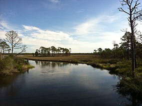
 Overlooking Chaires Creek | |
| Location | Franklin County, Florida, USA |
| Nearest city | Alligator Point, Florida |
| Coordinates | 29°56′51″N 84°20′29″W / 29.94750°N 84.34139°W |
| Governing body | Florida Department of Environmental Protection |
 | |
Bald Point State Park is a
Ochlockonee Bay.[1]
The first land in Bald Point State Park, 1,349 acres (5.46 km2) primarily along the shore of
Ochlockonee Bay, east of the Crooked River (Florida) in Franklin County, Florida.[3] As of 2006[update], the park included approximately 4,860 acres (19.7 km2).[2]
Recreational Activities
The park has such amenities as
swimming and wildlife
viewing.
Gallery
References
- ^ "Bald Point, Florida". Geographic Names Information System. United States Geological Survey, United States Department of the Interior.
- ^ a b Bald Point State Park Approved Management Plan (PDF) (Report). Florida Department of Environmental Protection. April 21, 2006. pp. 1, A 1-1. Retrieved September 23, 2021.
- ^ "State buys 13,000 acres along river". Tampa Bay Times. September 2, 2005. Retrieved September 23, 2021.
External links
- Bald Point State Park at Florida State Parks
- Bald Point State Park at Visit Florida
- Nature Tourism - Bald Point State Park - State Extension Service site


