
Balkans
 Geographical map of the Balkan Peninsula | |
 | |
| Geography | |
|---|---|
| Location | Southeastern Europe |
| Highest elevation | 2,925 m (9596 ft) |
| Highest point | Musala (Bulgaria) |
| Administration | |
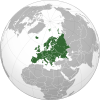
The Balkans (/ˈbɔːlkənz/ BAWL-kənz), corresponding partially with the Balkan Peninsula, is a geographical area in southeastern Europe with various geographical and historical definitions.[1][2][3] The region takes its name from the Balkan Mountains that stretch throughout the whole of Bulgaria. The Balkan Peninsula is bordered by the Adriatic Sea in the northwest, the Ionian Sea in the southwest, the Aegean Sea in the south, the Turkish straits in the east, and the Black Sea in the northeast. The northern border of the peninsula is variously defined.[4] The highest point of the Balkans is Musala, 2,925 metres (9,596 ft), in the Rila mountain range, Bulgaria.
The concept of the Balkan Peninsula was created by the German geographer August Zeune in 1808,[5] who mistakenly considered the Balkan Mountains the dominant mountain system of Southeast Europe spanning from the Adriatic Sea to the Black Sea. The term Balkan Peninsula was a synonym for Rumelia in the 19th century, the parts of Europe that were provinces of the Ottoman Empire at the time. It had a geopolitical rather than a geographical definition, which was further promoted during the creation of the Kingdom of Yugoslavia in the early 20th century. The definition of the Balkan Peninsula's natural borders does not coincide with the technical definition of a peninsula; hence modern geographers reject the idea of a Balkan Peninsula, while historical scholars usually discuss the Balkans as a region. The term has acquired a stigmatized and pejorative meaning related to the process of Balkanization.[4][6] The alternative term used for the region is Southeast Europe.
The borders of the Balkans are, due to many contrasting definitions, disputed. There exists no universal agreement on the region's components. The term by most definitions fully encompasses
Name
Etymology
The origin of the word Balkan is obscure; it may be related to Turkish bālk 'mud' (from Proto-Turkic *bal 'mud, clay; thick or gluey substance', cf. also Turkic bal 'honey'), and the Turkish suffix -an 'swampy forest'[7] or Persian bālā-khāna 'big high house'.[8] It was used mainly during the time of the Ottoman Empire. In both Ottoman Turkish and modern Turkish, balkan means 'chain of wooded mountains'.[9][10][11]
Historical names and meaning
Classical antiquity and the early Middle Ages
From classical antiquity through the Middle Ages, the Balkan Mountains were called by the local Thracian[12] name Haemus.[13] According to Greek mythology, the Thracian king Haemus was turned into a mountain by Zeus as a punishment and the mountain has remained with his name.[14] A reverse name scheme has also been suggested. D. Dechev considers that Haemus (Αἷμος) is derived from a Thracian word *saimon, 'mountain ridge'.[15] A third possibility is that "Haemus" (Αἵμος) derives from the Greek word haima (αἷμα) meaning 'blood'. The myth relates to a fight between Zeus and the monster/titan Typhon. Zeus injured Typhon with a thunder bolt and Typhon's blood fell on the mountains, giving them their name.[16]
Late Middle Ages and Ottoman period
The earliest mention of the name appears in an early 14th-century Arab map, in which the
Evolution of meaning in the 19th and 20th centuries
The term was not commonly used in geographical literature until the mid-19th century because, already then, scientists like Carl Ritter warned that only the part south of the Balkan Mountains could be considered as a peninsula and considered it to be renamed as "Greek peninsula". Other prominent geographers who did not agree with Zeune were Hermann Wagner, Theobald Fischer, Marion Newbigin, and Albrecht Penck, while Austrian diplomat Johann Georg von Hahn, in 1869, for the same territory, used the term Südostereuropäische Halbinsel ('southeasterneuropean peninsula'). Another reason it was not commonly accepted as the definition of then European Turkey had a similar land extent. However, after the Congress of Berlin (1878) there was a political need for a new term and gradually "the Balkans" was revitalized, but in the maps, the northern border was in Serbia and Montenegro without Greece (it only depicted the Ottoman occupied parts of Europe), while Yugoslavian maps also included Croatia and Bosnia. The term Balkan Peninsula was a synonym for European Turkey, the political borders of former Ottoman Empire provinces.[4][24][27]
The usage of the term changed in the very end of the 19th and beginning of the 20th century, when it was embraced by Serbian geographers, most prominently by Jovan Cvijić.[23] It was done with political reasoning as affirmation for Serbian nationalism on the whole territory of the South Slavs, and also included anthropological and ethnological studies of the South Slavs through which were claimed various nationalistic and racialist theories.[23] Through such policies and Yugoslavian maps the term was elevated to the modern status of a geographical region.[24] The term acquired political nationalistic connotations far from its initial geographic meaning,[4] arising from political changes from the late 19th century to the creation of post–World War I Yugoslavia (initially the Kingdom of Serbs, Croats and Slovenes in 1918).[24] After the dissolution of Yugoslavia beginning in June 1991, the term Balkans acquired a negative political meaning, especially in Croatia and Slovenia, as well in worldwide casual usage for war conflicts and fragmentation of territory (see Balkanization).[23][24]
Southeast Europe
In part due to the historical and political connotations of the term Balkans,[28] especially since the military conflicts of the 1990s in Yugoslavia in the western half of the region, the term Southeast Europe is becoming increasingly popular.[24][29] A European Union initiative of 1999 is called the Stability Pact for Southeastern Europe. The online newspaper Balkan Times renamed itself Southeast European Times in 2003.[citation needed]
Current
In other languages of the region, the region is known as:
- Slavic languages:
- Bulgarian and Macedonian: Балкански Полуостров, transliterated: Balkanski Poluostrov
- Bosnian, Montenegrin and Serbian: Balkansko poluostrvo / Балканско полуострво
- Bosnian and Croatian: Balkanski poluotok
- Slovene: Balkanski polotok
- Romance languages:
- Other languages:
Definitions and boundaries

Balkan Peninsula
The Balkan Peninsula is bounded by the Adriatic Sea to the west, the Mediterranean Sea (including the Ionian and Aegean seas) and the Sea of Marmara to the south and the Black Sea to the east. Its northern boundary is often given as the Danube, Sava and Kupa Rivers.[30] The Balkan Peninsula has a combined area of about 470,000 km2 (181,000 sq mi) (slightly smaller than Spain). It is more or less identical to the region known as Southeast Europe.[31][32][33]
Italy currently holds a small area around Trieste that is by some older definitions considered a part of the Balkan Peninsula. However, the regions of Trieste and Istria are not usually considered part of the Balkans by Italian geographers, due to their definition of the Balkans that limits its western border to the Kupa River.[34]
Balkans
The borders of the Balkans are due to many contrasting definitions disputed. There exists no universal agreement on the region's components. The term by most definitions fully encompasses Albania, Bosnia and Herzegovina, Bulgaria, Greece, Kosovo, Montenegro, North Macedonia, European Turkey, and a large part of Croatia and Serbia. Sometimes the term also includes Romania and southern parts of Slovenia. Italy, although by some definitions having a small part of its territory on the Peninsula, is generally excluded.
The term
Western Balkans

The Western Balkans is a political neologism coined to refer to Albania and the territory of the former Yugoslavia, except Slovenia, since the early 1990s.[e] The region of the Western Balkans, a coinage exclusively used in pan-European parlance, roughly corresponds to the Dinaric Alps territory.
The institutions of the European Union have generally used the term Western Balkans to mean the Balkan area that includes countries that are not members of the European Union, while others refer to the geographical aspects.[d] Each of these countries aims to be part of the future enlargement of the European Union and reach democracy and transmission scores but, until then, they will be strongly connected with the pre-EU waiting program Central European Free Trade Agreement.[35] Croatia, considered part of the Western Balkans, joined the EU in July 2013.[36]
Criticism of the geographical definition
The term is criticized for having a geopolitical, rather than a geographical meaning and definition, as a multiethnic and political area in the southeastern part of Europe.[24] The geographical term of a peninsula defines that the water border must be longer than land, with the land side being the shortest in the triangle, but that is not the case with the Balkan Peninsula.[23][24] Both Eastern and Western water cathetus from Odesa to Cape Matapan (c. 1230–1350 km) and from Trieste to Cape Matapan (c. 1270–1285 km) are shorter than land cathetus from Trieste to Odesa (c. 1330–1365 km).[23][24] The land has a too wide line connected to the continent to be technically proclaimed as a peninsula – Szczecin (920 km) and Rostock (950 km) at the Baltic Sea are closer to Trieste than Odesa yet it is not considered as another European peninsula.[23] Since the late 19th and early 20th-century literature is not known where is exactly the northern border between the peninsula and the continent,[23][24] with an issue, whether the rivers are suitable for its definition.[4] In the studies the Balkans' natural borders, especially the northern border, are often avoided to be addressed, considered as a "fastidious problem" by André Blanc in Geography of the Balkans (1965), while John Lampe and Marvin Jackman in Balkan Economic History (1971) noted that "modern geographers seem agreed in rejecting the old idea of a Balkan Peninsula".[4] Another issue is the name because the Balkan Mountains which are mostly located in Northern Bulgaria are not dominating the region by length and area like the Dinaric Alps.[23] An eventual Balkan peninsula can be considered a territory South of the Balkan Mountains, with a possible name "Greek-Albanian Peninsula."[4][24] The term influenced the meaning of Southeast Europe which again is not properly defined by geographical factors yet historical borders of the Balkans.[24]
Croatian geographers and academics are highly critical of inclusion of Croatia within the broad geographical, social-political and historical context of the Balkans, while the neologism Western Balkans is perceived as a humiliation of Croatia by the European political powers.[23] According to M. S. Altić, the term has two different meanings, "geographical, ultimately undefined, and cultural, extremely negative, and recently strongly motivated by the contemporary political context".[24] In 2018, President of Croatia Kolinda Grabar-Kitarović stated that the use of the term "Western Balkans" should be avoided because it does not imply only a geographic area, but also negative connotations, and instead must be perceived as and called Southeast Europe because it is part of Europe.[37]
Slovenian philosopher Slavoj Žižek said of the definition,[38]
This very alibi confronts us with the first of many paradoxes concerning Balkan: its geographic delimitation was never precise. It is as if one can never receive a definitive answer to the question, "Where does it begin?" For Serbs, it begins down there in Kosovo or Bosnia, and they defend the Christian civilization against this Europe's Other. For Croats, it begins with the Orthodox, despotic, Byzantine Serbia, against which Croatia defends the values of democratic Western civilization. For Slovenes, it begins with Croatia, and we Slovenes are the last outpost of the peaceful Mitteleuropa. For Italians and Austrians, it begins with Slovenia, where the reign of the Slavic hordes starts. For Germans, Austria itself, on account of its historic connections, is already tainted by Balkanic corruption and inefficiency. For some arrogant Frenchmen, Germany is associated with the Balkanian Eastern savagery—up to the extreme case of some conservative anti-European-Union Englishmen for whom, in an implicit way, it is ultimately the whole of continental Europe itself that functions as a kind of Balkan Turkish global empire with Brussels as the new Constantinople, the capricious despotic center threatening English freedom and sovereignty. So Balkan is always the Other: it lies somewhere else, always a little bit more to the southeast, with the paradox that, when we reach the very bottom of the Balkan peninsula, we again magically escape Balkan. Greece is no longer Balkan proper, but the cradle of our Western civilization.
Nature and natural resources


Most of the area is covered by mountain ranges running from the northwest to southeast. The main ranges are the
On the Adriatic and Aegean coasts the climate is Mediterranean, on the Black Sea coast the climate is humid subtropical and oceanic, and inland it is humid continental. In the northern part of the peninsula and on the mountains, winters are frosty and snowy, while summers are hot and dry. In the southern part, winters are milder. The humid continental climate is predominant in Bosnia and Herzegovina, northern Croatia, Bulgaria, Kosovo, northern Montenegro, the Republic of North Macedonia, and the interior of Albania and Serbia. Meanwhile, the other less common climates, the humid subtropical and oceanic climates, are seen on the Black Sea coast of Bulgaria and Balkan Turkey (European Turkey). The Mediterranean climate is seen on the Adriatic coasts of Albania, Croatia and Montenegro, as well as the Ionian coasts of Albania and Greece, in addition to the Aegean coasts of Greece and Balkan Turkey (European Turkey).[41]
Over the centuries forests have been cut down and replaced with
The soils are generally poor, except on the plains, where areas with natural grass, fertile soils and warm summers provide an opportunity for tillage. Elsewhere, land cultivation is mostly unsuccessful because of the mountains, hot summers and poor soils, although certain cultures such as olive and grape flourish.
Resources of energy are scarce, except in
Metal ores are more usual than other raw materials. Iron ore is rare, but in some countries there is a considerable amount of copper, zinc, tin, chromite, manganese, magnesite and bauxite. Some metals are exported.
History and geopolitical significance
Antiquity

.jpg)
The Balkan region was the first area in Europe to experience the arrival of farming cultures in the
The identity of the Balkans is dominated by its geographical position; historically the area was known as a crossroads of cultures. It has been a juncture between the
The
Middle Ages and Early modern period


.jpg)
During the
The emergence of the First Bulgarian Empire and the constant conflicts between the Byzantine Empire and the First Bulgarian Empire significantly weakened the Byzantine control over the Balkans by the end of the 10th century. The Byzantines further lost power in the Balkans after the resurgence of the Bulgarians in the late 12th century, with the forming of their Second Bulgarian Empire.[62] After the collapse of the Second Bulgarian Empire, the Byzantine's Empire grip on power was prolonged by the inability of the Slavs to unite, which was caused by frequent infighting amongst themselves. Bulgaria in the first half of the 14th century was then overshadowed by the new rising regional power of Serbia, which was a result of Stefan Dušan rising up and conquering much of the Balkans to create the Serbian Empire. The Serbian and Byzantine empires continued to be the dominant forces in the region until the arrival of the Ottomans several decades later.[63]
The Albanians under
By the end of the 16th century, the Ottoman Empire had become the controlling force in the region after expanding from Anatolia through
In the past several centuries, because of the frequent Ottoman wars in Europe fought in and around the Balkans and the comparative Ottoman isolation from the mainstream of economic advance (reflecting the shift of Europe's commercial and political centre of gravity towards the Atlantic), the Balkans have been the least developed part of Europe. According to Halil İnalcık, "The population of the Balkans, according to one estimate, fell from a high of 8 million in the late 16th-century to only 3 million by the mid-eighteenth. This estimate is based on Ottoman documentary evidence."[70]
Most of the Balkan nation-states emerged during the 19th and early 20th centuries as they gained independence from the Ottoman Empire or the
Recent history

World wars
In 1912–1913 the
Between the two wars, in order to maintain the geopolitical status quo in the region after the end of World War I, the Balkan Pact, or Balkan Entente, was formed by a treaty between Greece, Romania, Turkey and Yugoslavia on 9 February 1934 in Athens.[72]
With the start of the
Although the new government reaffirmed its intentions to fulfill its obligations as a member of the Axis,[75] Germany, with Bulgaria, invaded both Greece and Yugoslavia. Yugoslavia immediately disintegrated when those loyal to the Serbian King and the Croatian units mutinied.[76] Greece resisted, but, after two months of fighting, collapsed and was occupied. The two countries were partitioned between the three Axis allies, Bulgaria, Germany and Italy, and the Independent State of Croatia, a puppet state of Italy and Germany.
During the occupation, the population suffered considerable hardship due to repression and starvation, to which the population reacted by creating a mass resistance movement.[77] Together with the early and extremely heavy winter of that year (which caused hundreds of thousands of deaths among the poorly fed population), the German invasion had disastrous effects in the timetable of the planned invasion in Russia causing a significant delay,[78] which had major consequences during the course of the war.[79]
Finally, at the end of 1944, the Soviets entered Romania and Bulgaria forcing the Germans out of the Balkans. They left behind a region largely ruined as a result of wartime exploitation.
Cold War
During the Cold War, most of the countries on the Balkans were governed by communist governments. Greece became the first battleground of the emerging Cold War. The Truman Doctrine was the US response to the civil war, which raged from 1944 to 1949. This civil war, unleashed by the Communist Party of Greece, backed by communist volunteers from neighboring countries (Albania, Bulgaria and Yugoslavia), led to massive American assistance for the non-communist Greek government. With this backing, Greece managed to defeat the partisans and, ultimately, remained one of the two only non-communist countries in the region with Turkey.
However, despite being under communist governments, Yugoslavia (1948) and Albania (1961) fell out with the Soviet Union. Yugoslavia, led by Marshal Josip Broz Tito (1892–1980), first propped up then rejected the idea of merging with Bulgaria and instead sought closer relations with the West, later even spearheaded, together with India and Egypt the Non-Aligned Movement. Albania on the other hand gravitated toward Communist China, later adopting an isolationist position.
On 28 February 1953,
As the only non-communist countries, Greece and Turkey were (and still are) part of NATO composing the southeastern wing of the alliance.
Post–Cold War
In the 1990s, the transition of the regions' ex-Eastern bloc countries towards democratic free-market societies went peacefully. While in the non-aligned

From the dissolution of Yugoslavia six states achieved internationally recognized sovereignty:
With the dissolution of
Balkan countries control the direct
Greece has been a member of the European Union since 1981, while Slovenia is a member since 2004, Bulgaria and Romania are members since 2007, and Croatia is a member since 2013. In 2005, the European Union decided to start accession negotiations with candidate countries; Turkey, and North Macedonia were accepted as candidates for EU membership. In 2012, Montenegro started accession negotiations with the EU. In 2014, Albania is an official candidate for accession to the EU. In 2015, Serbia was expected to start accession negotiations with the EU, however this process has been stalled over the recognition of Kosovo as an independent state by existing EU member states.[83]
Greece and Turkey have been NATO members since 1952. In March 2004, Bulgaria, Romania and Slovenia have become members of NATO. As of April 2009,[84] Albania and Croatia are members of NATO. Montenegro joined in June 2017.[85] The most recent member state to be added to NATO was North Macedonia on 27 March 2020.
Almost all other countries have expressed a desire to join the EU, NATO, or both at some point in the future.[86]
Politics and economy
This article relies largely or entirely on a single source. (September 2022) |
This article needs to be updated. (September 2021) |
.jpg)

Currently, all of the states are republics, but until World War II all countries were monarchies. Most of the republics are
As nations in the Western Balkans opened up to private investment in the 1990s, newly created enterprises (mostly SMEs) fueled regional economic development by facilitating the transition from a massive state-owned structure to a market economy.[95][96] SMEs now account for 99% of all active businesses, up to 81% of total value created, and 72% of total employment in the Western Balkans.[95]
The Western Balkans are mostly bank-based economies, with bank credit serving as the primary source of external capital for all enterprises, including SMEs. Despite this, the region's bank credit supply is limited and undeveloped. A recent analysis from the European Investment Bank estimated the funding deficit to be at US$2.8 billion, or around 2.5% of nominal GDP.[95]
In most Western Balkan markets, international banks have a market share of 70% to 90%.[97] At the end of 2023, the macroeconomic environment in the Western Balkans indicates that risks are increasing, threatening to worsen the financial imbalance. Recent survey findings give conflicting data on enterprises' funding circumstances. While supply has fallen as a result of the COVID-19 pandemic and interest rate increasers, it has showed progressive recovery.[95][98]
- On political, social and economic criteria the divisions are as follows:
- Territories members of the European Union: Bulgaria, Croatia, Greece, Romania, Slovenia
- Territories currently in negotiation processfor EU membership: Albania, North Macedonia, Montenegro, Serbia, Turkey
- Territories with "candidate " status for EU membership: Bosnia and Herzegovina
- Territories with "potential candidates" status for EU membership: Kosovo
- On border control and trade criteria the divisions are as follows:
- Territories in the Schengen Area: Croatia,[99] Greece, Slovenia
- Territories that are legally bound to join the Schengen Area: Bulgaria, Romania
- Territories in a customs union with the EU: Turkey
- Territories members of the Central European Free Trade Agreement: Albania, Bosnia and Herzegovina, Kosovo, Montenegro, North Macedonia, Serbia.
- On currency criteria, the divisions are as follows:
- Territories that are members of the Eurozone: Croatia,[99] Greece, and Slovenia
- Territories using the euro without authorization by the EU: Kosovo, Montenegro
- Territories using national currencies that are candidates for the Eurozone: Bulgaria (lev), Romania (leu)
- Territories using national currencies: Albania (lek), Bosnia and Herzegovina (convertible mark), North Macedonia (denar), Serbia (dinar), Turkey (lira).
- On military criteria the divisions are as follows:
- Member territories of NATO: Albania, Bulgaria, Croatia, Greece, Montenegro, North Macedonia, Romania, Slovenia, Turkey
- Member territories of the Membership Action Planfor joining NATO: Bosnia and Herzegovina
- Member territories of the Partnership for Peace: Serbia
- On the recent political, social and economic criteria there are two groups of countries:
- Former communist territories: Albania, Bosnia and Herzegovina, Bulgaria, Croatia, Kosovo, Montenegro, North Macedonia, Romania, Serbia, Slovenia
- Capitalist and aligned to the West during the Cold War: Greece, Turkey
- During the Cold War the Balkans were disputed between the two blocks. Greece and Turkey were members of NATO, Bulgaria and Romania of the Warsaw Pact, while Yugoslavia was a proponent of a third way and was a founding member of the Non-Aligned Movement. After the dissolution of Yugoslavia, Serbia and Bosnia and Herzegovina kept an observer status within the organization.
Regional organizations
Southeast European Cooperation Process (SEECP) member states |
Stability Pact for South Eastern Europe members observers supporting partners |
 members observers |
Black Sea Economic Cooperation (BSEC) members observers |
See also the Black Sea regional organizations
Statistics
| Albania | Bosnia and Herzegovina | Bulgaria | Croatia | Greece | Kosovo | Montenegro | North Macedonia | Romania | Serbia | Slovenia | Turkey | |
|---|---|---|---|---|---|---|---|---|---|---|---|---|
| Flag | ||||||||||||
| Coat of arms | ||||||||||||
| Capital | Tirana | Sarajevo | Sofia | Zagreb | Athens | Pristina | Podgorica | Skopje | Bucharest | Belgrade | Ljubljana | Ankara |
| Independence | 28 November, 1912 |
3 March, 1992 |
5 October, 1908 |
26 June, 1991 |
25 March, 1821 |
17 February, 2008 |
3 June, 2006 |
17 November, 1991 |
9 May, 1878 |
5 June, 2006 |
25 June, 1991 |
29 October, 1923 |
| Head of state | Bajram Begaj | Željka Cvijanović Željko Komšić Denis Bećirović |
Rumen Radev | Zoran Milanović | Katerina Sakellaropoulou | Vjosa Osmani | Jakov Milatović | Stevo Pendarovski | Klaus Iohannis | Aleksandar Vučić | Nataša Pirc Musar | Recep Tayyip Erdoğan |
| Head of government | Edi Rama | Borjana Krišto | Nikolai Denkov | Andrej Plenković | Kyriakos Mitsotakis | Albin Kurti | Milojko Spajić | Dimitar Kovačevski | Marcel Ciolacu | Ana Brnabić | Robert Golob | Office abolished in 2018 |
| Population (2023)[100] | ||||||||||||
| Area | 28,749 km2 | 51,197 km2 | 111,900 km2 | 56,594 km2 | 131,117 km2 | 10,908 km2 | 13,812 km2 | 25,713 km2 | 238,391 km2 | 77,474 km2[101] | 20,273 km2 | 781,162 km2 |
| Density | 100/km2 | 69/km2 | 97/km2 | 74/km2 | 82/km2 | 159/km2 | 45/km2 | 81/km2 | 83/km2 | 91/km2 | 102/km2 | 101/km2 |
| Water area (%) | 4.7% | 0.02% | 2.22% | 1.1% | 0.99% | 1.00% | 2.61% | 1.09% | 2.97% | 0.13% | 0.6% | 1.3% |
| GDP (nominal, 2019)[102] | ||||||||||||
| GDP (PPP, 2018)[102] | ||||||||||||
| GDP per capita (nominal, 2019)[102] | ||||||||||||
| GDP per capita (PPP, 2018)[102] | ||||||||||||
| Gini Index (2018)[103] | 29.0 low (2012)[104] | 33.0 medium (2011)[105] | ||||||||||
| HDI (2018)[107] | 0.739 high (2016) | |||||||||||
IHDI (2018)[108]
|
||||||||||||
| Internet TLD | .al | .ba | .bg | .hr | .gr | Doesn't have | .me | .mk | .ro | .rs | .si | .tr |
| Calling code | +355 | +387 | +359 | +385 | +30 | +383[109] | +382 | +389 | +40 | +381 | +386 | +90 |
Demographics
The region is inhabited by
| State | Population (2023)[111] | Density/km2 (2018)[112] | Life expectancy (2018)[113] |
|---|---|---|---|
| 2,761,785 | 100 | 78.3 years | |
| 3,502,550 | 69 | 77.2 years | |
| 6,447,710 | 64 | 79.9 years | |
| 3,850,894 | 73 | 78.2 years | |
| 10,394,055 | 82 | 80.1 years | |
| 1,798,188 | 165 | 77.7 years | |
| 616,695 | 45 | 76.4 years | |
| 1,829,954 | 81 | 76.2 years | |
| 19,051,562 | 82 | 76.3 years | |
| 6,664,449 | 90 | 76.5 years | |
| 2,116,792 | 102 | 80.3 years | |
| 11,929,013[114][c] | 101 | 78.5 years |
Religion

The region is a meeting point of
Islam has a significant history in the region where Muslims make up a large percentage of the population. A 2013 estimate placed the total Muslim population of the Balkans at around eight million.[117] Islam is the largest religion in nations like Albania, Bosnia-Herzegovina, and Kosovo with significant minorities in Bulgaria, North Macedonia and Montenegro. Smaller populations of Muslims are also found in Romania, Serbia and Greece.[117]

| Territories in which the principal religion is Eastern Orthodoxy (with national churches in parentheses)[118] | Religious minorities of these territories[118] |
|---|---|
| Bulgaria: 59% (Bulgarian Orthodox Church) | Islam (8%) and undeclared (27%) |
| Greece: 81–90% (Greek Orthodox Church) | Catholicism , other and undeclared
|
| Montenegro: 72% (Serbian Orthodox Church) | Catholicism (3%), other and undeclared (5%)
|
| North Macedonia: 64% (Macedonian Orthodox Church) | Catholicism
|
| Romania: 81% (Romanian Orthodox Church) | Protestantism (6%), Catholicism (5%), other and undeclared (8%) |
| Serbia: 84% (Serbian Orthodox Church) | Catholicism (5%), Islam (3%), Protestantism (1%), other and undeclared (6%)
|
| Territories in which the principal religion is Catholicism[118] | Religious minorities of these territories[118] |
Croatia (86%)
|
Eastern Orthodoxy (4%), Islam (1%), other and undeclared (7%)
|
Slovenia (57%)
|
Islam (2%), Orthodox (2%), other and undeclared (36%) |
| Territories in which the principal religion is Islam[118] | Religious minorities of these territories[118] |
| Albania (58%) | Orthodoxy (7%), other and undeclared (24%)
|
| Bosnia and Herzegovina (51%) | Catholicism (15%), other and undeclared (4%)
|
| Kosovo (95%) | Catholicism (2%), Orthodoxy (2%), other and undeclared (1%)
|
| Turkey (90–99%[118]) | Orthodoxy, Irreligious (5%–10%) |
The
Languages

The Balkan region today is a very diverse ethnolinguistic region, being home to multiple Slavic and Romance languages, as well as Albanian, Greek, Turkish, Hungarian and others. Romani is spoken by a large portion of the Romanis living throughout the Balkan countries. Throughout history, many other ethnic groups with their own languages lived in the area, among them Thracians, Illyrians, Romans, Celts and various Germanic tribes. All of the aforementioned languages from the present and from the past belong to the wider Indo-European language family, with the exception of the Turkic languages (e.g., Turkish and Gagauz) and Hungarian.
| State | Most spoken language[122] | Linguistic minorities[122] |
|---|---|---|
| 98% Albanian | 2% other | |
| 53% Bosnian | 31% Serbian (official), 15% Croatian (official), 2% other | |
| 86% Bulgarian | 8% Turkish, 4% Romani, 1% other, 1% unspecified | |
| 96% Croatian | 1% Serbian, 3% other | |
| 99% Greek | 1% other | |
| 94% Albanian | 2% Bosnian, 2% Serbian (official), 1% Turkish, 1% other | |
| 43% Serbian | 37% Montenegrin (official), 5% Albanian, 5% Bosnian, 5% other, 4% unspecified | |
| 67% Macedonian | 25% Albanian (official), 4% Turkish, 2% Romani, 1% Serbian, 2% other | |
| 85% Romanian | 6% Hungarian, 1% Romani | |
| 88% Serbian | 3% Hungarian, 2% Bosnian, 1% Romani, 3% other, 2% unspecified | |
| 91% Slovene | 5% Serbo-Croatian, 4% other | |
| 85% Turkish[123] | 12% Kurdish, 3% other and unspecified[123] |
Urbanization
Most of the states in the Balkans are predominantly urbanized, with the lowest number of urban population as % of the total population found in Bosnia and Herzegovina at 49%, Kosovo at 50% and Slovenia at 55%.[124][125]

A list of largest cities:
| City | Country | Agglomeration | City proper | Year |
|---|---|---|---|---|
| Istanbul[b] | 10,097,862 | 10,097,862 | 2019[126] | |
| Athens | 3,753,783 | 664,046 | 2018[127] | |
| Bucharest | 2,272,163 | 1,887,485 | 2018[128] | |
| Sofia | 1,995,950 | 1,313,595 | 2018[129] | |
| Belgrade | 1,659,440 | 1,119,696 | 2018[130] | |
| Zagreb | 1,113,111 | 792,875 | 2011[131] | |
| Tekirdağ | 1,055,412 | 1,055,412 | 2019[132] | |
| Thessaloniki | 1,012,297 | 325,182 | 2018[127] | |
| Tirana | 912,000 | 418,495 | 2018[133] | |
| Ljubljana | 537,712 | 292,988 | 2018[134] | |
| Skopje | 506,926 | 444,800 | 2018[135] | |
| Constanța | 425,916 | 283,872 | 2018[128] | |
| Craiova | 420,000 | 269,506 | 2018[128] | |
| Edirne | 413,903 | 306,464 | 2019[136] | |
| Sarajevo | 413,593 | 275,524 | 2018 | |
| Cluj-Napoca | 411,379 | 324,576 | 2018[128] | |
| Plovdiv | 396,092 | 411,567 | 2018[129] | |
| Varna | 383,075 | 395,949 | 2018[129] | |
| Iași | 382,484 | 290,422 | 2018[128] | |
| Brașov | 369,896 | 253,200 | 2018[128] | |
| Kırklareli | 361,836 | 259,302 | 2019[137] | |
| Timișoara | 356,443 | 319,279 | 2018[128] | |
| Novi Sad | 341,625 | 277,522 | 2018[138] | |
| Split | 325,600 | 161,312 | 2021[131] |
b Only the European part of Istanbul is a part of the Balkans.[139] It is home to two-thirds of the city's 15,519,267 inhabitants.[126]
Time zones
The time zones in the Balkans are defined as the following:
- Territories in the time zone of UTC+01:00: Albania, Bosnia and Herzegovina, Croatia, Kosovo, Montenegro, North Macedonia, Serbia and Slovenia
- Territories in the time zone of UTC+02:00: Bulgaria, Greece, and Romania
- Territories in the time zone of UTC+03:00: Turkey
Culture
- Cuisine of the Balkans
- Balkan music
- Balkan Athletics Championships
- Balkan Athletics Indoor Championships
- Imagining the Balkans
Historiography
See also
Notes
| b. | ^ As The World Factbook cites, regarding Turkey and Southeastern Europe; "that portion of Turkey west of the Bosphorus is geographically part of Europe." |
| c. | ^ The population only of European Turkey, that excludes the Anatolian Peninsula, which otherwise has a population of 75,627,384 and a density of 97. |
| d. | ^ See:[140][141][142][143][144][145][146][147] |
| e. | ^ See:[24][148][142][143][149][150][144][145][146][147] |
References
- ISBN 9781135265021. Retrieved 10 November 2014.
- ^ "Balkans". Encyclopædia Britannica. Retrieved 13 December 2017.
- ISBN 978-1-4129-2694-2.
- ^ ISBN 978-90-04-33782-4.
- ISBN 978-1-4020-4488-5.
- ISBN 978-1-134-58328-7.
- ^ Current Trends in Altaic Linguistics; European Balkan(s), Turkic bal(yk) and the Problem of Their Original Meanings, Marek Stachowski, Jagiellonian University, p. 618.
- ^ ISBN 9780195087512.
- ^ "Balkan". Encarta World English Dictionary. Microsoft Corporation. Archived from the original on 10 January 2007. Retrieved 31 March 2008.
- ^ "balkan". Büyük Türkçe Sözlük (in Turkish). Türk Dil Kurumu. Archived from the original on 25 August 2011.
Sarp ve ormanlık sıradağ
- ^ Kélékian, Diran (1911). "بالقان balqan". Dictionnaire Turc-Français (in French). Mihran. p. 247.
Chaîne de montagnes couveres de forêts. Geogr. Le mont Hæmus; le Balkan.
- ^ "Bulgaria". Hemus – a Thracian name. Indiana University. 1986. p. 54.
- ^ Balkan Studies. 1986.
- ^ Ovid, Metamorphoses 6.87–89
- ^ Decev, D (1986). Balkan Studies. University of Michigan. Retrieved 20 June 2015.
- ISBN 978-0870232060. Retrieved 12 September 2014.
Haemus bloody zeus typhon.
- ^ Dobrev, Ivan (1989). Проиcхождение географического названия Балкан – Sixieme Congres international d'etudes du Sud-Est Europeen (in French). Sofia: Ed.de l'Académie bulgare des Sciences.
- ISBN 978-0-19-538786-5.
- ^ Encyclopaedia of Islam, Second Edition, Editors: P. Bearman, Th. Bianquis, C.E. Bosworth, E. van Donzel and W.P. Heinrichs. Brill Online Reference Works.
- ^ Inalcık, Halil (24 April 2012). "Balkan – Brill Reference". Brillonline.com.
- ^ "Balkhan Mountains". World Land Features Database. Land.WorldCityDB.com. Archived from the original on 28 February 2008. Retrieved 31 March 2008.
- ^ Pavic, Silvia (22 November 2000). "Some Thoughts About The Balkans". About, Inc. Archived from the original on 28 February 2008. Retrieved 31 March 2008.
- ^ a b c d e f g h i j Somek, Petra (29 October 2015). "Hrvatska nije na "zapadnom Balkanu"" [Croatia is not on "Western Balkans"]. Vijenac (in Croatian). Zagreb: Matica hrvatska. Retrieved 31 December 2018.
- ^ .
- ISBN 0-19-972838-0), p. 24.
- ^ Illyrische Halbinsel. 1851.
- ^ Vezenkov, Alexander (2006). "History against Geography: Should We Always Think of the Balkans As Part of Europe?". Junior Visiting Fellows' Conferences. XXI (4). Archived from the original on 24 December 2017. Retrieved 5 January 2018.
- ^ "Balkanize". merriam-webster.com.
- ISBN 978-0-415-36627-4.
- ^ Jelavich 1983a, p. 1.
- ISBN 978-963-9052-65-9. Retrieved 8 June 2015.
- ]
- ISBN 978-953-6096-22-0. Archived(PDF) from the original on 9 October 2022. Retrieved 8 June 2015.
- ^ Istituto Geografico De Agostini, L'Enciclopedia Geografica – Vol. I – Italia, 2004, Ed. De Agostini p. 78
- ^ "Perspectives on the Region" (PDF). Archived from the original (PDF) on 4 September 2013. Retrieved 19 July 2013.
- ^ De Munter, André (December 2016). "Fact Sheets on the European Union:The Western Balkans". European Parliament. Retrieved 22 March 2017.
- ^ "Predsjednica objasnila zašto izbjegava izraz 'zapadni Balkan'" [The presidents explained why it avoids the term "Western Balkans"]. Večernji list (in Croatian). Zagreb. 27 September 2018. Retrieved 31 December 2018.
- .
- ^ "Macedonia-Thrace - Peakbagger.com". www.peakbagger.com.
- ^ "Mount Olympus | mountain, Greece". Encyclopædia Britannica. 20 February 2024.
- ^ "Balkans – Definition, Map, Countries, & Facts". Encyclopædia Britannica. 10 November 2020. Retrieved 25 June 2021.
- ^ "Regions and territories: Kosovo". BBC News. 20 November 2009. Archived from the original on 14 February 2009. Retrieved 17 April 2010.
- ISBN 978-0691008806
- ISBN 9780521000277
- ISBN 978-3-406-47998-4.
- ^ Goldstein, I. (1999). Croatia: A History. McGill-Queen's University Press.
- ^ ISBN 9781009115773.
- ^ S2CID 251843620. pp. 1, 10.
- ISBN 978-1-4443-5163-7
- ISBN 978-1-351-71032-9. Retrieved 10 February 2024.
- S2CID 161691285.
- ^ Kahl, Thede - "Istoria aromânilor", Editura Tritonic, București, 2006
- ISBN 973-8299-25-X
- ISBN 1-4346-3426-4
- S2CID 203297381. Retrieved 23 November 2023.
- JSTOR 207774. Retrieved 23 November 2023.
- OCLC 65166691.
- ^ Geniş & Maynard 2009, p. 557
- ^ Katičić, Radoslav (1976). Ancient Languages of the Balkans. Mouton. p. 186. ISBN 9789027933157. "On the other hand Niš from Ναϊσσός, Štip from Ἄστιβος, Šar from Scardus, and Ohrid from Lychnidus presuppose the sound development characteristic for Albanian."
- ^ Curtis, Matthew Cowan (2012). Slavic-Albanian Language Contact, Convergence, and Coexistence (Thesis). The Ohio State University. p. 42.
- ^ "Roman Empire, Geography, Culture". Encyclopedia Britannica. 5 August 1998. Retrieved 21 November 2023.
- ^ "The Byzantine-Bulgarian Wars". Western Civilization. Retrieved 22 November 2023.
- ^ "Medieval, Orthodox, Balkan". Encyclopedia Britannica. 26 July 1999. Retrieved 22 November 2023.
- ^ "Ottoman Empire, Southeastern Europe, Conflict". Encyclopedia Britannica. 5 August 1998. Retrieved 21 November 2023.
- ISBN 978-0-295-97291-6.
A rare example of successful Christian resistance to the Turks in the 15th century, although in a fairly remote part of Europe, was provided by Skanderbeg, the Albanian mountain chieftain who became the leader of a national revolt. For over a quarter-century until his death in 1468, he led the Albanians in surprisingly effective guerrilla warfare against the Turkish occupiers.
- ^ Stephen Clissold (1966). A short history of Yugoslavia from earliest times to 1966, chapter III
- ISBN 978-615-5053-79-5. Retrieved 21 November 2023.
- S2CID 145595992.
- ^ a b Considered a Bulgarian in Bulgaria
- ISBN 0-521-57455-2
- ^ Encyclopedia of World War I, Spencer Tucker, Priscilla Mary Roberts, p. 242
- ^ "Balkan Entente | Europe [1934]". Encyclopædia Britannica. Retrieved 31 August 2021.
- ^ Europe in Flames, J. Klam, 2002, p. 41
- ^ Russia's life-saver, Albert Loren Weeks, 2004, p. 98
- ^ Schreiber, Stegemann & Vogel 1995, p. 484.
- ^ Schreiber, Stegemann & Vogel 1995, p. 521.
- ^ Inside Hitler's Greece: The Experience of Occupation, Mark Mazower, 1993
- ^ Hermann Goring: Hitler's Second-In-Command, Fred Ramen, 2002, p. 61
- ^ The encyclopedia of codenames of World War II#Marita, Christopher Chant, 1986, pp. 125–126
- ^ "Balkan Pact of 1953". Retrieved 5 September 2021.
- ^ "Kosovo independence declaration deemed legal". Reuters. 22 July 2010. Retrieved 16 February 2014.
- ^ "UNODC South Eastern Europe". www.unodc.org. Retrieved 17 June 2019.
- ^ "Serbia must accept Kosovo independence to join EU – Gabriel". 16 February 2018.
- ^ Ceremony marks the accession of Albania to NATO, NATO – News, 7 April 2009. Retrieved 18 April 2009.
- ^ Archives, EWB (20 April 2017). "Darmanović: Montenegro becomes EU member in 2022 – European Western Balkans".
- ^ "The Western Balkans – Fact Sheets on the European Union". European Parliament. Retrieved 25 June 2021.
- ^ "Tourism". International Trade Administration. 6 August 2022. Retrieved 23 November 2023.
- ^ Ralev, Radomir (3 November 2021). "Moody's completes periodic review of three Serbian cities". SeeNews. Retrieved 23 November 2023.
- ^ "For a Sustainable Tourism Industry". Ελληνική Δημοκρατία - Υπουργείο Εξωτερικών. 23 November 2023. Retrieved 23 November 2023.
- ^ "FACT SHEET: Developing Sustainable Tourism (Turizam) in Bosnia and Herzegovina". U.S. Agency for International Development. 10 March 2023. Retrieved 24 November 2023.
- ^ "OECD Tourism Trends and Policies 2022". OECD iLibrary. Retrieved 23 November 2023.
- .
- ^ "GDP per capita (current US$)". World Bank Open Data. Retrieved 19 August 2022.
- ^ "Unemployment, total (% of total labor force) (modeled ILO estimate)". World Bank Open Data. Retrieved 19 August 2022.
- ^ ISBN 978-92-861-5651-9. Archivedfrom the original on 14 February 2024.
- ^ "The Western Balkans in Transition" (PDF). Occasional Paper. European Commission. May 2009. Archived (PDF) from the original on 27 December 2023.
- ^ "Economic Growth in the Western Balkans To Accelerate in 2024, Albeit Slowly and Unevenly". World Bank. 19 October 2023. Archived from the original on 27 December 2023. Retrieved 27 December 2023.
- ^ "Western Balkans Regular Economic Report – No. 22: Beyond the Crises" (PDF). World Bank. Fall 2022. Archived (PDF) from the original on 27 December 2023.
- ^ a b "Croatia begins new euro and Schengen zone era". BBC News. 2 January 2023.
- ^ "Population on 1 January". European Commission. Retrieved 3 December 2023.
- ^ a b Without Kosovo and Metohija
- ^ a b c d "World Economic Outlook Database, October 2019". IMF.org. International Monetary Fund. Retrieved 21 December 2019.
- ^ "Gini coefficient of equivalised disposable income – EU-SILC survey". ec.europa.eu/eurostat. Eurostat. Retrieved 21 December 2019.
- ^ "Gini index - Albania". World Bank Open Data. Retrieved 21 December 2019.
- ^ "GINI index (World Bank estimate) – Bosnia and Herzegovina". World Bank Open Data. Retrieved 21 December 2019.
- ^ "GINI index (World Bank estimate) – Kosovo". World Bank Open Data. Retrieved 21 December 2019.
- ^ "Human Development Index (HDI)". hdr.undp.org. HDRO (Human Development Report Office) United Nations Development Programme. Retrieved 11 December 2019.
- ^ "Inequality-adjusted HDI (IHDI)". hdr.undp.org. UNDP. Retrieved 22 May 2020.
- ^ As Kosovo*
- ^ "Balkans". Encyclopædia Britannica. Retrieved 21 August 2019.
The Balkans are usually characterized as comprising Albania, Bosnia and Herzegovina, Bulgaria, Croatia, Kosovo, Montenegro, North Macedonia, Romania, Serbia, and Slovenia—with all or part of each of those countries located within the peninsula. Portions of Greece and Turkey are also located within the geographic region generally defined as the Balkan Peninsula, and many descriptions of the Balkans include those countries too. Some define the region in cultural and historical terms and others geographically, though there are even different interpretations among historians and geographers... Generally, the Balkans are bordered on the northwest by Italy, on the north by Hungary, on the north and northeast by Moldova and Ukraine, and on the south by Greece and Turkey or the Aegean Sea (depending on how the region is defined)... For discussion of physical and human geography, along with the history of individual countries in the region, see Albania, Bosnia and Herzegovina, Bulgaria, Croatia, Greece, Kosovo, North Macedonia, Moldova, Montenegro, Romania, Serbia, Slovenia, and Turkey. Area 257,400 square miles (666,700 square km). Pop. (2002 est.) 59,297,000.
- ^ "Eurostat – Tables, Graphs and Maps Interface (TGM) table". europa.eu.
- ^ "Countries by Population Density 2019". statisticstimes.com.
- ^ "Country Comparison: Life Expectancy at Birth". CIA: The World Factbook. Archived from the original on 29 December 2018. Retrieved 20 January 2016.
- ^ "Turkey's Population". Retrieved 10 December 2020.
- ^ Okey, Robin (2007). Taming Balkan Nationalism. Oxford University Press.
- ^ Ware 1993, p. 8.
- ^ ISBN 978-1-84904-659-6.
- ^ a b c d e f g "Field Listing: Religions". CIA. Archived from the original on 16 October 2020. Retrieved 23 February 2019.
- ^ European Jewish Congress – Bosnia-Herzegovina, Accessed 15 July 2008.
- ^ Jones, Sam (30 July 2020). "Thessaloniki's Jews: 'We can't let this be forgotten; if it's forgotten, it will die'". The Guardian.
- ^ "Bulgaria". Holocaust Encyclopedia. Retrieved 13 July 2023.
- ^ a b "Field Listings: Languages". CIA. Archived from the original on 20 April 2019. Retrieved 30 November 2020.
- ^ a b "Türkiye'nin yüzde 85'i 'anadilim Türkçe' diyor". Milliyet.com.tr. Retrieved 25 June 2021.
- ^ "World Bank Open Data". World Bank Open Data. Retrieved 17 June 2023.
- ^ "Urbanization in Kosovo: Building inclusive & sustainable cities". unhabitat.org. Retrieved 17 June 2023.
- ^ a b "Istanbul Population". Retrieved 1 December 2020.
- ^ a b "Greece: Regions and Agglomerations". Retrieved 9 November 2015.
- ^ a b c d e f g "Romania: Counties and Major Cities". Retrieved 9 November 2015.
- ^ a b c "Bulgaria: Major Cities". Retrieved 9 November 2015.
- ^ Statistical Officeof the Republic of Serbia Archived 14 July 2014 at the Wayback Machine p. 32
- ^ a b "Croatia: Counties and Major Cities". Retrieved 9 November 2015.
- ^ "Tekirdağ Population". Retrieved 30 November 2020.
- ^ "Albania: Prefectures and Major Cities – Population Statistics in Maps and Charts". citypopulation.de.
- ^ "Osebna izkaznica – RRA LUR". rralur.si. 24 February 2020.
- ^ "Macedonia". Retrieved 9 November 2015.
- ^ "Edirne Population". Retrieved 30 November 2020.
- ^ "Kırklareli Population". Retrieved 1 December 2020.
- ^ "Serbia: Regions, Districts and Major Cities". Archived from the original on 8 November 2015. Retrieved 9 November 2015.
- ISBN 978-1317891161.
- Federal Ministry for Europe, Integration and Foreign Affairs. "Western Balkans Summit". Retrieved 11 August 2015.
- ^ "Western Balkans – Trade – European Commission". europa.eu.
- ^ ISBN 978-963-9052-65-9. Retrieved 18 October 2014.
- ^ a b "European Economic and Social Committee – Western Balkans". European Economic and Social Committee. Archived from the original on 6 October 2014. Retrieved 12 September 2014.
- ^ a b "Austrian Foreign Miniistry – The Western Balkans – A Priority of Austrian Foreign Policy".
- ^ a b "WBIF – Western Balkans Investment Framework – Stakeholders". Archived from the original on 6 October 2014. Retrieved 12 September 2014.
- ^ a b "European Commission – Trade – Countries and regions – Western Balkans". Retrieved 12 September 2014.
- ^ a b "Western Balkans: Enhancing the European Perspective" (PDF). Communication from the Commission to the European Parliament and the Council. 5 March 2008. Archived (PDF) from the original on 9 April 2008. Retrieved 8 April 2008.
- ISBN 978-0-8157-7160-9.
western balkans minus slovenia.
- ^ "European Union External Action – EU relations with the Western Balkans". Retrieved 12 September 2014.
- ^ Redaktion: PT-DLR. "Federal Ministry of Education and Research of Germany – Western Balkan Countries". Archived from the original on 6 October 2014. Retrieved 12 September 2014.
Further reading
- Gray, Colin S. (1999). Geopolitics, Geography and Strategy. London: Routledge. ISBN 978-0-7146-8053-8.
- JSTOR 2165494.
- Banac, Ivo (1984). The National Question in Yugoslavia: Origins, History, Politics. Ithaca, NY: Cornell University Press. ISBN 978-0-8014-9493-2.
- Goldstein, Ivo (1999). Croatia: A History. Montreal, Quebec: McGill-Queen's University Press. ISBN 978-0-7735-2017-2.
- Carter, Francis W., ed. (1977). An Historical Geography of the Balkans Academic Press. [ISBN missing]
- Dvornik, Francis (1962). The Slavs in European History and Civilization Rutgers University Press. [ISBN missing]
- Fine, John V. A., Jr. The Early Medieval Balkans: A Critical Survey from the Sixth to the Late Twelfth Century [1983]; The Late Medieval Balkans: A Critical Survey from the Late Twelfth Century to the Ottoman Conquest. Ann Arbor: University of Michigan Press, [1987]. [ISBN missing]
- Forbes, Nevill (1915). The Balkans: A History of Bulgaria, Serbia, Greece, Rumania, Turkey Clarendon Press, online
- ISBN 978-0521274586.
- ISBN 978-0521274593.
- Jelavich, Charles; Jelavich, Barbara, eds. (1963). The Balkans in Transition: Essays on the Development of Balkan Life and Politics Since the Eighteenth Century. University of California Press.
- Kitsikis, Dimitri (2008). La montée du national-bolchevisme dans les Balkans. Le retour à la Serbie de 1830. Paris: Avatar.
- Lampe, John R., and Marvin R. Jackson (1982). Balkan Economic History, 1550–1950: From Imperial Borderlands to Developing Nations Indiana University Press. [ISBN missing]
- Király, Béla K., ed. (1984). East Central European Society in the Era of Revolutions, 1775–1856. [ISBN missing]
- ISBN 978-0-88033-177-7.
- ISBN 978-0-679-64087-5.
- Schreiber, Gerhard; Stegemann, Bernd; Vogel, Detlef (1995). The Mediterranean, south-east Europe, and north Africa, 1939–1941. Germany and the 2nd World War. Vol. III. Clarendon Press. ISBN 978-0-19-822884-4.
- Stoianovich, Traian (1994). Balkan Worlds: The First and Last Europe. Sources and Studies in World History. New York: M.E. Sharpe. ISBN 978-1-56324-032-4.
- ISBN 978-0-14-014656-1.
- Zametica, John (2017). Folly and malice: the Habsburg empire, the Balkans and the start of World War One London: Shepheard–Walwyn. 416 pp. ISBN 978-0856835131.
External links
 Definitions from Wiktionary
 Media from Commons
 Quotations from Wikiquote
 Texts from Wikisource
 Travel information from Wikivoyage
- Balkan Insight – Analysis from Balkans
- Balkanalysis, in-depth research on Balkan geopolitics
- Western Balkans Photo impression
- Shared Pasts in Central and Southeast Europe, 17th–21st Centuries. Eds. G. Demeter, P. Peykovska. 2015.
Countries on the Balkan Peninsula | ||
|---|---|---|
| Geographically fully located |  | |
| Significantly located | ||
| Partially located | ||
| Mostly outside the peninsula |
| |
| See also | ||
| Africa | |
|---|---|
| North America |
|
| South America |
|
| Asia | |
| Europe | |
| Oceania | |
| Polar | |
| Oceans | |
| Non-continent-based world regions | |
| International | |
|---|---|
| National | |
| Other | |