
Bamako
Bamako
| ||
|---|---|---|
Capital city | ||
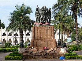
       Bamako at night, Place de la Liberté, BCEAO tower, Statue in the Cité du Niger, Nkwame N'krumah statue, NCC tower, western bridge entering into the Cité du Niger, Tower of Africa | ||
|
Region Bamako Capital District | | |
| Cercle | Bamako | |
| Subdivisions | ||
| Government | ||
| • Type | Capital District | |
| • Maire du District | UTC (Coordinated Universal Time) | |
| ISO 3166 code | ML-BKO | |
| HDI (2017) | ||
Bamako (Bambara: ߓߡߊ߬ߞߐ߬ Bàmakɔ̌, Fula: 𞤄𞤢𞤥𞤢𞤳𞤮 Bamako) is the capital and largest city of Mali, with a 2022 population of 4,227,569. It is located on the Niger River, near the rapids that divide the upper and middle Niger valleys in the southwestern part of the country.
Bamako is the nation's administrative center. The city proper is a cercle in its own right. Bamako's river port is located in nearby Koulikoro, along with a major regional trade and conference center. Bamako is the seventh-largest West African urban center after Lagos, Abidjan, Kano, Ibadan, Dakar, and Accra. Locally manufactured goods include textiles, processed meat, and metal goods as well as mining. Commercial fishing occurs on the Niger River.
Bamako is known for its vibrant music scene, with various genres such as Malian blues, traditional music, and Afrobeat flourishing in Bamako. Many renowned Malian musicians and bands have emerged from the city. Some notable artists are Salif Keita, Oumou Sangaré, Ali Farka Touré, Toumani Diabaté and Amadou & Mariam.
In recent years, Bamako has seen significant urban development, with the construction of modern buildings, shopping malls, and infrastructure projects aimed at improving the quality of life for its residents. The city is home to many notable institutions such as the University of Bamako, the National Museum of Mali, the Mali National Zoo, the Grand Mosque of Bamako, and the Modibo Keita International Airport. The buildings of Bamako have a unique architectural style. The name Bamako (ߓߡߊ߬ߞߐ߬ Bàmakɔ̌ in Bambara) comes from the Bambara word meaning "crocodile river".[8]
History
The area of the city has evidence of settlements since the
The Mali Empire grew during the early Middle Ages and replaced Ghana as the dominant kingdom in west Africa, dominating Senegal, Gambia, Guinea, and Mauritania.[9] In the 14th century, the Mali Empire became increasingly wealthy because of the trade of cotton, gold and salt. Bamako became a center of commerce and Islamic learning, but declined when Mali was overthrown by the Songhai.[9][10]
The Scottish explorer Mungo Park visited Bamako in 1797 and 1806 during his exploration of the Niger River. He estimated that the city at the time held 6000 inhabitants.[10]

In February 1882,
Bamako began growing quickly upon being named the capital of
Mali gained independence from France in April 1960, and the Republic of Mali was later established. At this time, Bamako had a population of around 160,000. During the 1960s, the country became socialist and Bamako was subject to Soviet investment and influence.[9] However, the economy declined as state enterprises collapsed and unrest was widespread.[9] Eventually, Moussa Traoré led a successful coup and ruled Mali for 23 years. However his rule was characterised by severe droughts and poor government management and problems of food shortages.[9]
In the late 1980s the people of Bamako and Mali campaigned for a free-market economy and multiparty democracy. In 1990, the
On 22 March 1991, a large-scale protest march in central Bamako was violently suppressed, with estimates of those killed reaching 300. Four days later, a military coup deposed Traoré. The Comité de Transition pour le Salut du Peuple was set up, headed by General Amadou Toumani Touré.[13] Alpha Oumar Konari officially became president on 26 April 1992.[9]
On 20 November 2015, two gunmen took 170 people hostage in the Radisson Blu hotel. Twenty-one people were killed in the Bamako hotel attack along with the two gunmen during the seven-hour siege.[14]
Geography

Bamako is situated on the Niger River floodplain, which hampers development along the riverfront and the Niger's tributaries. Bamako is relatively flat, except to the immediate north where an escarpment is found, being what remains of an extinct volcano. The Presidential Palace and main hospital are located here.


Originally, the city developed on the northern side of the river, but as it grew, bridges were developed to connect the north with the south. The first of these was the
Environment
Waste Management Controversy
In 2015, the Bamako city government privatized waste collection in the city. Before the introduction of this program there was a long standing informal waste collection system carried out by "Economic interest groups."[16] Before the privatization these independent groups collected waste throughout the city. After privatization, not only did many waste collectors become unemployed but the corporation that they enlisted to do the job was collecting only 30% of Bamako's waste. The garbage build up creates toxic living conditions and it only worsens when it rains. Due to the prevalence of waste in Bamako's streets, including informal dumping sites near a school, citizens have taken to protesting, marching and it has even escalated to the point of property damage.[17]
Climate
Under the
| Climate data for Bamako (1991–2020, extremes 1949–2015) | |||||||||||||
|---|---|---|---|---|---|---|---|---|---|---|---|---|---|
| Month | Jan | Feb | Mar | Apr | May | Jun | Jul | Aug | Sep | Oct | Nov | Dec | Year |
| Record high °C (°F) | 38.9 (102.0) |
42.8 (109.0) |
43.9 (111.0) |
43.5 (110.3) |
45.0 (113.0) |
42.0 (107.6) |
42.4 (108.3) |
37.8 (100.0) |
38.4 (101.1) |
38.9 (102.0) |
42.0 (107.6) |
40.0 (104.0) |
45.0 (113.0) |
| Mean daily maximum °C (°F) | 32.6 (90.7) |
35.7 (96.3) |
38.3 (100.9) |
39.5 (103.1) |
37.9 (100.2) |
34.8 (94.6) |
31.6 (88.9) |
30.6 (87.1) |
31.9 (89.4) |
34.5 (94.1) |
35.4 (95.7) |
33.3 (91.9) |
34.7 (94.4) |
| Daily mean °C (°F) | 24.9 (76.8) |
27.9 (82.2) |
30.6 (87.1) |
32.3 (90.1) |
31.6 (88.9) |
29.1 (84.4) |
26.8 (80.2) |
26.1 (79.0) |
26.7 (80.1) |
27.8 (82.0) |
26.7 (80.1) |
25.1 (77.2) |
28.0 (82.3) |
| Mean daily minimum °C (°F) | 17.2 (63.0) |
20.1 (68.2) |
22.9 (73.2) |
25.1 (77.2) |
25.2 (77.4) |
23.3 (73.9) |
22.0 (71.6) |
21.7 (71.1) |
21.5 (70.7) |
21.1 (70.0) |
17.9 (64.2) |
16.8 (62.2) |
21.2 (70.2) |
| Record low °C (°F) | 8.7 (47.7) |
9.0 (48.2) |
12.0 (53.6) |
15.8 (60.4) |
17.8 (64.0) |
16.1 (61.0) |
17.5 (63.5) |
17.2 (63.0) |
18.0 (64.4) |
14.7 (58.5) |
10.8 (51.4) |
6.0 (42.8) |
6.0 (42.8) |
| Average precipitation mm (inches) | 2.1 (0.08) |
0.8 (0.03) |
3.7 (0.15) |
17.7 (0.70) |
70.9 (2.79) |
129.9 (5.11) |
227.4 (8.95) |
263.8 (10.39) |
175.7 (6.92) |
52.6 (2.07) |
2.2 (0.09) |
0.0 (0.0) |
946.8 (37.28) |
| Average precipitation days (≥ 1.0 mm) | 0.2 | 0.1 | 0.4 | 2.2 | 5.8 | 9.6 | 14.1 | 16.3 | 12.5 | 5.4 | 0.3 | 0 | 66.9 |
| Average relative humidity (%)
|
24 | 20 | 22 | 33 | 50 | 67 | 77 | 81 | 78 | 65 | 38 | 27 | 49 |
| Mean monthly sunshine hours | 277.4 | 253.0 | 268.1 | 230.4 | 242.6 | 233.6 | 216.6 | 218.3 | 221.7 | 253.7 | 270.7 | 268.6 | 2,954.7 |
| Source 1: NOAA (sun, 1961–1990)[18][19] | |||||||||||||
| Source 2: World Meteorological Organization,[20] Deutscher Wetterdienst (extremes and humidity)[21] | |||||||||||||
Administration
The District of Bamako has been divided into six communes (distinguished by numbers, and not named) since Ordinance No. 78-34/CNLM of 18 August 1978, and amended by a law in February 1982 establishing the new boundaries of Communes III and IV.[22] Each commune is administered by the municipal council and a mayor elected from among its members. The last elections were held on 26 April 2009 and the Alliance for Democracy in Mali hold the majority of representatives for the communes.
Communes and neighborhoods
Commune II has a population of 159,805 people (2009) and covers 18.3 square kilometres (7.1 sq mi). It is bounded to the east by the backwater of Korofina at the west foot of the Point G hill, and to the south by Niger River. The municipality has eleven neighborhoods: Niaréla (the oldest), Bagadadji, Medina-Coura, Bozola, Missira, Hippodrome, Quinzambougou, Bakaribougou, TSF, Industrial Area, and Bougouba. The new Cité du Niger island is also located in the Commune II.[24] The area is the most important in the industry sector in Bamako.
Commune IV has a population of 300,085 people (2009) and covers 42 square kilometres (16 sq mi). It is bounded to the east by Commune III, north, west by Kati Cercle and south by the left bank of the Niger River. Commune IV consists of eight neighborhoods: Taliko, Lassa, Sibiribougou, Djikoroni Para, Sébénikoro, Hamdallaye, Lafiabougou and Kalabambougou.[26]
Commune V has a population of 414,668 people (2009) and covers 42 square kilometres (16 sq mi).[27] It is bounded to the north by the Niger River, south by the airport and the commune of Kalabancoro, and to the east by the Commune VI and Niger. It consists of eight neighborhoods: Badalabougou, Sema I, Quartier Mali, Torokorobougou, Baco-Djicoroni, Sabalibougou, Daoudabougou and Kalaban-Coura.

Commune VI has a population of 470,269 people (2009) and covers 87 square kilometres (34 sq mi). This is the largest of the communes that make up Bamako. It consists of ten neighborhoods: Banankabougou, Djanékéla, Faladié, Magnambougou, Missabougou, Niamakoro, Sénou, Sogoniko, Sokorodji and Yrimadio.
Bamako contains the following neighborhoods (quartiers): ACI-2000, Badalabugu, Bajalan I, Bajalan II, Bako Jikoroni, Bagadaji, Bamako Kura, Bankoni, Bolibana, Bozola, Bugudani, Bulkasumbugu, Dar Salam, N'tomikorobougou, Dawdabugu, Dravela, Fajigila, Falaje, Garantigibugu, Jalakoroji, Janekela, Janjigila, Jelibugu, Jikoroni Para, Jumanzana, Hamdallaye, Hippodrome, Kalaban Koro, Kalaban Kura, Korofina, Kuluba, Kulubleni, Lafiabugu, Madina Kura, Magnambugu (Magnambugu Faso Kanu), Misabugu, Misira, Niarela, Ntomikorobugu, Point G, Quartier du Fleuve, Quartier Mali, Quinzanbugu, Sabalibugu I, Sabalibugu II, Safo, Same, Sangarebugu, Saranbugu, Sebeninkoro, Sikoroni, Sirakoro, Senu, Sibiribugu, Sokoniko, Sokoroji, Sotuba, Titibugu, Torokorobugu, TSF-Sans Fil, Wolofobugu, Yirimanjo, Zone Industrielle
Economy

Industry
The District of Bamako concentrates 70% of industrial activity in the country.[28] [29] The service sector is the most developed, and the city thrives in crafts and trade.
The traditional commercial center of Bamako was located to the north of the river, and contained within a triangle bounded by Avenue du Fleuve, Rue Baba Diarra, and Boulevard du Peuple. This area contains the Marché Rose and Street Market.
The downtown area is highly congested, polluted, and expensive, and urbanization is sprawling at a rapid pace within a radius of 30 kilometres (19 mi). The largest urbanized area now lies on the southern bank of the Niger River. A modern central business district is rapidly developing immediately west of the downtown area in the ACI-2000 district, taking advantage of a well-designed geometric layout, legacy of the old airport runways and taxiways. A large administrative area is being developed at the junction between ACI-2000 and the King Fadh Bridge, containing most of the state departments (ministries) and administrative services in a central location. Bamako is also the headquarters of many large companies and administrative institutions.[citation needed] Air Mali (formerly Compagnie Aérienne du Mali) has its head office in Bamako.[30] Bamako received much investment by Saudi Arabia for decades which saw a number of important structures being built. In recent years, China has become an important investor in Bamako, developing its infrastructure and facilities.

Agriculture is active in Bamako, with the presence of Bozo fisherman, and it is common to see cattle crossing the streets.
Energy
Much of the electricity is generated from the hydroelectric
Architecture
.jpg)
The
The Cité Administrative (Administrative City) is a complex of buildings located just west of the northern end of the King Fahd Bridge. The complex was begun in 2003 by then President Konaré with the help of funding from the government of Libya. The 10-hectare (25-acre) Cité Administrative was completed in 2010 and houses many of the offices of the government.[32][33]
Demographics
| Year | Pop. | ±% p.a. |
|---|---|---|
| 1976 | 419,239 | — |
| 1987 | 658,275 | +4.19% |
| 1998 | 1,016,167 | +4.03% |
| 2009 | 1,810,366 | +5.39% |
| 2022 | 4,227,569 | +6.74% |
| source:[34] | ||

Bamako has experienced staggering population growth. In 1884, it had only 2,500 inhabitants, 8,000 in 1908, 37,000 in 1945, and 100,000 in 1960. Today, the population is at least 18 times what it was in 1960, with 1,810,366 recorded at the 2009 census, and continues to attract a rural population in search of work.[35] Including illegal squatters and temporary workers, some experts believe the population today is well over 2 million. This uncontrolled growth has caused significant difficulties in terms of traffic, sanitation (including access to safe water), and pollution. Bamako hosts a diverse population composed of different ethnic groups in Mali and from neighboring countries.
Over 4.2 million people lived in the city in 2022.
Culture
The
The

With the independence of the Republic of Mali in 1960, the Sudanese Museum became the National Museum of Mali, with the new objectives of promoting national unity and celebrating Malian traditional culture. However, lack of financial means and absence of qualified personnel caused some deterioration in the museum's collections. On 30 March 1956, the National Museum moved into a new cemented structure, created by architect Jean-Loup Pivin from traditional Malian designs. Since the 1996 election of former archaeologist Alpha Oumar Konaré to Mali's presidency, the museum's funding has increased considerably, becoming among the best in West Africa. The museum often hosts part of the biannual African Photography Encounters, photography festival held in Bamako since 1994.
Also of note is the
In 1988, Bamako was the location of a WHO conference known as the Bamako Initiative that helped reshape health policy of sub-Saharan Africa. The yearly held Budapest-Bamako rally has the endpoint in Bamako, with the Dakar Rally often passing through Bamako.
Music
A music boom in Bamako took off in the 1990s, when vocalist Salif Keita and singer-guitarist Ali Farka Touré achieved international fame.[36] It attracted a number of tourists, record producers, and aspiring musicians to the city to try to follow in their footsteps. It is common to see musicians in the streets with djembes and percussion bands playing traditional Bamana rhythms.[36]
Education
In 2011, four universities were founded; the University of Social Sciences and Management of Bamako (USSGB), the University of Humanities and Social Sciences of Bamako (ULSHB), the University of Science, Technology and Technologies of Bamako (USTTB) and the University of Legal and Political Sciences of Bamako (USJPB).[37]
In 1972, the Union Malienne Des Aveugles, an integrated school and centre for the blind and partially sighted, was established.
Places of worship

Among the
Islam
Transport

The
.In 2015, a rail link to San-Pédro in Ivory Coast is proposed.[39]
The road network links Bamako to Koulikoro, Kati, Kolokani, Ségou, and Sikasso.

The
Today, with the new administrative arrangement,[42] the territory of Mali will henceforth comprise twenty (20) Regions instead of eight (08), plus the District of Bamako which will henceforth comprise ten (10) urban communes instead of six (06). [4]
Much of the transportation is either by the Niger River, or by paved roads linking Bamako to other major urban areas. Navigating the river is possible from Koulikoro to Mopti and Gao. The bush taxi is one of the main modes of transport.
Bamako is situated on both sides of the Niger River and three bridges connect the two banks: the Bridge of Martyrs completed in 1960 and renamed in memory of protesters killed in March 1991 by the regime of
Healthcare
The Point G hospital, built between 1906 and 1913, covers 25 hectares (62 acres). A former military hospital, it became a civilian hospital shortly before the independence of Mali, and is situated on a hill overlooking Bamako.[44]
The second hospital of Bamako is the Gabriel Touré Hospital named after a young doctor and humanist Gabriel Touré who was born in 1910 in Ouagadougou and died in 1935 after having been contaminated by a patient with the pneumonic plague. The hospital was established in 1959.[45]
The contract for the building of a new hospital in Bamako, to relieve pressure on the other hospital resources was signed on 27 December 2008. Located in the district of Yirimadio, the department will include a pediatric and obstetrics-gynecology facilities, a department of internal medicine, medical imagery facilities and hospital care with 150 beds to support the emergency services and intensive care. This hospital, like many recent developments in Bamako is financed and equipped with Chinese investment.[46]
In popular culture
Bamako has provided the backdrop or been the subject of books and films such as
Bamako was one of the cities featured in Where in the World is Carmen Sandiego?, an educational computer game staple of the 1980s.[48]
Notable people
- Tiken Jah Fakoly
- Amadou & Mariam
- Sangaré Niamoto Ba
- Ousmane Cisse
- Idrissa Coulibaly
- Mohamed Coulibaly
- Massa Makan Diabaté
- Sidy Fassara Diabaté
- Drissa Diakite
- Mahamadou Diarra
- Drissa Diarra
- Moké Diarra
- Lamine Diawara
- Nare Diawara
- Yaya Dissa
- Adama Drabo
- Bakari Fofana
- Amara Morikè Kallé
- Ibrahim Kante
- Salif Keita
- Makan Konaté
- Amadou Konte
- Seydou Badian Kouyaté
- Abdoulaye Maïga
- Hamchétou Maïga
- Modibo Maiga
- Aya Nakamura
- Alpha Yaya Sangaré
- Adama Sanogo
- Amadou Sidibé
- Malick Sidibé
- Noé Sissoko
- Bakary Soumaré
- Tidiani (Jeff) Tall
- Jean Tigana
- Meiya Tireira
- Ali Farka Touré
- Almamy Toure
- Sidi Touré
- Dramane Traoré
Gallery
-
 Monument de l'hospitalité
 -
 Bamako airport road welcome sign
 -
 Place de la liberté
 -
 Al Quoods Monument
 -
 Hamdallaye obelisk
 -
 Statue of Gustave Borgnis-Desbordes
 -
 Pyramide du souvenir


Twin towns and sister cities
 Angers, France (1974)
 Ashgabat, Turkmenistan (1974)
 Bobo-Dioulasso, Burkina Faso (1994)
- Bordeaux, France (1999)
 Dakar, Senegal (1973)
 Nouakchott, Mauritania
 Rochester, United States (1975)
See also
References
- ^ "Bamako population".
- ^ a b [1][dead link]
- ^ a b [2][dead link]
- ^ a b [3][dead link]
- ^ "Coupe du Maire du District : Le Stade reçoit son trophée" Archived 13 June 2017 at the Wayback Machine. L'Essor, 24 September 2008
- ^ "Population of Bamako, Mali". Mongabay.com. Archived from the original on 25 May 2015. Retrieved 25 May 2015.
- ^ "Sub-national HDI – Area Database – Global Data Lab". hdi.globaldatalab.org. Archived from the original on 23 September 2018. Retrieved 13 September 2018.
- ^ Rosenthal, A.M. (3 September 1960). "SUDANESE IMPOSE SENEGAL BOYCOTT; Traders Told to Use Port in Ivory Coast – Move Is Aimed at Dakar's Trade". The New York Times. Archived from the original on 22 July 2018. Retrieved 22 July 2018.
- ^ a b c d e f g h "Bamako – History". Africatravelling.net. Archived from the original on 23 September 2009. Retrieved 23 October 2009.
- ^ a b c Wade, Evan (2015). "BAMAKO, MALI (11TH CENTURY- )". Black Past. Retrieved 26 July 2022.
- ^ Fofana, Khalil (1998). L' Almami Samori Touré Empereur. Paris: Présence Africaine. Retrieved 30 September 2023.
- ^ Person, Yves (1968). Samori. Une révolution dyula. Mémoires de l'Institut Fondamental d'Afrique Noire. Archived from the original on 28 August 2017.
- ISBN 0-521-64519-0pp.198–199
- ^ Mali attack: more than 20 dead after terrorist raid on Bamako hotel Archived 29 November 2016 at the Wayback Machine, Mamadou Tapily et al, 21 November 2015, The Guardian, Retrieved 5 January 2015
- ^ "maliweb.net :: Construction du 3e Pont de Bamako : Maliens et Chinois d'accord sur les aspects techniques du projet". Archived from the original on 25 May 2015. Retrieved 25 May 2015.
- ^ EJOLT. "QUATRE ANS APRÈS LA SIGNATURE DU CONTRAT OZONE MALI : AUCUNE PARTIE N'EST SATISFAITE" (in French). Archived from the original on 21 April 2021. Retrieved 21 April 2021.
- ^ EJOLT. "Waste collection dispute in Bamako, Mali | EJAtlas". Environmental Justice Atlas. Archived from the original on 19 April 2021. Retrieved 19 April 2021.
- ^ "World Meteorological Organization Climate Normals for 1991-2020: Mali-Bamako Senou" (CSV). NOAA. Retrieved 7 January 2024.
- ^ "BKO–s (Bamako) Climate Normals 1961–1990". National Oceanic and Atmospheric Administration. Retrieved 10 September 2015.
- ^ "World Weather Information Service – Bamako". World Meteorological Organization. Archived from the original on 13 March 2013. Retrieved 20 June 2013.
- ^ "Klimatafel von Bamako (Flughafen) / Mali" (PDF). Baseline climate means (1961–1990) from stations all over the world (in German). Deutscher Wetterdienst. Archived (PDF) from the original on 9 June 2020. Retrieved 3 February 2019.
- ^ Ordonnance n° 78-34/CNLM du 18 août 1978, modifiée par une loi de février 1982 fixant les nouvelles limites des Communes III et IV, cité par Doussou Djiré, Commune IV : entre tradition et modernité[dead link], l'Essor, 24 April 2009
- ^ Badiaga, S. (24 April 2009). "Town I: 26 lists in contention, the Rise"[dead link]
- ISBN 9781841620770. Archivedfrom the original on 5 February 2021. Retrieved 1 October 2020.
- ^ Cissé, A.M. (24 April 2009). Commune III : dans un mouchoir de poche ?[dead link] l'Essor
- ^ Djiré, Doussou (24 April 2009), Commune IV : entre tradition et modernité[dead link], l'Essor
- ^ Doumbia, B. (24 April 2009). Commune V : La nécessité d’agir[dead link], L’Essor]
- ^ Britannica, Bamako Archived 23 July 2019 at the Wayback Machine, britannica.com, US, accessed on 30 June 2019
- ^ Industrial Census in 2006, provided the Council of Ministers of 20 December 2006.
- ^ "Contact-us Archived 6 May 2015 at the Wayback Machine." Air Mali. Retrieved 19 October 2009.
- ^ ISBN 978-1-84162-077-0.
- ^ "Orange". Archived from the original on 24 September 2015. Retrieved 25 May 2015.
- ^ "JournalDuMali.com: Bamako : la Cité administrative inaugurée par ATT". Archived from the original on 16 October 2015. Retrieved 25 May 2015.
- ^ "Regions, Major Cities, and Localities". Archived from the original on 25 January 2012. Retrieved 25 March 2020.
- ^ Institut national de la statistique (Mali), Recensement Général de la Population et de l'Habitat 2009 Archived 5 November 2018 at the Wayback Machine, instat-mali.org, Mali, 3 Apr 2014
- ^ a b Hammer, Joshua (2 April 2006). "The Siren Song of Mali". The New York Times. Archived from the original on 11 March 2007.
- ^ Allaye Lam, Assemblée nationale : FEU VERT POUR LA MODIFICATION DU CODE DU TRAVAIL ET L’ECLATEMENT DE L’UNIVERSITE DE BAMAKO Archived 21 July 2019 at the Wayback Machine, malijet.com, Mali, 11 December 2011
- ^ J. Gordon Melton, Martin Baumann, "Religions of the World: A Comprehensive Encyclopedia of Beliefs and Practices", ABC-CLIO, US, 2010, p. 1793
- ^ "San Pedro-Bamako Corridor". Railways Africa. 22 October 2015. Archived from the original on 4 May 2019. Retrieved 4 May 2019.
- ^ a b Composante aéroport Bamako-Sénou Archived 27 July 2011 at the Wayback Machine, Proposition MCA-Mali (2006)
- ^ a b "Air traffic at Bamako airport increases by 14% in 2008" Archived 7 July 2011 at the Wayback Machine. PANA press. 2009-01-14
- ^ "Les nouvelles régions du Mali : Des gouverneurs dans deux déjà ! | Niarela.net". Archived from the original on 21 May 2021. Retrieved 21 May 2021.
- ^ " Troisième pont de Bamako : le compte à rebours a commencé ", L'Essor, 19 November 2007.
- ^ B. Doumbia, " Centenaire du Point G : Un siècle à la pointe des soins et une belle histoire ", L'Essor, 11 December 2006.
- ^ B. Doumbia, Board of Directors of the Gabriel Toure hospital: the quality imperative, L'Essor, 26 February 2009
- ^ B. Doumbia, Futur " Hôpital du Mali " : les travaux peuvent démarrer, l'Essor, 31 December 2008
- ^ ""Bamako", winner of the first Council of Europe film award in Istanbul". Council of Europe. 14 April 2007. Archived from the original on 3 March 2016. Retrieved 14 April 2009.
- ^ Madrigal, Alexis C. (27 January 2011). "The Geopolitics of Where in the World is Carmen Sandiego?". The Atlantic. Archived from the original on 4 December 2020. Retrieved 30 October 2020.
- ^ "Villes jumelées". bamako.ml (in French). Bamako. Archived from the original on 19 October 2020. Retrieved 19 October 2020.
- Pascal James Imperato. Historical Dictionary of Mali. Scarecrow Press/ Metuchen. NJ – London (1986) ISBN 0-8108-1369-6
- Ross Velton. Mali: The Bradt Travel Guide. Guilford, Connecticut: Globe Pequot Press, 2000.
Bibliography
External links
| Countries |  | |
|---|---|---|
| Sections | ||
| Tributaries (list) and distributaries |
| |
| Cities | ||
| Lakes | ||
| Dams and bridges |
| |
| Protected Areas | ||
| disasters | ||
| Kayes Region |  | |
|---|---|---|
| Koulikoro Region | ||
| Sikasso Region | ||
| Ségou Region | ||
| Mopti Region | ||
| Tombouctou Region | ||
| Gao Region | ||
| Kidal Region | ||
| Bamako Capital District | ||
| Ménaka Region | ||
| Taoudénit Region | ||
| International | |
|---|---|
| National | |
| Geographic | |
| Other | |