
Bani Zeid al-Gharbia
Bani Zeid | ||
|---|---|---|
Governorate Ramallah and al-Bireh | | |
| Government | ||
| • Type | Municipality | |
| • Head of Municipality | Abdel Karim Abu Aql | |
| Population (2017)[1] | ||
| • Total | 6,027 | |
| Name meaning | "[the] Zaid Tribe" | |
Bani Zeid (
Bani Zeid owes its name to the
During the
Historically, Bani Zeid's economy was dependent on the olive crop, which was supplied to soap factories in Nablus. Until the present day, olive trees cover most of the town's cultivable land. However, the residents of Bani Zeid today largely derive their income from employment in the civil service and private business. There are a number of archaeological sites in Bani Zeid, including the old town of Deir Ghassaneh, the manor of Sheikh Salih al-Barghouti and the maqam ("saintly person's tomb") of Sheikh al-Khawwas.
History
Habitation periods
In Beit Rima,
In Deir Ghassaneh, sherds from all of the same periods, except Persian, have also been found.[4] Small fragments of a marble column were found in Deir Ghassaneh.[5]
According to Sharon, there is no mention of Deir Ghassaneh or Beit Rima[6] in early Arabic sources.
Biblical reference
Deir Ghassaneh has been identified as the ancient Saredah (also spelled
Roman period
In the compendium of Jewish oral law known as the
Byzantine period
English orientalist
Byzantine ceramics have been found in Deir Ghassaneh,[5] and on the north side of Beit Rima.[10]
Ayyubid period: Bani Zeid tribe in Palestine
The modern town of Bani Zeid receives its name from the Arab tribe of Bani Zeid, which settled in Palestine during the Ayyubid period in the late 12th century. They formed part of the Bedouin units of Saladin's army that hailed from the Hejaz. After the siege of Jerusalem in 1187, Saladin's forces captured the city and the Ayyubid army was garrisoned there.[2] The Bani Zeid temporarily resided in Jerusalem and a street, located near the present-day al-Sa'idia Street, was named after them, but has since been renamed.[11]
In order for Saladin to persuade the Hejazi Arab tribes that joined his army to remain in Palestine, he offered each tribe a cluster of villages captured from the Crusaders as iqta' (fiefs) to settle in and control. The Bani Zeid were granted the villages of Deir Ghassaneh and Beit Rima, as well as the nearby towns of Kafr Ein and Qarawa. However, the Bani Zeid tribe only settled there after another century.[2]
Mamluk period
It was not until 1293, after the
It is known that Deir Ghassaneh was inhabited during the
A Mamluk-era (1260–1516) stone inscription belonging to an unidentified building in Deir Ghassaneh dating from 1330 describes a two-story "felicitous palace" with a garden. The palace was apparently an asset of the Sultan
Early Ottoman period
During the
In 1556 the sheikdom was led by Sheikh Abu Rayyan bin Sheikh Manna, who was succeeded by Sheikh Muhammad Abu Rabban in 1560.
Nineteenth century
In the 19th century Bani Zeid was one of about two dozen sheikdoms in the central highlands of Palestine. While its exact borders varied from time to time, it was generally marked by the Wadi al-Dilb stream to the south, which separated it from the Bani Harith al-Shamali sheikdom, and the Wadi Nattif stream to the north that separated it from Bilad Jamma'in. The Bani Zeid sheikdom contained the highest slopes and the largest concentration of mountain faults of all the highland sheikdoms. About two-thirds of its villages were situated on relatively wide hilltops while the remainder were built along slopes. None were located in the valleys or the foothills.[20] In 1838 English biblical scholars Edward Robinson and Eli Smith noted that the Bani Zeid Nahiya consisted of 18 inhabited localities and four khirbas (abandoned or ruined villages). They classified Deir Ghassaneh and Beit Rima as inhabited by Muslims.[21]
In the early 19th century, the paramount sheikhs of Bani Zeid were Sheikh Marif al-Barghouti and Sheikh 'Asi al-Rabbah Barghouti.
In the second half of the 19th century Bani Zeid was officially ruled by Sheikh Salih al-Barghouti,[24] although he struggled to maintain full authority over the sheikdom, having to contend with his Abwein-based rival Sheikh Musa and his family, al-Sahwil.[26][28] The latter controlled seven villages in the eastern part of the sheikdom, while the Barghouti maintained control over twelve villages in the western part. The two domains were separated by a wadi (seasonal stream).[26] Nonetheless, Sheikh Salih enjoyed high political and social status, holding the official title of sheikh al-nahiya (chief of the subdistrict) and was also referred to locally as sheikh al-mashayikh (chief of the chieftains).[28] The title ceased to be recognized by the Istanbul-based central government in 1864, but locally the title continued to demonstrate the guise of official authority.[25] As sheikh al-nahiya, Sheikh Salih was tasked with the nomination and dismissal of makhatir (village headmen) and maintaining order through local custom.[28] He also served as the multazim (tax collector) of the Bani Zeid sheikdom on behalf of the Ottoman authorities, despite the ban on tax-farming in 1853. This role in particular enabled the Barghouti clan to acquire vast wealth and property either forcefully or through legal transfer.[25] During previous inter-family disputes, members of the clan had begun to settle in the surrounding villages of Beit Rima, Kobar and Deir Nidham.[22]
As members of the
French explorer
In the 1887 census the Bani Zeid sheikdom consisted of 24 villages with an estimated collective population of 7,700, including 400 Christians. According to the census, Deir Ghassaneh had 1,200 inhabitants living in 196 households, making it significantly larger than the surrounding localities. There were nine elite households, each of whose family head was recognized by the census as a sheikh.[23] The local imam, Muhammad Shams al-Din al-Shaykh Hanafi, was Egyptian and one of five men in Deir Ghassaneh born outside the village.[33] The PEF's Survey of Western Palestine (SWP) in the late 19th century stated Deir Ghassaneh was "a village on a ridge, with springs in the valley below. It is of moderate size, built of stone and has olives beneath it."[34][35] The SWP described Beit Rima as "a small village on the summit of a ridge with wells to the west".[34]
British Mandate
Sheikh Salih was succeeded by his son Umar Salih al-Barghouti, who aligned Bani Zeid with the
-
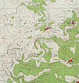 Deir Ghassana, (Beit Rima bottom left), 1943 1:20,000
 -
 Deir Ghassana 1945 1:250,000


Jordanian period
Deir Ghassaneh and Beit Rima were merged and granted municipal status in February 1966 during
From 1967 until today

In June 1967
Second Intifada
In the late night hours of 24 October 2001, during the
Geography
Bani Zeid is situated in the central highlands of the West Bank, off the southwestern cliffs of the mountainous spine that runs from the
Bani Zeid had a total land area of 22,249 dunams in 1945, of which 90 dunams were classified as built-up areas (Deir Ghassaneh was larger than Beit Rima) and 8,400 dunams were planted with olive or fig groves.[46] Today the Bani Zeid municipality has a jurisdiction of over 21,979 dunams, of which 80.6% is cultivable land. today Beit Rima is the larger village. The built-up areas of the town constitute 918 dunams, 832 of which is geared towards residential areas while the remaining 86 is used for commercial, industrial and transportation purposes.[39] The town is surrounded by olive groves,[7] which Bani Zeid is well known for, and 14,505 dunams are planted with olive trees.[39] The old village center of Deir Ghassaneh consists of three quarters: Harat al-Barghouti (Harat al-Fauqa), Harat al-Shu'aibi and Harat al-Tahtani.[47]
The average annual rainfall in the town is 592.9 millimeters (23.34 in) and average annual humidity is roughly 62%. Average temperature is 17.4 °C (63.3 °F).[39]
Climate
| Climate data for Bani Zeid, Palestine 480m (1985–2016 normals),[a] | |||||||||||||
|---|---|---|---|---|---|---|---|---|---|---|---|---|---|
| Month | Jan | Feb | Mar | Apr | May | Jun | Jul | Aug | Sep | Oct | Nov | Dec | Year |
| Mean daily maximum °F (°C) | 59 (15) |
61 (16) |
66 (19) |
75 (24) |
82 (28) |
86 (30) |
90 (32) |
90 (32) |
86 (30) |
81 (27) |
72 (22) |
64 (18) |
75.96 (24.42) |
| Mean daily minimum °F (°C) | 41 (5) |
43 (6) |
45 (7) |
50 (10) |
55 (13) |
59 (15) |
63 (17) |
64 (18) |
64 (18) |
59 (15) |
52 (11) |
45 (7) |
53.2 (11.8) |
| Source: MeteoBlue (Climate Bani Zayd)[48] | |||||||||||||
Note
- ^ Mean monthly maxima and minima (i.e. the expected highest and lowest temperature readings at any point during the year or given month) calculated based on data at said location from 1985 to 2016.
Demographics
Ottoman village statistics from 1870 showed that "Der Ghassana" had 164 houses and a population of 559,[49][50] while "Bet Rima" had 60 houses and a population of 220, though in both cases the population count included only men.[51][52] In the Ottoman census of 1887, Deir Ghassaneh's population of 196 households (roughly 1,200 people) was homogeneous, everyone being Muslim, and with the exception of five individuals, all the males had been born in the village. The estimated 9% of the inhabitants who were born outside the village were almost exclusively women, with one fifth of all females hailing primarily from other villages in the Bani Zeid nahiya such as Beit Rima, Abwein, Kobar and Kafr Ein and about 14 women originating from other parts of Palestine, particularly al-Majdal Ascalon. Several men from Deir Ghassaneh settled in the surrounding villages, namely Beit Rima, Deir Nidham and Nabi Salih.[53] In 1896 the population of Der Ghisane was estimated to be 1,341, while Bet Rima had an estimated 480 inhabitants.[54]
In the 1922 census of Palestine, conducted by the British Mandatory authorities, "Dair Ghassaneh" had a population of 625, while "Bait Rema" had a population of 555, all Muslims.[55] In the 1931 census Deir Ghassaneh had 181 occupied houses and a population of 753,[56] while Beit Rima had had 175 occupied houses and a population of 746, still all Muslim.[57] In a land and population survey by Sami Hadawi in 1945 both villages had a total population of 1,810. Beit Rima had a slightly larger population, but Deir Ghassaneh had a larger land area.[46][58] In a 1961 census by Jordanian authorities, Deir Ghassaneh's population reached 1,461, but it declined drastically after more than half of the residents fled during the Six-Day War in June 1967. In 1982 there were 892 inhabitants in the town. Beit Rima had 2,165 inhabitants in 1961 and unlike Deir Ghassaneh, the population continued to grow, reaching 3,451 in 1987.[59]
In the first census taken by the
According to the PCBS census of 2007, Bani Zeid had a population of 5,515, of which 49% were males and 51% females. There were 1,176 housing units and the average size of a household was five family members.
Economy and education
Historically, Deir Ghassaneh depended primarily on olive cultivation,[62] and until the present day most of Bani Zeid's cultivable land is covered by olive orchards. The cultivation of other fruit trees is significantly lower, with almonds being a distant second at 240 dunams. Other crops grown include grains which cover 135 dunams and onions, dry legumes and fodder to a lesser degree. Only 1% of the town's residents own livestock and according to the Palestinian Ministry of Agriculture, there were 1,880 goats, 268 sheep, 12 cows and 281 beehives in Bani Zeid in 2009. Agriculture currently accounts for 10% of labor in the town.[39]
Today, employment by the Palestinian government and private businesses is the dominant economic activity in Bani Zeid, making up around 70% of the town's workforce. The trade sector accounts for 10% of the labor force, followed by the industrial sector which makes up 8%. Work in the Israeli labor market employs around 2% of the working population. Unemployment in the town was at 20% in 2011. According to the Bani Zeid Municipality, there are 26 grocery stores, 26 public service venues, 11 workshops, a bakery, a butchery and two olive oil presses in the town.[39]
A school was founded in Deir Ghassaneh in 1925.
According to the PCBS, in 2007 94.5% of the population over the age of 10 was literate. Of that demographic segment, 21.7% received elementary education, 24.8% received primary education and 20.2% had secondary education. Over 15% had completed some form of higher education (617 persons), with 248 attaining associate degrees, 324 attaining bachelor's degrees and 45 obtaining higher diplomas.[39]
Governance
Bani Zeid is governed by a
During an Israeli raid in Bani Zeid in 2007, two Hamas party members in the municipal council were arrested by Israeli authorities along with dozens of other Palestinian mayors, parliament members and ministers belonging to Hamas throughout the West Bank.[citation needed]
In the most
The municipal council takes part in the international
Religious sites
One of the notable characteristics of Deir Ghassaneh was the concentration of 16 local Muslim shrines or saintly-person tombs (
All the maqamat of Bani Zeid were designed differently, with some being rustic tombstones and others built more elaborately. The latter types consisted of a domed mausoleum known as a qubba, a shelter known as a makan nawm, a garden, a well and either a distinguishable olive or oak tree. Most of the upkeep of the buildings was provided by awqaf ("religious endowments"). One of the shrines was considered by the local peasantry to be a place to safeguard firewood and outside the reach of potential thieves.[70] The maqamat were also divided by status, with some bearing significance only to an individual village or clan and some collectively revered by the residents of the sheikhdom.[72] Of all the sites in the Bani Zeid sheikhdom, the most venerated shrine was that of Nabi Salih, dedicated to the prophet (nabi) Salih, which held special significance beyond Bani Zeid.[70]
Maqam al-Khawwas
One of the notable maqamat close to the modern town of Bani Zeid is Maqam al-Khawwas (var. Khawassi, Khawwas and Kawas), a double-domed building situated on a hilltop 500 meters west of Deir Ghassaneh,
It contained a mihrab ("niche indicating direction towards Mecca.")[74] The maqam was noted by Guérin in 1863.[35][75] Its eastern dome was constructed by the residents of Deir Ghassaneh, while local legend holds the western dome was completed by angels. The interior of the domes were simple and typical of most maqamat domes, lacking cross-vault roofing which was a common feature for most of Deir Ghassaneh's buildings.[76] The sanctuary had a two-door entrance on its northern end. The interior walls were whitewashed, reflecting the Muslim tradition of heavenly light and spirit in the color white. A few verses from the Qur'an were written on parts of the walls. The tomb of al-Khawwas was covered in white cloth. A small niche on the western wall was fitted for an oil lamp.[77]
An important feature that distinguished Maqam al-Khawwas from the Deir Ghassaneh mosque was that it acted primarily as a women's domain whereas the mosque had largely been a male domain. In the pre-British Mandate era, it was frequented by women on a daily basis and during a seasonal pilgrimage for women known as mawsim al-banat. During this pilgrimage, which coincided with the Nabi Salih pilgrimage, a largely male affair, large groups of women and children from the villages of Bani Zeid would visit the Khawwas mausoleum to celebrate festivities, socialize with other women and pray.[74] According to Palestinian architecture expert Suad Amiry, Maqam al-Khawwas's isolation and the ritual of having to travel uphill to reach the sanctuary added to the tranquil feeling of the visit.[73]
Manor of Salih al-Barghouti
The late 19th-century chief of the Bani Zeid sheikhdom, Sheikh Salih al-Barghouti, resided in a large palace-like manor in Deir Ghassaneh. The first floor and portions of the second floor were originally built in 1602.[78][79] In 1862-63 Sheikh Salih renovated the manor which became known locally as "Saraya al-Sheikh Salih al-Barghouti" and built the remainder of the second floor.[78][79] The building was divided into three main components, namely the salamlek, the khazeen and the haramlek. The salamlek included a reception area, dining halls and a guesthouse while the khazeen consisted of workshops, food depots and horse stables. The haramlek, on the second floor, served as the living quarters for women and servants. Above the living quarters hung the sheikh's retreat and leisure area from which he could view his estates.[80]
According to Amiry, Sheikh Salih's manor, along with other Barghouti family palace compounds, "was strongly influenced by urban architecture" in light of its "majestic scale, ornate fine stone work and the introverted spatial organisation." The manor, which has a rectangular ground plan, roughly measures 23 meters by 34 meters.[79] An open courtyard occupied the central position of the manor.[81] The courtyard was mostly enclosed by four partially open arcades known as riwaqs which either serves as stables or storage.[82]
The main gate of the palace consists of two arches, with one being built within the other. According to Sharon, while this gate structure was common among village manors in the area, the gate of Sheikh Salih's palace was "particularly monumental" as the arch was pointed and contained one keystone. The entire arch was constructed in the ablaq style with alternating black and white stone. A large, heavy and decorated wooden door is fitted into the gate and it was used to receive vehicles or large loads while a smaller door for personal use was built in the center of the larger door.[83] A smaller secondary entrance was located at the building's northern side, vertically parallel of the main entrance.[81]
Notable people
Members of the
References
- ^ a b c Preliminary Results of the Population, Housing and Establishments Census, 2017 (PDF). Palestinian Central Bureau of Statistics (PCBS) (Report). State of Palestine. February 2018. pp. 64–82. Retrieved 2023-10-24.
- ^ a b c d e Bani Zeid: Excerpt Palestinian Association for Culture Exchange
- ^ Finkelstein and Lederman, 1997, p. 279
- ^ Finkelstein and Lederman, 1997, p. 281
- ^ a b Dauphin, 1998, p. 821
- ^ Meaning "The house of Rima", see Palmer, 1881, p. 226
- ^ a b c d e f Sharon, 2004, p. 36
- ISBN 0-19-815402-X
- ^ Palmer, 1881, p. 228
- ^ Dauphin, 1998, p. 823
- ^ a b Singer, 1994, p. 179
- ^ Sharon, 2004, pp. 46-47.
- Surda. See Singer, 1994, p. 77.
- ^ a b Singer, 1994, pp. 76-78.
- ^ Amiry, 1987, p. 46.
- ^ Hütteroth and Abdulfattah, 1977, p. 120-121
- ^ Hütteroth and Abdulfattah, 1977, p. 120.
- ^ Hütteroth and Abdulfattah, 1977, p. 121.
- ^ Singer, 1994, p. 180
- ^ a b Amiry, 1987, p. 44.
- , Khirbet Ibrahim, Artubba and Rashaniya.
- ^ a b c d e f g Macalister and Masterman, 1905, p. 355
- ^ a b c Bussow, 2011, p. 114
- ^ a b c d Sharon, 2004, p. 41
- ^ a b c d e Bussow, 2011, p. 113
- ^ a b c d e Amiry, 1987, p. 45.
- ^ Macalister and Masterman, 1906, p. 39
- ^ a b c Bussow, 2011, p. 112
- ^ a b Bussow, 2011, p. 128
- ^ Bussow, 2011, pp. 129-130.
- ^ Guérin, 1875, p. 150 ff.
- ^ Bussow, 2011, pp. 128-129.
- ^ Bussow, 2011, p. 115
- ^ a b Conder and Kitchener, 1882, p. 290
- ^ a b c d Sharon, 2004, p. 37
- ^ Probert, 2006, p. 82.
- ^ LeVine, Sonia Nimr, 2012, pp. 150–151.
- ^ a b c "About Municipality" (in Arabic). Municipality of West Bani Zaid. Archived from the original on March 11, 2008.
- ^ Applied Research Institute-Jerusalem(ARI). 2012. Retrieved 2013-02-26.
- ^ UN Doc A/33/165 of 5 July 1978
- ^ The Israeli Army Ravages Beit Rima Archived 2005-12-22 at the Wayback Machine Applied Research Institute – Jerusalem. 2001-11-05.
- ^ a b c Human Rights Watch. Israel, the Occupied West Bank and Gaza Strip, and the Palestinian Authority Territories. 14:2. April 2002. pp. 9-10.
- ^ a b Dellios, Hugh.Israel raids village to pursue assassins Chicago Tribune. 2001-10-05. pp. 1-2.
- ^ a b Hanna, Mike. Hanna: Beit Rima clashes. CNN. 2001-10-25.
- ^ Maraqa, Hania Nabil. Palestinians; From Village Peasant to Camp Refugees: Analogies and Disparities in the Social Use of Space. University of Arizona-Faculty of the School of Architecture. 2004.
- ^ a b Government of Palestine, Department of Statistics. Village Statistics, April, 1945. Quoted in Hadawi, 1970, p. 64
- ^ Amiry, 1987, p. 78.
- ^ "Climate Bani Zayd". MeteoBlue. Retrieved 2017-04-22.
- ^ Socin, 1879, p. 152 Also noted it in the Beni Zeid district
- ^ Hartmann, 1883, p. 106 also noted 164 houses
- ^ Socin, 1879, p. 147
- ^ Hartmann, 1883, p. 107 NB: found only 6 houses
- ^ Bussow, 2011, pp. 116-117.
- ^ Schick, 1896, p. 126
- ^ Barron, 1923, Table VII, Sub-district of Ramallah, p. 16
- ^ Mills, 1932, p. 48.
- ^ Mills, 1932, p. 47.
- ^ Department of Statistics, 1945, p. 26
- ^ Bayt Rima Statistics and Dayr Ghassana Statistics British Mandate censuses via PalestineRemembered.
- ^ Palestinian Population by Locality, Sex and Age Groups in Years Archived 2008-11-19 at the Wayback Machine
Palestinian Population by Locality and Refugee Status Archived 2008-11-19 at the Wayback Machine Results of 1997 Census by the Palestinian Central Bureau of Statistics (PCBS) for the Ramallah and al-Bireh Governorate. - ^ 2007 PCBS Census. Palestinian Central Bureau of Statistics. p. 112.
- ^ Carter (ed), 1996, p. 394
- ^ Amiry, 1986, p. 241.
- ^ Amiry, 1986, p. 195.
- ^ "Current Municipal Council of West Bani Zaid" (in Arabic). Municipality of West Bani Zaid. Archived from the original on March 11, 2008.
- ^ Moore, Molly.Democracy's New Face: Radical and Female Palestinian Mayor Embodies Both Tradition and Change in Middle East Washington Post Foreign Service. Washington Post Company. 2005-01-29.
- ^ "2012 Local Elections: West Bani Zeid" (PDF). Palestine Central Elections Commission (in Arabic). Wafa. 2012. Retrieved 2013-04-24.
- ^ Leon, Eli. Paris suburb honors Palestinian assassin of Israeli minister. Israel Hayom. 2013-03-11.
- ^ French town honours Israeli minister 'killer'. Al Jazeera English. 2013-03-11.
- ^ a b c Bussow, 2011, pp. 123-124.
- ^ Maraqa, 2004, p. 55.
- ^ a b Amiry, 1987, p. 208.
- ^ a b c Amiry, 1987, p. 211.
- ^ a b Maraqa, 2004, p. 59.
- ^ Guérin, 1875, p. 151
- ^ Amiry, 1987, p. 212.
- ^ Amiry, 1987, p. 213.
- ^ a b Sharon, 2004, p. 40
- ^ a b c Amiry, 1987, p. 103.
- ^ Tamari, 2002, pp. 29-30.
- ^ a b Amiry, 1987, p. 104.
- ^ Amiry, 1987, p. 108.
- ^ Sharon, 2004, p. 42
- ^ Tamari, 2008, p. 134
- ^ "Palestinian Personalities". passia.org. Archived from the original on 2013-12-04. Retrieved 2014-05-01.
- ISBN 9780470928981.
- ^ "From Beit Reema". beitreema.com.
- ISBN 9780905118659.
- ^ "Mahmoud al-Rimawy". arabicfiction.org. Archived from the original on 2011-10-02. Retrieved 2014-05-01.
Bibliography
- hdl:1842/6987
- Barron, J.B., ed. (1923). Palestine: Report and General Abstracts of the Census of 1922. Government of Palestine.
- ISBN 978-9004205697.
- Carter, Charles Edward, ed. (1996). Community, Identity, and Ideology: Social Science Approaches to the Hebrew Bible. Eisenbrauns. ISBN 1575060051.
- Conder, C.R.; Kitchener, H. H. (1882). The Survey of Western Palestine: Memoirs of the Topography, Orography, Hydrography, and Archaeology. Vol. 2. London: Committee of the Palestine Exploration Fund.
- ISBN 0-860549-05-4.
- Department of Statistics (1945). Village Statistics, April, 1945. Government of Palestine.
- ISBN 965-440-007-3.
- Hadawi, S. (1970). Village Statistics of 1945: A Classification of Land and Area ownership in Palestine. Palestine Liberation Organization Research Center.
- Hartmann, M. (1883). "Die Ortschaftenliste des Liwa Jerusalem in dem türkischen Staatskalender für Syrien auf das Jahr 1288 der Flucht (1871)". Zeitschrift des Deutschen Palästina-Vereins. 6: 102–149.
- Hütteroth, Wolf-Dieter; Abdulfattah, Kamal (1977). Historical Geography of Palestine, Transjordan and Southern Syria in the Late 16th Century. Erlanger Geographische Arbeiten, Sonderband 5. Erlangen, Germany: Vorstand der Fränkischen Geographischen Gesellschaft. ISBN 3-920405-41-2.
- Guérin, V. (1875). Description Géographique Historique et Archéologique de la Palestine (in French). Vol. 2: Samarie, pt. 2. Paris: L'Imprimerie Nationale.
- S2CID 161632875.
- .
- Mills, E., ed. (1932). Census of Palestine 1931. Population of Villages, Towns and Administrative Areas. Jerusalem: Government of Palestine.
- Palmer, E.H. (1881). The Survey of Western Palestine: Arabic and English Name Lists Collected During the Survey by Lieutenants Conder and Kitchener, R. E. Transliterated and Explained by E.H. Palmer. Committee of the Palestine Exploration Fund.
- Probert, Harry (2006). Bomber Harris: His Life and Times. MBI Publishing Company. ISBN 1-85367-691-8.
- Robinson, E.; Smith, E. (1841). Biblical Researches in Palestine, Mount Sinai and Arabia Petraea: A Journal of Travels in the year 1838. Vol. 3. Boston: Crocker & Brewster.
- Schick, C. (1896). "Zur Einwohnerzahl des Bezirks Jerusalem". Zeitschrift des Deutschen Palästina-Vereins. 19: 120–127.
- ISBN 90-04-13197-3.
- ISBN 0-521-47679-8.
- Socin, A. (1879). "Alphabetisches Verzeichniss von Ortschaften des Paschalik Jerusalem". Zeitschrift des Deutschen Palästina-Vereins. 2: 135–163.
- Tamari, S. (Autumn 2002). The Last Feudal Lord in Palestine. Vol. 85. Revue d'études palestiniennes. Archived from the original on June 22, 2015.
{{cite book}}:|work=ignored (help) - ISBN 978-0-520-25129-8.
External links
- Official Website beitreema
- Welcome To Bayt Rima
- Welcome To Dayr Ghassana
- Bani Zeid, Welcome to Palestine
- Survey of Western Palestine, Map 14: IAA, Wikimedia commons
- Bani Zeid Town (Fact Sheet), Applied Research Institute–Jerusalem (ARIJ)
- Bani Zeid Town profile, ARIJ
- Bani Zeid aerial photo, ARIJ
 | ||||
| Municipalities |
| |||
Village councils |
| |||
Refugee camps |
| |||