
Barton Hills, Michigan
Barton Hills, Michigan | ||
|---|---|---|
| Barton Hills Village | ||
 Walter Esch Village Hall on Barton Shore Drive | ||
|
FIPS code 26-05660[3] | | |
| GNIS feature ID | 2398044[4] | |
| Website | Official website | |
Barton Hills is a village in Washtenaw County in the U.S. state of Michigan. The population was 316 at the 2020 census. The village is located within Ann Arbor Charter Township just northwest of the city of Ann Arbor.
Originally established by Detroit Edison president Alex Dow on land acquired for the Barton Dam, Barton Hills was designed as an exclusive, forested residential enclave just outside Ann Arbor. In 1944, the community was sold to its residents, and a village was incorporated in 1973. The streets in the village were formerly owned by the Barton Hills Maintenance Corporation but were purchased by the village itself in 2010.
History
In the early 1900s the land now occupied by Barton Hills Village was used for cattle grazing by a local firm, Towar Dairy. Around 1910 the
An area known as "Huron Farms" was established by the Detroit Edison Company in 1913 on this property on the north shore of the Huron River, adjacent to the City of Ann Arbor.[6][7] Land owned by the company was also used for agricultural purposes, including farms, dairy cattle, and fruit orchards.[6]
Detroit Edison's president, Alex Dow, devoted parted of the company's acquisition as an exclusive residential community for company executives.
The Barton Hills Country Club, the only business establishment within the village, was founded in 1917.[8] Membership in the Barton Hills Country Club was considered by many to be a mark of distinction.[citation needed] In 2020, about 45% of Barton Hills residents were members of the country club.[7]
The subdivision was in its early years considered too far from Ann Arbor to be attractive, and grew slowly. The economic depression of the 1930s slowed all types of building, and it was only in the post-World War II years of the 1950s and 1960s that construction of private homes resumed in earnest. This has continued so that few empty lots remain.[9]
By the 1940s, through the economic and social turmoil of the Great Depression and World War II, the community had become an economic liability for a public utility.[9] The company shareholders decided to make an outright gift of its holding to the residents of the community in exchange for assuming responsibility for maintaining the water system, roads, and other municipal services.[6] However, the community did not seek municipal status until some thirty years later. On December 12, 1973, the community became the first home rule village in Washtenaw County.[9]
Geography
According to the U.S. Census Bureau, the village has a total area of 0.76 square miles (1.97 km2), all land.[2]
Barton Hills sits on the north bank of Barton Pond along the
Demographics
| Census | Pop. | Note | %± |
|---|---|---|---|
| 1980 | 357 | — | |
| 1990 | 320 | −10.4% | |
| 2000 | 335 | 4.7% | |
| 2010 | 294 | −12.2% | |
| 2020 | 316 | 7.5% | |
| U.S. Decennial Census[10] | |||
2010 census
As of the
There were 123 households, of which 25.2% had children under the age of 18 living with them, 69.9% were married couples living together, 2.4% had a female householder with no husband present, 3.3% had a male householder with no wife present, and 24.4% were non-families. 21.1% of all households were made up of individuals, and 14.6% had someone living alone who was 65 years of age or older. The average household size was 2.39 and the average family size was 2.74.
The median age in the village was 53.7 years. 21.8% of residents were under the age of 18; 1% were between the ages of 18 and 24; 10.2% were from 25 to 44; 37.3% were from 45 to 64; and 29.6% were 65 years of age or older. The gender makeup of the village was 48.0% male and 52.0% female.
2000 census
As of the
There were 136 households, out of which 25.0% had children under the age of 18 living with them. 81.6% of households were married couples living together, 0.7% had a female householder with no husband present, and 17.6% were non-families. 15.4% of all households were made up of individuals, and 9.6% had someone living alone who was 65 years of age or older. The average household size was 2.46 and the average family size was 2.73.
The village population was 18.8% under the age of 18, 3.6% age 18 to 24, 14.6% age 25 to 44, 40.6% age 45 to 64, and 22.4% age 65 and older. The median age was 52. For every 100 females, there were 92.5 males. For every 100 females age 18 and over, there were 95.7 males.
The median household income was $149,056, and the median family income was $153,166. Males had a median income of $100,000 versus $51,111 for females. The
Education
Barton Hills is served by Ann Arbor Public Schools, although there are no schools located within the village.[12]
Images
-
 Barton Pond created from the Barton Dam
 -
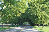 Barton Shore Drive
 -
 Maple–Foster Bridge


References
- ^ Barton Hills Village (2021). "BVH Board of Trustees". Retrieved December 10, 2023.
- ^ a b "2020 U.S. Gazetteer Files". United States Census Bureau. Retrieved May 21, 2022.
- ^ a b "U.S. Census website". United States Census Bureau. Retrieved January 31, 2008.
- ^ U.S. Geological Survey Geographic Names Information System: Barton Hills, Michigan
- ^ Barton Hills Maintenance Corporation Architectural Guidelines” url=https://thebhmc.org/wp-content/uploads/2021/08/Architectural-Guidelines-May-1-2021.pdf
- ^ a b c d e Shackman, Grace; Kane, Lois (June 2005). "The Buried History of Barton Hills". Ann Arbor Observer.
- ^ a b c Rahal, Sarah (April 18, 2020). "If you've never heard of Michigan's richest community, that's just fine". Detroit News.
- ^ ISBN 9781591937692.
- ^ a b c d “Barton Hills Maintenance Corporation Architectural Guidelines” url=https://thebhmc.org/wp-content/uploads/2021/08/Architectural-Guidelines-May-1-2021.pdf
- ^ "Census of Population and Housing". Census.gov. Retrieved June 4, 2015.
- ^ "U.S. Census website". United States Census Bureau. Retrieved November 25, 2012.
- ^ Michigan Geographic Framework (November 15, 2013). "Washtenaw County School Districts" (PDF). Archived (PDF) from the original on August 21, 2014. Retrieved July 22, 2021.
External links
Municipalities and communities of Washtenaw County, Michigan, United States | ||
|---|---|---|
| Cities |  | |
| Village | ||
| Charter townships | ||
| Civil townships | ||
| CDPs | ||
| Other communities |
| |
| Defunct |
| |
| Ghost towns |
| |
| Footnotes | ‡This populated place also has portions in an adjacent county or counties | |
| ||