
Batanaea
Batanaea or Batanea was an area often mentioned between the first century BC until the fourth century AD. It is often mixed with the biblical Bashan as its hellenized/latinized form (of
Bashan was, in biblical context, the whole region east of the Jordan, above Gadara and Abila until the Jebel el Druz, the old Hauran (Bashan) mountains.
History
Bataneaea was one of the four post-exile divisions of the area of Bashan. Today, as it was during Greco-Roman times, Batanaea is more commonly considered to be the area east of the Leja.
The region south of the Leja and west of the Hauran (Auranitis) called Nuqrah[2] to the southwestern edge of the Leja is sometimes falsely called Batanaea. This is because of the permanent mix with the name of the Basan/Bashan region. The biblical Bashan/Basan was the whole area from Adra (Deraa) at its ancient capital to the Hauran mountains. Its highest peak may be the Hill of Basan referenced in Psalm 68:15.
In the 1st century AD, the land was acquired by
On Philip's death in 34 BC, Batanea briefly became part of the Roman province of
New Testament
Maps
-

-

-
 Theological map
 -

-
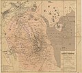 The regions east of Damascus, by Kiepert after Consul Wetzstein, 1860
 -
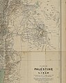
 Map of Palestine, 1868, by K.v. Raumer
 -
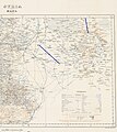
 Map with the regions of the Decapolis between the first century BC and the late first century AD
 -
 1938 English topographic map (detail)
 -
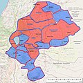
 English topographic map with Batanea (Beteniye) and Nukra marked
 -
-
 1908 German map (detail)


References
- ^ Ptolomaios, Handbook of Geography, by Stückelberger, Grasshoff, see Mapsection, created together with Ptolemaios-Forschungsstelle
Institut für Klassische Philologie, 2017, ISBN 3796521487
- ^ F.E. Peters (1977). The Nabateans in the Hawran, Journal of the American Oriental Society, Vol. 97, No. 3, New York University, pp. 263, 265
- ^ Paneas/Caesarea Philippi and the World of the Gospels, John Francis Wilson