
Beauly Firth
| Beauly Firth | ||
|---|---|---|
| Linne Fharair ( Primary inflows River Beauly | | |
| Primary outflows | Moray Firth | |
| Max. length | 6.8 mi (10.9 km) | |
| Max. width | 2.2 mi (3.5 km) | |
The Beauly Firth (
Several other watercourses drain into the Beauly Firth, including the
In 1982, the first bridge crossing the Beauly Firth was opened between North and South Kessock, known as the Kessock Bridge. As part of the A9 road, the bridge linked Inverness to the Black Isle for the first time. Prior to this, the Kessock Ferry crossed the firth at its eastern end since sometime in the 15th century.[3]
Today, the roads around the Beauly Firth provide a popular circuit for cyclists. However, the
The Beauly Firth is prone to flooding, affecting shoreline communities such as Bunchrew and Redcastle. This is a particular issue following heavy rainfall, such as in 2020's Storm Ciara.[5]
The Beauly Firth is also known as Poll an Ròid in Scottish Gaelic, meaning "Pool of the Cross". This name is mostly used on Scotland's west coast, and is a reference to a cross erected by the Collegiate Friars of Inverness on an islet in the firth.[6]
History
From studies in nearby Munlochy, scientists predict the Beauly Firth was once the site of a glacier 55m high, its meltwaters flowing into the Munlochy Valley. As the Last Glacial Period ended however, the ice gradually retreated, leaving the firth and its steep surrounding hills.[7]
Several ancient cairns can be found within the Beauly Firth, with at least one reported to contain timber and human remains.[8]
In Ptolemy's geography of the British Isles, written around AD 150 at the height of the Roman Empire, the Beauly Firth is possibly referred to as the "Varar estuary"[9]—a view supported by Scottish scholar William J. Watson.[10]
During the late-19th century, the firth was the cause of much dispute between fishermen there and others on the Moray Firth. According to fisherman in Moray, heavy garvie fishing in the Beauly Firth (where the young fish live in winter months) had led to a decline in their herring stock. This led to calls for the prohibition of garvie fishing in the area.[11]
-
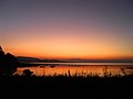 Sunset over the Beauly Firth, viewed from its southern shore
 -
 Beauly Firth looking towards the Kessock Bridge, seen in the distance
 -
 Road running along the north shore of the Beauly Firth, from Beauly to North Kessock


Footnotes
- ISBN 978-1-4020-8638-0.
- ^ Wildfowl. 1981.
- ^ "North Kessock and District History". North Kessock & District Local History Society. Retrieved 18 September 2009.
- ^ "Around the Beauly Firth, The Highlands – Cycling". www.visitscotland.com. Retrieved 30 July 2020.
- ^ Henderson, Michelle. "Highland communities urged to be vigilant as flood warnings are issued". Press and Journal. Retrieved 30 July 2020.
- ^ Barron, Hugh (1968). Transactions of the Gaelic Society of Inverness.
- ISBN 978-94-011-1500-1.
- ^ Lewis, Samuel (1851). A Topographical Dictionary of Scotland: Comprising the Several Counties, Islands, Cities, Burgh and Market Towns, Parishes, and Principal Villages, with Historical and Statistical Descriptions: Embellished with Engravings of the Seals and Arms of the Different Burghs and Universities. S. Lewis and Company.
- ^ "LacusCurtius • Ptolemy's Geography—Book II, Chapter 2". penelope.uchicago.edu. Retrieved 30 July 2020.
- ^ Taylor, Simon (2002). "PLACE-NAME SURVEY OF THE PARISHES OF KILMORACK, KILTARLITY & CONVINTH, AND KIRKHILL, INVERNESS-SHIRE" (PDF).
- ^ Buckland, Francis Trevelyan; Walpole, Sir Spencer; Young, Archibald (1878). Report on the Herring Fisheries of Scotland. George E. Eyre and William Spottiswoode.