
Beaumont, Texas
Beaumont | ||
|---|---|---|
| City of Beaumont | ||
From top, left to right: Downtown, Port of Beaumont, Lamar University Sports Complex, Hotel Beaumont, Fire Museum of Texas, Tyrrell Historical Library, Crockett Street Entertainment District, Neches River Lift Bridge | ||
|
FIPS code 48-07000[4] | | |
| GNIS feature ID | 1330268[2] | |
| Website | beaumonttexas | |


Beaumont is a city in the
The city of Beaumont was founded in 1838.[6] The pioneer settlement had an economy based on the development of lumber, farming, and port industries. In 1892, Joseph Eloi Broussard opened the first commercially successful rice mill in Texas, stimulating development of rice farming in the area; he also started an irrigation company (since 1933, established as the Lower Neches Valley Authority) to support rice culture. Rice became an important commodity crop in Texas and is now cultivated in 23 counties.[7]
A big change occurred in 1901 with the Spindletop gusher, which demonstrated that a huge oil field lay underneath and adjacent to the city. With Spindletop, several energy companies developed in Beaumont, and some remain. The area rapidly developed as one of the country's major petrochemical refining areas. Along with Port Arthur and Orange, Beaumont forms the Golden Triangle, a major industrial area on the Texas Gulf Coast.
Beaumont is home to
History
In 1824 Noah and Nancy Tevis settled on the west bank of the Neches River and developed a farm. Soon after that, a small community grew up around the farm, which was named Tevis Bluff or Neches River Settlement.[8] In 1835 the land of Tevis, together with the nearby community of Santa Anna (in total, 50 acres (20 ha)), was purchased by Henry Millard (c. 1796–1844),[9] Joseph Pulsifer (1805–1861),[10] and Thomas Byers Huling (1804–1865).[11] They began planning a town to be laid out on this land.[8] Their partnership, J.P. Pulsifer and Company, controlled the first 50 acres (200,000 m2) upon which the town was founded.[10] This town was named Beaumont, after Mary Dewburleigh Barlace Warren Beaumont, the wife of Henry Millard.[12] They added more property for a total of 200 acres.
Beaumont became a town on December 16, 1838. Beaumont's first mayor was
The Beaumont Rice Mill, founded in 1892 by Joseph Eloi Broussard, was the first commercially successful rice mill in Texas.[7] In addition, Broussard cofounded the Beaumont Irrigation Company in 1898 to operate an irrigation system to support rice culture. The company along with four others established around the same time helped stimulate the expansion of rice cultivation from 1500 acres in 1892 to 400,000 acres in 23 counties by his death in 1956.[7] The other companies were The Port Arthur Rice and Irrigation Company, The McFaddin-Wiess-Kyle Canal Company, the Treadaway or Neches Canal Company, and the Taylors-Hillebrand complex.[15] The holdings of those companies formed the basis for the Lower Neches Valley Authority established by the state legislature in 1933.[16]
The rise of Beaumont's mill economy drew many new residents to the city, many of them immigrants.[17] By the early 20th century, the city was served by the Southern Pacific; Kansas City Southern, Atchison, Topeka, and Santa Fe; and Missouri Pacific railroad systems.[18]

When the city became a major center for defense shipbuilding during
During the war years, airmen cadets from the Royal Air Force, flying from their training base at Terrell, Texas, routinely flew to Beaumont on training flights. The community served as a stand-in for the British for Paris, France, which was the same distance from London, England as Beaumont is from Terrell.[24]
In the postwar years, Beaumont's port continued in importance. As was typical with other cities, post-war highway construction led to the development of new suburbs and dispersal of the population in search of new housing. Recently, there has been some renewal in Downtown Beaumont and in other areas of the city.
In 1996, the Jefferson County courts, located in Beaumont, became the first court in the nation to implement electronic filing and service of court documents. This eliminated the need for law firms to print and mail reams of documents.
In 2005 and 2008, Beaumont and surrounding areas suffered extensive damage from Hurricane Rita and Hurricane Ike, respectively.[25][26] Mandatory evacuations were issued in advance of both storms.
In August 2017, Beaumont and surrounding areas experienced severe flooding as a result of Hurricane Harvey.[27][28] Due to the flooding, Memorial Hermann Baptist Hospital evacuated all of its highest level of acuity patients with the help of National Guard helicopters.[29] In addition, many Beaumont residents had to be rescued by both boats and helicopters as a result of the floodwaters. As of March 2019[update], many residents in the area are still attempting to recover from the hurricane as the city received emergency assistance.[30]
Geography
According to the United States Census Bureau, the city has a total area of 85.8 square miles (222.3 km2), of which 82.8 square miles (214.5 km2) are land and 3.1 square miles (7.9 km2), or 3.53%, are water.[31]
Beaumont lies on Texas' coastal plain, about 30 miles (48 km) inland from the Gulf of Mexico, 85 miles (137 km) east of Houston, and just south of the dense pine forests of East Texas. The city is bordered on the east by the Neches River and to the north by Pine Island Bayou. Before being settled, the area was crisscrossed by numerous small streams. Most of these streams have since been filled in or converted for drainage purposes. The island directly across from Riverfront Park is called Trinity Island. There are also three other islands in the Neches River around the downtown area/port: Harbor, Smith and Clark. Beaumont is relatively flat compared to other Texas cites at being 16 ft. above sea level. South of Beaumont, Port Arthur is only 7 ft. above sea level.
Annexations
Several towns and communities have been absorbed into the city of Beaumont. These include: Amelia, established in 1885 and incorporated into Beaumont in 1956; Elizabeth, the depot of Amelia that was established around 1903 or after and annexed into Beaumont in 1957; Elwood, established sometimes in the late 1800s, changed to Voth in 1902, and annexed into Beaumont in 1957; Guffey, post office was established in 1901 and closed in 1925 but is part of Beaumont now; Santa Anna, became part of Beaumont when it was founded; Tevis Bluff, became part of Beaumont when it was founded in 1835.[32]
Architecture

Beaumont has 8 buildings over 100 feet (30 m) tall, the tallest being the
The second oil boom of 1925 brought more people and wealth to Beaumont, the same year the 12-story American National Bank Building (now Orleans Building), was erected, and in 1926 Forrest Goodhue built the 12-story Goodhue Building which included a penthouse. In 1928, the Edson Hotel was built. No other buildings were built until Century Tower in 1962 and in 1982 Edison Plaza was built. In 1994 the 12-story LaSalle Hotel, built in 1927, was demolished.
The
Beaumont's Jefferson County Courthouse is one of the tallest county courthouses in the state and is an excellent example of Art Deco architecture.[36] Across the street from the Jack Brooks Federal Building is the Kyle Building, built in 1933. The storefront was recently restored and is considered to be one of the best examples of Zig-Zag architecture in Texas.[37] The Oaks Historic District has many restored historic homes.
-

-

-
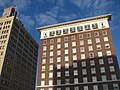 Left-San Jacinto Building, Right-Hotel Beaumont
 -
 Century Tower
 -

-

-
 Julie Rogers Theater
 -


Pollution
The Beaumont–Port Arthur region has historically been cited as one of the most polluted urban areas in the United States due to various energy industries and chemical plants in the area. Even so, as of July 2014[update], the Beaumont-Port Arthur region was not under any
Climate

The city of Beaumont experiences a humid subtropical climate and is within the Piney Woods region of eastern Texas.[41][42] The area around Beaumont receives the most rainfall in the state: more than 60 inches (1,500 mm) annually. The city has two distinct seasons, a wet season from April to October and a dry season from November to March. Hurricanes also pose a threat to the city and greater metropolitan area.
Hurricane Rita in 2005 and Hurricane Ike in 2008 both caused significant damage.[43][44] Both Hurricane Harvey in 2017 and Tropical Storm Imelda in 2019 caused historic flooding throughout the city.[45] Hurricane Laura in 2020 posed a significant threat to the town,[46] as it was forecasted to make landfall at the border of Texas and Louisiana, almost following the same track as Hurricane Rita in 2005. The storm turned more northerly close to landfall, and spared Beaumont the worst impacts and damage. Minor damage was reported with winds gusting around hurricane-force for a short period of time as Laura moved over Lake Charles, Louisiana. Also, Hurricane Delta in 2020 passed near the region as it made landfall in Southwest Louisiana.[47] Impacts were about the same with Delta as they were with Laura.
On August 18, 2009, a tornado hit the west side of Beaumont, causing damage to cars and several local businesses. Injuries were minimal.[48]
While wintry precipitation is unusual, it does occur. The most recent significant wintry event to occur was December 8, 2017 when the
| Climate data for Beaumont, Texas (1991–2020 normals, extremes 1901–present) | |||||||||||||
|---|---|---|---|---|---|---|---|---|---|---|---|---|---|
| Month | Jan | Feb | Mar | Apr | May | Jun | Jul | Aug | Sep | Oct | Nov | Dec | Year |
| Record high °F (°C) | 86 (30) |
90 (32) |
95 (35) |
97 (36) |
101 (38) |
106 (41) |
108 (42) |
105 (41) |
108 (42) |
99 (37) |
94 (34) |
86 (30) |
108 (42) |
| Mean maximum °F (°C) | 77.6 (25.3) |
79.1 (26.2) |
83.4 (28.6) |
87.3 (30.7) |
92.2 (33.4) |
96.2 (35.7) |
97.7 (36.5) |
98.7 (37.1) |
96.0 (35.6) |
91.2 (32.9) |
84.6 (29.2) |
78.7 (25.9) |
99.5 (37.5) |
| Mean daily maximum °F (°C) | 62.6 (17.0) |
65.8 (18.8) |
72.1 (22.3) |
78.3 (25.7) |
85.2 (29.6) |
90.4 (32.4) |
92.0 (33.3) |
92.8 (33.8) |
88.6 (31.4) |
81.5 (27.5) |
71.4 (21.9) |
64.2 (17.9) |
78.7 (25.9) |
| Daily mean °F (°C) | 52.9 (11.6) |
56.6 (13.7) |
62.9 (17.2) |
68.9 (20.5) |
76.6 (24.8) |
82.3 (27.9) |
83.7 (28.7) |
84.1 (28.9) |
79.3 (26.3) |
71.0 (21.7) |
61.3 (16.3) |
54.7 (12.6) |
69.5 (20.8) |
| Mean daily minimum °F (°C) | 43.3 (6.3) |
47.4 (8.6) |
53.7 (12.1) |
59.4 (15.2) |
68.1 (20.1) |
74.1 (23.4) |
75.5 (24.2) |
75.3 (24.1) |
70.1 (21.2) |
60.6 (15.9) |
51.2 (10.7) |
45.1 (7.3) |
60.3 (15.7) |
| Mean minimum °F (°C) | 28.4 (−2.0) |
33.6 (0.9) |
37.5 (3.1) |
44.3 (6.8) |
54.7 (12.6) |
66.5 (19.2) |
69.5 (20.8) |
69.0 (20.6) |
59.5 (15.3) |
45.0 (7.2) |
34.7 (1.5) |
30.9 (−0.6) |
26.6 (−3.0) |
| Record low °F (°C) | 11 (−12) |
10 (−12) |
20 (−7) |
36 (2) |
43 (6) |
53 (12) |
64 (18) |
57 (14) |
44 (7) |
33 (1) |
23 (−5) |
20 (−7) |
10 (−12) |
| Average precipitation inches (mm) | 5.38 (137) |
3.66 (93) |
3.73 (95) |
3.93 (100) |
5.24 (133) |
7.04 (179) |
6.48 (165) |
7.19 (183) |
7.36 (187) |
5.38 (137) |
4.42 (112) |
5.26 (134) |
65.07 (1,653) |
| Average snowfall inches (cm) | 0.0 (0.0) |
0.0 (0.0) |
0.0 (0.0) |
0.0 (0.0) |
0.0 (0.0) |
0.0 (0.0) |
0.0 (0.0) |
0.0 (0.0) |
0.0 (0.0) |
0.0 (0.0) |
0.0 (0.0) |
0.1 (0.25) |
0.1 (0.25) |
| Average precipitation days (≥ 0.01 in) | 10.3 | 9.5 | 8.2 | 7.2 | 7.2 | 10.6 | 12.0 | 10.4 | 9.2 | 7.2 | 7.9 | 10.0 | 109.7 |
| Average snowy days (≥ 0.1 in) | 0.0 | 0.0 | 0.0 | 0.0 | 0.0 | 0.0 | 0.0 | 0.0 | 0.0 | 0.0 | 0.0 | 0.0 | 0.0 |
| Source: | |||||||||||||
Demographics
| Census | Pop. | Note | %± |
|---|---|---|---|
| 1850 | 171 | — | |
| 1890 | 3,296 | — | |
| 1900 | 9,427 | 186.0% | |
| 1910 | 20,640 | 118.9% | |
| 1920 | 40,422 | 95.8% | |
| 1930 | 57,732 | 42.8% | |
| 1940 | 59,061 | 2.3% | |
| 1950 | 94,014 | 59.2% | |
| 1960 | 119,175 | 26.8% | |
| 1970 | 117,548 | −1.4% | |
| 1980 | 118,067 | 0.4% | |
| 1990 | 114,177 | −3.3% | |
| 2000 | 113,866 | −0.3% | |
| 2010 | 118,296 | 3.9% | |
| 2020 | 115,282 | −2.5% | |
| U.S. Decennial Census[57][failed verification] 2020[3] | |||

| Race / Ethnicity (NH = Non-Hispanic) | Pop 2000[58] | Pop 2010[59] | Pop 2020[60] | % 2000 | % 2010 | % 2020 |
|---|---|---|---|---|---|---|
White alone (NH)
|
48,595 | 41,041 | 32,549 | 42.68% | 34.69% | 28.23% |
Black or African American alone (NH)
|
51,928 | 55,489 | 54,034 | 45.60% | 46.91% | 46.87% |
Alaska Native alone (NH)
|
223 | 360 | 209 | 0.20% | 0.30% | 0.18% |
| Asian alone (NH) | 2,808 | 3,850 | 4,328 | 2.47% | 3.25% | 3.75% |
| Pacific Islander alone (NH) | 36 | 25 | 29 | 0.03% | 0.02% | 0.03% |
| Some Other Race alone (NH) | 118 | 11 | 486 | 0.10% | 0.09% | 0.42% |
| Mixed Race or Multi-Racial (NH) | 1,130 | 1,522 | 3,040 | 0.99% | 1.29% | 2.64% |
| Hispanic or Latino (any race) | 9,028 | 15,898 | 20,607 | 7.93% | 13.44% | 17.88% |
| Total | 113,866 | 118,296 | 115,282 | 100.00% | 100.00% | 100.00% |
The city of Beaumont and its metropolitan statistical area have experienced slight population decline and stagnation since 2015's census estimates, while modest increases in population have assisted in the area's demographic sustainment.[61] Similar to its population fluctuations from 1980 to 1990, Beaumont's population has shifted from roughly 115,000 to 118,000 residents from the 2020 and 2010 United States census.[4][3] According to the 2010 United States census there were 118,296 people, 45,648 households, and 28,859 families residing in the city limits. Per the 2020 United States census, its population slightly declined to 115,282 residents. In 2010, Beaumont's population density was 1,339.4 inhabitants per square mile (517.1/km2). Housing units were at an average density of 574.2 per square mile (221.7/km2).
Of the 45,648 households at the 2010 United States census, out of which 28.9% had children under the age of 18 living with them, 38.7% were married couples living together, 19.2% had a female householder with no husband present, and 36.8% were non-families; 30.7% of all households were made up of individuals, and 10.0% had someone living alone who was 65 years of age or older. The average household size was 2.48 and the average family size was 3.12. Among its population at the 2019 American Community Survey, the median age was 34.6 and the average family size was 3.23.[3] From an estimated 45,435 occupied housing units in 2019, 52.1% were owner-occupied and the median selected monthly costs for units with a mortgage were $1,366 and $412 without a mortgage.[62]
The median income for a household in the city was $39,699, according to the American Community Survey during 2010, and the median income for a family was $49,766. The per capita income for the city was $23,137. About 17.6% of families and 22.1% of the population lived at or below the poverty line. From 2014 to 2019, its median income for households was $54,488; families had a median income of $61,069; married-couple families $78,239; and non-family households $29,415. In 2019, an estimated 16.7% of the population lived at or below the poverty line.[3]
According to the 2010 census, the racial and ethnic makeup of the city was 33.5%
Religion

Religiously,
Beyond Christianity, the second largest religion in the city and metropolitan area has been Islam, with religious Jews comprising the third largest religiously-affiliated demographic in Beaumont; Jewish Beaumonters settled the area in the 19th century, primarily affiliated with Orthodox Judaism.[70][71] As the area has a substantial Islamic community, interfaith efforts among the dominant religions have occurred,[72] and the Islamic Society of the Triplex completed a 9,000 square foot mosque in 2017.[73][74]
Economy
According to the city's 2018 Comprehensive Annual Financial Report the top employers in the city were:[75]

| # | Employer | # of Employees |
|---|---|---|
| 1 | Lamar University | 2,546 |
| 2 | Beaumont Independent School District | 2,317 |
| 3 | ExxonMobil Corporation
|
2,189 |
| 4 | Christus St. Elizabeth Hospital | 2,136 |
| 5 | Memorial Hermann Baptist Hospital | 1,653 |
| 6 | City of Beaumont | 1,293 |
| 7 | Jefferson County | 1,155 |
| 8 | Burrow Global Services | 785 |
| 9 | Conns Appliances Inc. | 617 |
| 10 | Alorica | 372 |
A significant element of the region's economy is the Port of Beaumont, one of the largest seaports by tonnage in the United States. The 842nd Transportation Battalion and the 596th Transportation Group are both stationed at the port in Beaumont.[76][77]
In addition to companies doing business within the city limits, several large industrial facilities are located within the city's five-mile extraterritorial jurisdiction boundaries including the ExxonMobil Beaumont refinery and chemical plants, Goodyear Beaumont chemical plant, and DuPont chemical plant.
Culture
Arts and theatre


Beaumont hosts many museums and buildings open for tours within the Southeast Texas region. The Art Museum of Southeast Texas (AMSET), with its Perlstein Plaza, was dedicated in memory of pioneer real estate developer Hyman Asher Perlstein (1869–1947), who arrived in Beaumont in 1889 as a poor Jewish immigrant from Lithuania and eventually became one of the city's major builders.[87] The museum stands on the site of the Perlstein building, which was the tallest structure between Houston and New Orleans when it was erected in 1907. Only one column still remains from the building. AMSET, formerly the Beaumont Art Museum, exhibits 19th–21st century American art with a collecting focus on Texas art and Folk Art and offers 10–14 educational programs in any given year. Admission is free, and is the only museum open seven days per week. Likewise, Beaumont Children's Museum started in 2008 and opened in 2012; the museum moved to a temporary location in 2015 to the Beaumont Civic Center.[88] Babe Didrikson Zaharias Museum is another notable museum dedicated to the life of the Beaumont native and accomplished athlete.
The Beaumont Art League is the oldest non-profit art gallery in the area, operating for 70 years. The two gallery spaces (at the old Fairgrounds on Gulf Street) host art exhibitions and juried shows year-round, including the notable BAL National Exhibition (formerly the Tri-State Show), which attracts artists from across the country. Within the city, the historic Chambers House, built in 1906, this home is open for tours. It is filled with period furniture, personal items, and artifacts used in the home.[89]
Among other museums, Clifton Steamboat Museum opened on October 26, 1995. The theme of the museum is "Heroes... Past, Present, and Future", honoring military and civilian heroes. The Clifton Steamboat Museum consists of a 24,000 square feet (2,200 m2), two-story museum. Exhibits bring to life the wars fought in Southeast Texas and Louisiana, as well as the Steamboat Era, World Wars I and II, Korea, and Vietnam. Upper art galleries of the museum feature original bronze sculptures; Native American artists, wildlife, and frontier paintings from famous artists. A special gallery in the museum is dedicated to the Boy Scouts of America. This gallery features many historical scouting artifacts, some dating before the 1960s. The tugboat, Hercules, 36 feet (11 m) high, 22 feet (6.7 m) wide, and 92 feet (28 m) long, is included on the museum tour.[90]
Dishman Art Museum is the university art museum of Lamar University. The museum features 19th and 20th century European and American Art, as well as Tribal Art from Africa and New Guinea. Nearby Edison Museum (about inventor Thomas Edison) and the Fire Museum of Texas (home of one of world's largest fire hydrants) are also located within the city. Antique fire trucks and equipment at the Fire Museum of Texas chronicle the history of firefighting in Texas.
The

Tourism and recreation
As downtown Beaumont is the center of business for the metropolitan statistical area, governance and night time entertainment within Southeast Texas, downtown features the Crockett Street Entertainment Complex with entertainment options from dancing, to live music to dining or a bar. In addition to the night time entertainment downtown also features a museum district with five distinct museums. Other entertainment and recreation venues located downtown include the following: Beaumont Civic Center; the Event Centre and plaza features include a twelve-acre great lawn for concerts and a walking path, and a 3,800 sq ft canopy with stage overlooks the great lawn, and a 14,000 sq ft canopy overlooks a two-acre lake with a thirty-five foot fountain;[96][97] and Beautiful Mountain Skate Plaza, opened in 2013.[98] The park includes ledges, rails, banks, bank-to-bank, quarter pipes, and stairs. The park also has an amphitheater for other events.[99][100][101]
Sports
Beaumont has had a number of professional and amateur sports teams throughout the city's history. The
The
University sports

The sports teams of
The university brought back football in 2010; as part of the return,
Government
Politics
Beaumont is a
According to the city's 2015 Comprehensive Annual Financial Report, the city's various funds had $219.0 million in revenues, $202.8 million in expenditures, $900.1 million in total assets, $586.8 million in total liabilities, and $202.2 million in cash and investments.[105]
| Position | Name | Elected to Current Position | Areas Represented Council Districts |
|---|---|---|---|
| Mayor | Roy West | 2023–present | Citywide |
| At Large Position 1 | Louis Randy Feldschau | 2019–present | Citywide |
| At Large Position 2 | A.J. Turner | 2021–present | Citywide |
| Ward 1 | Taylor Neild | 2019–present | North Beaumont |
| Ward 2 | Mike Getz | 2011–present | West Beaumont |
| Ward 3 | Audwin M. Samuels | 1984–1992, 1999–present | Central Beaumont |
| Ward 4 | Charles Durio | 2021–present | South Beaumont |
| Mayors of Beaumont, Texas | ||||||||||||||||||||||||||||||||||||||||||||||||||||||||||||||||||||||||||||||||||||||||||||||||||||||||||||||||||||||||||||||||||||||||||||||||||||||||||||||||||||||||||||||||||||||||
|---|---|---|---|---|---|---|---|---|---|---|---|---|---|---|---|---|---|---|---|---|---|---|---|---|---|---|---|---|---|---|---|---|---|---|---|---|---|---|---|---|---|---|---|---|---|---|---|---|---|---|---|---|---|---|---|---|---|---|---|---|---|---|---|---|---|---|---|---|---|---|---|---|---|---|---|---|---|---|---|---|---|---|---|---|---|---|---|---|---|---|---|---|---|---|---|---|---|---|---|---|---|---|---|---|---|---|---|---|---|---|---|---|---|---|---|---|---|---|---|---|---|---|---|---|---|---|---|---|---|---|---|---|---|---|---|---|---|---|---|---|---|---|---|---|---|---|---|---|---|---|---|---|---|---|---|---|---|---|---|---|---|---|---|---|---|---|---|---|---|---|---|---|---|---|---|---|---|---|---|---|---|---|---|---|
|

State and federal facilities
The
Education
Colleges and universities
Lamar University

Beaumont has one state university, Lamar University, which is a part of the Texas State University System. Lamar University was established in 1923 as South Park Junior College. The university is classified as a national university. It is also classified as a "Doctoral Research University – Moderate Research Activity" by the Carnegie Foundation.[156] With over 100 degrees offered, the university's main academic offerings are in business, nursing, teaching and engineering. Lamar University's enrollment has grown tremendously in the first decade of the 21st century.[157] This has prompted a building boom at the campus. The school's enrollment as of Fall, 2015 was above 14,966 students.[158]
Lamar Institute of Technology
Lamar Institute of Technology, located directly adjacent to Lamar University, serves as the region's technical college for two-year degrees and certificates. Originally a part of Lamar University and its predecessors since 1923, Lamar Institute of Technology was chartered in 1949 when the Lamar College Bill was passed. The bill was sponsored in the Texas Legislature by State Representative Jack Brooks and Senator W.R. Cousins, Jr. of Beaumont. Lamar Institute of Technology became a separate entity in 1995.[159][160] As of Fall, 2014, enrollment totaled 2,920 students.
Primary and secondary schools

Beaumont is served by the Beaumont Independent School District, though there are also several private schools in the city and metropolitan area.
High schools
- Early College High School
- West Brook Senior High School
- Beaumont United High School
- Monsignor Kelly Catholic High School
- Texas Academy of Leadership in the Humanities
The Roman Catholic Diocese of Beaumont runs three Catholic elementary schools in Beaumont, St. Anne Catholic School, St. Anthony Cathedral Catholic School, and Our Mother of Mercy Catholic School.
Residents who live in unincorporated Jefferson County, but have a Beaumont address, are zoned either to Hamshire-Fannett Independent School District (south of Beaumont) or Hardin-Jefferson Independent School District (west of Major Drive and Highway 90).
Media
Newspapers
The
Television
| Channel | Call Sign | Network | Subchannels |
|---|---|---|---|
| 4 | KBTV | Dabl | TBD on 4.2, Comet TV on 4.3, Stadium on 4.4, Charge! on 4.5 |
| 6 | KFDM | CBS | The CW Plus on 6.2, Fox on 6.3 |
| 12 | KBMT | ABC | NBC on 12.2, Cozi TV on 12.3, MeTV on 12.4, True Crime on 12.7, Quest on 12.8, Twist on 12.16 |
| 22 | KUMY-LD
|
NewsNet | |
| 27 | KAOB-LD | Heartland | Vidor Television on 27.2, Retro Television Network on 27.6, KHTW Audio Simulcast on 27.7
|
| 34 | KITU-TV | TBN (O&O) | on 34.5 |
Lamar University's video services, LUTV and LUTV Channel 7, (respectively) provide C-SPAN-like coverage on local government proceedings and original programming from students. Neither channel has an over the air channel and are available only on cable TV.
The region currently has no
Radio
Radio stations that were licensed in the Greater Houston area (mainly the Senior Road Tower) are barely perceptible in most of the Beaumont area.
| Frequency | Call letters / licensed to (if not Beaumont) | Format | Owner | Notes |
|---|---|---|---|---|
| 560 | KLVI | News, Talk radio | iHeartMedia | |
| 990 | KZZB | Gospel "Gospel 990" | Martin Broadcasting | |
| 1150 | KBPO (Port Neches) | Spanish-language Christian Radio
|
Christian Ministries of the Valley | |
| 1250 | KDEI (Port Arthur) | Catholic radio
|
Radio Maria | |
| 1300 | KWTH (Lumberton; Was MusicRadio KLLS in AM Stereo from 2015 to 2019) | Tejano | ||
| 1340 | KOLE (Port Arthur) | Various | Birach Broadcasting
| |
| 1450 | KIKR | Sports "Sports Radio 1450/1510 AM"
|
Cumulus Broadcasting
| |
| 1510 | KBED (Nederland) | Sports "Sports Radio 1450/1510 AM"
|
Cumulus Broadcasting
|
Simulcast of KIKR only during daytime hours |
| 1600 | KOGT (Orange) | Country | ||
| 88.1 | KLBT | Contemporary Christian | The King's Musician Educational Foundation | |
| 88.5 | KGHY | Southern Gospel "The Gospel Highway" | CCS Radio | |
| 89.7 | KTXB
|
Christian radio "Family Radio" | Family Stations
| |
| 90.5 | KZFT (Fannett)
|
Christian radio | AFR | |
| 91.3 | KVLU | Public Radio
|
Lamar University | |
| 92.5 | KCOL (Groves) | Oldies "Cool 92.5" | iHeartMedia | |
| 93.3 (Port Arthur) | KQBU | Regional Mexican "Que Buena 93.3" | Univision | |
| 94.1 | KQXY
|
CHR "Q94" | Cumulus Broadcasting
| |
| 95.1 | KYKR | Country "Kicker 95.1" | iHeartMedia | |
| 97.1 | KLVH (Cleveland) | Contemporary Christian "K-Love "
|
Educational Media Foundation | |
| 97.5 | KFNC (Mont Belvieu) | Sports "ESPN 97.5"
|
Gow Media-Houston | |
| 98.5 | KTJM (Port Arthur) | Regional Mexican "La Raza 98.5/103.3" | Liberman Broadcasting -Houston
| |
| 99.9 | KHIH (Liberty) | Contemporary Christian "KSBJ"
|
KSBJ Educational Foundation, Inc. | |
| 100.7 | KKHT (Lumberton)
|
Christian radio "100.7 The Word" | Salem Broadcasting
| |
| 101.7 | KAYD (Silsbee)
|
Country "KD101" | Cumulus Broadcasting
| |
| 102.5 | KTCX | Urban contemporary "Magic 102.5"
|
Cumulus Broadcasting
| |
| 103.3 | K277AG (Beaumont) | R&B "The Beat 103.3"
|
iHeartMedia | Simulcast of KKMY-HD2 |
| 104.5 (Orange) | KKMY | Rhythmic CHR "104.5 Kiss FM"
|
iHeartMedia | |
| 105.3 | KLTW (Winnie) | (with Walton and Johnson mornings) | Educational Media Foundation | |
| 106.1 | KIOC (Orange) | Rock "Big Dog 106" | iHeartMedia | |
| 106.9 | KHPT (Conroe) | Classic Rock "The Eagle 106.9" (107.5 simulcast KGLK )
|
Urban One | |
| 107.9 | KQQK | Regional Mexican "107.9 El Norte" | Liberman Broadcasting -Houston
|
Transportation
The Port of Beaumont is located on the Neches River at Beaumont.
The city operates the Beaumont Municipal Transit System (BMT), a citywide bus system.
Major highways
Notable people
For a more extensive list of people associated with Beaumont, Texas see: People from Beaumont, Texas
- Chip Ambres, Major League Baseball player[161]
- Kelly Asbury, film director, writer, illustrator and voice actor[162]
- Doug Ault, Major League Baseball player
- Melvin Baker, football player
- Jerry Ball, football player for SMU and in NFL, 3-time Pro Bowl selection; born in Beaumont[163]
- Vance Bedford, football coach
- Charlotte Beers, businesswoman and former Under Secretary of State[164]
- Jan van Beveren, Dutch soccer player (goalkeeper)
- Squire Booker, biochemist at Penn State University
- James Brown, starting quarterback of Texas Longhorns from 1994 to 1997[165]
- Ben Broussard, Major League Baseball first baseman[166]
- Jay Bruce, Major League Baseball player, three-time All-Star; born in Beaumont[167]
- James Busceme, boxer who fought Alexis Argüello for world title in 1982
- Wayde Butler, football player
- Tommy Byars, motorcycle racer and dealer
- Tracy Byrd, country music artist; grew up in Vidor[168]
- Mark Chesnutt, country music artist; grew up in Nederland[168]
- Robert Crippen, astronaut[169]
- Tiffany Derry, celebrity chef, Top Chef contestant and fan favorite winner[170]
- Floyd Dixon, professional football player
- Earl Dotson, professional football player
- Mel Farr, football player, UCLA, first-round draft choice of Detroit Lions, NFL Rookie if the Year; born in Beaumont[171]
- Miller Farr, NFL player, first-round draft choice, three-time AFL All-Star; born in Beaumont[172]
- Debra Jo Fondren, model and actress, lived in Beaumont[173]
- Lew Ford, Major League Baseball player[174]
- Herman Fontenot, NFL player [175]
- Larry Graham, bass player for Sly and The Family Stone, pioneered "slapping" technique, founder and frontman of Graham Central Station[176]
- Irma P. Hall, actress in Soul Food, The Lady Killers, and many other movies
- Detrick Hughes, poet, author[177]
- Grammy Hall of Fame[178]
- Blind Willie Johnson, Baptist minister and seminal gospel/blues bottle-neck guitarist[179]
- George Jones, country music artist; grew up in Vidor[180]
- Louie Kelcher, NFL player, 4-time All-Pro for San Diego Chargers; born in Beaumont[181]
- Jerry LeVias, college and NFL football player, member of the College Football Hall of Fame.[182]
- Bruce Lietzke, professional golfer, 22 victories, member of winning 1981 Ryder Cup team[183]
- Arlon Lindner, Minnesota state representative and businessman[184]
- Barbara Lynn, R&B music artist[185]
- Bob Mann, political historian, columnist, head of Department of Journalism at LSU; born in Beaumont[186]
- Masada, pro wrestler
- Texas A&M running back[187]
- Kevin Millar, Major League Baseball player; played in college for Lamar[188]
- Frank Middleton, NFL player[189]
- Roger Mobley, child actor; police officer in Beaumont
- Vamsi Mootha, Indian-American physician-scientist[citation needed]
- David Ozio, bowler, won 11 titles on PBA Tour; executive at Etonic Shoe Company[190]
- Kendrick Perkins, NBA player; member of 2008 NBA champion Boston Celtics[191]
- Mark Petkovsek, Major League Baseball player[192]
- Dade Phelan, Speaker of the Texas House of Representatives, and Republican representative from District 21; real estate developer born in Beaumont[193]
- Bob Pollard, NFL player[194]
- Kheeston Randall, football player[195]
- Taylor Reed, football player
- J.P. Richardson, "The Big Bopper", DJ, rock & roll singer, killed with Buddy Holly and Ritchie Valens in 1959 plane crash[196]
- Allan Ritter, member of Texas House of Representatives from Jefferson and Orange counties, born in Beaumont[197]
- Hall of Fame; born in Beaumont[198]
- Kevin Russell, musician, born and raised in Beaumont[199]
- Brian Sanches, Major League Baseball player; grew up in Nederland, TX[200]
- Bubba Smith, football player, College Football Hall of Fame, Super Bowl V champion in NFL and actor[201]
- Tom Tierney, noted paper doll artist, cartoonist, and painter[202]
- Billy Tubbs, basketball coach at Lamar, Texas Christian and Oklahoma University, 1988 NCAA Final Four
- Teezo Touchdown, rapper, singer and songwriter
- Jason Tyner, Major League Baseball player[203]
- Helen Vinson, actress, appeared in more than 40 films between 1932 and 1945; born in Beaumont
- Clay Walker, country music artist; grew up in Vidor, Texas[204]
- Ben Wells, defensive back for CFL's Montreal Alouettes
- Edgar Winter, rock music artist, brother to Johnny Winter; born in Beaumont[205]
- Johnny Winter, blues and rock music artist, brother to Edgar Winter; born in Beaumont[206]
- Will Wynn, former mayor of Austin[207]
- Mildred Ella ("Babe") Didrikson Zaharias, Olympic champion athlete and Hall of Fame pro golfer; one of the founders of LPGA[208]
- Gus Zernial, Major League Baseball player, 1951 American League home run leader; born in Beaumont[209]
See also
Notes
References
- ^ "2019 U.S. Gazetteer Files". United States Census Bureau. Retrieved August 7, 2020.
- ^ a b U.S. Geological Survey Geographic Names Information System: Beaumont, Texas
- ^ a b c d e f "Geography Profile: Beaumont city, Texas". data.census.gov. Retrieved February 18, 2022.
- ^ a b "U.S. Census website". United States Census Bureau. Retrieved January 31, 2008.
- ^ "Find a County". National Association of Counties. Archived from the original on March 2, 2011. Retrieved June 7, 2011.
- ^ "Beaumont, Texas". www.tshaonline.org. Retrieved February 18, 2022.
- ^ a b c "Broussard, Joseph Eloi". The Handbook of Texas Online. Retrieved March 14, 2015.
- ^ a b Paul E. Isaac. "Beaumont, Texas". The Handbook of Texas Online. Retrieved February 19, 2011.
- ^ Judith Linsley & Ellen Rienstra. "Henry Millard". The Handbook of Texas Online. Retrieved February 20, 2011.
- ^ a b Judith Linsley & Ellen Rienstra. "Joseph Perkins Pulsifer". The Handbook of Texas Online. Retrieved February 20, 2011.
- ^ Robert Wooster. "Thomas Byers Huling". The Handbook of Texas Online. Retrieved February 20, 2011.
- ^ "History of Beaumont, Texas". Beaumont Convention & Visitor Bureau. Retrieved October 12, 2018.
- ISBN 1-893619-28-1.
- ^ Robert S. Maxwell (February 21, 2012). "Lumber Industry". Texas State Historical Association. Retrieved September 11, 2018.
- ^ "Jefferson County, Texas Its Geological, Historical and Agricultural Background Part D: Jefferson County Agriculture After 1900t". W.. T. Block. Retrieved September 11, 2018.
- ^ "Senate Bill 38" (PDF). Legislative Reference Library of Texas. October 11, 1933. Retrieved September 11, 2018.
- ^ "ISJL - Texas Beaumont Encyclopedia". Goldring/Woldenberg Institute of Southern Jewish Life. Retrieved February 18, 2022.
- ^ Robert L. Schaadt, "The Business of Beaumont Prior to 1880," Texas Gulf Historical and Biographical Record 2006 42: 34–53
- ^ Carolyn Davis Smith, "Captain William Casper Tyrrell: Philanthropist Extraordinaire and the Legacy of Philanthropy in Beaumont," Texas Gulf Historical and Biographical Record 2002 38: 5–18
- ^ James S. Olson. "Beaumont riot of 1943". The Handbook of Texas Online. Retrieved July 28, 2015.
- ^ "Los Angeles Zoot Suit Riots". Los Angeles Almanac. Retrieved January 2, 2015.
- ^ "Hatred on the Home Front: The Race Riots During WWII". Time Inc. Archived from the original on June 7, 2013. Retrieved January 2, 2015.
- ^ "Detroit Race Riots 1943". WGBH Educational Foundation. Archived from the original on March 1, 2017. Retrieved September 22, 2015.
In many cities the demands of wartime were manifesting themselves in outbursts of intolerance. Race riots had already erupted in Los Angeles, as well as Mobile, Alabama, and Beaumont, Texas.
- ^ AT6 Monument
- ^ Levin, Matt (September 23, 2015). "Despite 'forgotten' status, Hurricane Rita ravaged southeast Texas". Chron. Retrieved February 18, 2022.
- ^ "10 years later: Remembering Hurricane Ike". Beaumont Enterprise. September 12, 2018. Retrieved February 18, 2022.
- ^ Taylor, Alan. "A Look Back at Hurricane Harvey: One Year Since Landfall - The Atlantic". www.theatlantic.com. Retrieved February 18, 2022.
- ^ "Residents "fighting for their lives" after record Texas rainfall". NBC News. Retrieved February 18, 2022.
- ^ Parker, Mike. "Hurricane Harvey sends Beaumont patient to Round Rock". Austin American-Statesman. Retrieved February 18, 2022.
- ^ "Beaumont to receive $9M federal grant for Harvey recovery through Robert T. Stafford Act". 12newsnow.com. July 30, 2019. Retrieved February 18, 2022.
- ^ "Geographic Identifiers: 2010 Census Summary File 1 (G001): Beaumont city, Texas (revised 02-22-2013)". American Factfinder. U.S. Census Bureau. Archived from the original on February 13, 2020. Retrieved December 10, 2018.
- ^ "Republic of Texas Land Grants, "Jefferson County Towns and Communities"" (PDF). Texas historical Commission. p. 68. Retrieved December 14, 2019.
- ^ Edison Plaza | Buildings. Emporis. Retrieved on June 26, 2012.
- ^ Edson Hotel | Buildings. Emporis. Retrieved on June 26, 2012.
- ^ San Jacinto Building | Buildings. Emporis. Retrieved on June 26, 2012.
- ^ Jefferson County Courthouse | Buildings. Emporis. Retrieved on June 26, 2012.
- ^ 1930s | Kyle Block. Houston Deco. Retrieved on June 26, 2012.
- ^ "The Green Book Nonattainment Areas for Criteria Pollutants As of July 02, 2014". Archived from the original on October 23, 2014. Retrieved October 2, 2014.
- ^ "Beaumont-Port Arthur: Current Attainment Status". Texas Commission on Environmental Quality. Retrieved October 2, 2014.
- ^ Rhor, Monica (October 20, 2007). "Texas toxic town lures industry while residents wheeze". Associated Press. Retrieved January 4, 2010.
- ^ Thomas J. Larkin and George W. Bomar. Climatic Atlas of Texas. Archived July 6, 2006, at the Wayback Machine Retrieved on March 19, 2008.
- ^ "Piney Woods forests". Terrestrial Ecoregions. World Wildlife Fund. Retrieved on March 19, 2008.
- ^ "Hurricane Rita, 15 years later". Beaumont Enterprise. August 24, 2020. Retrieved June 21, 2022.
- ^ Wallach, Dan (September 13, 2016). "8 years ago, Hurricane Ike powered through Southeast Texas". Beaumont Enterprise. Retrieved June 21, 2022.
- ^ Lam, John Bacon and Kristin. "'Worse than Hurricane Harvey': At least 2 dead as Imelda overwhelms Texas with' incredibly dangerous' flooding". USA TODAY. Retrieved June 21, 2022.
- ^ Garnham, Juan Pablo (August 26, 2020). "Still recovering from Harvey, Texans in Beaumont and Port Arthur are now preparing for a new hurricane during the pandemic". The Texas Tribune. Retrieved June 21, 2022.
- ^ Ramos, Jorge (October 9, 2020). "Hurricane Delta weakens, makes landfall as category 2". Beaumont Enterprise. Retrieved June 21, 2022.
- ^ "Police: Tornado hits Beaumont store". Associated Press. August 18, 2009. Retrieved August 18, 2009.
- ^ December 8, 2017 Snowfall
- ^ US Department of Commerce, NOAA. "Significant Weather Events". www.weather.gov=June 3, 2.
- ^ US Department of Commerce, NOAA. "Significant Weather Events". www.weather.gov. Retrieved June 3, 2021.
- ^ "Christmas Eve 2004 Snowfall" (PDF). Retrieved June 3, 2021.
- ^ US Department of Commerce, NOAA. "Significant Weather Events". www.weather.gov. Retrieved June 3, 2021.
- ^ "February 1895 Snowstorm (U.S. Gulf Coast)". wintercenter.homestead.com. Retrieved June 3, 2021.
- ^ "NowData – NOAA Online Weather Data". National Oceanic and Atmospheric Administration. Retrieved August 27, 2021.
- ^ "Station: Beaumont City, TX". U.S. Climate Normals 2020: U.S. Monthly Climate Normals (1991–2020). National Oceanic and Atmospheric Administration. Retrieved August 27, 2021.
- ^ "Census of Population and Housing". Census.gov. Retrieved June 4, 2015.
- ^ "P004 Hispanic or Latino, and Not Hispanic or Latino by Race – 2000: DEC Summary File 1 – Beaumont city, Texas". United States Census Bureau.
- ^ "P2 Hispanic or Latino, and Not Hispanic or Latino by Race – 2010: DEC Redistricting Data (PL 94-171) – Beaumont city, Texas". United States Census Bureau.
- ^ "P2 Hispanic or Latino, and Not Hispanic or Latino by Race – 2020: DEC Redistricting Data (PL 94-171) – Beaumont city, Texas". United States Census Bureau.
- ^ Besson, Eric (March 28, 2016). "Beaumont-Port Arthur population remains stagnant as rest of Texas grows". Beaumont Enterprise. Retrieved February 18, 2022.
- ^ "2019 ACS Selected Housing Characteristics". data.census.gov. Retrieved February 19, 2022.
- ^ "2020 Race". data.census.gov. Retrieved February 18, 2022.
- ^ "Census shows US is diversifying, white population shrinking". AP NEWS. August 12, 2021. Retrieved February 18, 2022.
- ^ "2020 Hispanic or Latino Population Count". data.census.gov. Retrieved February 18, 2022.
- ^ "Religion in Beaumont, Texas". Sperling's BestPlaces. Retrieved June 21, 2022.
- ^ "SBC Churches Directory". Southern Baptist Convention. Retrieved February 18, 2022.
- ^ "Religion". Texas State Historical Association. Retrieved June 21, 2022.
- ^ "The Hispanic Catholic population is growing. Here's how the Church is learning to respond". Catholic News Agency. Retrieved June 21, 2022.
- ^ "ISJL - Texas Beaumont Encyclopedia". Goldring/Woldenberg Institute of Southern Jewish Life. Retrieved June 22, 2022.
- ^ "A Brief History of the Early Beaumont Jewish Community". wtblock.com. Retrieved June 22, 2022.
- ^ Brent, Kim (February 4, 2017). "Priests join in prayer and fellowship with Muslim faithful". Beaumont Enterprise. Retrieved June 21, 2022.
- ^ Krebs, Natalie (June 13, 2017). "$2 million, 9K square-foot mosque now open to all," imam says". Beaumont Enterprise. Retrieved June 21, 2022.
- ^ "Islamic Society of the Triplex unveils new Mosque". 12newsnow.com. Retrieved June 21, 2022.
- ^ "Comprehensive Annual Financial Report" (PDF). City of Beaumont, Texas. p. 144. Retrieved May 2, 2019.
- ^ "842nd Transportation "Warhorse" Battalion conducts virtual hail and farewell during busy PCS season". www.army.mil. Retrieved February 18, 2022.
- ^ "596th Transportation Brigade". www.globalsecurity.org. Retrieved February 18, 2022.
- ^ "Corporate Office Contact Information." Jason's Deli. Retrieved February 25, 2010.
- Conn's Appliances. Retrieved January 2, 2012.
- ^ "Contact Us." Sweet Leaf Tea Company. June 7, 2001. Retrieved January 10, 2010.
- ^ "History Archived January 20, 2013, at the Wayback Machine." Sweet Leaf Tea Company. Retrieved January 10, 2010.
- ^ "Drilling Rigs Built in U.S. Shipyards". ShipbuildingHistory.com. Archived from the original on November 10, 2015. Retrieved November 9, 2015.
- ^ "Bethlehem Steel Company, Beaumont, TX". Shipbuilding.com. Archived from the original on January 2, 2016. Retrieved November 9, 2015.
- ^ "Dresser to shut oilfield plant; operations to be consolidated. (Dresser Industries Inc. Ideco Div)". Archived from the original on January 2, 2016. Retrieved November 9, 2015.
- ^ About Us. Texjoy.com. Retrieved on June 26, 2012.
- ^ "Universal Coin & Bullion". Coinweek.
- ^ "ISJL – Texas Beaumont Encyclopedia". Encyclopedia of Southern Jewish Communities.
- ^ "Beaumont Children's Museum". Beaumont Children's Museum. Retrieved January 19, 2015.
- ^ "The Chambers House - A Historic House Museum in Beaumont, Texas". The Chambers House. Retrieved June 3, 2021.
- ^ "Clifton Steamboat Museum". museum. Retrieved June 3, 2021.
- ^ "Texas Energy Museum". Downtown Beaumont Cultural Arts District. April 16, 2019. Retrieved June 29, 2022.
- ^ City of Beaumont, Texas Archived September 5, 2011, at the Wayback Machine. Beaumontrecreation.com. Retrieved on June 26, 2012.
- ^ "Cattail Marsh". Golden Triangle Audubon. Archived from the original on January 2, 2016. Retrieved October 24, 2015.
- ^ Gerald E. McCleod (February 13, 2015). "Day Trips: Cattail Marsh, Beaumont". The Austin Chronicle. Retrieved October 24, 2015.
- Hearst Newspapers II, LLC. Retrieved October 24, 2015.
- ^ "The Event Centre". Beaumont Convention and Visitors Bureau. Retrieved November 24, 2015.
- Hearst Newspapers II, LLC. Retrieved November 24, 2015.
- Hearst Newspapers II, LLC. Retrieved November 24, 2015.
- ^ "Beautiful Mountain Skate Plaza". City of Beaumont Parks and Recreation. Retrieved November 24, 2015.
- ^ "Beaumont Texas Skate Park". spaskateparks.com. SPASkateparks. Retrieved November 24, 2015.
- Hearst Newspapers II, LLC. Retrieved November 24, 2015.
- ^ de beste bron van informatie over setxmavericks. Deze website is te koop! Archived July 16, 2011, at the Wayback Machine. setxmavericks.com. Retrieved on June 26, 2012.
- ^ "Beaumont could finally have a pro team". June 3, 2021.
- ^ "Mayor and City Council". City of Beaumont, Texas. Archived from the original on February 3, 2007. Retrieved March 6, 2007.
- ^ "Comprehensive Annual Financial Report for the Fiscal Year Ended September 30, 2015" (PDF). City of Beaumont, Texas. March 26, 2016. Retrieved July 16, 2016.
- ^ "City of Baldwin Park - Roster of Mayors and Mayor Pro Tem's". baldwinpark.granicus.com. December 21, 2022.
- ^ "Beaumont Municipal Mayor, 1881-1882". Tyrrell Historical Library. City of Beaumont. Retrieved December 13, 2019.
- ^ "Beaumont Municipal Mayor, 1882-1883". Tyrrell Historical Library. City of Beaumont. Retrieved February 27, 2020.
- ^ "Beaumont Municipal Mayor, 1883-1884". Tyrrell Historical Library. City of Beaumont. Retrieved February 27, 2020.
- ^ "Beaumont Municipal Mayor, 1886-1887". Tyrrell Historical Library. City of Beaumont. Retrieved December 13, 2019.
- ^ "Beaumont Municipal Mayor, 1887". Tyrrell Historical Library. City of Beaumont. Retrieved February 27, 2020.
- ^ "Beaumont Municipal Mayor, 1887-1889". Tyrrell Historical Library. City of Beaumont. Retrieved February 27, 2020.
- ^ "Beaumont Municipal Mayor, 1889-1892". Tyrrell Historical Library. City of Beaumont. Retrieved February 27, 2020.
- ^ "Beaumont Municipal Mayor, 1892-1896". Tyrrell Historical Library. City of Beaumont. Retrieved February 27, 2020.
- ^ "Beaumont Municipal Mayor, 1896-1898". Tyrrell Historical Library. City of Beaumont. Retrieved February 27, 2020.
- ^ "Beaumont Municipal Mayor, 1898-1902". Tyrrell Historical Library. City of Beaumont. Retrieved February 27, 2020.
- ^ "Beaumont Municipal Mayor, 1902-1906". Tyrrell Historical Library. City of Beaumont. Retrieved February 27, 2020.
- ^ "Beaumont Municipal Mayor, 1906-1918, 1930-1934". Tyrrell Historical Library. City of Beaumont. Retrieved February 27, 2020.
- ^ a b c d "Tyrrell Digital Archive". Tyrrell Historical Library. City of Beaumont. Retrieved April 12, 2017.
- ^ "Beaumont Municipal Mayor, 1918-1920". Tyrrell Historical Library. City of Beaumont. Retrieved February 27, 2020.
- ^ "Beaumont Municipal Mayor, 1920-1924". Tyrrell Historical Library. City of Beaumont. Retrieved February 27, 2020.
- ^ "Beaumont Municipal Mayor, 1924-1928". Tyrrell Historical Library. City of Beaumont. Retrieved February 27, 2020.
- ^ a b "Past Presidents of the Texas Municipal League". Austin: Texas Municipal League. Retrieved April 12, 2017.
- ^ "Beaumont Municipal Mayor, 1928-1929". Tyrrell Historical Library. City of Beaumont. Retrieved February 27, 2020.
- ^ "Beaumont Municipal Mayor, 1929". Tyrrell Historical Library. City of Beaumont. Retrieved February 27, 2020.
- ^ "Beaumont Municipal Mayor, 1929-1930". Tyrrell Historical Library. City of Beaumont. Retrieved February 27, 2020.
- ^ "Beaumont Municipal Mayor, 1906-1918, 1930-1934". Tyrrell Historical Library. City of Beaumont. Retrieved February 27, 2020.
- ^ "Beaumont Municipal Mayor, 1934-1938". Tyrrell Historical Library. City of Beaumont. Retrieved February 27, 2020.
- ^ "Beaumont Municipal Mayor, 1940-1942". Tyrrell Historical Library. City of Beaumont. Retrieved February 27, 2020.
- ^ "Beaumont Municipal Mayor, 1942-1943". Tyrrell Historical Library. City of Beaumont. Retrieved February 27, 2020.
- ^ "Beaumont Municipal Mayor, 1944-1947". Tyrrell Historical Library. City of Beaumont. Retrieved February 27, 2020.
- ^ "Beaumont Municipal Mayor, 1947-1954". Tyrrell Historical Library. City of Beaumont. Retrieved February 27, 2020.
- ^ Political Graveyard. Retrieved April 12, 2017.
- ^ "Beaumont Municipal Mayor, 1954-1956". Tyrrell Historical Library. City of Beaumont. Retrieved February 27, 2020.
- ^ "Beaumont Municipal Mayor, 1956-1960". Tyrrell Historical Library. City of Beaumont. Retrieved February 27, 2020.
- ^ "Beaumont political legend Jimmie Cokinos dies", Houston Chronicle, November 6, 2013
- ^ "Beaumont Municipal Mayor, 1962-1968". Tyrrell Historical Library. City of Beaumont. Retrieved February 27, 2020.
- ^ "Beaumont Municipal Mayor, 1968-1970". Tyrrell Historical Library. City of Beaumont. Retrieved February 27, 2020.
- ^ "Beaumont Municipal Mayor, 1970-1978". Tyrrell Historical Library. City of Beaumont. Retrieved February 27, 2020.
- ^ Beaumont Enterprise, June 16, 2014
- ^ "Beaumont Municipal Mayor, 1978-1982, 1986-1990". Tyrrell Historical Library. City of Beaumont. Retrieved February 27, 2020.
- ^ "Beaumont Municipal Mayor, 1982-1986". Tyrrell Historical Library. City of Beaumont. Retrieved February 27, 2020.
- ^ "Beaumont Municipal Mayor, 1978-1982, 1986-1990". Tyrrell Historical Library. City of Beaumont. Retrieved February 27, 2020.
- ^ "Beaumont Municipal Mayor, 1990-1994, 2002-2005". Tyrrell Historical Library. City of Beaumont. Retrieved February 27, 2020.
- ^ a b "Mayor". City of Beaumont. Archived from the original on April 7, 2003 – via Internet Archive, Wayback Machine.
- Newspapers.com.
- ^ "Beaumont Municipal Mayor, 1994-2002". Tyrrell Historical Library. City of Beaumont. Retrieved February 27, 2020.
- ^ "Beaumont ex-mayor convicted of bribery", Houston Chronicle, November 27, 2002
- ^ "Beaumont Municipal Mayor, 1990-1994, 2002-2005". Tyrrell Historical Library. City of Beaumont. Retrieved February 27, 2020.
- ^ "Beaumont Municipal Mayor, 2005-2007". Tyrrell Historical Library. City of Beaumont. Retrieved February 27, 2020.
- ^ "City Council". City of Beaumont, Texas. Retrieved April 12, 2017.
- ^ "Beaumont District Office." Texas Department of Transportation. Retrieved on January 11, 2010.
- ^ "Contact Information Archived January 18, 2016, at the Wayback Machine." Texas Ninth Court of Appeals. Retrieved March 10, 2010.
- ^ "Parole Division Region I Archived September 28, 2011, at the Wayback Machine." Texas Department of Criminal Justice. Retrieved May 15, 2010.
- ^ "FCI Beaumont Low Contact Information." Federal Bureau of Prisons. Retrieved January 11, 2010.
- ^ "The Carnegie Classification of Institutions of Higher Learning". Carnegie Foundation. Retrieved February 26, 2015.
- ^ "Lamar University History". Lamar University. Retrieved February 26, 2015.
- ^ Brian Sattler (September 22, 2015). "LU posts new enrollment record". Lamar University. Retrieved October 15, 2015.
- ^ "Lamar Institute of Technology – History". Lamar Institute of Technology. Retrieved February 26, 2015.
- ^ "Journal of the Senate of the State of Texas, 70th Legislature, 2nd Called Session, Senate Resolution 125" (PDF). State of Texas. p. 310.
- ^ "Chip Ambres". Baseball-Reference.Com. Retrieved November 23, 2012.
- ^ "Kelly Asbury". Museum of the Gulf Coast. Archived from the original on October 16, 2013. Retrieved October 7, 2013.
- ^ "Jerry Lee Ball". Pro-Football-Reference.Com. Retrieved November 23, 2012.
- ^ "Advertising • Charlotte Beers". Texas Monthly. Retrieved October 4, 2013.
- ^ "Catching up with: James Brown". The University of Texas at Austin. Retrieved October 7, 2013.
- ^ "Ben Broussard Stats". Baseball Almanac. Retrieved November 26, 2012.
- ^ "Jay Allen Bruce". Baseball-Reference.Com. Retrieved November 23, 2012.
- ^ a b "Byrd, Chesnutt Plan Hometown Labor Day Bash". Billboard. Retrieved October 8, 2013.
- ^ "Robert L. Crippen". New Mexico Museum of Space History. Retrieved October 8, 2013.
- ^ "Greyhound Benefit; Derry & Immanivong Team Up". Eater Dallas. Retrieved October 8, 2013.
- ^ "Mel Farr". NFL Enterprises, LLC. Retrieved January 18, 2015.
- ^ "Miller Farr". Sports Reference, LLC. Retrieved January 18, 2015.
- ^ "Golden Triangle Godiva" (PDF). debrajofonden.com. Retrieved October 9, 2013.
- ^ "Lew Ford Stats". Baseball Almanac. Retrieved November 23, 2012.
- ^ "Herman Fontenot". Stats Crew. Retrieved May 9, 2021.
- ^ "Larry Graham". Museum of the Gulf Coast. Archived from the original on July 2, 2014. Retrieved October 9, 2013.
- ^ "Detrick Hughes". Poets & Writers. Retrieved January 8, 2016.
- ^ "This Week in Texas Music History: Harry James". KERA, North Texas Public Broadcasting. March 15, 2013. Retrieved October 9, 2013.
- ^ "JOHNSON, "BLIND WILLIE"". Texas State Historical Association. Retrieved October 9, 2013.
- ^ "Why George Jones Ranks with Frank Sinatra and Billie Holiday". New Republic. Retrieved October 9, 2013.
- ^ "Louie Kelcher". databaseSports.com. Archived from the original on January 18, 2015. Retrieved January 18, 2015.
- ^ "Jerry LeVias". National Football Foundation and College Football Hall of Fame, Inc. Retrieved January 18, 2015.
- ^ "Bruce Lietzke". Museum of the Gulf Coast. Archived from the original on July 3, 2014. Retrieved October 9, 2013.
- ^ "Obituary for Arlon W. Lindner at Gearty-Delmore - Plymouth Chapel". www.gearty-delmore.com. Retrieved June 3, 2021.
- ^ "An R&B comeback, more than three decades in the making". Blues Music Now. Retrieved October 9, 2013.
- ^ "Robert Townley Mann, Sr". The Beaumont Enterprise, August 13, 2008. Archived from the original on October 19, 2013. Retrieved October 18, 2013.
- ^ "Christine Michael -". 247sports.com. Retrieved November 23, 2012.
- ^ "Kevin Charles Millar". Baseball-Reference.Com. Retrieved November 23, 2012.
- ^ "Frank Middleton". Pro-Football-Reference.com. Retrieved October 9, 2013.
- ^ "David Ozio". PBA. Retrieved October 9, 2013.
- ^ "Kendrick Le'Dale Perkins". Basketball-Reference.Com. Retrieved November 23, 2012.
- ^ "Mark Joseph Petkovsek". Basketball-Reference.Com. Retrieved November 23, 2012.
- ^ "About Dade Phelan". texansfordade.com. Archived from the original on December 7, 2014. Retrieved December 5, 2014.
- ^ "Mark Joseph Petkovsek". Pro-Football-Reference.Com. Retrieved November 23, 2012.
- ^ "Kheeston Randall". NFL Enterprises LLC. Retrieved October 9, 2013.
- ^ "J.P. Richardson". .biography.com. Retrieved November 1, 2013.
- ^ "Allan Ritter's Biography". votesmart.org. Retrieved February 20, 2014.
- ^ "Frank Robinson". BASEBALL REFERENCE. COM. Retrieved November 1, 2013.
- ^ "Kevin Russell". AllMusic. Retrieved January 19, 2015.
When Kevin was in junior high, his dad moved them from Beaumont, TX, to Houston. Unsettled by the change from a blue-collar neighborhood to the high-class suburbs, Russell turned to guitar and writing songs.
- ^ "Brian Lee Sanches". Baseball-Reference.Com. Retrieved November 23, 2012.
- ^ "Bubba Smith". Football-Reference.Com. Retrieved November 23, 2012.
- ^ "Tom Tierney Paper Dolls - Biography". Archived from the original on July 17, 2014. Retrieved August 16, 2014.
- ^ "Bubba Smith". Baseball-Reference.Com. Retrieved November 23, 2012.
- ^ "Clay Walker". Last.fm Ltd. Retrieved November 2, 2013.
- ^ "Edgar Winter". Last.fm Ltd. Retrieved November 2, 2013.
- ISBN 978-0-87930-973-2
- ^ Everybody Loves a Wynn-er February 14, 2003. Clark-Madison, Mike. Austin Chronicle. Retrieved September 13, 2016.
- ^ "Babe Zaharias". lpga.com. Retrieved November 2, 2013.
- ^ "Gus Zernial Stats". Baseball Almanac. Retrieved November 23, 2012.
Further reading
- "Banking in Beaumont 1960–2006", Texas Gulf Historical and Biographical Record (Nov 2007), Vol. 43, pp 2–6; Examines the banking system since the 1960s and the effects of the One Bank Holding Company Act of 1970.
- Burran, James A. "Violence in an 'Arsenal of Democracy': The Beaumont Race Riot, 1943", East Texas Historical Journal, 1976 Vol. 14, Iss.1, Article 8, available at ScholarWorks
- Faucett, William T. "Shipbuilding in Beaumont during World War II", Texas Gulf Historical and Biographical Record 2005 41: 55–65.
- Linsley, Judith Walker; Rienstra, Ellen Walker; and Stiles, Jo Ann. Giant under the Hill: A History of the Spindletop Oil Discovery at Beaumont, Texas, in 1901 (Austin: Texas State Hist. Assoc., 2002). 304 pp.
- Looscan, Adele B. "Elizabeth Bullock Huling," Southwestern Historical Quarterly 11 (July 1907).
- Martin, Madeleine. More Early Southeast Texas Families (Quanah, Texas: Nortex, 1978).
- Schaadt, Robert L. "The Business of Beaumont Prior to 1880," Texas Gulf Historical and Biographical Record 2006 42: 34–53.
External links
- City of Beaumont Archived January 12, 1998, at the Wayback Machine
- Beaumont Convention and Visitors Bureau
- Chisholm, Hugh, ed. (1911). . Encyclopædia Britannica. Vol. 3 (11th ed.). Cambridge University Press. p. 598.
- Beach, Chandler B., ed. (1914). . . Chicago: F. E. Compton and Co.
| Academics | ||
|---|---|---|
| Athletics |
| |
| Campus | ||
| Student life | ||
| Misc. | ||
Municipalities and communities of Jefferson County, Texas, United States | ||
|---|---|---|
| Cities |  | |
| CDPs | ||
| Other communities | ||
| Footnotes | ‡This populated place also has portions in an adjacent county or counties | |
| ||
| International | |
|---|---|
| National | |
| Geographic | |
| Other | |