
Belur, Karnataka
Belur
Belooru Baylore, Beluru, Velapuri | |
|---|---|
Town | |
UTC+5:30 (IST) | |
| PIN | 573 115 |
| Telephone code | 08177 |
| ISO 3166 code | IN-KA |
| Vehicle registration | KA-46, KA-13 |
| Website | www |
Belur (IPA:
Belur is also
Geography
Belur is situated on the banks of
Belur has an elevation of 979 metres (3,212 ft) above mean sea level, making it the highest town in Hassan district. The National Highway 73 (India), its subsidiary, NH-373, State Highway 57 (Karnataka), SH-110 & SH-112 passes through the town of Belur.
There are regular buses to Belur from
Rainfall
In the year 2022, Belur hobli received 1,585 millimetres (62.4 in) of annual rainfall. Meanwhile other hoblis of Belur taluk received rainfall as follows:
- Arehalli - 2,290 millimetres (90 in)
- Bikkodu - 1,637 millimetres (64.4 in)
- Halebeedu- 1,208 millimetres (47.6 in)
- Madihalli - 1,185 millimetres (46.7 in) [5]
History
Belur is near the foothills east of the Western Ghats, at an altitude of 3,200 feet. It and the nearby Halebidu are well connected to northern Karnataka, western Andhra Pradesh and northern Tamil Nadu.[6] Around this region, between the 10th and 14th century, the Hoysaḷa dynasty came to power, whose history is unclear. By their own 11th and 12th-century inscriptions, they were descendants of the Krishna-Baladeva-roots and the Yadavas of Maharashtra. They married into the Kalyana Chalukya Hindu dynasty, known for its temple and art tradition. The reliability of these inscriptions have been questioned as potential mythistory by some historians, who propose that the Hoysalas were a local Hindu family – a hill chief from the Western Ghats remembered for having killed a tiger or a lion, and they seized power and over time expanded their territory starting in the 10th century.[7][6][8]
Belur was the early capital of the
Monuments
Belur is home to several monuments:[12]
- Chennakeshava Temple, Belur – a large Vishnu-related Hoysala Hindu temples complex from the early 12th century. The main temple was originally called the Vijaya-Narayana temple built by the king, which is surrounded by many smaller temples built by a Hoysala queen, generals and merchants of Hoysalas, an attached monastery, Brahmins residences, a simple pushkarini (temple water tank), a pilgrim's choultry, kitchen and grains storage. The towering Belur gopura is visible from a distance.
- Sankaresvara temple – the oldest temple in Belur, predates the Vishnuvardhana's Chennakeshava temples complex. Also called Shankaralingeshwara temple, dedicated to Shiva, it is about 400 metres (1,300 ft) northwest of the Chennakeshava temple gopura. The temple has a phamsana style shikara, square architectural plan, notable sukhanasi, much simpler artwork, with ruins of its mandapa scattered nearby.[13]
- Pathaleshwara Temple – a small Hoysala style Shiva temple with fine artwork, about 600 metres (2,000 ft) east of the Chennakeshava temple gopura.
- Amrutheswara temple ruins – a temple with a large temple tank, it was restored and expanded with a mandapa during the Vijayanagara-Nayaka period, but damaged and its parts scattered after the fall of Vijayanagara. The temple is about 800 metres (2,600 ft) south of the Chennakeshava temple gopura. It provides a contrast between the Hoysala and Vijayanagara architectural styles.
World heritage and tourism
The Belur monuments, along with those at
Nearby sites

- Hoysaleswara Temple, Halebidu: it is 16 km from Belur, was capital of Hoysala and it was formerly called as Dwarasamudra. It has another famed collection of Hindu and Jain temples showing 12th century Hoysala architecture and artwork.[3]
- Bucesvara Temple, Koravangala – a twin temple near Hassan city that synthesizes the pre-Hoysala traditions of Hindu architecture, includes artwork from all three major Hindu traditions
- Nageshvara-Chennakeshava Temple complex, Mosale – another major temple complex near Hassan city that presents Shaivism and Vaishnavism traditions together
- Veera Narayana Temple, Belavadi – a major three sanctum temples complex, about 25 kilometers from Belur, with beautiful carvings, preserved Vesara superstructure and a galaxy of artwork from all Hindu traditions
- Lakshminarasimha Temple, Javagal – a triple sanctum shrine from the 13th century, with a galaxy of artwork from all Hindu traditions; A Vesara architecture, where the aedicule on the outer walls show many major variants of Dravida and Nagara shikhara (superstructure) styles; it is about 25 kilometres (16 mi) northeast from Belur.
- Lakshminarasimha Temple, Haranhalli – another triple sanctum 13th-century Hindu temple, with a complex two-storey Vesara-architecture, dedicated to Vishnu avatars, but includes major reliefs of Shaivism and Shaktism; about 45 kilometres (28 mi) northeast from Belur.
- Ishvara Temple, Arasikere – a Vesara and Hoysala architecture Hindu temple for Shiva that illustrates the dome-style Hindu architecture for mandapa built about a hundred years before the first invasion of Delhi Sultanate and the start of Deccan version of the Indo-Islamic architecture. It is about 60 kilometers east of Belur.
- Lakshmi Devi Temple, Doddagaddavalli – one of the earliest Hoysala temples, four sanctums and beautifully carved
- Shravanabelagola, Channarayapatna: a major group of many Jain and Hindu monuments; it is about 75 kilometres (47 mi) southeast from Belur on National Highway 75, one of the most important Digambara Jainism pilgrimage site in South India.[4]
- Nuggehalligroup of temples – about 80 kilometers to the east of Belur, with an ingenious structure that makes three sanctums appear as one sanctum from outside; a Vesara architecture from the 13th-century
- Kesava Temple, Somanathapura: it is about 180 kilometres (110 mi) southeast from Belur, another site of a major 13th century Hoysala temple and arts dedicated to Krishna and other forms of Vishnu.[4]
Gallery
-
 Positioning of Hassan district in Karnataka
 -
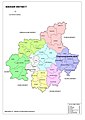 Hobli Map of Hassan district
 -
 Map of Belur Taluk as per 2001 Census
 -
 Map of Belur Taluk as per 2011 Census
 -
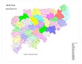
 Belur Taluk - Hobli and Village Map
 -
 Belur Taluk - Grama Panchayat and Village Map
 -
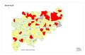
 Belur Taluk Map about Fluoride content in DWS


References
- ^ "Census Data Handbook 2011 Hassan District" (PDF). Retrieved 9 August 2023.
- ISBN 978-81-86526-00-2.
- ^ a b c Permanent Delegation of India to UNESCO (2014), Sacred Ensembles of the Hoysala, UNESCO
- ^ ISBN 978-81-7017-431-8.
- ^ "Annual State Report 2022" (PDF). Retrieved 5 July 2023.[permanent dead link]
- ^ a b Katherine E. Kasdorf (2013), Forming Dōrasamudra: Temples of the Hoysaḷa Capital in Context, Columbia University Press, pp. 42–49
- ISBN 978-1-4744-3609-0.
- ISBN 978-81-86526-00-2.
- ISBN 978-9-38060-734-4.
- ^ Narasimhacharya 1987, pp. 1–2.
- ISBN 978-81-86526-00-2.
- ^ Gopal, Madan (1990). K.S. Gautam (ed.). India through the ages. Publication Division, Ministry of Information and Broadcasting, Government of India. p. 174.
- ISBN 978-81-86526-00-2.
- M.H. Krishna (1966). K.A. Nilakanta Sastri (ed.). The history of the Sri Vijayanarayana Temple of Belur (Mysore State). The Bhandarkar Oriental Research Institute.
- Narasimhacharya, Ramanujapuram (1987). The Kesava Temple at Belur. Asiatic Society. OCLC 37520409.
External links
 Belur travel guide from Wikivoyage
| International | |
|---|---|
| National | |