Benito Juárez Municipality, Quintana Roo
Benito Juarez | ||
|---|---|---|
Municipality | ||
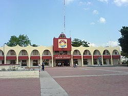
 Municipal Hall, Cancun | ||
|
INEGI Code 23005 | | |
| Website | cancun | |
Benito Juárez is one of the eleven municipalities of the Mexican state of Quintana Roo. Most of its population reside in the municipal seat, Cancún. It is named after the 19th century president and statesman Benito Juárez.
Geography
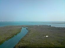
Benito Juárez is located in the north of the state with the Caribbean Sea as its eastern border. It borders on the municipalities of Isla Mujeres to the north, Puerto Morelos to the south, and Lázaro Cárdenas to the west. The municipality covers an area 1,664 square kilometres (642 sq mi) which is 3.72% of the territory of the state.
Communities
The 2010 census enumerated 295 populated localities and 272 unpopulated localities. The largest are as follows:[3]

| Community | Population (2010) |
|---|---|
| Cancún | 628,306 |
| Alfredo V. Bonfil | 14,900 |
| Puerto Morelos | 9,188 |
| Leona Vicario | 6,517 |
| El Porvenir | 505 |
| Los Tres Reyes | 470 |
| Colonia Chiapaneca Siglo XXI | 275 |
| Lagos del Sol | 156 |
| Entire municipality | 661,176 |
History
The
After World War II gum production dropped. In the 1960s, other commercial activities were started. In the 1960s the "island of Cancún" was only occupied at certain times of the year,
In 2016, the
Demographics
| Year | Pop. | ±% p.a. |
|---|---|---|
| 1995 | 311,696 | — |
| 2000 | 419,815 | +6.14% |
| 2005 | 572,973 | +6.42% |
| 2010 | 661,176 | +2.91% |
| 2020 | 911,503 | +3.26% |
| Source: INEGI Instituto Nacional de Estadística y Geografía[6] | ||
Economy

The principal businesses in this municipality are hotels, restaurants, travel agencies and tourist transportation.
Economic activities:[7]
- Primary……………….3.7% (agriculture, hunting, fishing)
- Secondary…………….6.0% (manufacturing, construction, electricity)
- Tertiary……………….90.3% (trade, tourism)
Local government
Mayors (Municipal Presidents):
- María Elena “Mara” Lezama Espinosa (MORENA) 2021-2024
- Clara Emilia Díaz Aguilar (MORENA) April-June 2021
- María Elena “Mara” Lezama Espinosa (MORENA) 2018-2021
- Remberto Estrada Barba (PVEM) 2016-2018
- Paul Michell Carrillo de Cáceres (PRI) 2013-2016
- Julián Javier Ricalde Magaña (PRD) 2011-2013
- Gregorio Sánchez Martínez (PRD) 2008-2010
References
- ^ "Benito Juárez". Archived from the original on 2007-07-07. Retrieved 2007-01-28.
- ^ 2010 census tables: INEGI Archived May 2, 2013, at the Wayback Machine
- ^ 2010 census tables: INEGI Archived May 2, 2013, at the Wayback Machine
- ^ "Benito Juárez History". Retrieved 2009-11-14.
- ^ "Quintana Roo - Benito Juárez".
- ^ "INEGI. Instituto Nacional de Estadística y Geografía. Censo de Población y Vivienda 1995, 2000, 2005, 2010". Archived from the original on 2013-09-28. Retrieved 2014-10-09.
- ^ "Benito Juárez". Archived from the original on 2007-07-07. Retrieved 2007-01-28.
External links
 Media related to Benito Juárez Municipality, Quintana Roo at Wikimedia Commons
- Official Cancún Website

