
Black Forest
| Black Forest | |
|---|---|
 View from the Hohfelsen near Seebach | |
| Highest point | |
| Elevation | 1,493 m (4,898 ft) |
| Coordinates | 48°18′00″N 8°09′00″E / 48.300°N 8.150°E |
| Dimensions | |
| Length | 160 km (99 mi) |
| Area | 6,000 km2 (2,300 sq mi) |
| Geography | |
 Map of Germany with the Black Forest(outlined in green)
| |
| Country | Bunter sandstone |
The Black Forest (German: Schwarzwald [ˈʃvaʁt͡svalt] ⓘ) is a large forested mountain range in the state of Baden-Württemberg in southwest Germany, bounded by the Rhine Valley to the west and south and close to the borders with France and Switzerland.[1] It is the source of the Danube and Neckar rivers.
Its highest peak is the Feldberg with an elevation of 1,493 metres (4,898 ft) above sea level. Roughly oblong in shape, with a length of 160 kilometres (100 miles) and breadth of up to 50 km (30 mi),[2] it has an area of about 6,009 km2 (2,320 sq mi).[1]
Historically, the area was known for forestry and the mining of ore deposits, but tourism has now become the primary industry, accounting for around 300,000 jobs.[3] There are several ruined military fortifications dating back to the 17th century.[4]
History


In ancient times, the Black Forest was known as Abnoba mons, after the Celtic deity, Abnoba. In Roman times (Late antiquity), it was given the name Silva Marciana ("Marcynian Forest", from the Germanic word marka = "border").[5] The Black Forest probably represented the border area of the Marcomanni ("border people") who were settled east of the Roman limes. They, in turn, were part of the Germanic tribe of Suebi, who subsequently gave their name to the historic state of Swabia. With the exception of Roman settlements on the perimeter (e.g. the baths in Badenweiler, and mines near Badenweiler and Sulzburg) and the construction of the Roman road of Kinzigtalstraße, the colonization of the Black Forest was not carried out by the Romans but by the Alemanni. They settled and first colonized the valleys, crossing the old settlement boundary, the so-called "red sandstone border", for example, from the region of Baar. Soon afterwards, increasingly higher areas and adjacent forests were colonized, so that by the end of the 10th century, the first settlements could be found in the red (bunter) sandstone region. These include, for example, Rötenbach, which was first mentioned in 819.
Some of the uprisings (including the Bundschuh movement) that preceded the 16th century German Peasants' War, originated in the Black Forest. Further peasant unrest, in the shape of the saltpetre uprisings, took place over the next two centuries in Hotzenwald.
Remnants of military fortifications dating from the 17th and 18th centuries can be found in the Black Forest, especially on the mountain passes. Examples include the multiple baroque fieldworks of Margrave Louis William of Baden-Baden or individual defensive positions such as the Alexanderschanze (Alexander's Redoubt), the Röschenschanze and the Schwedenschanze (Swedish Redoubt).[6][7]
Originally, the Black Forest was a mixed forest of deciduous trees and firs. At the higher elevations spruce also grew. In the middle of the 19th century, the Black Forest was almost completely deforested by intensive forestry and was subsequently replanted, mostly with spruce monocultures.
In 1990, extensive damage to the forest was caused by a series of windstorms.[a] On 26 December 1999, Cyclone Lothar raged across the Black Forest and caused even greater damage, especially to the spruce monocultures. As had happened following the 1990 storms, large quantities of fallen logs were kept in provisional wet-storage areas for years. The effects of the storm are demonstrated by the Lothar Path, a forest educational and adventure trail at the nature centre in Ruhestein on a highland timber forest of about 10 hectares that was destroyed by a hurricane. Several areas of storm damage, both large and small, were left to nature and have developed today into a natural mixed forest again.
Geography

The Black Forest stretches from the High Rhine in the south to the Kraichgau in the north. In the west it is bounded by the Upper Rhine Plain (which, from a natural region perspective, also includes the low chain of foothills); in the east it transitions to the Gäu, Baar and hill country west of the Klettgau. From north to south, the Black Forest extends for over 160 km (100 mi), attaining a width of up to 50 km (30 mi) in the south and 30 km (20 mi) in the north.[8] The Black Forest is the highest part of the South German Scarplands, and much of it is densely wooded, a fragment of the Hercynian Forest of antiquity.
Administratively, the Black Forest belongs completely to the state of Baden-Württemberg and comprises the cities of
.Natural regions
The natural regions of the Black Forest are separated by various features.
Geologically the clearest division is also between east and west. Large areas of the eastern Black Forest, the lowest layer of the

The most common way of dividing the regions of the Black Forest is, however, from north to south. Until the 1930s, the Black Forest was divided into the Northern and Southern Black Forest, the boundary being the line of the Kinzig valley. Later the Black Forest was divided into the heavily forested Northern Black Forest, the lower, central section, predominantly used for agriculture in the valleys, was the Central Black Forest and the much higher Southern Black Forest with its distinctive highland economy and ice age glacial relief. The term High Black Forest referred to the highest areas of the South and southern Central Black Forest.
The boundaries drawn were, however, quite varied. In 1931, Robert Gradmann called the Central Black Forest the catchment area of the Kinzig and in the west the section up to the lower Elz and Kinzig tributary of the Gutach.[9] A pragmatic division, which is oriented not just on natural and cultural regions, uses the most important transverse valleys. Based on that, the Central Black Forest is bounded by the Kinzig in the north and the line from Dreisam to Gutach in the south, corresponding to the Bonndorf Graben zone and the course of the present day B 31.
In 1959, Rudolf Metz combined the earlier divisions and proposed a modified tripartite division, which combined natural and cultural regional approaches and was widely used.[10] His Central Black Forest is bounded in the north by the watershed between the Acher and Rench and subsequently between the Murg and Kinzig or Forbach and Kinzig, in the south by the Bonndorf Graben zone, which restricts the Black Forest in the east as does the Freudenstadt Graben further north by its transition into the Northern Black Forest.[11]
Work of the Institute of Applied Geography
The Handbook of the Natural Region Divisions of Germany published by the Federal Office of Regional Geography (Bundesanstalt für Landeskunde) since the early 1950s names the Black Forest as one of six tertiary-level major landscape regions within the secondary-level region of the South German Scarplands and, at the same time, one of nine new major landscape unit groups. It is divided into six so-called major units (level 4 landscapes).[12] This division was refined and modified in several successor publications (1:200,000 individual map sheets) up to 1967, each covering individual sections of the map. The mountain range was also divided into three regions. The northern boundary of the Central Black Forest in this classification runs south of the Rench Valley and the Kniebis to near Freudenstadt. Its southern boundary varied with each edition.[13]
In 1998, the Baden-Württemberg State Department for Environmental Protection (today the Baden-Württemberg State Department for the Environment, Survey and Nature Conservation) published a reworked Natural Region Division of Baden-Württemberg.[14] It is restricted to the level of the natural regional major units and has been used since for the state's administration of nature conservation:[15]
| No. | Natural region | Area in km2 |
Population | Pop./km2 | Settlement area in % |
Open land in % |
Forest in % |
Major centres of population |
Middle-sized centres of population |
|---|---|---|---|---|---|---|---|---|---|
| 150 | Black Forest Foothills[16] | 930 | 268,000 | 289 | 7.69 | 29.33 | 62.92 | Pforzheim | Calw, Freudenstadt |
| 151 | Black Forest Grinden and Enz Hills[17] | 699 | 60,000 | 86 | 1.92 | 6.39 | 91.51 | ||
| 152 | Northern Black Forest Valleys[18] | 562 | 107,000 | 190 | 4.12 | 19.48 | 76.41 | Baden-Baden, Gaggenau/Gernsbach | |
| 153 | Central Black Forest[19] | 1,422 | 188,000 | 133 | 3.35 | 30.25 | 66.39 | Haslach/Hausach/Wolfach, Waldkirch, Schramberg | |
| 154 | Southeastern Black Forest[20] | 558 | 80,923 | 112 | 3.03 | 32.44 | 64.49 | Villingen-Schwenningen | |
| 155 | High Black Forest[21] | 1,990 | 213,000 | 107 | 2.44 | 26.93 | 70.31 | Schopfheim, Titisee-Neustadt |
.jpg)
The Black Forest Foothills (Schwarzwald-Randplatten, 150) geomorphologically form plateaux on the north and northeast periphery of the mountain range that descend to the Kraichgau in the north and the Heckengäu landscapes in the east. They are incised by valleys, especially those of the Nagold river system, into individual interfluves; a narrow northwestern finger extends to beyond the Enz near Neuenbürg and also borders the middle reaches of the Alb to the west as far as a point immediately above Ettlingen. To the southwest it is adjoined by the Black Forest Grinden and Enz Hills (Grindenschwarzwald und Enzhöhen, 151), along the upper reaches of the Enz and Murg, forming the heart of the Northern Black Forest. The west of the Northern Black Forest is formed by the Northern Black Forest Valleys (Nördliche Talschwarzwald, 152) with the middle reaches of the Murg around Gernsbach, the middle course of the Oos to Baden-Baden, the middle reaches of the Bühlot above Bühls and the upper reaches of the Rench around Oppenau. Their exit valleys from the mountain range are all oriented towards the northwest.

The Central Black Forest (153) is mainly restricted to the catchment area of the River Kinzig above Offenburg as well as the Schutter and the low hills north of the Elz.
The Southeastern Black Forest (Südöstliche Schwarzwald, 154) consists mainly of the catchment areas of the upper reaches of the
Mountains
At 1,493 m above
Rivers and lakes


Rivers in the Black Forest include the Danube (which originates in the Black Forest as the confluence of the Brigach and Breg rivers), the Enz, the Kinzig, the Murg, the Nagold, the Neckar, the Rench, and the Wiese. The Black Forest occupies part of the continental divide between the Atlantic Ocean drainage basin (drained by the Rhine) and the Black Sea drainage basin (drained by the Danube).
The longest Black Forest rivers are (length includes stretches outside the Black Forest):
- Enz (105 kilometres; 65 mi)
- Kinzig (93 kilometres; 58 mi)
- Elz (90 kilometres; 56 mi)
- Wutach (91 kilometres; 57 mi)
- Nagold (90 kilometres; 56 mi), hydrological main artery of the Nagold-Enz systems
- headstreams:
- Murg (79 kilometres; 49 mi)
- Rench (57 kilometres; 35 mi)
- Schutter (56 kilometres; 35 mi)
- Wiese (55 kilometres; 34 mi)
- Acher (54 kilometres; 34 mi)
- Dreisam (incl. Rotbach 49 kilometres; 30 mi)
- Menzenschwander Alb43 kilometres; 27 mi)
- Glatt (37 kilometres; 23 mi)
- Möhlin (32 kilometres; 20 mi)
- Wolf (31 kilometres; 19 mi)
- Schiltach (30 kilometres; 19 mi)
- Wehra (incl. Rüttebach 28 kilometres; 17 mi)
- Oos (25 kilometres; 16 mi)
- Glasbach (18 kilometres; 11 mi), hydrological main artery of the Neckar system
Important lakes of natural,
Geology
This article needs additional citations for verification. (November 2017) |

The Black Forest consists of a cover of sandstone on top of a core of gneiss and granite. Formerly it shared tectonic evolution with the nearby Vosges Mountains. Later during the Middle Eocene a rifting period affected the area and caused formation of the Upper Rhine Plain. During the last glacial period of the Würm glaciation, the Black Forest was covered by glaciers; several tarns (or lakes) such as the Mummelsee are remains of this period.
Basement
The geological foundation of the Black Forest is formed by the crystalline bedrock of the Variscan basement. This is covered in the east and northeast by Bunter Sandstone slabs, the so-called platforms. On the western edge a descending, step-fault-like, foothill zone borders the Upper Rhine Graben consisting of rocks of the Triassic and Jurassic periods.
The dominant rocks of the basement are gneiss (ortho- and paragneisses, in the south also migmatites and diatexites, for example on the Schauinsland and Kandel). These gneisses were penetrated by a number of granitic bodies during the Carboniferous period. Among the bigger ones are the Triberg Granite and the Forbach Granite, the youngest is the Bärhalde Granite. In the south lies the zone of Badenweiler-Lenzkirch, in which Palaeozoic rocks have been preserved (volcanite and sedimentary rocks), which are interpreted as the intercalated remains of a microcontinental collision. Still further in the southeast (around Todtmoos) is a range of exotic inclusions: gabbro from Ehrsberg, serpentinites and pyroxenites near Todtmoos, norite near Horbach), which are possibly the remnants of an accretionary wedge from a continental collision. Also noteworthy are the basins in the Rotliegend, for example the Schramberg or the Baden-Baden Basin with thick quartz-porphyry and tuff plates (exposed, for example, on the rock massif of Battert near Baden-Baden). Thick rotliegendes rock, covered by bunter, also occurs in the north of the Dinkelberg block (several hundred metres thick in the Basel geothermal borehole). Even further to the southeast, under the Jura, lies the North Swiss Permocarboniferous Basin.
Uplift of the mountains
Since the downfaulting of the Upper Rhine Graben during the Eocene epoch, the two shoulders on either side have been uplifted: the Black Forest to the east and the Vosges to the west. In the centre lies the Kaiserstuhl volcano, which dates to the Miocene. In the times that followed, the Mesozoic platform on the uplands was largely eroded, apart from remains of Bunter Sandstone and Rotliegend Group, but it has survived within the graben itself. During the Pliocene a pronounced but uneven bulge especially affected the southern Black Forest, including the Feldberg. As a result, the upper surface of the basement in the northern part of the forest around the Hornisgrinde is considerably lower. In the central Black Forest, the tectonic syncline of the Kinzig and Murg emerged.
Geomorphologist Walther Penck regarded the Black Forest as an uplifted geologic dome and modeled his theory of piedmonttreppen (piedmont benchlands) on it.[23][24]
Platform
Above the crystalline basement of the Northern Black Forest and the adjacent parts of the Central Black Forest, the bunter sandstone platforms rise in prominent steps. The most resistant surface strata on the stepped terrain of the of the Upper Bunter (platten sandstones and red clays). South of the Kinzig the Bunter Sandstone zone narrows to a fringe in the east of the mountain range.
Ice age and topography
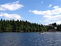
It is considered proven that the Black Forest was heavily glaciated during the peak periods of at least the Riss and Würm glaciations (up to about 10,000 years ago). This glacial geomorphology characterizes almost all of the High Black Forest as well as the main ridge of the Northern Black Forest. Apart from that, it is only discernible from a large number of cirques mainly facing northeast. Especially in this direction snow accumulated on the shaded and leeward slopes of the summit plateau to form short cirque glaciers that made the sides of these funnel-shaped depressions. There are still tarns in some of these old cirques, partly a result of the anthropogenic elevation of the low-side lip of the cirque, such as the Mummelsee, Wildsee, Schurmsee, Glaswaldsee, Buhlbachsee, Nonnenmattweiher, and Feldsee. The Titisee formed as glacial lake behind a glacial moraine.
Culture
The Black Forest is mainly rural, with many scattered villages and a few large towns. Tradition and custom are celebrated in many places in the form of annual festivities. The main dialect spoken in the Black Forest area is Alemannic. The forest is best known for its typical farmhouses with their sweeping half-hipped roofs, its Black Forest gâteaus, Black Forest ham, Black Forest gnomes,[25][26] Kirschwasser and the cuckoo clock.
Traditional costume
Traditional costume or Tracht is still sometimes worn today, usually at festive occasions. The appearance of such costume varies from region to region, sometimes markedly. One of the best-known Black Forest costumes is that of the villages of Kirnbach, Reichenbach and Gutach im Kinzigtal with the characteristic Bollenhut headdress. Unmarried women wear the hats with red bobbles or Bollen; married women wear black. Engaged women sometimes wear a bridal crown (Schäppel) before and on the day of their wedding,[27][28] whose largest examples from the town of St. Georgen weigh up to 5 kilograms.
-
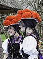 Traditionally, the Bollenhut is worn by unmarried women as part of the tracht.
 -


Art
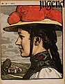
Its rural beauty as well as the sense of tradition of its inhabitants attracted many artists in the 19th and early 20th centuries, whose works made the Black Forest famous the world over. Notable were Hans Thoma from Bernau and his fellow student, Rudolf Epp, who was sponsored by the Grand Duke of Baden, Frederick I. Both artists painted motifs from the Black Forest throughout their lives. Artist J. Metzler from Düsseldorf travelled through the Black Forest to paint his landscapes. The works of the Gutach artist colony around Wilhelm Hasemann were widely admired, their landscape and genre motifs capturing the character of the Black Forest. Like local author Heinrich Hansjakob, they were part of a Baden folk costume movement.[29]
- Art gallery
-
 Arnold Lyongrün: "Frühling im Schwarzwald" (1912)
 -
 "Kinderreigen" (1872) by Black Forest artist Hans Thoma
 -
 Black Forest landscape by J. Metzler
 -
 Black Forest landscape by J. Metzler
 -
 Black Forest farmhouse, painted by Wilhelm Hasemann
 -
 A Gutach family, painted by Wilhelm Hasemann (c. 1900)

.jpg)


.jpg)
.jpg)
Crafts
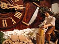
In the field of handicrafts, wood carving produces folk art like the Longinus crosses along with sculptors like Matthias Faller. Wood carving is a traditional cottage industry in the region, and carved ornaments now are produced in substantial numbers as souvenirs for tourists. Cuckoo clocks are a popular example.
Glassblowing is another notable craft of the Black Forest region.[30] At the beginning of the 15th century, the art of glassmaking took hold in the Bavarian-Bohemian border mountains, especially since the necessary raw materials such as quartz and wood were abundant here. With the permission of the manor, glassblowers operated simple glass production facilities as "wandering huts" (Wanderhütten), the locations of which were relocated when the local resources were available. They needed huge amounts of firewood and wood for potash. In the second half of the 18th century, the huts had to close due to a shortage of wood and sales difficulties. Only after 1800, when the demand for luxury glass increased enormously, when a few decades of regulated forestry had ensured the regrowth of the raw material wood and when the forest-destroying potash extraction had become unnecessary due to the new glass flux soda, some glass huts (Glashütten) revived.[31] Some glassblowing factories still testify to this today, for example in Höllental, near Todtnau and in Wolfach.[32]
- Crafts gallery
-
 German cuckoo clock

Cuisine
The Black Forest is known for its long tradition in gourmet cuisine. No fewer than 17 Michelin starred restaurants are located in the region, among them two restaurants with three stars (Restaurants Bareiss and Schwarzwaldstube in Baiersbronn)[34] as well as the only restaurant in Germany that has been awarded a Michelin star every year since 1966. At Schwarzwald Hotel Adler in Häusern, three generations of chefs from the same family have defended the award from the first year the Michelin Guide selected restaurants in Germany until today.[35]
- Cuisine gallery
-
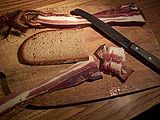 Black Forest ham with German bread
 -
 A Black Forest cake
 -
 Slice of a Black Forest Cake


.jpg)
Fasnet
The German holiday of Fastnacht, or Fasnet, as it is known in the Black Forest region, occurs in the time leading up to Lent. On Fasnetmendig, or the Monday before Ash Wednesday, crowds of people line the streets, wearing wooden, mostly hand-carved masks.[36] One prominent style of mask is called the Black Forest Style, originating from the Black Forest Region.
- Fastnacht gallery
-
 Fastnacht in the Black Forest
 -
 Carnival pleasure in the Black Forest (1890)
 -
 Fastnacht in Gernsbach (Black Forest)
.jpg)


Cego

The Black Forest is home to an unusual
Cego soon developed into the national game of Baden and Hohenzollern, and these are the only regions of Germany where tarot cards are still used for playing games.[39] The game has grown organically, and there are many regional variations, but in recent years the establishment of a Cego Black Forest Championship has led to official tournament rules being defined.[38][37] In addition, regular courses and local tournaments are held and it is a permanent feature of Alemannic Week, held annually in the Black Forest at the end of September.[40]
Nature
Conservation areas

There are two
The Southern Black Forest Nature Park (Naturpark Südschwarzwald) was founded in 1999. It comprises 394,000 ha and is therefore Germany's largest nature park (as of 2020). It encloses the southern part of the Central Black Forest, the Southern Black Forest and adjacent areas.[43]
The Central/North Black Forest Nature Park (Naturpark Schwarzwald Mitte/Nord) was founded in 2000. It covers 375,000 ha and is thus the second-largest in Germany (as of 2020). It begins in the southern part of the Central Black Forest, bordering on the Southern Black Forest Nature Park and covers the rest of the Black Forest to the north.[44]
The Black Forest National Park, established in 2014, is the first national park in Baden-Württemberg. It lies completely within the Central/North Black Forest Nature Park between the cities of Freudenstadt and Baden-Baden and covers an area of 10,062 ha. Its motto is "Natur Natur sein lassen" (let nature be nature).[45]

Fauna
In addition to the characteristic range of fauna found in Central European forests, the following less common animals may be observed in the Black Forest:[46]
- Black Forest cattle which belong to the rare breed of Hinterwälder cattle,[47]
- the giant earthworm Lumbricus badensis, which is found only in the Black Forest region,[48]
- the Black Forest Horse, a draft horse once indispensable for heavy field work and nowadays an endangered breed,[49] and
- the endangered Western capercaillie.[50]
Climate
The mountain range has lower temperatures and higher rainfall than its surrounding countryside. The highlands of the Black Forest are characterized by regular rainfall throughout the year. However, temperatures do not fall evenly with increasing elevation, nor does the rainfall increase uniformly. Rather, the precipitation rises quickly even in the lower regions and is disproportionately heavy on the rainier western side of the mountains.

The wettest areas are the highlands around the Hornisgrinde in the north and around the Belchen and Feldberg in the south, where annual rainfall reaches 1,800–2,100 mm.[51] Moisture-laden Atlantic westerlies dump about as much rain in the Northern Black Forest, despite its lower elevation, than in the higher area of the Southern Black Forest.[52] There, the Vosges act as a rain shield in the face of the prevailing winds. On the exposed east side of the Central Black Forest, it is much drier; the annual rainfall there is about 750 L/m2.
The higher elevations of the Black Forest are characterized by relatively small annual fluctuations and steamed extreme values. This is the result of the frequent light winds and greater cloud cover in summer. During the winter months, frequent high pressure means that the summits are often bathed in sunshine, while the valleys disappear under a thick blanket of fog as a result of pockets of cold air (temperature inversion).
Tourism and transport

The main industry of the Black Forest is tourism. Black Forest Tourism (Schwarzwald Tourismus) assesses that there are around 140,000 direct full-time jobs in the tourist sector and around 34.8 million tourist overnight stays in 2009.[53] In spring, summer and autumn an extensive network of hiking trails and mountain bike routes enable different groups of people to use the natural region. In winter, it is the various types of winter sport that come to the fore. There are facilities for both downhill and Nordic skiing in many places.
Tourist attractions

The most heavily frequented tourist destinations and resorts in the Black Forest are the
One often visited town is Baden-Baden with its thermal baths and festival hall. Other thermal baths are found in the spa resorts of Badenweiler, Bad Herrenalb, Bad Wildbad, Bad Krozingen, Bad Liebenzell and Bad Bellingen. From the beginning of the 19th century, the desire for spa and bathing resorts arose in all of Central Europe because of the increasing economic potential, increasing mobility and the use of advertising. The Neo-renaissance style Friedrichsbad and the Palais Thermal are examples for spas built in this era.[55]
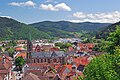
Other tourist destinations are the old imperial town of Gengenbach, the former county towns of Wolfach, Schiltach and Haslach im Kinzigtal and the flower and wine village of Sasbachwalden at the foot of the Hornisgrinde. Picturesque old towns may be visited in Altensteig, Dornstetten, Freiburg im Breisgau, Gernsbach, Villingen and Zell am Harmersbach. Baiersbronn is a centre of gastronomic excellence, Freudenstadt is built around the largest market place in Germany. Gersbach's floral displays have won awards as the German Golden Village of 2004 and the European Golden Village of 2007.
Noted for their fine interiors are the former monastery of
Alpirsbach Abbey and the ruined Hirsau Abbey were built of red sandstone in the Hirsau style. Another idyllic rural edifice is Wittichen Abbey near Schenkenzell.

There are well known winter sports areas around the Feldberg, near
Hiking trails
The Black Forest has a great number of very varied trails; some of pan-regional significance. The
There are numerous shorter paths suitable for day walks, as well as mountain biking and cross-country skiing trails. The total network of tracks amounts to around 23,000 kilometres (14,000 mi), and is maintained and overseen by volunteers of the Black Forest Club (figures from Bremke, 1999, p. 9), which is the second largest German hiking association. As of 2021, the club counts 65,000 members.[56]
|
|
Museums in the Black Forest
Culture and crafts

The Black Forest Open Air Museum at the Vogtsbauernhof farm in Gutach has original Black Forest houses offering insights into farming life of the 16th and 17th centuries. The buildings were dismantled at their original sites, the individual pieces numbered and then re-erected to exactly the same plan in the museum. The open-air museum shows the life of 16th and 17th century farmers in the region featuring the Vogtsbauernhof which dates back to 1612.[57]
The
From this early precision engineering a formerly important phonographic industry developed in the 20th century; the history of leisure electronics is presented in the
The
The Black Forest Costume Museum in Haslach im Kinzigtal offers an overview of the traditional costume of the whole of the Black Forest and its peripheral regions. Also located in Haslach: the Hansjakob Museum and the Hansjakob Archive with numerous works of the writer, priest, politician, historian and chronicler, Heinrich Hansjakob.
Nature and science
The MiMa Mineralogy and Mathematics Museum in Oberwolfach houses minerals and mining exhibits from the whole of the Black Forest and links them to mathematical explanations.
Infrastructure
Road transport
Several tourist routes run through the Black Forest. Well known
Thanks to its winding country roads, the Black Forest is a popular destination for
Railway transport

The whole of the Black Forest was once linked by
Many railway lines run from the Rhine Plain up the valleys into the Black Forest: the
The Three Lakes Railway branches off at the Titisee from the Höllental Railway and runs to the Windgfällweiher and the Schluchsee. The Wutach Valley Railway runs along the border between Baden-Württemberg and Switzerland, linking Waldshut-Tiengen with Immendingen on the Black Forest Railway.
Most of these routes are still busy today, whilst some are popular
Administration
Since January 2006, the Black Forest Tourist organisation, Schwarzwald Tourismus, whose head office is in Freiburg, has been responsible for the administration of tourism in the 320 municipalities of the region. Hitherto there had been four separate tourist associations.
Points of interest

There are many historic towns in the Black Forest. Popular tourist destinations include
For drivers, the main route through the region is the fast

Due to the rich mining history dating from medieval times (the Black Forest was one of the most important mining regions of Europe c. 1100) there are many mines re-opened to the public. Such mines may be visited in the Kinzig valley, the Suggental, the Muenster valley, and around Todtmoos.
The Black Forest was visited on several occasions by Count Otto von Bismarck during his years as Prussian and later German chancellor (1862–1890). Allegedly, he was especially interested in the Triberg Waterfalls.[63] There is now a monument in Triberg dedicated to Bismarck, who apparently enjoyed the tranquility of the region as an escape from his day-to-day political duties in Berlin.
The Black Forest featured in the philosophical development of Martin Heidegger. Heidegger wrote and edited some of his philosophical works in a small hut in the Black Forest,[64] and would receive visitors there for walks, including his former pupil Hannah Arendt. This hut features explicitly in his essay Building, Dwelling, Thinking.[65] His walks in the Black Forest are supposed to have inspired the title of his collection of essays Holzwege, translated as Off The Beaten Track.[66]
Economy and craftsmanship
Mining

Mining developed in the Black Forest due to its ore deposits, which were often lode-shaped. The formation of these deposits (
Small liquid magmatic deposits of nickel-magnetite gravel in
Chronology:
An important mining area was the
Another boom began in the early 18th century after the loss of the
Non-ferrous metal mining in the Black Forest continued until the middle of the 20th century near Wildschapbach and on the Schauinsland (to 1954); fluorite and baryte are still mined today at the Clara Pit in the Rankach valley in Oberwolfach. Iron ores of the Dogger formation was worked until the 1970s near Ringsheim and was smelted in Kehl.
Compared with the Harz and Ore Mountains the quantities of silver extracted in the Black Forest were rather modest and reached only about ten percent of that produced in the other silver-mining regions.
There are many show mines in the Black Forest. These include: the Frischglück Pit near
Forestry
For several centuries logs from the Black Forest were rafted down the
Today, loggers harvest fir trees—especially very tall and branchless ones—mainly to ship to Japan. The global advertising impact of
Glass-making, charcoal-burning and potash-mining
The timber resources of the Black Forest provided the basis for other sectors of the economy that have now largely disappeared.
Precision-engineering, clock and jewellery manufacture

In the relatively inaccessible Black Forest valleys,
Since the start of industrialisation there have been numerous firms in Pforzheim that manufacture jewellery and work with precious metals and stones. There is also a goldsmith's school in Pforzheim.
Hydropower

Due to the large amounts of precipitation and elevation changes the Black Forest has significant
Since the 20th century, the Black Forest has seen the large-scale generation of electrical power using
In the 21st century, in the wake of the Renewable Energy Sources Act, numerous smaller run-of-the-river power stations were re-opened or newly constructed.
Notable people and residents
- Hans Jakob Christoffel von Grimmelshausen (1621/22–1676), German novelist; in 1665–67, he kept an inn in Gaisbach in the Black Forest while writing his famous picaresque novel Simplicius Simplicissimus (1669)
- Hans Thoma, born in Bernau (1839–1924), German painter
- Hermann Hesse, born in Calw (1877–1962), German poet and novelist
- Jürgen Klopp, football manager, who grew up in village of Glatten
- Martin Heidegger, German philosopher, who spent much of his time in Todtnauberg, where he wrote most of Being and Time.
Gallery
-
 The Feldberg
 -
 View from theBelchentowards the Alps
 -
 Cattle near Simonswald
 -
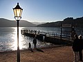 The Titisee, popular year-round
 -
 TheFreiburg, the region's biggest city
 -
 The River Kinzig passing through the Black Forest
 -
 The Mummelsee
 -

-

-
 The Black Forest is known for its native clockmakers
 -
 Traditional farmhouse of the Black Forest
 -
-

-
 Paragliding above Baden-Baden
 -
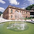 The former Graf-Eberhard-Bad (now: Palais Thermal) in Bad Wildbad


See also
- Hercynian Forest (historic)
- Schwarzwaldverein (Black Forest Association)
- German Clock Museum
- Black Forest gateau
- Black Forest ham
Notes
- ^ These severe storms or cyclones are commonly known as hurricanes even though they are not true tropical hurricanes.
References
- ^ a b "Black Forest | Description, Map, & Facts". Encyclopedia Britannica. Archived from the original on 20 December 2020. Retrieved 17 January 2021.
- ^ Chilcoat, Loretta and Rueben Acciano, Western Europe, Lonely Planet: 2005, p. 480.
- ^ "Die Wirtschaft im Schwarzwald: Tourismus, Holzwirtschaft und anderes". www.schwarzwald-reiseinfo.de. Archived from the original on 11 April 2021. Retrieved 4 January 2021.
- ^ "Gersbacher Barockschanze". www.schwarzwald-tourismus.info (in German). Archived from the original on 22 January 2021. Retrieved 17 January 2021.
- ^ Tabula Peutingeriana; Ammianus Marcellinus 21, 8, 2;
- ^ "Schwedenschanze". www.schwarzwald-tourismus.info (in German). Archived from the original on 1 June 2022. Retrieved 17 January 2021.
- ^ "Schwarzwald Röschenschanze". www.schwarzwald-informationen.de. Archived from the original on 22 January 2021. Retrieved 17 January 2021.
- ^ Information Service for Agriculture, Nutrition and Regional Planning Archived 10 February 2012 at the Wayback Machine at the Ministry for Regional Planning, Nutrition and Consumer Protection in Baden-Württemberg
- ISBN 3-534-00124-9. Vol. 2: The einzelnen Landschaften, p. 85.
- ISBN 3-17-001835-3, p. 32, or: Christoph Borcherdt (ed.): Geographische Landeskunde von Baden-Württemberg. 3rd edition, Kohlhammer, Stuttgart, 1993, pp. 169 f.
- ^ Rudolf Metz: Zur naturräumlichen Gliederung des Schwarzwalds In: Alemannisches Institut (ed.): Alemannisches Jahrbuch 1959, Schauenburg, Lahr 1959, pp. 1–33
- Handbuch der naturräumlichen Gliederung Deutschlands. Bundesanstalt für Landeskunde, Remagen/Bad Godesberg 1953–1962 (nine instalments in eight books, updated 1:1,000,000 map with major units, 1960).
- ^ Emil Meynen, Josef Schmithüsen (editors: Handbuch der naturräumlichen Gliederung Deutschlands. Bundesanstalt für Landeskunde, Remagen/Bad Godesberg, 1953–1962 (9 issues in 8 books, updated map, 1:1,000,000 with major units, 1960).
- ^ Thomas Breunig: Überarbeitung der Naturräumlichen Gliederung Baden-Württembergs auf Ebene der naturräumlichen Haupteinheiten. Archived 19 December 2014 at the Wayback Machine In: Naturschutz-Info 1998, Heft 1
- ^ Major natural region units, Baden-Württemberg State Office for the Environment, Survey and Conservation (Landesanstalt für Umwelt, Messungen und Naturschutz Baden-Württemberg) (pdf, 3.1 MB)
- LUBW(pdf, 9,9 MB)
- LUBW(pdf, 8,9 MB)
- LUBW(pdf, 9,0 MB)
- LUBW(pdf, 9,6 MB)
- LUBW(pdf, 6,8 MB)
- LUBW(pdf, 10,1 MB)
- Federal Agency for Nature Conservation
- ISBN 978-3-540-31060-0.
- JSTOR 25635740.
- ^ Schwarzwaldwichtel Archived 23 August 2017 at the Wayback Machine at www.trachten-winkler.com. Retrieved 23 August 2017.
- ^ Schwarzwaldwichtel Archived 23 August 2017 at the Wayback Machine at www.schwarzwald-laden.de. Retrieved 23 August 2017.
- ^ "Schwarzwald-Geschichten". onlinesammlung.freiburg.de (in German). Archived from the original on 12 June 2021. Retrieved 3 January 2021.
- ^ Germany, Schwarzwälder Bote, Oberndorf. "Gutach: Bollenhutmacherin gibt Einblicke in ihr Handwerk – Schwarzwälder Bote". www.schwarzwaelder-bote.de (in German). Archived from the original on 26 January 2021. Retrieved 3 January 2021.
{{cite web}}: CS1 maint: multiple names: authors list (link) - ISBN 978-3-937345-56-7, p. 256 (Katalog zur Großen Landesausstellung)
- ^ "Glasmuseum". Dorotheenhütte Wolfach/Schwarzwald (in German). Archived from the original on 6 December 2020. Retrieved 3 January 2021.
- ^ "Gemeinde Grainet – Wanderglashütten". grainet.de. Archived from the original on 26 January 2021. Retrieved 3 January 2021.
- ^ "Die Wirtschaft im Schwarzwald". Schwarzwaldportal (in German). 10 October 2008. Archived from the original on 7 January 2021. Retrieved 4 January 2021.
- ^ "Possibly Germany's most famous cake: Schwarzwalder Kirschtorte (Black Forest Cake)". European Cuisines. Archived from the original on 1 February 2018. Retrieved 24 December 2015.
- ^ Michelin Restaurants Archived 23 June 2011 at the Wayback Machine. Via Michelin. Retrieved 18 June 2011
- ^ "The Archived 21 June 2011 at the Wayback Machine Michelin Guide and the Zumkeller Chefs". Schwarzwald Hotel Adler. Retrieved 18 June 2011
- ^ "80.000 Besucher bestaunen Fasnetmendig-Umzug zum Rosenmontag in Freiburg". www.baden.fm (in German). 24 February 2020. Archived from the original on 7 January 2021. Retrieved 4 January 2021.
- ^ a b Cego – Regeln Archived 16 July 2020 at the Wayback Machine at cego.de. Retrieved 17 May 2020.
- ^ a b Vermutliche Herkunft Archived 8 December 2020 at the Wayback Machine at cego-online.de. Retrieved 17 May 2020.
- ^ Cego Archived 27 March 2020 at the Wayback Machine at pagat.com. Retrieved 17 May 2020.
- ^ Cego – ein altes Kartenspiel, das eine Renaissance erlebt Archived 9 October 2020 at the Wayback Machine at schwarzwaldregion-freiburg.de. Retrieved 17 May 2020.
- ^ e.V, VDN-Verband Deutscher Naturparke. "Aufgaben & Ziele". www.naturparke.de (in German). Archived from the original on 2 December 2020. Retrieved 3 January 2021.
- ^ "BfN: National Parks". www.bfn.de. Archived from the original on 24 March 2020. Retrieved 3 January 2021.
- ^ "Naturpark Südschwarzwald – Allgemeines". www.naturpark-suedschwarzwald.de. Archived from the original on 9 January 2021. Retrieved 3 January 2021.
- ^ "Naturpark Schwarzwald Mitte/Nord". www.schwarzwald-tourismus.info (in German). Archived from the original on 23 January 2021. Retrieved 3 January 2021.
- ^ "Schwarzwald Nationalpark: Nationalpark". www.nationalpark-schwarzwald.de. Archived from the original on 18 January 2021. Retrieved 3 January 2021.
- ^ Enjoy nature with all the senses / Nature / Home / Inhalte – Schwarzwald Tourismus GmbH
- ^ "Schöder's Biohof – HINTERWÄLDER RIND". 510173769.swh.strato-hosting.eu (in German). Archived from the original on 26 January 2021. Retrieved 3 January 2021.
- ^ Lamparski, 1985
- ^ "Home". Black Forest Stud. Archived from the original on 6 May 2021. Retrieved 3 January 2021.
- ^ Zeitung, Badische (26 January 2020). "Dem Auerhuhn fehlt im Schwarzwald der Lebensraum – Südwest – Badische Zeitung". www.badische-zeitung.de (in German). Archived from the original on 18 May 2021. Retrieved 3 January 2021.
- ISBN 3-7826-0047-9
- ^ LUBW, Deutscher Wetterdienst: Klimaatlas Baden-Württemberg, Jahresniederschläge 1971–2000: Kartenbeschreibung Archived 20 May 2008 at the Wayback Machine, KarteArchived 11 November 2013 at the Wayback Machine, retrieved 3 September 2013
- ^ Including private accommodation and visitors by relatives and friends. Schwarzwald Tourismus GmbH: Tourismusentwicklung im Schwarzwald 2009 Archived 10 October 2012 at the Wayback Machine, retrieved 12 October 2011.
- ^ muellerwerbung_wp. "Kunstpfad". Erlebniswelt Mummelsee (in German). Archived from the original on 28 September 2020. Retrieved 21 September 2020.
- ^ Bachmann, Günther (1996). Denkmalpflege in Baden-Württemberg. Baden-Württemberg: Nachrichtenblatt des Landesdenkmalamtes. pp. 47–56.
- ^ "Der Schwarzwaldverein". www.schwarzwaldverein.de. Archived from the original on 22 January 2021. Retrieved 17 January 2021.
- ^ "Open Air Museum Vogtsbauernhof – Vogtsbauernhof". Open Air Museum Vogtsbauernhof Gutach. Retrieved 29 November 2020.[permanent dead link]
- ^ Parallelus. "On the trail of the Black Forest Cuckooclock » Black Forest Clock Association". Archived from the original on 8 May 2021. Retrieved 1 September 2020.
- ^ Baden-Württemberg: Landesregierung will Motorradlärm eindämmen. Archived 1 June 2022 at the Wayback Machine In: Spiegel Online date 24 July 2012
- ^ Schauinsland: Motorradfahrer ignorieren Fahrverbot – Radler in Angst. Archived 2 April 2015 at the Wayback Machine In: Badische Zeitung dated 28 June 2010
- ^ "The complete guide to The Black Forest". The Independent. 19 March 2014. Archived from the original on 8 March 2009. Retrieved 9 August 2014.
- ^ Apropos Werbung, Telefon 07721-98770. "German Clock Route Location". Deutsche Uhrenstrasse. Archived from the original on 9 February 2006. Retrieved 9 August 2014.
{{cite web}}: CS1 maint: numeric names: authors list (link) - ISBN 9781845112646. Archivedfrom the original on 1 June 2022. Retrieved 9 August 2014.
- ISBN 9780262195515. Archivedfrom the original on 10 May 2015. Retrieved 24 December 2015.
- ^ "Heidegger's Aesthetics (Stanford Encyclopedia of Philosophy)". Plato.stanford.edu. Archived from the original on 11 December 2015. Retrieved 24 December 2015.
- ISBN 9780521805070. Archivedfrom the original on 21 December 2019. Retrieved 24 August 2017.
Bibliography
Geography
- Hartwig Haubrich; Wolfgang Hug; Herbert Lange (1991), Das große Buch vom Schwarzwald (in German), Stuttgart: Theiss, ISBN 3-8062-0819-0.
- Ekkehard Liehl, Wolf Dieter Sick, ed. (1989), "Der Schwarzwald. Beiträge zur Landeskunde", Veröffentlichung des Alemannischen Instituts Freiburg I. Br. (in German), vol. 47 (4. ed.), Bühl: Konkordia, ISBN 3-7826-0047-9.
- Kurt Klein (1988), "Verborgener Schwarzwald. Unbekanntes aus Volkskunde und Geschichte", Edition Morstadt (in German), vol. Bd. 18, Kehl, Strasbourg, Basel: Morstadt, ISBN 3-88571-172-9.
- Max Scheifele (2004), Aus der Waldgeschichte des Schwarzwaldes. Die Trift von Brenn- und Kohlholz. Wenn Grenzsteine reden (in German), Stuttgart: DRW-Verlag, ISBN 3-87181-010-X.
- Horst Friedrich Vorwerk (Text), Erich Spiegelhalter (Abb.) (1992), Der Schwarzwald. Eine deutsche Kulturlandschaft in Geschichte und Gegenwart (in German), Freiburg: Herder, ISBN 3-451-22658-8.
Economy, geology and mining
- Michael Bliedtner, Manfred Martin (1986), Erz- und Minerallagerstätten des Mittleren Schwarzwaldes (in German), Freiburg im Breisgau: Geologisches Landesamt Baden-Württemberg, ISBN 978-88-12-65452-9.
- Eberhard Gothein: Wirtschaftsgeschichte des Schwarzwaldes und der angrenzenden Landschaften. Erster Band: Städte- und Gewerbegeschichte, Verlag Karl J. Trübner, Strassburg 1892 (digitalised).
- Gregor Markl, Sönke Lorenz, ed. (2004), Silber, Kupfer, Kobalt. Bergbau im Schwarzwald (in German), Filderstadt: Markstein, ISBN 3-935129-10-6.
- Georg Sawatzki, Horst Peter Hann (2003), "Badenweiler-Lenzkirch-Zone (Südschwarzwald): Erläuterungen mit Hinweisen für Exkursionen", Geologische Karte von Baden-Württemberg 1:50000 (in German), Freiburg im Breisgau: Landesamt für Geologie, Rohstoffe und Bergbau Baden-Württemberg.
- Wolfgang Werner, Volker Dennert (2004), Lagerstätten und Bergbau im Schwarzwald (in German), Freiburg im Breisgau: Landesamt für Geologie, Rohstoffe und Bergbau Baden-Württemberg.
Art history
- Richard Schmidt: Schwarzwald (Deutsche Lande – Deutsche Kunst). Munich/Berlin, 1965.
Nature
- Adolf Hanle: Nordschwarzwald (Meyers Naturführer). Mannheim/Vienna/Zurich, 1989.
- Adolf Hanle: Südschwarzwald (Meyers Naturführer). Mannheim/Vienna/Zurich, 1989.
- Ulrike Klugmann (Hrsg.): Südschwarzwald, Feldberg und Wutachschlucht (Naturmagazin Draußen). Hamburg, 1983.
- Hans-Peter Schaub: Der Schwarzwald. Naturvielfalt in einer alten Kulturlandschaft. Mannheim, 2001.
Fiction
- Jürgen Lodemann (ed.): Schwarzwaldgeschichten. Klöpfer & Mayer, Tübingen, 2007, ISBN 978-3-940086-04-4.
- Herbert Schnierle-Lutz (ed.): Schwarzwald-Lesebuch. Geschichten aus 6 Jahrhunderten mit zahlreichen Bildern, 224 pages, Hohenheim Verlag, Stuttgart, 2011, ISBN 978-3-89850-213-9.
General
- Bremke, N. (1999). Schwarzwald quer. Karlsruhe: Braun. ISBN 3-7650-8228-7.
- Lamparski, F. (1985). Der Einfluß der Regenwurmart Lumbricus badensis auf Waldböden im Südschwarzwald. Schriftenreihe des Institut für Bodenkunde und Waldernährungslehre der Albert-Ludwigs-Universität Freiburg i. Br., 15. ISSN 0344-2691. English summary
- Barnes, K. J. (2007). A Rough Passage: Memories of an Empire
- Käflein, Achim (photographs); Huber, Alexander (German text); Freund, BethAnne (English translation) (2012), Schwarzwald: Natur und Landschaft, edition-kaeflein.de, p. 228, ISBN 978-3-940788-16-0.
External links
 Black Forest travel guide from Wikivoyage
- . Encyclopædia Britannica. Vol. 4 (11th ed.). 1911.
- Schwarzwald at Curlie
Important cities and tourist sites in | |||||||
|---|---|---|---|---|---|---|---|
| Major cities | |||||||
| Other tourist destinations | |||||||
| Landscapes | |||||||
| Neighbouring areas |
| ||||||

| International | |
|---|---|
| National | |
| Other | |