
Buna (Adriatic Sea)
| Buna Bojana | |
|---|---|
Shkodër (Albania) Ulcinj (Montenegro) | |
| City | Shkodër (Albania) |
| Physical characteristics | |
| Source | Lake Skadar |
| Mouth | Adriatic Sea |
• coordinates | 41°50′50″N 19°22′18″E / 41.84722°N 19.37167°E |
| Length | 41 km (25 mi) |
| Basin size | 19,582[1] km2 (7,561 sq mi) |
| Discharge | |
| • average | 672[1] m3/s (23,700 cu ft/s) |
| Basin features | |
| Tributaries | |
| • left | Great Drin |
| Designation | |
| Official name | Lake Shkodra and River Buna |
| Designated | 2 February 2006 |
| Reference no. | 1598[2] |
The Buna (
Name
The modern Albanian name of the river is derived from Illyrian Barbanna and follows Albanian phonetic sound rules.[4][5][6]
History
The river appears as the Fiume Boiana in a 1688 map of the region, published by Vincenzo Coronelli. At the time, the river did not have any tributaries feeding into it. The presence of the Drin river having its own mouth into the Adriatic Sea on the map suggests that the Drin did not join the Buna river until after 1688. Over time, the frequent changes in its course and water levels led to flooding of its banks and the surrounding plains. Such occurrences led to the slow decay of the Monastery of Saints Sergius and Bacchus, located right on the bank of the Buna river.[7]
Course
This section needs additional citations for verification. (June 2010) |
The river used to be longer, but due to a rise in the level of Lake Skadar, the uppermost part of the river is now under the lake's surface. The river initially flows east, but after only few kilometers reaches the city of
After 20 kilometres (12 mi) in Albania, it forms the border between Albania and Montenegro. On this border section, which is 24 km (15 mi) long, the river meanders widely, flowing around Lakes Šas and Zogajsko blato, both in Montenegro. Settlements include villages of Sveti Đorđe and Reč on the Montenegrin, and Luarzë and Pulaj on the Albanian side. The area surrounding the river in this section is low and marshy, with the Buna river being the eastern border of the Field of Ulcinj and of the 12-kilometre-long (7.5 mi) Long Beach (Velika Plaža) of Ulcinj.
At its mouth into the
Another, smaller island belonged to Albania and was called Franc Jozeph Island or Ada Major. This small island was not artificial such as Ada Bojana but natural. The Island of Franz Joseph frequently received tourists, however, the island disappeared in recent years.
Characteristics
The river has a large
It is highly navigable and is worked and toured by vessels ranging from motorboats, canal barges up to large tour boats and inland goods barges.
Gallery
-
 Aerial view the river's mouth, where it flows into the Adriatic
 -
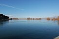 The Buna river in Shkodër, Albania


References
- ^ a b "The coastline of Albania : morphology, evolution and coastal management issues" (PDF). ciesm.org. p. 8.
- ^ "Lake Shkodra and River Buna". Ramsar Sites Information Service. Retrieved 25 April 2018.
- ^ "The Buna River- Velipojë Protected Landscape, BRPL Project". livingbuna.org. Retrieved 2023-01-21.
- ^ Demiraj, S. (2006). The Origin of the Albanians: Linguistically Investigated. Albanien: Academy of Sciences of Albania (p. 147)
- ^ Ismajli, Rexhep (2015). Eqrem Basha (ed.). Studime për historinë e shqipes në kontekst ballkanik (p. 474)
- ISBN 978-9027933058.
But on the main Albanian names such as Lesh, Drisht, Kunavja, Drin, Buenë, Mat and Ishm can be derived from their ancient forms Lissus, Drivastum, Candavia, Drinus, Barbanna, Mathis, and Isamnus only by Albanian sound changes, and by no others.
- ^ Ožujski Živkov, Stanislav (2020). "Evidence for the architectural reconstruction of the church of Sts. Sergius and Bacchus (Kisha e Shirgjit) on the Bojana (Buna) River near Skhodra, Albania". Starohrvatska prosvjeta. 3 (47): 589–629. Retrieved 16 March 2024.
Bibliography
- Mala Prosvetina Enciklopedija, Third edition, Prosveta, 1985, ISBN 86-07-00001-2
- Jovan Đ. Marković, Enciklopedijski geografski leksikon Jugoslavije, Svjetlost-Sarajevo, 1990, ISBN 86-01-02651-6