
Bokhtar
Bokhtar
Official languages | ||
|---|---|---|
Bokhtar (
Population
As of 2019, the city's population was estimated at 110,800, making it the third-largest city in the country. The population fluctuates depending on the season, due to the many
Along with the capital
Bokhtar is a stronghold of Tajikistan's political opposition.[5]
Overview
During the
The city was officially renamed from Qurghonteppa to Bokhtar on 22 January 2018.[8] The name change was one of many in Tajikistan targeting places whose names derive from the Uzbek and Kyrgyz languages.[9]
Near Bokhtar are the ruins of a Buddhist monastery complex called Ajina Tepe, believed to be built in the 7th or 8th centuries CE. It features a 12-meter-long image of Buddha in Nirvana.[10]
Bokhtar International Airport provides flights to a handful of cities in Tajikistan, Russia and Kazakhstan.
-
 with personnel of the India-Tajik Friendship Hospital in Bokhtar, 13 July 2015.
 -
 Bokhtar Bazaar
 -
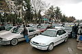 Taxi station in Bokhtar
 -
 Bokhtar library


Climate
Bokhtar has a semi-arid climate (Köppen climate classification BSk), with cool winters and very hot summers. Precipitation is quite low. It is highest in the spring, while summers are very dry.
| Climate data for Bokhtar (1991-2020, extremes 1929-present) | |||||||||||||
|---|---|---|---|---|---|---|---|---|---|---|---|---|---|
| Month | Jan | Feb | Mar | Apr | May | Jun | Jul | Aug | Sep | Oct | Nov | Dec | Year |
| Record high °C (°F) | 24.0 (75.2) |
28.8 (83.8) |
35.3 (95.5) |
37.0 (98.6) |
41.3 (106.3) |
43.6 (110.5) |
46.0 (114.8) |
42.8 (109.0) |
40.2 (104.4) |
38.1 (100.6) |
31.3 (88.3) |
24.3 (75.7) |
46.0 (114.8) |
| Mean daily maximum °C (°F) | 9.7 (49.5) |
12.2 (54.0) |
18.7 (65.7) |
25.0 (77.0) |
30.7 (87.3) |
36.1 (97.0) |
37.7 (99.9) |
36.0 (96.8) |
32.1 (89.8) |
25.6 (78.1) |
17.5 (63.5) |
11.0 (51.8) |
24.4 (75.9) |
| Daily mean °C (°F) | 4.4 (39.9) |
6.5 (43.7) |
12.3 (54.1) |
18.2 (64.8) |
23.4 (74.1) |
28.1 (82.6) |
29.4 (84.9) |
27.5 (81.5) |
23.0 (73.4) |
16.8 (62.2) |
10.5 (50.9) |
5.6 (42.1) |
17.1 (62.9) |
| Mean daily minimum °C (°F) | 0.6 (33.1) |
2.2 (36.0) |
7.4 (45.3) |
12.5 (54.5) |
16.7 (62.1) |
20.2 (68.4) |
21.5 (70.7) |
19.5 (67.1) |
15.0 (59.0) |
10.1 (50.2) |
5.5 (41.9) |
1.7 (35.1) |
11.1 (52.0) |
| Record low °C (°F) | −24.1 (−11.4) |
−22.6 (−8.7) |
−12.7 (9.1) |
−5.6 (21.9) |
4.0 (39.2) |
9.1 (48.4) |
11.0 (51.8) |
9.4 (48.9) |
3.5 (38.3) |
−4.2 (24.4) |
−10.9 (12.4) |
−20.0 (−4.0) |
−24.1 (−11.4) |
| Average precipitation mm (inches) | 35 (1.4) |
47 (1.9) |
48 (1.9) |
49 (1.9) |
32 (1.3) |
10 (0.4) |
1 (0.0) |
1 (0.0) |
2 (0.1) |
8 (0.3) |
29 (1.1) |
33 (1.3) |
295 (11.6) |
| Average precipitation days (≥ 0.1 mm) | 8.2 | 11.2 | 7.0 | 5.9 | 2.7 | 0.2 | 1.0 | 0.8 | 1.3 | 3.7 | 6.4 | 7.3 | 55.7 |
| Average relative humidity (%)
|
73.2 | 70.1 | 62.3 | 57.6 | 50.2 | 45.5 | 45.6 | 48.3 | 51.0 | 57.1 | 66.6 | 73.0 | 58.4 |
| Mean monthly sunshine hours | 112 | 125 | 164 | 213 | 291 | 339 | 351 | 334 | 294 | 235 | 174 | 115 | 2,747 |
| Source 1: Pogoda.ru.net,[11] climatebase.ru (precipitation days, humidity)[12] | |||||||||||||
| Source 2: NOAA (sun only, 1961-1990)[13] | |||||||||||||
Notable people
- Sergei Mandreko (1971-2022) - football coach
- Nurudin N. Mukhitdinov (1959-) - politician
Trivia
Finnish electronic duo Pan Sonic have a track entitled "Radio Qurghonteppa" on their 2010 farewell album Gravitoni.[14]

See also
- List of cities in Tajikistan
- FC Khatlon football club
- Buddhistic cloister of Ajina-Tepa
References
- ^ Агентии омори назди Президенти Ҷумҳурии Тоҷикистон. "ШУМОРАИ АҲОЛИИ ҶУМҲУРИИ ТОҶИКИСТОН ТО 1 ЯНВАРИ СОЛИ 2022" (PDF).
- ^ "КОНСТИТУЦИЯ РЕСПУБЛИКИ ТАДЖИКИСТАН". prokuratura.tj. Parliament of Tajikistan. Retrieved 9 January 2020.
- ^ "Переименование ряда городов, районов и селений Хатлонской области | Президенти Тоҷикистон - President of Tajikistan - Президент Таджикистана - رئيس جمهورية تاجيكستان". prezident.tj. Retrieved 2022-07-12.
- ^ Borjian, Habib, “Kurgan Tepe”, Encyclopaedia Iranica. Online edition 2005. [1]
- ^ Ethnic groups at risk: The status of Tajiks Heritage Society
- ^ "Memories of the Tajik Civil War". CESMI. November 22, 2012. Archived from the original on April 12, 2019. Retrieved January 4, 2019.
- ^ Hays, Jeffrey. "HEART OF THE TAJIK CIVIL WAR IN 1992 | Facts and Details". factsanddetails.com.
- ^ "Renaming of a number of cities, districts and settlements of Khatlon Province | Президенти Тоҷикистон - President of Tajikistan - Президент Таджикистана - رئيس جمهورية تاجيكستان". prezident.tj.
- ^ "Tajik authorities continue renaming cities and districts". Asia-Plus. 1 July 2023. Retrieved 23 January 2018.
- ^ "Kurgan Tube". Archived from the original on 2021-08-15. Retrieved March 27, 2021.
- ^ КЛИМАТ УЛАН-БАТОРА (in Russian). Pogoda.ru.net. Retrieved 4 January 2015.
- ^ "Kurgan-Tyube,Tajikistan". Climatebase.ru. Retrieved 31 January 2013.
- ^ "Climate Normals for Kurgan-Tjube". National Oceanic and Atmospheric Administration. Retrieved 31 January 2013.
- ^ "Pan Sonic - Gravitoni". Discogs.
External links
- Kurgan Tepe in Encyclopaedia Iranica Online
Largest cities or towns in Tajikistan | |||||||||||||||||||||||||||||||||||||||||||||||||
|---|---|---|---|---|---|---|---|---|---|---|---|---|---|---|---|---|---|---|---|---|---|---|---|---|---|---|---|---|---|---|---|---|---|---|---|---|---|---|---|---|---|---|---|---|---|---|---|---|---|
| |||||||||||||||||||||||||||||||||||||||||||||||||


Capital: Bokhtar | |||||||
| Kulob
| ||||||
| Levakant |
| ||||||
| Norak |
| ||||||
| Bokhtar |
| ||||||
Districts | |
|---|---|
District subdivisions | |||||||||||||||||||||||||||||||||||||||||||
|---|---|---|---|---|---|---|---|---|---|---|---|---|---|---|---|---|---|---|---|---|---|---|---|---|---|---|---|---|---|---|---|---|---|---|---|---|---|---|---|---|---|---|---|
| |||||||||||||||||||||||||||||||||||||||||||