
California State Route 47
| ||
|---|---|---|
| ||
| North end | ||
| Location | ||
| Country | United States | |
| State | California | |
| Counties | Los Angeles | |
| Highway system | ||
| ||
State Route 47 (SR 47) is a
Route description
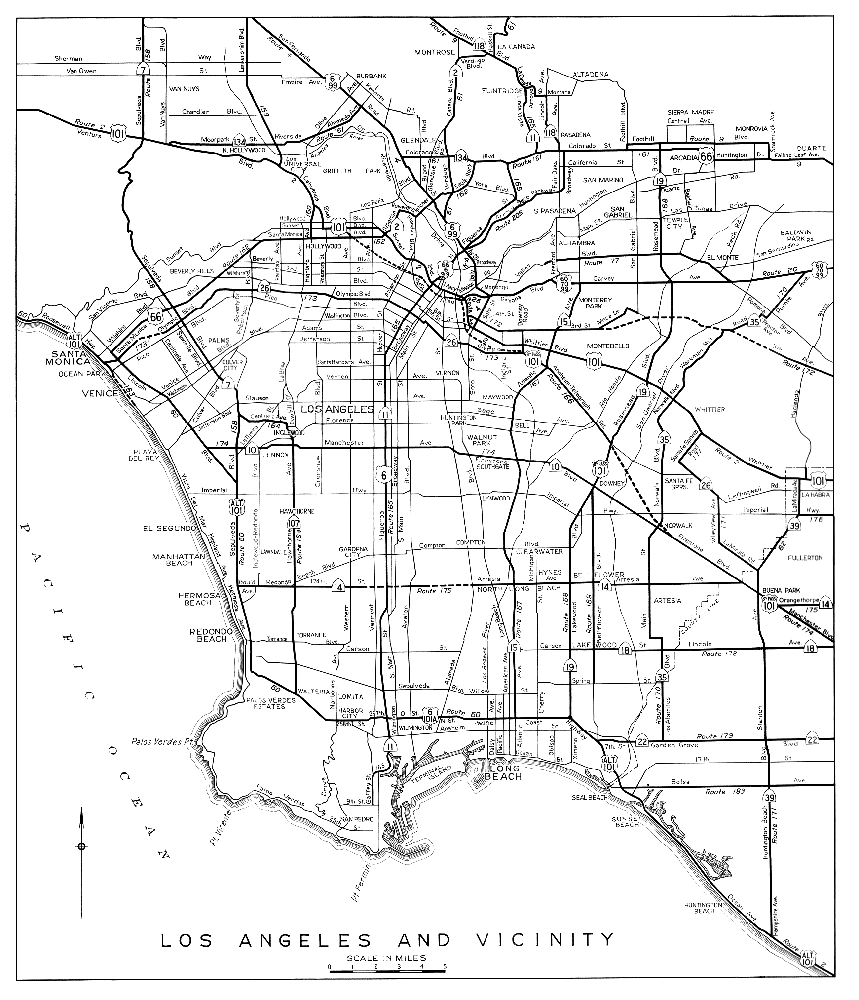
State Route 47 begins at the south end of the
State maintenance begins again on the Terminal Island Freeway, which is also signed as
The entire route is part of the
Alameda Street
The part of Alameda Street rebuilt during the

North of Artesia Boulevard, the rail line descends into the 10-mile (16 km)
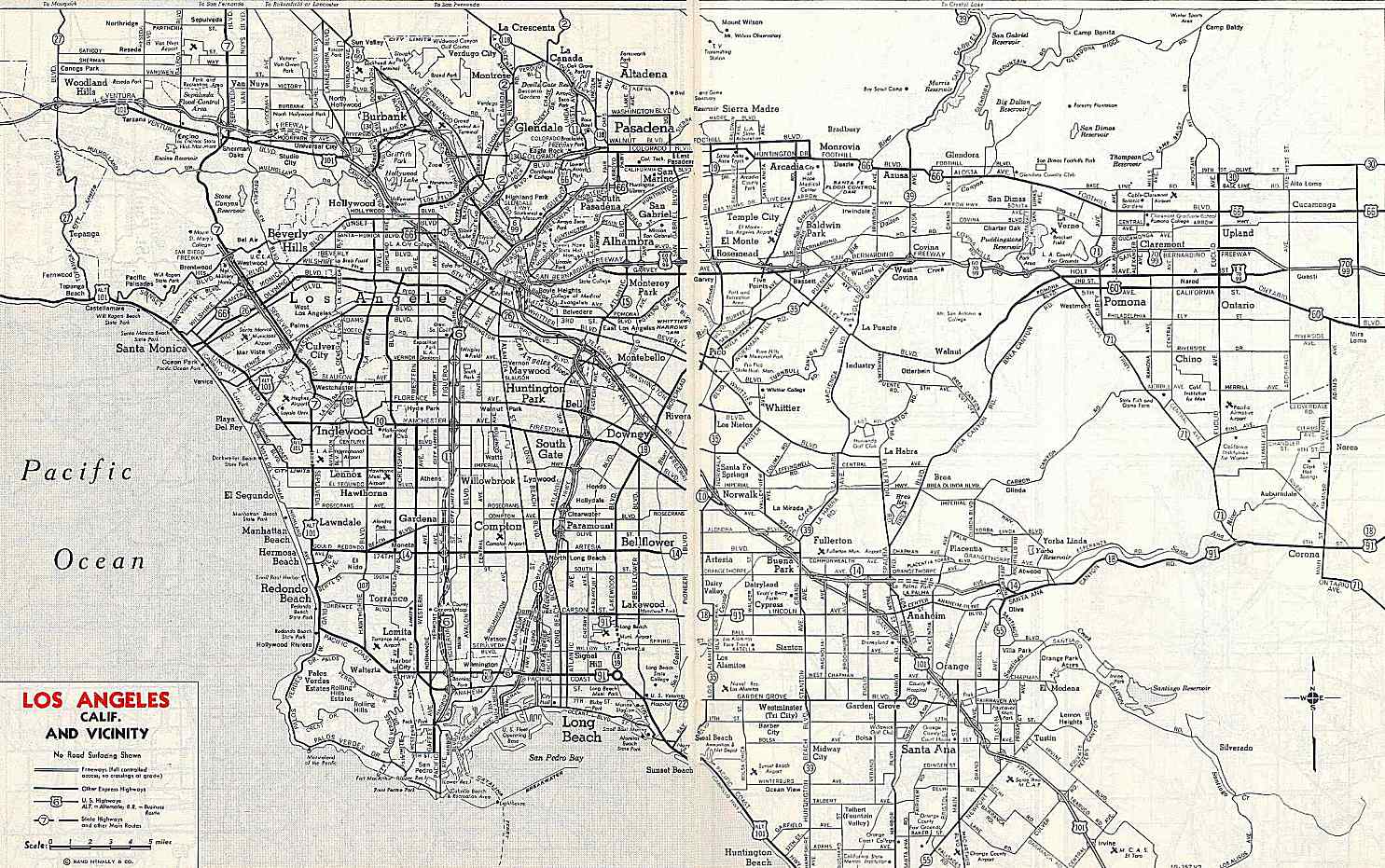
History
The
Plans for
Early plans also included a north–south freeway on each side of the
In the
Early maps show that the Terminal Island Freeway was to extend north to the
Major intersections
Except where prefixed with a letter, postmiles were measured on the road as it was in 1964, based on the alignment that existed at the time, and do not necessarily reflect current mileage. R reflects a realignment in the route since then, M indicates a second realignment, L refers to an overlap due to a correction or change, and T indicates postmiles classified as temporary ().[1] Segments that remain unconstructed or have been relinquished to local control may be omitted. The entire route is in Los Angeles County.
| Location | Postmile [1][46][47] | Exit [48] | Destinations | Notes | |
|---|---|---|---|---|---|
San Pedro, Los Angeles | R0.00 | 1A | Gaffey Street | Southbound left exit; northbound entrances accessible from Miraflores Avenue and the I-110 north on-ramp. | |
| R0.00 | 1B | Los Angeles | South end of SR 47 | ||
| R0.43 0.72 | 1C | Harbor Boulevard | Signed as exit 1A northbound | ||
| Los Angeles Harbor Main Channel | 0.86 | Vincent Thomas Bridge | |||
Wilmington, Los Angeles | 2.30 | 1B | Ferry Street | Northbound exit and entrance | |
| | Site of the former toll plaza; north end of freeway and state maintenance | ||||
| | Ferry Street | Southbound exit and entrance | |||
| | Navy Way | At-grade intersection | |||
| | Berths 301–305 (Terminal Way) / Berths 401–406 (Navy Way) | Southbound exit only | |||
I-710 north / Pier T (Avenue) – Piers B-J, Downtown Long Beach | Interchange | ||||
| | South end of freeway and state maintenance | ||||
| 3.58 | 4 | New Dock Street – Pier S | Southbound exit and northbound entrance | ||
Schuyler Heim Bridge over Cerritos Channel | |||||
Terminal Island Freeway ) / Willow Street | Northbound left exit and southbound left entrance | ||||
| | North end of freeway and state maintenance | ||||
| | Pacific Coast Highway ) | Interchange | |||
| Carson | | Sepulveda Boulevard | Interchange | ||
| | 223rd Street | Interchange | |||
| | SR 7 ; I-405 exit 33A | ||||
| | Carson Street | Interchange | |||
| | Del Amo Boulevard | Interchange | |||
Gardena Freeway) – Long Beach | Interchange; SR 91 east exit 10B, west exit 10 | ||||
| | Gardena Freeway) / Artesia Boulevard – Redondo Beach | Interchange; north end of SR 47; SR 91 east exit 10B, west exit 10 | |||
| | Alameda Street | Continuation beyond SR 91 | |||
| 1.000 mi = 1.609 km; 1.000 km = 0.621 mi | |||||
See also
 California Roads portal
References
- ^ a b c California Department of Transportation. "State Truck Route List". Sacramento: California Department of Transportation. Archived from the original (XLS file) on June 30, 2015. Retrieved June 30, 2015.
- ^
- ^ a b Photographs of SR 47 northbound, taken May 30, 2004, from California @ AARoads - California 47
- ^ "Article 2 of Chapter 2 of Division 1". California Streets and Highways Code. Sacramento: California Office of Legislative Counsel. Retrieved February 6, 2019.
- ^ Federal Highway Administration (March 25, 2015). National Highway System: Los Angeles, CA (PDF) (Map). Scale not given. Washington, DC: Federal Highway Administration. Retrieved October 14, 2017.
- ^ Natzke, Stefan; Neathery, Mike & Adderly, Kevin (June 20, 2012). "What is the National Highway System?". National Highway System. Washington, DC: Federal Highway Administration. Retrieved July 1, 2012.
- ^ California State Assembly. "Relating to the Seaside Freeway". 1959 Session of the Legislature. Statutes of California (House Resolution). State of California. Ch. 144 p. 3502.: "That the California Highway Commission is requested to declare the added portion of Route 167 which will connect the Harbor Freeway and the Long Beach Freeway to be a freeway, to be known as the Seaside Freeway..."
- ^ California Department of Transportation; California State Transportation Agency (January 2021). 2020 Named Freeways, Highways, Structures and Other Appurtenances in California (PDF). Sacramento: California Department of Transportation. pp. 37, 340. Archived from the original (PDF) on October 10, 2022.
- ^ Los Angeles Times, Harbor Truck Highway Association is Formed, July 4, 1917, p. II7
- ^ American Road Builders' Association, Good Roads, Harbor Truck Boulevard to be Built by Los Angeles County, California, June 24, 1916
- ^ Los Angeles Times, Truck Boulevard Opened, February 5, 1924, p. A1
- ^ United States Geological Survey, Pasadena (1900) and Downey (1902), scale 1:62500
- ^ United States Geological Survey, Los Angeles (1928), Watts (1924 and 1937), Compton (1924 and 1930), and Wilmington (1925), scale 1:24000 Archived 2007-12-21 at the Wayback Machine
- Division of Highways, Los Angeles and Vicinity, 1944
- ^ Automobile Club of Southern California, map from Traffic Survey, Los Angeles Metropolitan Area, 1937, reproduced in Janet L. Abu-Lughod, New York, Chicago, Los Angeles: America's Global Cities, 1999, p. 256
- ^ a b Transportation Engineering Board, map from A Transit Program for the Los Angeles Metropolitan Region, 1939, reproduced in Gerrylynn K. Roberts, Philip Steadman, American Cities and Technology: Wilderness to Wired City, 1999, p. 79
- Long Beach Independent, City Served by Three Freeways Urged for Postwar Period by Planning Group, July 9, 1943
- ^ a b Los Angeles County Regional Planning District, Master Plan of Metropolitan Los Angeles Freeways, adopted August 6, 1947
- ^ Los Angeles Times, Harbor Bridge Project Reinstated by Navy, December 18, 1945, p. A1
- ^ Los Angeles Times, Terminal Island Bridge Under Way, January 28, 1946, p. 3
- ^ Los Angeles Times, High Lift Bridge Dedicated at Terminal Island, January 11, 1948, p. 14
- ^ Andrew Hamilton, The New York Times, Los Angeles Roads Plan, February 25, 1940, p. 128
- ^ California State Assembly. "An act to provide for a system of public streets and highways..." Fifty-seventh Session of the Legislature, 1st extraordinary session. Statutes of California. State of California. Ch. 11 p. 3798.: "Route 222 is from Route 165 [I-110] near Adams Street to Route 205 [SR 110] near Elysian Park in Los Angeles"
- ^ Los Angeles City Planning Commission, Accomplishments, 1955, p. 6
- ^ Metropolitan Transportation Engineering Board, Master Plan of Freeways and Expressways, adopted February 28, 1958
- ^ California State Assembly. "An act to amend Sections 306, 320, 332, 351, 362, 365, 369, 374, 382, 388, 397, 407, 408, 409, 410, 415, 422, 435, 440, 446, 453, 456, 460, 467, 470, 476, 487, 492, 493, 494, 506, 521, 528, and 529..." 1959 Session of the Legislature. Statutes of California. State of California. Ch. 1062 p. 3120.: "Route 270 is from Terminal Island to Route 173 [I-10]."
- Division of Highways, Los Angeles and Vicinity, 1963
- ^ California State Assembly. "An act to add Section 253 and Article 3 (commencing with Section 300) to Chapter 2 of Division 1 of, and to repeal Section 253 and Article 3 (commencing with Section 300) of Chapter 2 of Division 1 of, the..." 1963 Session of the Legislature. Statutes of California. State of California. Ch. 385 p. 1175, 1187.: "Route 47 is from Route 7 at Terminal Island to Route 10." "Route 241 is from Route 11 near Adams Street to Route 11 near Elysian Park in Los Angeles."
- ^ California State Assembly. "An act to amend Sections 253, 307, 317, 322, 334, 342, 347, 349, 361, 363, 372, 373, 374, 379, 384, 390, 407, 408, 443, 455, 470, 486, 514, 517, 548, and 550 of, to add Sections 556, 557, 558, 560..." 1965 Session of the Legislature. Statutes of California. State of California. Ch. 1372 p. 3273, 3276.: "Route 7 is from Route 1 to Route 210 in Pasadena." "Route 47 is from Route 11 in San Pedro to Route 10 via the Vincent Thomas Bridge."
- ^ California State Assembly. "An act to add Section 544 to the Streets and Highways Code, relating to state highway routes". 1949 Session of the Legislature. Statutes of California. State of California. Ch. 1261 p. 2215.: "Route 231 is...from Route 165 [I-110] in San Pedro to Route 167 [I-710] in Long Beach, via the mainland portion of Long Beach Outer Harbor and Terminal Island..."
- ^ Los Angeles Times, Vincent Thomas Bridge to Be Dedicated Saturday, September 27, 1963, p. C7
- ^ Los Angeles Times, Governor to Speak at Bridge Link Ceremony, March 3, 1968, p. 1
- ^ Lee Bastajian, Los Angeles Times, Vincent Thomas Bridge Link Scheduled to Open in July, May 31, 1970, p. CS1
- Long Beach Independent, Dedication Set on Freeway Link to Bridge, July 8, 1970
- Valley News (Van Nuys), Harbor Freeway Extension to Be Dedicated Today, July 9, 1970
- ^ Port of Long Beach, Port Dedicates New $65-million Ocean Boulevard Roadway, June 25, 2007
- Rand McNally & Company, Los Angeles and Vicinity, 1959
- ^ Rand McNally Auto Road Atlas: United States, Canada, Mexico, 1963
- Long Beach Press-Telegram, August 5, 1969, p. 1
- Long Beach Press-Telegram, Public Notice of Route Location Approval by Bureau of Public Roads, June 1, 1970
- ^ California State Assembly. "An act to add sections 307.1 and 347.1 to the Streets and Highways Code, relating to state highways". 1981–1982 Session of the Legislature. Statutes of California. State of California. Ch. 914 p. 3351.
- ^ California State Assembly. "An act...relating to state highways". 1983–1984 Session of the Legislature. Statutes of California. State of California. Ch. 409 p. 1773.
- ^ George Stein, Los Angeles Times, Price of Progress: Expansion of Ports, Boon to Greater L.A., May Be Burden Along Alameda St., October 12, 1986, p. 1
- ^ Sheryl Stolberg, Los Angeles Times, Harbor Plan Brings New Wilmington a Little Closer, December 25, 1988, p. 6
- Alameda Corridor Transportation Authority, Planning—SR-47 Port Access Expressway, accessed March 11, 2009
- ^ California Department of Transportation (July 2007). "Log of Bridges on State Highways". Sacramento: California Department of Transportation.
- ^ California Department of Transportation, All Traffic Volumes on CSHS Archived July 21, 2011, at the Wayback Machine, 2006
- California Numbered Exit Uniform System, State Route 47 Freeway Interchanges, Retrieved on 2009-02-05.
External links
- Caltrans: State Route 47 highway conditions
- Caltrans Traffic Conditions Map
- California Highway Patrol Traffic Incidents
- California @ AARoads - California 47
- California Highways: SR 47