Camberwell Green


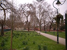
Camberwell Green is a hectare (2.5 acres) of
electoral ward
around the Green.
Measured from building to building, the open space including roads and pavements, and private frontages (size of the square) is 1.8 hectares (4.4 acres), and due to curves its parameters are not fixed; these average about 190 metres by 90 metres.
See also
External links
51°28′30″N 0°05′35″W / 51.475°N 0.093°W

