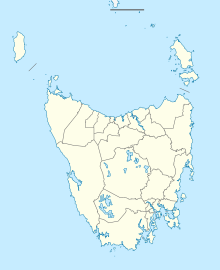
Cambridge Aerodrome
Cambridge Aerodrome Hobart/Cambridge Aerodrome | |||||||||||||||
|---|---|---|---|---|---|---|---|---|---|---|---|---|---|---|---|
AMSL 67 ft / 20 m | | ||||||||||||||
| Coordinates | 42°49′35″S 147°28′36″E / 42.82639°S 147.47667°E | ||||||||||||||
| Maps | |||||||||||||||
 | |||||||||||||||
 | |||||||||||||||
| Runways | |||||||||||||||
| |||||||||||||||
Cambridge Aerodrome (
Cambridge has been the primary site of aeronautics in Hobart from its opening in the 1920s.[citation needed] In July 1934, the federal government compulsorily acquired 190 acres (77 ha) of land from a local farmer to establish an aerodrome on the current site.[2] It served as Hobart's main airport until the International Airport opened in 1956. Today, it is the base of Par Avion, which specialises in day trips and scenic flights around Hobart and the South West Wilderness of Tasmania; the Aeroclub of Southern Tasmania; and Heli Resources, a Helicopter Company that focuses on aerial work and flights in Antarctica.
Accidents and incidents

On 10 March 1946, a Douglas DC-3 aircraft operated by Australian National Airways departed from Cambridge Aerodrome with a crew of 4 and 21 passengers for Essendon Airport. Less than 2 minutes after take-off, the aircraft crashed at Seven-Mile Beach, killing all on board. At the time, it was Australia's worst civil aviation accident.[3]
Airlines and destinations
| Airlines | Destinations |
|---|---|
| Airlines of Tasmania | Launceston, Maria Island, Melaleuca, Strahan |
See also
References
- ^ YCBG – Hobart/Cambridge (PDF). AIP En Route Supplement from Airservices Australia, effective 21 March 2024
- ^ "CAMBRIDGE AERODROME SITE: Suit Against the Commonwealth". The Mercury (Hobart). 26 March 1936.
- ^ The Canberra Times – 12 March 1946, p. 2. Retrieved 2011-10-03


