
Canaveral National Seashore
| Canaveral National Seashore | |
|---|---|
IUCN category V (protected landscape/seascape) | |
 An eastward view of the shoreline at sunrise | |
  | |
| Location | Brevard County and Volusia County, Florida, United States |
| Nearest city | New Smyrna Beach, Florida and Titusville, Florida |
| Coordinates | 28°46′03″N 80°46′37″W / 28.76750°N 80.77694°W |
| Area | 57,662 acres (23,335 ha)[1] |
| Established | January 3, 1975 |
| Visitors | 1,005,001 (in 2011)[2] |
| Governing body | National Park Service |
| Website | Canaveral National Seashore |
The Canaveral National Seashore (CANA) is a
History
The National Park Service has documented 120 archaeological sites within the seashore. Their analysis shows Paleo-Indians began hunting and gathering and later cultivating in the area as early as 2000 B.C.E. Mounds and middens remain today as evidence of from this era. Snyder’s Mound at Seminole Rest dates to their earliest period. Castle Windy is a 17 foot tall midden located on the barrier island, which dates from 1200 CE and continued for another 300 years. Turtle Mound, at 35 feet in height, is the largest midden. It dates to the historical period, called Surruque by early Spanish mapmakers, named for native people residing in the area. Later it became known as Turtle Mound as an obvious navigational landmark for sailors along the Florida Coast.[4]
The names Canaveral and Los Moquitos, now Cape Canaveral and Mosquito Lagoon, noted by Spanish explorers in the sixteenth century are among the oldest place names in North America. Turtle Mound was documented by early naturalists William Bartram in 1774, and Andre Michaux in 1788.[5]
As early as 1934, the National Park Service began investigating areas suitable for “national beach parks,” leading to the establishment of Cape Hatteras National Seashore in 1937. In 1955, the National Park Service published Our Vanishing Shoreline (1955), which made the case for protecting undeveloped coastal areas for conservation and recreation.[6] Following its publication, 126 undeveloped areas were identified with sixteen as a priority. One of those sites was Mosquito Lagoon and the undeveloped portions of the barrier island associated with it.[7]
In 1961 NASA selected Cape Canaveral as the primary launch location for space exploration. Soon afterwards, NASA undertook acquisition of over 100 square miles of lands along the barrier island, Mosquito Lagoon, and mainland areas as a launch buffer. In 1963 NASA and the Department of Interior reached agreement to dedicate 25,000 acres as Merritt Island National Wildlife Refuge. Over the next decade the refuge was expanded to 140,000 acres. [8] That same year Florida passed a bond issue to acquire lands for state parks and began purchasing lands along the barrier island south of Turtle Mound which had previously been acquired a state historical site.[9]
By 1968 there was growing community support for establishment of a national seashore. During this time artist-environmentalist Doris Leeper led efforts to stop proposed developments on the barrier island.[10] On April 26, 1968, the Volusia County Board of Commissioners passed Resolution No. 68-51 requesting the Department of the Interior to establish a National Seashore on the east coast of Volusia County, Florida. In 1968, William "Bill" Chappell and Lou Frey were elected to Congress and introduced legislation to establish the seashore. On April 5 and 6, 1974, Congressman Roy Taylor, chairman of the house subcommittee on National Parks and Recreation, brought a congressional party to review the proposed site. A second group, including chairman of the Senate National Parks and Recreation Committee, Senator Alan Bible, visited on April 19. Things then began to progress quickly. Florida State Parks committed to transfer approximately 4,000 acres of lands it had already acquired to the proposed seashore. On the other hand, the Department of Interior raised questions about possible conflicts with rocket launches at Cape Canaveral.[11] The House passed the Seashore Act on December 3, with the Senate following suit on December 17.[12] Still objecting, Department of Interior urged a veto of the bill, but on January 3, 1975, President Gerald Ford signed the bill into law.[13] For many years Rep. Frey credited Doris Leeper as “the driving force behind establishment of Canaveral National Seashore.” [14]
Recreation
The Canaveral National Seashore is a popular place for boaters, kayakers, fishers, sun-bathers, and hunters with many opportunities for recreation. It features numerous boat ramps and locations for launching kayaks, along with miles of beaches popular with locals and tourists.[15]
The
The seashore also is home to 2 nude beaches.
Fishing and hunting are extremely popular in the seashore. On the beaches, anglers target species such as
Gallery
-
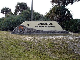 The New Smyrna Beach entrance to the park
 -
 A SSE view down the shore
 -
 A NNW view up the shore
 -
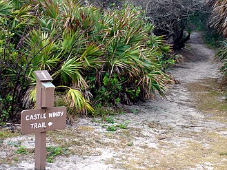 Castle Windy Trail in the park
 -
 Looking north on the southern part of the seashore


See also
- Eldora, Florida
- Old Haulover Canal
- Ross Hammock Site
- Seminole Rest
- Turtle Mound
References
- ^ a b "Listing of acreage – December 31, 2011" (XLSX). Land Resource Division, National Park Service. Retrieved 2012-12-26. (National Park Service Acreage Reports)
- ^ "NPS Annual Recreation Visits Report". National Park Service. Retrieved 2012-12-26.
- ^ "Canaveral National Seashore (U.S. National Park Service". U.S. National Park Service. 29 October 2021. Retrieved 14 November 2021.
- ^ Parker, Susan (2008). Canaveral National Seashore Historic Resources Study. Atlanta, Ga.: National Park Service. pp. 7–12.
- ISBN 9780813069524.
- ^ A report on our vanishing shoreline. Washington,D.C.: National Park Service. 1955.
- ^ Report on the Seashore Recreation Survey of the Atlantic and Gulf Coasts (PDF). Washington, D.C.: National Park Service. 1955. p. 171.
- ^ Vento, Charles (2020). "The History of the Merritt Island National Wildlife Refuge". Florida Historical Quarterly. 99 (1): 125–151 – via JSTOR.
- ^ Henderson. Forces of Nature. p. 172.
- ^ Henderson. Forces of Nature. p. 174.
- ^ Henderson. Forces of Nature. p. 175.
- ^ "HISTORY OF CANAVERAL NATIONAL SEASHORE". North Brevard Business Directory. Retrieved April 28, 2015.
- ^ Henderson. Forces of Nature. p. 175.
- ^ Henderson. Forces of Nature. p. 174.
- ^ "Canaveral". National Park Service. 2023-09-17. Retrieved 2023-11-11.
- ^ "SpaceX launching NASA astronauts to space Saturday, here's how to watch historic mission from anywhere". Space Explored. 2020-05-25. Retrieved 2021-09-03.
- ^ Steven L. Markos (22 March 2021). "Canaveral National Seashore - PLAYALINDA BEACH". Retrieved 11 November 2021.
External links
 Canaveral National Seashore travel guide from Wikivoyage
- National Park Service: Canaveral National Seashore
- scheduled closing (e.g. for rocket launches)
| International | |
|---|---|
| National | |