
Cape of Good Hope

The Cape of Good Hope (
A common misconception is that the Cape of Good Hope is the southern tip of


When following the western side of the African coastline from the equator, however, the Cape of Good Hope marks the point where a ship begins to travel more eastward than southward. Thus, the first modern rounding of the cape in 1487 by
As one of the
.The term Cape of Good Hope is also used in three other ways:
- It is a section of the Table Mountain National Park, within which the cape of the same name, as well as Cape Point, falls. Prior to its incorporation into the national park, this section constituted the Cape Point Nature Reserve.[5]
- It was the name of the early Cape Colony established by the Dutch East Indies Company in 1652, on the Cape Peninsula.
- Just before the Cape of Good Hope Province(usually shortened to the Cape Province).
History
When Eudoxus was returning from his second voyage to India, the wind forced him south of the Gulf of Aden and down the coast of Africa for some distance. Somewhere along the coast of East Africa, he found the remains of the ship. Due to its appearance and the story told by the natives, Eudoxus concluded that the ship was from Gades and had sailed anti-clockwise around Africa, passing the Cape and entering the Indian Ocean. This inspired him to repeat the voyage and attempt a circumnavigation of the continent. Organising the expedition on his own account he set sail from Gades and began to work down the African coast. The difficulties were too great, however, and he was obliged to return to Europe.[6]
After this failure he again set out to circumnavigate Africa. His eventual fate is unknown. Although some, such as Pliny, claimed that Eudoxus did achieve his goal, the most probable conclusion is that he perished on the journey.[7]
In the 1450 Fra Mauro map, the Indian Ocean is depicted as connected to the Atlantic. Fra Mauro puts the following inscription by the southern tip of Africa, which he names the "Cape of Diab", describing the exploration by a ship from the East around 1420:[8][9]

Around 1420 a ship, or junk, from India crossed the Sea of India towards the Island of Men and the Island of Women, off Cape Diab, between the Green Islands and the shadows. It sailed for 40 days in a south-westerly direction without ever finding anything other than wind and water. According to these people themselves, the ship went some 2,000 miles ahead until — once favourable conditions came to an end — it turned round and sailed back to Cape Diab in 70 days.
The ships called junks (lit. "
astrologer, who stands on the side and, with an astrolabein hand, gives orders to the navigator.
—Text from the Fra Mauro map, 09-P25
Fra Mauro explained that he obtained the information from "a trustworthy source", who traveled with the expedition, possibly the Venetian explorer
at the time the expedition left:What is more, I have spoken with a person worthy of trust, who says that he sailed in an Indian ship caught in the fury of a tempest for 40 days out in the Sea of India, beyond the Cape of Soffala and the Green Islands towards west-southwest; and according to the astrologers who act as their guides, they had advanced almost 2,000 miles. Thus one can believe and confirm what is said by both these and those, and that they had therefore sailed 4,000 miles.
Fra Mauro also comments that the account of the expedition, together with the relation by Strabo of the travels of Eudoxus of Cyzicus from Arabia to Gibraltar through the southern Ocean in Antiquity, led him to believe that the Indian Ocean was not a closed sea and that Africa could be circumnavigated by her southern end (Text from Fra Mauro map, 11, G2). This knowledge, together with the map depiction of the African continent, probably encouraged the Portuguese to intensify their effort to round the tip of Africa.
In 1511, after Afonso de Albuquerque conquered Malacca, the Portuguese recovered a chart from a Javanese maritime pilot, which, according to Albuquerque, already included the Cape of Good Hope. Regarding the chart Albuquerque said:[10][11]: 98–99
"...a large map of a Javanese pilot, containing the Cape of Good Hope, Portugal and the land of Brazil, the Red Sea and the Sea of Persia, the Clove Islands, the navigation of the Chinese and the Gores, with their rhumbs and direct routes followed by the ships, and the hinterland, and how the kingdoms border on each other. It seems to me, Sir, that this was the best thing I have ever seen, and Your Highness will be very pleased to see it; it had the names in Javanese writing, but I had with me a Javanese who could read and write. I send this piece to Your Highness, which Francisco Rodrigues traced from the other, in which Your Highness can truly see where the Chinese and Gores come from, and the course your ships must take to the Clove Islands, and where the gold mines lie, and the islands of Java and Banda, of nutmeg and mace, and the land of the King of Siam, and also the end of the land of the navigation of the Chinese, the direction it takes, and how they do not navigate farther."
— Letter of Albuquerque to King Manuel I of Portugal, 1 April 1512.
European exploration


In the
The
In 1652, the Dutch East India Company's administrator Jan van Riebeeck established a resupply camp for the Dutch East India Company some 50 km north of the cape in Table Bay on 6 April 1652, and this eventually developed into Cape Town. Supplies of fresh food were vital on the long journey around Africa and Cape Town became known as "The Tavern of the Seas".
On 31 December 1687 a community of Huguenots (French Protestants) arrived at the Cape of Good Hope from the Netherlands. They had fled from France due to religious persecution and gone to the Netherlands, before making the journey to the Cape Colony. Members of this group included Pierre Joubert, who came from La Motte-d'Aigues, as well as Jean Roy. The Dutch East India Company needed skilled farmers at the Cape of Good Hope and the Dutch government saw opportunities to settle Huguenots at the Cape. The colony gradually grew over the next 150 years until it extended hundreds of kilometres to the north and north-east.
During the
The Portuguese government erected two navigational beacons, Dias Cross and da Gama Cross, to commemorate Bartolomeu Dias and Vasco da Gama, who were the first modern European explorers to reach the cape. When lined up, these crosses point to Whittle Rock, a large, permanently submerged shipping hazard in False Bay. Two other beacons in Simon's Town provide the intersection.
Contemporary

The Cape of Good Hope saw an increase of ship activity after the
Geography


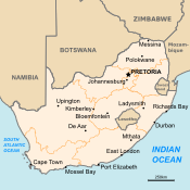
The Cape of Good Hope is at the southern tip of the
The term "the Cape" has also been used in a wider sense, to indicate the area of the European colony centred on Cape Town, and the later South African province. Since 1994, it has been broken up into three smaller provinces: the Western Cape, Eastern Cape and Northern Cape; parts of the province were also absorbed into the North West.
Fauna
,_cabo_de_Buena_Esparanza,_Sud%C3%A1frica,_2018-07-23,_DD_85.jpg)


With its diverse habitat, ranging from rocky mountain tops to beaches and open sea, the Cape of Good Hope is home to at least 250 species of birds including one of the two mainland colonies of
In 1842,
Flora

The Cape of Good Hope is an integral part of the
Characteristic fynbos plants include
Many popular horticultural plants like
Legends

- The Cape of Good Hope is the legendary home of the Flying Dutchman. According to the legend, crewed by tormented and damned ghostly sailors, it is doomed forever to beat its way through the adjacent waters without ever succeeding in rounding the headland.
- Adamastor is a Greek-type mythological character invented by the Portuguese poet Luís de Camões in his epic poem Os Lusíadas (first printed in 1572), as a symbol of the forces of nature Portuguese navigators had to overcome during their discoveries and more specifically of the dangers they faced when trying to round the Cape of Storms.
See also
- Cape Horn – Headland of the Tierra del Fuego archipelago located in Chile, its South American counterpart
- Western Cape – Province of South Africa on the south-western coast
- History of Cape Colony– British colony from 1806 to 1910
- Simon's Town – Seaside town in South Africa
- Postage stamps and postal history of the Cape of Good Hope
Notes
- ^ Dutch: Kaap de Goede Hoop [ˌkaːb də ˌɣudə ˈɦoːp] ⓘ; Kaap in isolation: [kaːp] ⓘ Portuguese: Cabo da Boa Esperança [ˈkaβu ðɐ ˈβoɐ ɨʃpɨˈɾɐ̃sɐ]
References
- ^ "Cape of Good Hope, South Africa - 360° Aerial Panoramas". Archived from the original on 2011-10-08. Retrieved 2017-02-03.
- ^ The first circumnavigation of Africa Archived 2015-10-16 at the Wayback Machine. livius.org
- ^ Sarah Mytton Maury (1848). Englishwoman In America. p. 33.
- ISBN 978-0-340-00191-2
- ^ "Map of the Park, showing the Cape of Good Hope section (retrieved 27 March 2010)". Archived from the original on 1 December 2022. Retrieved 28 March 2010.
- ISBN 978-0-8196-0138-4 – via Google Books.
- ISBN 978-0-8196-0138-4 – via Google Books.
- ^ Marco Polo, p. 409
- ^ Needham 1971, p. 501
- ^ Carta IX, 1 April 1512. In Pato, Raymundo Antonio de Bulhão (1884). Cartas de Affonso de Albuquerque, Seguidas de Documentos que as Elucidam tomo I (pp. 29–65). Lisboa: Typographia da Academia Real das Sciencas. p. 64.
- ISSN 0104-5970. Archived from the original on 4 January 2022. Retrieved 19 October 2023.)
{{cite journal}}: CS1 maint: bot: original URL status unknown (link - ISBN 978-0-8139-2057-3.
- ^ Farrer, Martin; Safi, Michael (26 March 2021). "Suez canal: Japanese owner of stricken ship talks of plan to refloat it". The Guardian. Archived from the original on 26 March 2021. Retrieved 26 March 2021.
- ^ El Wardany, Salma; Magdy, Mirette (27 March 2001). "Ships Divert From Canal; More Tugs Coming: Suez Update". MSN. Bloomberg News. Archived from the original on 26 March 2021. Retrieved 26 March 2021.
- ^ "Container ships turn to Cape of Good Hope as Suez issues continue: cFlow". Bunker World. Archived from the original on 2021-04-16. Retrieved 2021-03-26.
- ^ "Red Sea crisis spurs maritime traffic to Cape of Good Hope, boosting South Africa's ports". 27 January 2024.
- .
- ^ Smith, C.H. (1842). "Black maned lion Leo melanochaita". In Jardine, W. (ed.). The Naturalist's Library. Vol. 15 Mammalia. London: Chatto and Windus. p. Plate X, 177.
- (PDF) from the original on 2020-01-17. Retrieved 2019-08-18.
- ^ Yamaguchi, N. (2000). "The Barbary lion and the Cape lion: their phylogenetic places and conservation" (PDF). African Lion Working Group News. Vol. 1. pp. 9–11. Archived from the original (PDF) on 2016-03-04. Retrieved 2019-08-18.
- ^ "'Extinct' lions (Cape lion) surface in Siberia". The BBC. 2000. Archived from the original on 2017-08-24. Retrieved 2012-12-31.
- ^ "Лев". Sibzoo.narod.ru. Archived from the original on March 29, 2009. Retrieved January 28, 2010.
- ^ "South Africa: Lion Cubs Thought to Be Cape Lions". AP Archive, The Associated Press. 2000. Archived from the original on 2019-08-18. Retrieved 2019-08-18. (with 2-minute video of cubs at zoo with John Spence, 3 sound-bites, and 15 photos)
- ^ "Peninsula Sandstone Fynbos. Cape Town Biodiversity Factsheets" (PDF). Archived (PDF) from the original on 2011-11-01.[dead link]
- ^ "Cape Flats Dune Strandveld. Cape Town Biodiversity Factsheets" (PDF). Archived (PDF) from the original on 2011-11-17.[dead link]
Bibliography
- Marco Polo (1875), Yule, Henry (ed.), The Book of Ser Marco Polo, the Venetian: Concerning the Kingdoms and Marvels of the East, John Murray
- Needham, Joseph (1971), Science and Civilisation in China
External links
- List of birds of the Cape of Good Hope Nature Reserve, with paragraph describing each species
- Cape of Good Hope, Panoramic view
- Cape of Good Hope is a map by John Arrowsmith in 1842
34°21′29″S 18°28′32″E / 34.35806°S 18.47556°E
| International | |
|---|---|
| National | |
| People | |
| Other | |