
Cataño, Puerto Rico
Cataño
Municipio Autónomo de Cataño | ||
|---|---|---|
Town and Municipality | ||
 Aerial view of Cataño | ||
|
Commonwealth | ||
| Founded | July 1, 1927 | |
| Barrios | 2 barrios | |
| Government | ||
| • Mayor | Julio Alicea Vasallo ( ZIP Codes 00962, 00963 | |
| Area code | 787/939 | |
| Major routes | ||
Cataño (Spanish pronunciation:
History
Hernando de Cataño was chosen to offer his medical services in Puerto Rico during Francisco Bahamonde de Lugo's tenure as Governor of Puerto Rico (1564–1568). He was one of the first physicians who arrived in Puerto Rico during its colonization[2] and, upon accepting his position, received as payment a piece of land across the San Juan islet. From that time, the region started to be recognized by the name of its original owner. As people started establishing in the area, Cataño was declared as a barrio of Bayamón. However, there wasn't much success in the town's development during these years due to its swamp-like terrain. Still, around 1690, a hermitage was established to allow residents to receive religious services without having to travel to Bayamón.

In the middle of the 19th century, a ferry company was founded to facilitate the transportation of merchandise and passengers through the San Juan Bay. This spurred a growth in the population of Cataño, transforming it into one of the most prosperous barrios of Bayamón. Still, attempts to separate themselves from Bayamón in 1839 were unsuccessful. On June 26, 1893, Bishop Antonio Puig y Montserrat separated the barrios of Cataño, Palo Seco, and Palmas from Bayamón's parish and established an independent parish for the residents of these sectors. In 1927, Cataño was officially declared a municipality with the name Hato de Palmas de Cataño, which overtime was simply shortened to Cataño.
Politics played a crucial part in the foundation of the town, since Bayamón was controlled by an administration with opposing ideologies to those of the island's Legislature. The separation of Cataño from Bayamón was a strategy to weaken that opposition.[3]
With only five square miles of territory (12.5 km2), Cataño is the smallest municipality in Puerto Rico. It is less than half the size of Hormigueros, the next-smallest in area.
The people of Cataño were left in despair when
Geography
Cataño consists mostly of flat plains that belong to the Northern region of Puerto Rico. Its northern shore falls on the San Juan Bay of the Atlantic Ocean.[6][7]
Bodies of water
Located in Cataño are a number of rivers, streams, named and unnamed creeks, and channels including:[8][9][10]
- Caño La Malaria (Malaria Channel)
- Río de Bayamón
- Río Hondo
Barrios

.jpg)
Cataño is divided into only two barrios: Cataño barrio-pueblo, and Palmas.[11][12]
Sectors
Barrios (which are, in contemporary times, roughly comparable to
Special Communities
Comunidades Especiales de Puerto Rico (Special Communities of Puerto Rico) are marginalized communities whose citizens are experiencing a certain amount of social exclusion. A map shows these communities occur in nearly every municipality of the commonwealth. Of the 742 places that were on the list in 2014, the following barrios, communities, sectors, or neighborhoods were in Cataño: Cucharillas, Juana Matos, Puente Blanco, and Puntilla.[17][18]
Culture
Festivals and events
Cataño celebrates its patron saint festival in July. The Fiestas Patronales de Nuestra Sra. del Carmen is a religious and cultural celebration that generally features parades, games, artisans, amusement rides, regional food, and live entertainment.[19][6]
Tourism
One of the main tourist attractions in Cataño is the
.jpg)
The Bacardi Distillery also offers tours of its facilities to visitors who want to learn about the rum manufacturing industry in the island and the Caribbean.[20]
To stimulate local tourism, the Puerto Rico Tourism Company launched the Voy Turistiendo ("I'm Touring") campaign, with a passport book and website. The Cataño page lists Lancha de Cataño, Malecón de Cataño, and Casa Bacardí, as places of interest.[21]
Christopher Columbus statue
The town gained notoriety in 1998, when Mayor Edwin Rivera Sierra traveled to
Sports
Cataño has a number of professional sports teams[citation needed], and there are several important sports facilities located in the town, including the Perucho Cepeda Stadium, the Pedro Rodríguez Gaya Boxing Coliseum, and the Cosme Beitía Salamo Coliseum.
Economy

Due to its location, Cataño has always played an important role as a port to the island.[citation needed] Fishing has also been a main source of economy for centuries[citation needed]. Bacardi, one of the largest rum manufacturers of the world, has a distillery in Cataño.
Other industries established in the town are refineries, commerce companies, transport and logistics, among others.
Demographics
| Census | Pop. | Note | %± |
|---|---|---|---|
| 1930 | 8,504 | — | |
| 1940 | 9,719 | 14.3% | |
| 1950 | 19,865 | 104.4% | |
| 1960 | 25,208 | 26.9% | |
| 1970 | 26,459 | 5.0% | |
| 1980 | 26,243 | −0.8% | |
| 1990 | 34,587 | 31.8% | |
| 2000 | 30,071 | −13.1% | |
| 2010 | 28,140 | −6.4% | |
| 2020 | 23,155 | −17.7% | |
| U.S. Decennial Census[23] 1930[24] 1930-1950[25] 1960-2000[26] 2010[27] 2020[28] | |||
Despite its small size, Cataño has a large population when compared to municipalities of similar areas. This is perhaps due to its location near the capital of San Juan. The population, according to the 2000 census, was 30,071 with a population density of 6,014.2 people per square mile (2,322.1 people/km2). Although the current population is almost the double of what it was in the 1950 census, the current census reflects a small decrease of inhabitants.
As a whole, Puerto Rico is populated mainly by people from a
| Race - Cataño, Puerto Rico - 2000 Census[30] | ||
|---|---|---|
| Race | Population | % of Total |
| White | 20,427 | 67.9% |
| Black/African American | 2,279 | 7.6% |
Alaska Native |
226 | 0.8% |
| Asian | 58 | 0.2% |
Native Hawaiian/Pacific Islander |
7 | 0.0% |
| Some other race | 1,839 | 6.1% |
| Two or more races | 5,235 | 17.4% |
Government
After its initial establishment, Cataño belonged to the Bayamón region. From 1839 to 1845, there were some attempts to separate the barrio from Bayamón, but these were unsuccessful. However, on late 19th century, Bishop Antonio Puig y Montserrat managed to separate Cataño establishing their own parish. Cataño was finally declared a municipality on April 25, 1927, being its first mayor Alberto Dávila.
In 1987, Edwin Rivera Sierra was elected as Mayor of Cataño. He remained in the position for 16 years, quitting in 2003. He was replaced by
The city belongs to the
Symbols
The municipio has an official flag and coat of arms.[33]
Flag
The flag consists of nine horizontal stripes: four blue stripes and five white stripes (substituting for the silver color on the coat of arms). A white and green band traverses diagonally the drape in all its extension, from the upper hoist to the lower fly.[34]
The green color represents the
Coat of arms
The coat of arms of Cataño consists of nine horizontal stripes of same the width: four blue and five silver. The colors of the coat and the flag represent the coat of arms of the family of Don Hernando de Cataño, an
On top of the coat of arms, there's a crown with three towers distinct of others coat of arms. The coat itself is surrounded by two green
Name
Aside of its name, derived from its original owner, Cataño has several
Education
Cataño has several public and private schools managed by the Puerto Rico Department of Education.
Transportation

Puerto Rico Highway 22 provides access to Cataño from San Juan or from other adjacent towns. Like most other towns in the island, it has a public transportation system consisting of public cars. Taxis are also available around the town.
Cataño also has a ferry service known as
There are 16 bridges in Cataño.[8]
Gallery
-
 View of the San Juan Bay from the Cataño shore
 -
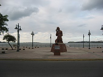 Statue of Taíno Girl


See also
References
- ^ "PUERTO RICO: 2020 Census". The United States Census Bureau. Retrieved August 25, 2021.
- ^ "Municipio de Cataño Puerto Rico el Pueblo que se nego a morir, Lancheros de Cataño, Antesalistas de San Juan". Archived from the original on April 1, 2009. Retrieved March 31, 2009.
- ^ "Municipios: Cataño". Archived from the original on July 28, 2011. Retrieved March 31, 2009.
- ^ "María, un nombre que no vamos a olvidar. Cataño, la vida antes y después del huracán María" [Maria, a name we will never forget. Cataño, life before and after Hurricane María.]. El Nuevo Día (in Spanish). June 13, 2019. Retrieved August 24, 2021.
- ^ Leposa, Adam (September 22, 2017). "After Hurricane Maria, First Commercial Flight Returns to San Juan". Travel Agent Central. Retrieved September 19, 2021.
- ^ a b "Cataño Municipality". enciclopediapr.org. Fundación Puertorriqueña de las Humanidades (FPH). Archived from the original on July 11, 2018. Retrieved March 20, 2019.
- ^ "Mapa de Municipios y Barrios: Cataño (1947)". Issuu (in Latin). June 29, 2015. Retrieved July 22, 2020.
- ^ a b "Cataño Bridges". National Bridge Inventory Data. US Dept. of Transportation. Archived from the original on February 21, 2019. Retrieved February 20, 2019.
- ^ "Rios de Puerto Rico" (in Spanish). Archived from the original on October 23, 2008.
- ^ "Jacksonville District Navigable Waters Lists" (PDF). saj usace army mil. SAJ. Archived (PDF) from the original on January 26, 2017. Retrieved February 18, 2019.
- ^ "Enciclopedia del Municipio de Cataño: Municipios" (in Spanish). September 3, 2010. Archived from the original on May 30, 2018. Retrieved May 29, 2018.
- ^ "Map of Cataño at the Wayback Machine" (PDF). Archived from the original (PDF) on March 24, 2018.
- ^ "US Census Barrio-Pueblo definition". factfinder.com. US Census. Archived from the original on May 13, 2017. Retrieved January 5, 2019.
- ^ "Agencia: Oficina del Coordinador General para el Financiamiento Socioeconómico y la Autogestión (Proposed 2016 Budget)". Puerto Rico Budgets (in Spanish). Retrieved June 28, 2019.
- ISBN 978-0-9820806-1-0
- ^ "Leyes del 2001". Lex Juris Puerto Rico (in Spanish). Retrieved June 24, 2020.
- ISBN 978-0-9820806-1-0
- ^ "Comunidades Especiales de Puerto Rico" (in Spanish). August 8, 2011. Archived from the original on June 24, 2019. Retrieved June 24, 2019.
- ^ "Puerto Rico Festivales, Eventos y Actividades en Puerto Rico". Puerto Rico Hoteles y Paradores (in Spanish). Archived from the original on February 26, 2020. Retrieved July 17, 2020.
- ^ "Casa Bacardí". Atlas Obscura. Archived from the original on May 10, 2019. Retrieved June 15, 2019.
- ^ Pasaporte: Voy Turisteando (in Spanish). Compañia de Turismo de Puerto Rico. 2021.
- ^ "Puerto Rico's Christopher Columbus Statue Survives Hurricane Maria". NPR. Archived from the original on January 23, 2018. Retrieved June 15, 2019.
- ^ "U.S. Decennial Census". United States Census Bureau. Archived from the original on February 13, 2020. Retrieved September 21, 2017.
- ^ "Table 3-Population of Municipalities: 1930 1920 and 1910" (PDF). United States Census Bureau. Archived (PDF) from the original on August 17, 2017. Retrieved September 21, 2017.
- ^ "Table 4-Area and Population of Municipalities Urban and Rural: 1930 to 1950" (PDF). United States Census Bureau. Archived (PDF) from the original on August 30, 2015. Retrieved September 21, 2014.
- ^ "Table 2 Population and Housing Units: 1960 to 2000" (PDF). United States Census Bureau. Archived (PDF) from the original on July 24, 2017. Retrieved September 21, 2017.
- ^ Puerto Rico:2010:population and housing unit counts.pdf (PDF). U.S. Dept. of Commerce Economics and Statistics Administration U.S. Census Bureau. 2010. Archived (PDF) from the original on February 20, 2017. Retrieved August 1, 2019.
- ^ "PUERTO RICO: 2020 Census". The United States Census Bureau. Retrieved August 25, 2021.
- ^ "Population and Housing Unit Estimates". United States Census Bureau. Retrieved September 21, 2017.
- ^ "Ethnicity 2000 census" (PDF). Archived (PDF) from the original on February 16, 2008. Retrieved March 31, 2009.
- ^ "El Vocero - Cargos criminales contra Wilson Soto". Archived from the original on March 30, 2009. Retrieved March 31, 2009.
- ^ Elecciones Generales 2008: Escrutinio General Archived November 20, 2011, at the Wayback Machine on CEEPUR
- ^ "Ley Núm. 70 de 2006 -Ley para disponer la oficialidad de la bandera y el escudo de los setenta y ocho (78) municipios". LexJuris de Puerto Rico (in Spanish). Retrieved June 15, 2021.
- ^ a b c d "CATAÑO". LexJuris (Leyes y Jurisprudencia) de Puerto Rico (in Spanish). February 19, 2020. Archived from the original on February 19, 2020. Retrieved September 16, 2020.
- ^ Schorr, Alvin Louis (1963). Slums and social insecurity, an appraisal of the effectiveness of housing policies in helping to eliminate poverty in the United States. Washington DC: Washington, U. S. Govt. Print. Office. p. 8.
- S2CID 144630039.
- ^ Torres, Daniel (2009). "Review: Review Essay: Estudios queer puertorriqueños". Chasqui. 38 (2): 141–147.
- ^ Foster, William Z. (1948). The crime of El Fanguito : an open letter to President Truman on Puerto Rico. New York: New Century Publishers. Archived from the original on March 17, 2016. Retrieved August 20, 2017.
- ^ Caro, Leysa (May 8, 2016). "Larga historia en la lancha de Cataño". El Nuevo Día. Archived from the original on May 9, 2016. Retrieved May 8, 2016.
External links
Further reading
- Mapa de municipios y barrios - Cataño - Memoria Núm. 2 (PDF). University of Puerto Rico: Junta de Planificacion, Urbanizacion, y Zonificacion de Puerto Rico. 1946.
Places adjacent to Cataño, Puerto Rico | ||||||||||||||||
|---|---|---|---|---|---|---|---|---|---|---|---|---|---|---|---|---|
| ||||||||||||||||
| Geographic | |
|---|---|
| Other | |