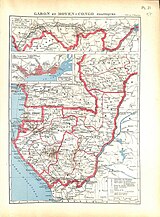
Central African Republic–Republic of the Congo border

The Central African Republic–Republic of the Congo border is 487 km (303 mi) in length and runs from the tripoint with Cameroon in the west to the tripoint with the Democratic Republic of the Congo in the east.[1]
Description
The border starts in the west at the tripoint with Cameroon in the Sangha River, and then proceeds via a straight line overland towards the northwest.[2] It then proceeds via a series of irregular lines to the north, generally following the Sangha-Ubangi drainage divide, before turning a broad arc to the east, and then continuing in that direction broadly following the Ibenga-Bodingué drainage divide.[2] It then follows the Lobaye-Gouga drainage divide up to the Democratic Republic of the Congo tripoint at the confluence of the Gouga and Ubangi.[2]
History
The border first emerged during the
After the
See also
References
- ^ CIA World Factbook - CAR, retrieved 18 December 2019
- ^ a b c d Brownlie, Ian (1979). African Boundaries: A Legal and Diplomatic Encyclopedia. Institute for International Affairs, Hurst and Co. pp. 593–96.
- ^ a b c d e f g h International Boundary Study No. 145 – Central African Republic-Republic of the Congo Boundary (PDF), 17 July 1974, retrieved 20 December 2019
- ISBN 0-313-30328-2.


