
Chaco Culture National Historical Park
| Chaco Culture National Historical Park | |
|---|---|
 Great kiva of Chetro Ketl | |
 Park map | |
| Location | San Juan County and McKinley County, New Mexico, US |
| Coordinates | 36°04′N 107°58′W / 36.06°N 107.96°W |
| Area | 33,977.8 acres (137.50 km2) |
| Architectural style(s) | Ancient Puebloan |
| Visitors | 41,594 (in 2022) |
| Governing body | National Park Service |
| Website | Chaco Culture National Historical Park |
| Official name | Chaco Culture |
| Type | Cultural |
| Criteria | iii |
| Designated | 1987 (11th session) |
| Reference no. | 353 |
| Region | Europe and North America |
| Type | historic district |
| Designated | October 15, 1966 |
| Reference no. | 66000895[1] |
Former U.S. National Monument | |
| Designated | March 11, 1907 |
| Delisted | December 19, 1980 |
| Designated by | President Theodore Roosevelt |
U.S. National Historical Park | |
| Designated | December 19, 1980 |
| Designated | May 21, 1971 |
| Reference no. | 57 |
 Location of Chaco Culture National Historical Park in New Mexico  Chaco Culture National Historical Park (the United States) | |
Chaco Culture National Historical Park is a United States
Between AD 900 and 1150, Chaco Canyon was a major center of culture for the Ancestral Puebloans.[a] Chacoans quarried sandstone blocks and hauled timber from great distances, assembling fifteen major complexes that remained the largest buildings ever built in North America until the 19th century.[2][4] Evidence of archaeoastronomy at Chaco has been proposed, with the "Sun Dagger" petroglyph at Fajada Butte a popular example. Many Chacoan buildings may have been aligned to capture the solar and lunar cycles,[5] requiring generations of astronomical observations and centuries of skillfully coordinated construction.[6] Climate change is thought to have led to the emigration of Chacoans and the eventual abandonment of the canyon, beginning with a fifty-year drought commencing in 1130.[7]
A UNESCO
The park is on the
Geography
Chaco Canyon lies within the
The
Geology

After the
The Chaco Wash flowed across the upper strata of what is now the 400-foot (120 m)
Climate

An arid region of high
Chaco endures remarkable climatic extremes: temperatures range between −38 and 102 °F (−39 and 39 °C),[18] and may swing 60 °F (33 °C) in a single day.[8] The region averages fewer than 150 frost-free days per year, and the local climate swings wildly from years of plentiful rainfall to prolonged drought.[19] The heavy influence of the El Niño–Southern Oscillation contributes to the canyon's fickle climate.[18]
Flora and fauna
Chacoan flora typifies that of North American high deserts:
Among Chacoan mammals are the plentiful
History
Archaic–Early Basketmakers
The first people in the San Juan Basin were hunter-gatherers: the Archaic–Early Basketmaker people. These small bands descended from nomadic Clovis big-game hunters who arrived in the Southwest around 10,000 BC.[22] More than 70 campsites from this period, carbon-dated to the period 7000–1500 BC and mostly consisting of stone chips and other leavings, were found in Atlatl Cave and elsewhere within Chaco Canyon, with at least one of the sites located on the canyon floor near an exposed arroyo. The Archaic–Early Basketmaker people were nomadic or semi-nomadic hunter-gatherers who over time began making baskets to store gathered plants. By the end of the period, some people cultivated food. Excavation of their campsites and rock shelters has revealed that they made tools, gathered wild plants, and killed and processed game. Slab-lined storage cists indicate a change from a wholly nomadic lifestyle.[8]
Ancestral Puebloans

By 900 BC, Archaic people lived at Atlatl Cave and similar sites.[23] They left little evidence of their presence in Chaco Canyon. By AD 490, their descendants, of the Late Basketmaker II Era, farmed lands around Shabik'eshchee Village and other pit-house settlements at Chaco.[citation needed]
A small population of
The cohesive Chacoan system began unravelling around 1140, perhaps triggered by an extreme fifty-year drought that began in 1130;
Some scholars suggest that violence and warfare, perhaps involving cannibalism, impelled the evacuations. Hints of such include dismembered bodies—dating from Chacoan times—found at two sites within the central canyon.
Athabaskan succession
![Large square map of northwestern New Mexico and neighboring parts of, clockwise from left, western Arizona, southeastern Utah, and southwestern Colorado. The map region has a green and blocky rectangular-crescent area at its center labeled "Chaco Culture National Historical Park". Radiating from the green region are seven segmented gold lines: "[p]rehistoric roads", each several dozen kilometers in length when measured according to the map scale factor. Roughly seventy red dots mark the location of "Great House[s]"; they are widely spread across the map, many of them far from the green area, near the extremes of the map, more than one hundred kilometers from the green area. Two proceed roughly south, one southwest, one northwest, one straight north, and the last to the southeast. Yellow dots mark the location of modern settlements: "Shiprock", "Cortez", "Farmington", and "Aztec" to the northwest and north; "Nageezi", "Cuba", and "Pueblo Pintado" to the northeast and east; "Grants", "Crownpoint", and "Gallup" to the south and southwest. They are connected by a network of gray lines marking various interstate and state highways. A fan of thin blue lines along the northern margins of the map depict the San Juan River and its communicants.](/File:Prehistoric-Roads.jpg)
Excavation and protection
The first documented trip through Chaco Canyon was an 1823 expedition led by New Mexican governor José Antonio Vizcarra when the area was under Mexican rule. He noted several large ruins in the canyon.[40] The American trader Josiah Gregg wrote about the ruins of Chaco Canyon, referring in 1832 to Pueblo Bonito as "built of fine-grit sandstone". In 1849, a U.S. Army detachment passed through and surveyed the ruins, following United States acquisition of the Southwest with its victory in the Mexican War in 1848.[41] The canyon was so remote, however, that it was scarcely visited over the next 50 years. After brief reconnaissance work by Smithsonian scholars in the 1870s, formal archaeological work began in 1896 when a party from the American Museum of Natural History based in New York City—the Hyde Exploring Expedition—began excavating Pueblo Bonito. Spending five summers in the region, they sent more than 60,000 artifacts back to New York and operated a series of trading posts in the area.[42]
In 1901
The next year,

In 1920, the
In 1949, the University of New Mexico deeded over adjoining lands to form an expanded Chaco Canyon National Monument. In return, the university maintained scientific research rights to the area. By 1959, the National Park Service had constructed a park visitor center, staff housing, and campgrounds. As a historic property of the National Park Service, the National Monument was listed on the National Register of Historic Places on October 15, 1966. In 1971, researchers Robert Lister and James Judge established the "Chaco Center", a division for cultural research that functioned as a joint project between the University of New Mexico and the National Park Service. A number of multi-disciplinary research projects, archaeological surveys, and limited excavations began during this time. The Chaco Center extensively surveyed the Chacoan roads, well-constructed and strongly reinforced thoroughfares radiating from the central canyon.[49]
The richness of the cultural remains at park sites led to the expansion of the small National Monument into the Chaco Culture National Historical Park on December 19, 1980, when an additional 13,000 acres (5,300 ha) were added to the protected area. In 1987, the park was designated a World Heritage Site by UNESCO. To safeguard Chacoan sites on adjacent Bureau of Land Management and Navajo Nation lands, the Park Service developed the multi-agency Chaco Culture Archaeological Protection Site program. These initiatives have identified more than 2,400 archeological sites within the current park's boundaries; only a small percentage of these have been excavated.[49][50]
Management


Chaco Culture National Historical Park is managed by the National Park Service, a federal agency within the Department of the Interior; neighboring federal lands hosting Chacoan roads are controlled by the Bureau of Land Management. In the 2002–03 fiscal year, the park's total annual operating budget was $1.434 million.[51] The park has a visitor center featuring the "Chaco Collection Museum", which has not been open to the public since being completed in 2017,[52][53] an information desk, a theater, a book store, an observatory,[54][55] and a gift shop. Visits to the Chaco Collection at the Hibben Center on the University of New Mexico Albuquerque campus can be arranged by appointment.[56] Prior to the 1980s, archeological excavations within current park boundaries were intensive: compound walls were dismantled or demolished, and thousands of artifacts were extracted. Starting in 1981, a new approach, informed by traditional Hopi and Pueblo beliefs, stopped such intrusions. Remote sensing, anthropological study of Indian oral traditions, and dendrochronology[dubious ]—which left Chacoan relics undisturbed—were pursued. In this vein, the "Chaco American Indian Consultation Committee" was established in 1991 to give Navajo, Hopi, Pueblo, and other Indian representatives a voice in park oversight.[8]
Current park policy mandates partial restoration of excavated sites. "Backfilling", or re-burying excavated sites with sand, is one such means.[8] Other measures attempt to safeguard the area's ancient ambience and mystique, such as the "Chaco Night Sky Program", which seeks to eliminate the effect of light pollution on the park's acclaimed night skies;[57] under the program, some 14,000 visitors make use of the Chaco Observatory (inaugurated in 1998), park telescopes, and astronomy-related programs.[8] The park was named a Gold-tier Dark Sky Park by the International Dark-Sky Association in 2013.[58] Chacoan relics outside the current park's boundaries have been threatened by development: an example was the proposed competitive leasing of federal lands in the San Juan Basin for surface coal mining beginning in 1983. As ample coal deposits abut the park, this strip mining threatened the web of ancient Chacoan roads. The year-long "Chaco Roads Project" thus documented the roads, which were later protected from mining.[59]
As archaeological significance extends beyond the park's boundaries, the United States Department of the Interior intends to withdraw a 10-mile buffer zone around the park from development.[60]
Sites
The Chacoans built their complexes along a 9-mile (14 km) stretch of canyon floor, with the walls of some structures aligned cardinally and others aligned with the 18.6-year cycle of minimum and maximum moonrise and moonset.[6]
Central canyon

The central portion of the canyon contains the largest Chacoan complexes. The most studied is Pueblo Bonito. Covering almost 2 acres (0.81 ha) and comprising at least 650 rooms, it is the largest great house; in parts of the complex, the structure was four stories high. The builders' use of core-and-veneer architecture and multi-story construction necessitated massive masonry walls up to 3 ft (91 cm) thick. Pueblo Bonito is divided into two sections by a wall precisely aligned to run north–south, bisecting the central plaza. A great kiva was placed on either side of the wall, creating a symmetrical pattern common to many Chacoan great houses. The scale of the complex, upon completion, rivaled that of the Colosseum.[6] Nearby is Pueblo del Arroyo, which was founded between AD 1050 and 1075 and completed in the early 12th century; it sits at a drainage outlet known as South Gap.[citation needed]


Casa Rinconada, isolated from the other central sites, sits to the south side of Chaco Wash, adjacent to a Chacoan road leading to a set of steep stairs that reached the top of Chacra Mesa. Its sole kiva stands alone, with no residential or support structures whatsoever; it did once have a 39 ft (12 m) passageway leading from the underground kiva to several above-ground levels. Chetro Ketl, located near Pueblo Bonito, bears the typical 'D'-shape of many other central complexes. Begun between 1020 and 1050, its 450–550 rooms shared one great kiva. Experts estimate that it took 29,135 man-hours to erect Chetro Ketl alone; Hewett estimated that it took the wood of 5,000 trees and 50 million stone blocks.[61]

Outliers
Another cluster of great houses lies in Chaco's northern reaches; among the largest is


Deeper in the canyon,
Ruins
Great houses

Immense complexes known as "great houses" embodied worship at Chaco.[citation needed] The Chacoans used masonry techniques unique for their time, and their building constructions lasted decades and even centuries. As architectural forms evolved and centuries passed, the houses kept several core traits. Most apparent is their sheer bulk; complexes averaged more than 200 rooms each, and some enclosed up to 700 rooms.[6] Individual rooms were substantial in size, with higher ceilings than Ancestral Puebloan works of preceding periods. They were well-planned: vast sections or wings erected were finished in a single stage, rather than in increments. Houses generally faced the south, and plaza areas were almost always girt with edifices of sealed-off rooms or high walls. Houses often stood four or five stories tall, with single-story rooms facing the plaza; room blocks were terraced to allow the tallest sections to compose the pueblo's rear edifice. Rooms were often organized into suites, with front rooms larger than rear, interior, and storage rooms or areas.[citation needed]
Ceremonial structures known as kivas were built in proportion to the number of rooms in a pueblo. One small kiva was built for roughly every 29 rooms. Nine complexes each hosted an oversized great kiva, each up to 63 ft (19 m) in diameter. T-shaped doorways and stone lintels marked all Chacoan kivas. Although simple and compound walls were often used, great houses were primarily constructed of core-and-veneer walls: two parallel load-bearing walls comprising dressed, flat sandstone blocks bound in clay mortar were erected. Gaps between walls were packed with rubble, forming the wall's core. Walls were then covered in a veneer of small sandstone pieces, which were pressed into a layer of binding mud.[72] These surfacing stones were often placed in distinctive patterns. The Chacoan structures altogether required the wood of 200,000 coniferous trees, mostly hauled—on foot—from mountain ranges up to 70 miles (110 km) away.[9][73][74]
Uses

The meticulously designed buildings composing the larger Chacoan complexes did not emerge until around AD 1030. The Chacoans melded pre-planned architectural designs, astronomical alignments, geometry, landscaping, and engineering into ancient urban centers of unique public architecture. Researchers have concluded that the complex may have had a relatively small residential population, with larger groups assembling only temporarily for annual ceremonies.[9] Smaller sites, apparently more residential in character, are scattered near the great houses in and around Chaco. The canyon itself runs along one of the lunar alignment lines, suggesting the location was originally chosen for its astronomical significance. If nothing else, this allowed alignment with several other key structures in the canyon.[6]

Turquoise was very important to the people of Chaco. Approximately 200,000 pieces of turquoise have been excavated from the ruins at Chaco Canyon,[76] and workshops for local manufacture of turquoise beads have been found. The turquoise was used locally for grave goods, burials and ceremonial offerings.[77] More than 15,000 turquoise beads and pendants accompanied two burials at Pueblo Bonito.[75] Some researchers found data supporting existence of widespread trade of the turquoise.[78][79]
Around this time, the extended Ancestral Puebloan (Anasazi) community experienced a population and construction boom. Throughout the 10th century, Chacoan building techniques spread from the canyon to neighboring regions.[80] By AD 1115 at least 70 outlying pueblos of Chacoan provenance had been built within the 25,000 sq mi (65,000 km2) composing the San Juan Basin. Experts speculate the function of these compounds, some large enough to be considered great houses in their own right. Some suggest they may have been more than agricultural communities, perhaps functioning as trading posts or ceremonial sites.[81]
Thirty such outliers spread across 65,000 sq mi (170,000 km2) are connected to the central canyon and to one another by an enigmatic web of six Chacoan road systems. Extending up to 60 mi (97 km) in generally straight routes, they appear to have been extensively surveyed and engineered.
Archaeoastronomy
Sun Dagger

Two whorl-shaped etchings near the top of Fajada Butte compose what is called the "Sun Dagger" petroglyph that is tucked behind the eponymous rock panels of the "Three-Slab Site". They are symbolically focal.[clarify][86][9]
It consists of two spirals—one principal and one ancillary. The latter left-hand spiral captured both spring and fall equinoxes; its artifice was revealed by a descending spear of light, filtered through the slabs, that shone upon it and split it in two. The former and larger whorl to its right was lit by the titular "sun dagger", which bisected it through another interplay of slab and sunlight. Light struck it, brilliantly, as the summer sun attains its solstice midday peak. The Chacoans were said to be marking, as Anna Sofaer, artist, "Sun Dagger" discoverer, and leading proponent puts it, "the middle of time". Each turn of the 9.25-turn large spiral was found to mark one year in the 18.6-year "lunar excursion cycle" of the rising mid-winter full moon. This record is kept by a slab-cast lunar shadow whose edge strikes in succession each ring.[87] As the full "minimum moon" closest to the winter solstice rises, the shadow's edge precisely strikes the center of the larger spiral; it steps outward year by year, ring by ring, until it strikes the outermost edge of it during the full "maximum moon", again in mid-winter.[9]
Fajada Butte bears five other petroglyphs—including a carving of a "rattlesnake", other spirals, and a rectangle—that are conspicuously lit by contrasts between sunbeams and shadows during equinoxes or solstices.[88] Public access to the butte was curtailed when, in 1989, erosion from modern foot traffic was found to be responsible for one of the three screening slabs at the "Sun Dagger" site shifting out of its ancient position; the assemblage of stones has thus lost some of its former spatial and temporal precision as a solar and lunar calendar. In 1990 the screens were stabilized and placed under observation, but the wayward slab was not moved back into its original orientation.[89]
Alignments

Some parties have advanced the theory that at least 12 of the 14 principal Chacoan complexes were sited and aligned in coordination, and that each was oriented along axes that mirrored the passing of the Sun and Moon at visually pivotal times. The first great house known to evince fastidious proportioning and alignment was Casa Rinconada: the twinned T-shaped portals of its 10 m (33 ft) radius great kiva were north–south collinear, and axes joining opposing windows passed within 10 cm (4 in) of its center.[86] The great houses of Pueblo Bonito and Chetro Ketl were found by the "Solstice Project" and the U.S. National Geodetic Survey to be sited along a precisely east–west line, an axis that captures the passage of the equinox sun. The lines perpendicularly bisecting their principal walls are aligned north–south, implying a possible intent to mirror the equinox midday. Pueblo Alto and Tsin Kletsin are also north–south aligned. These two axes form an inverted cross when viewed from above; its northbound reach is extended another 35 mi (56 km) past Pueblo Alto by the ramrod-straight Great North Road, a pilgrimage route that modern-day Pueblo Indians believe to be an allusion to myths surrounding their arrival from the distant north.[9]

Two shared-latitude but diametrically opposed complexes,
Speculation regarding the reasons for the alignments have been offered:
As these people would view the heavens... there was an order of things up there. What you had here... contrasted to that. Some years it was too dry, too hot... too windy, too cold. If there was a way to transfer the orderly nature of the cosmos down onto what seems to be chaos that exists here, then you begin to then integrate at this place both heaven and earth. And this would be... the center place.
— Phillip Tuwaletstiwa, U.S. National Geodetic Survey, The Mystery of Chaco Canyon[9]
Gallery
-
 Chaco Prehistoric Stairway, Chaco National Cultural Historic Park, New Mexico
 -
 Chaco Kiva Detail, Chaco Culture National Historic Park, New Mexico
 -
 Chaco interior wall, showing log and stone construction, Chaco Cultural Historic Park, New Mexico
 -
 Early Graffiti, Chaco Culture National Historic Park, New Mexico
 -
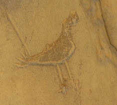 Chaco Pictograph, Chaco Culture Historical Park, New Mexico


See also
- Oasisamerica
- Ah-Shi-Sle-Pah Wilderness Study Area
- Bisti/De-Na-Zin Wilderness
- Dune Dam
- Kasha-Katuwe Tent Rocks National Monument
- Bryce Canyon National Park
- List of archaeoastronomical sites by country
- List of the oldest buildings in New Mexico
- National Register of Historic Places listings in McKinley County, New Mexico
Notes
- ^ The question of how to date Chacoan ruins was tackled by A. E. Douglass, the earliest practitioner of dendrochronology; consequently, the developmental chronology of Chaco Canyon's ruins is now the world's most extensively researched and accurate.[3]
- ^ The Crab Nebula, now a supernova remnant in the constellation of Taurus, was the result of the event in question; the original supernova attained peak brilliance on the date that the Chacoans presumably sighted it.[65]
References
- ^ "National Register Information System". National Register of Historic Places. National Park Service. July 9, 2010.
- ^ a b Strutin 1994, p. 6.
- ^ Fagan 2005, pp. 50–55.
- ^ a b Fagan 2005, p. 35.
- ^ Fagan 1998, pp. 177–182.
- ^ a b c d e f Sofaer 1997.
- ^ a b Fagan 2005, p. 198.
- ^ a b c d e f g National Park Service.
- ^ a b c d e f g h Sofaer & Dibble 1999.
- ^ "Foundation Document Chaco Canyon Culture National Park" (PDF). US National Park Service. August 2015. p. 8 Ongoing Cultural Connections.
- ^ a b c Trail of the Ancients. Archived August 21, 2014, at the Wayback Machine New Mexico Tourism Department. Retrieved August 14, 2014.
- ^ Fagan 2005, p. 5.
- ^ Fagan 2005, p. 43.
- ^ a b Hopkins 2003, p. 240.
- ^ a b Fagan 2005, p. 47.
- ^ Fagan 2005, pp. 46–47.
- ^ Fagan 2005, p. 44.
- ^ a b Fagan 2005, p. 45.
- ^ Frazier 2005, p. 181.
- ^ Fagan 2005, p. 222.
- ^ Fagan 1998, p. 177.
- ^ Stuart 2000, pp. 14–17.
- ^ Stuart 2000, p. 43.
- ^ Fagan 2005, pp. 18–19.
- ^ Noble 2000, p. 120.
- ^ Fagan 2005, p. 20.
- PMID 28221340.
- ^ Fagan 2005, p. 126.
- ^ Fagan 2005, pp. 55–57.
- ^ Diamond 2005, pp. 136–156.
- ^ Noble 1984, p. 11.
- ^ Noble 1984, pp. 57–58.
- ^ English et al. 2001.
- ^ LeBlanc 1999, p. 166.
- ^ LeBlanc 1999, p. 180.
- ^ a b Strutin 1994, p. 57.
- ISBN 978-0521386739.
- ^ Strutin 1994, p. 60.
- ^ Strutin 1994, pp. 57–59.
- ^ Reed 2004, p. 16.
- ^ Brugge, Hayes & Judge 1988, p. 4.
- ^ Strutin 1994, pp. 12–17.
- ^ Brugge, Hayes & Judge 1988, p. 7.
- ^ Fagan 2005, p. 32.
- ^ Strutin 1994, pp. 18–19.
- ^ a b Fagan 2005, p. 165.
- ^ Fagan 2005, p. 33.
- ^ a b Elliott 1995.
- ^ a b Strutin 1994, p. 32.
- ^ a b Fagan 2005, p. 6.
- ^ National Park Service 2005.
- ^ Povolny, Bonnie (January 10, 2018). "Chaco Canyon Exhibit on Indefinite Hold". Cultural Property News. Archived from the original on September 24, 2023. Retrieved April 19, 2023.
- ^ Barker, Larry (July 24, 2019). "Chaco Canyon: $3,000,000 Government Project Bungled". KRQE News 13. Archived from the original on January 17, 2024. Retrieved April 19, 2023.
- ^ "Find Epic Stargazing at 'New Mexico's Machu Picchu'". National Geographic. March 25, 2019. Archived from the original on February 19, 2021. Retrieved April 19, 2023.
- ^ "Chaco Night Sky Program". National Park Service. Archived from the original on January 17, 2024. Retrieved April 19, 2023.
- ^ "Collections - Chaco Culture National Historical Park (U.S. National Park Service)". www.nps.gov. Archived from the original on January 17, 2024. Retrieved April 19, 2023.
- ^ "Chaco Culture National Historical Park International Dark Sky Park Application" (PDF). National Park Service. July 2013. Archived from the original (PDF) on January 31, 2015. Retrieved January 9, 2015.
- ^ "New Mexican Skies Protected with Dark Sky Park Designation (press release)" (PDF). International Dark-Sky Association. August 28, 2013. Archived from the original (PDF) on January 31, 2015. Retrieved January 9, 2015.
- ^ Frazier 2005, pp. 120–121.
- ^ Bryan, Susan Montoya (November 16, 2021). "Chaco Canyon gets temporary protections as officials consider 20-year development ban". USA TODAY. Archived from the original on January 15, 2022. Retrieved January 10, 2022.
- ^ Strutin 1994, p. 26.
- ^ Fagan 2005, p. 11.
- ^ Fagan 2005, pp. 10–11.
- ^ Fagan 2005, p. 21.
- ^ Kelley & Milone 2004, p. 413.
- ^ a b Fagan 2005, p. 26.
- ^ Fagan 2005, p. 98.
- ^ Frazier 2005, p. 101.
- ^ Fagan 2005, pp. 6–7.
- ^ Fagan 2005, p. 208.
- ^ Casamero Pueblo. Archived 2014-08-19 at the Wayback Machine Bureau of Land Management. Retrieved August 15, 2014.
- ^ Fagan 2005, pp. 119–121.
- ^ Reynolds et al. 2005, p. 1062.
- ^ Reynolds et al. 2005, p. 1073.
- ^ a b Chaco technology Archived 2010-07-06 at the Wayback Machine at NPS
- ^ The Turquoise Trail, by Eric A. Powell (abstract) Archived 2013-12-19 at the Wayback Machine, Archaeology Magazine, Volume 58 Number 1, January/February 2005
- S2CID 161192386.
- ^ Castro, Joseph (April 10, 2014). "Massive Turquoise Trade Network of Ancient Pueblos Revealed". Scientific American. Archived from the original on April 19, 2023. Retrieved April 19, 2023.
- .
- ^ Fagan 2005, p. 204.
- ^ Fagan 2005, pp. 202–208.
- ^ Fagan 1998, p. 178.
- ^ Noble 1984, pp. 52–53.
- ^ Strutin 1994, p. 35.
- ^ Chaco: 1054 Supernova Petrograph Archived 2013-12-19 at the Wayback Machine at National Center for Atmospheric Research
- ^ a b Magli 2009, pp. 137–139.
- ^ Frazier 2005, p. 198.
- ^ Frazier 2005, pp. 198–199.
- ^ Frazier 2005, p. 221.
Bibliography
- English, N. B.; Betancourt, J.; Dean, J. S.; Quade, J. (2001), "Strontium isotopes reveal distant sources of architectural timber in Chaco Canyon, New Mexico", Proceedings of the National Academy of Sciences, 98 (21): 11891–96, PMID 11572943
- Brugge, D. M.; Hayes, A.; Judge, W. J. (1988), Archeological Surveys of Chaco Canyon, New Mexico, University of New Mexico Press (published February 1988), ISBN 978-0826310293
- ISBN 978-0670033379
- Elliott, M. (1995), Great Excavations: Tales of Early Southwestern Archaeology, 1888–1939 (1st ed.), School of American Research Press (published August 15, 1995), ISBN 978-0933452435
- ISBN 978-0195170436
- ISBN 978-0738201412
- Frazier, K. (2005), People of Chaco: A Canyon and Its Culture, Norton, ISBN 978-0393318258
- Hopkins, R. L. (2003), Hiking the Southwest's Geology: Four Corners Region, Mountaineers Books (published January 15, 2003), ISBN 978-0898868562
- Kelley, D. H.; Milone, E. F. (2004), Exploring Ancient Skies: An Encyclopedic Survey of Archaeoastronomy (1st ed.), Springer (published November 19, 2004), ISBN 978-0387953106
- LeBlanc, S. A. (1999), Prehistoric Warfare in the American Southwest (1st ed.), Salt Lake City: University of Utah Press (published February 9, 1999), ISBN 978-0874805819
- Magli, Giulio (2009), Mysteries and Discoveries of Archaeoastronomy: From Giza to Easter Island (1st ed.), Springer (published April 28, 2009), ISBN 978-0387765648
- Noble, David Grant, ed. (1984), New Light on Chaco Canyon (1st ed.), School of American Research Press (published August 1984), ISBN 978-0933452107
- Noble, David Grant (2000), Ancient Ruins of the Southwest: An Archaeological Guide, Cooper Square Publishing (published January 1, 2000), ISBN 978-0873587242
- Reed, Paul F. (2004). The Puebloan Society of Chaco Canyon. Greenwood Publishing Group. ISBN 978-0-313-32720-9. Archivedfrom the original on April 20, 2014. Retrieved July 15, 2012.
- Reynolds, A.; Betancourt, J.; Quade, J.; Patchett, P. J.; Dean, J. S.; Stein, J. (2005), "87Sr/86Sr Sourcing of Ponderosa Pine Used in Anasazi Great House Construction at Chaco Canyon, New Mexico" (PDF), Journal of Archaeological Science, 32 (7): 1061–75, doi:10.1016/j.jas.2005.01.016, archived from the original(PDF) on March 26, 2009, retrieved August 21, 2009
- Sofaer, A. (1997), The Primary Architecture of the Chacoan Culture: A Cosmological Expression, University of New Mexico Press, archived from the original on July 23, 2009, retrieved August 21, 2009
- Sofaer, A.; Dibble, M. (1999), "The Mystery of Chaco Canyon", The Solstice Project, Bullfrog Films, retrieved June 15, 2011
- Strutin, M. (1994), Chaco: A Cultural Legacy, Southwest Parks and Monuments Association (published June 1994), ISBN 978-1877856457,
photography by George H. H. Huey.
- Stuart, D. E. (2000), Anasazi America, University of New Mexico Press (published May 1, 2000), ISBN 978-0826321794,
research assistance by Susan Moczygemba-McKinsey.
Sources
- United States World Heritage Periodic Report: Chaco Culture National Historical Park (Section II) (PDF), National Park Service, 2005, archived (PDF) from the original on May 30, 2009, retrieved November 23, 2009
- Chaco Culture National Historical Park, National Park Service, 2007, archived from the original on July 30, 2009, retrieved November 23, 2009
- "Chaco Culture National Historical Park", National Register of Historic Places, Thoreau, New Mexico: National Park Service (published October 15, 1966), 1966, #148900
Further reading
- Bower, Bruce (May 17, 2017). "Chaco Canyon's ancient civilization continues to puzzle". Science News. Archived from the original on July 9, 2017. Retrieved May 24, 2017.
- OCLC 912500940,
drawings by Amy Elizabeth Grey.
External links
Official and academic
- Chaco Culture National Historical Park, National Park Service
- "Chaco Research Archive", University of Virginia
Imagery and travel
- "Chaco Culture National Historical Park", A National Register of Historic Places Travel Itinerary: American Southwest, National Park Service
Other
- "Ancient Observatories: Chaco Canyon", Exploratorium, archived from the original on June 30, 2017, retrieved February 11, 2006
- "The Solstice Project", Non-profit studying, documenting, and preserving the Sun Dagger, archived from the original on June 11, 2017, retrieved January 6, 2006
- The Sun Dagger Explorer, The Solstice Project, archived from the original on August 11, 2011, retrieved September 17, 2011
- "Chaco Canyon National Historical Park", Traditions of the Sun, University of California, archived from the original on July 28, 2017, retrieved August 21, 2009