
Chaffee County, Colorado
Chaffee County | ||
|---|---|---|
FIPS code 08015 | | |
| GNIS feature ID | 198123 | |
| Website | www.chaffeecounty.org | |

Chaffee County is a county located in the
History
Chaffee County has a confusing origin. Between February 8 and 10, 1879,
Geography
According to the
Adjacent counties
- Lake County - north
- Park County - northeast
- Fremont County - southeast
- Saguache County - south
- Gunnison County - west
- Pitkin County - northwest
Major highways
- U.S. Highway 24
- U.S. Highway 50
- U.S. Highway 285
 State Highway 291
 State Highway 306
National protected areas
- Browns Canyon National Monument
- Buffalo Peaks Wilderness
- Collegiate Peaks Wilderness
- San Isabel National Forest
Recreation area
Trails
- American Discovery Trail
- Colorado Trail
- Continental Divide National Scenic Trail
Bicycle routes
- Great Parks Bicycle Route
- Western Express Bicycle Route
Demographics
| Census | Pop. | Note | %± |
|---|---|---|---|
| 1880 | 6,512 | — | |
| 1890 | 6,612 | 1.5% | |
| 1900 | 7,085 | 7.2% | |
| 1910 | 7,622 | 7.6% | |
| 1920 | 7,753 | 1.7% | |
| 1930 | 8,126 | 4.8% | |
| 1940 | 8,109 | −0.2% | |
| 1950 | 7,168 | −11.6% | |
| 1960 | 8,298 | 15.8% | |
| 1970 | 10,162 | 22.5% | |
| 1980 | 13,227 | 30.2% | |
| 1990 | 12,684 | −4.1% | |
| 2000 | 16,242 | 28.1% | |
| 2010 | 17,809 | 9.6% | |
| 2020 | 19,476 | 9.4% | |
| 2023 (est.) | 20,617 | [6] | 5.9% |
| U.S. Decennial Census[7] 1790-1960[8] 1900-1990[9] 1990-2000[10] 2010-2020[2] | |||
At the
The age distribution was 19.70% under the age of 18, 7.70% from 18 to 24, 28.00% from 25 to 44, 27.50% from 45 to 64, and 17.00% 65 or older. The median age was 42 years. For every 100 females, there were 113.60 males. For every 100 females age 18 and over, there were 116.20 males.
The median household income was $34,368 and the median family income was $42,043. Males had a median income of $30,770 versus $22,219 for females. The per capita income for the county was $19,430. About 7.40% of families and 11.70% of the population were below the
Chaffee County is also home to a source of water that Arrowhead water uses for some water bottles. The source is Ruby Mountain Springs.
Politics
Chaffee County is a bellwether county, having supported the winner of 8 out of the last 11 presidential elections. The most recent election where Chaffee County supported the presidential loser was in 2008, when John McCain won the county despite Barack Obama winning decisively nationally and statewide.
| Year | Republican | Democratic | Third party | |||
|---|---|---|---|---|---|---|
| No. | % | No. | % | No. | % | |
| 2020 | 6,222 | 45.36% | 7,160 | 52.19% | 336 | 2.45% |
| 2016 | 5,391 | 47.92% | 4,888 | 43.45% | 971 | 8.63% |
| 2012 | 5,070 | 48.46% | 5,086 | 48.61% | 306 | 2.92% |
| 2008 | 4,873 | 49.12% | 4,862 | 49.01% | 186 | 1.87% |
| 2004 | 4,875 | 55.59% | 3,766 | 42.94% | 129 | 1.47% |
| 2000 | 4,300 | 56.50% | 2,768 | 36.37% | 542 | 7.12% |
| 1996 | 3,052 | 46.85% | 2,768 | 42.49% | 695 | 10.67% |
| 1992 | 2,419 | 38.51% | 2,284 | 36.36% | 1,579 | 25.14% |
| 1988 | 3,080 | 53.90% | 2,548 | 44.59% | 86 | 1.51% |
| 1984 | 3,680 | 66.31% | 1,779 | 32.05% | 91 | 1.64% |
| 1980 | 3,327 | 60.73% | 1,583 | 28.90% | 568 | 10.37% |
| 1976 | 2,925 | 56.66% | 2,064 | 39.98% | 173 | 3.35% |
| 1972 | 2,859 | 66.63% | 1,354 | 31.55% | 78 | 1.82% |
| 1968 | 2,121 | 51.07% | 1,667 | 40.14% | 365 | 8.79% |
| 1964 | 1,476 | 37.36% | 2,463 | 62.34% | 12 | 0.30% |
| 1960 | 2,094 | 52.14% | 1,918 | 47.76% | 4 | 0.10% |
| 1956 | 2,284 | 63.67% | 1,303 | 36.33% | 0 | 0.00% |
| 1952 | 2,171 | 56.70% | 1,643 | 42.91% | 15 | 0.39% |
| 1948 | 2,065 | 57.68% | 1,476 | 41.23% | 39 | 1.09% |
| 1944 | 1,675 | 48.83% | 1,731 | 50.47% | 24 | 0.70% |
| 1940 | 1,933 | 46.91% | 2,153 | 52.24% | 35 | 0.85% |
| 1936 | 1,069 | 29.18% | 2,447 | 66.78% | 148 | 4.04% |
| 1932 | 1,061 | 29.24% | 2,393 | 65.96% | 174 | 4.80% |
| 1928 | 1,880 | 59.49% | 1,230 | 38.92% | 50 | 1.58% |
| 1924 | 1,336 | 43.40% | 612 | 19.88% | 1,130 | 36.71% |
| 1920 | 1,501 | 52.91% | 1,233 | 43.46% | 103 | 3.63% |
| 1916 | 864 | 24.59% | 2,546 | 72.47% | 103 | 2.93% |
| 1912 | 723 | 21.30% | 1,641 | 48.34% | 1,031 | 30.37% |
| 1908 | 1,233 | 38.23% | 1,679 | 52.06% | 313 | 9.71% |
| 1904 | 1,611 | 46.90% | 1,601 | 46.61% | 223 | 6.49% |
| 1900 | 1,033 | 34.41% | 1,890 | 62.96% | 79 | 2.63% |
| 1896 | 141 | 5.10% | 2,606 | 94.35% | 15 | 0.54% |
| 1892 | 678 | 40.12% | 0 | 0.00% | 1,012 | 59.88% |
| 1888 | 1,277 | 56.21% | 941 | 41.42% | 54 | 2.38% |
| 1884 | 1,142 | 53.46% | 986 | 46.16% | 8 | 0.37% |
| 1880 | 1,135 | 48.50% | 1,188 | 50.77% | 17 | 0.73% |
Communities


City
Towns
Census-designated places
Unincorporated communities
Ghost towns
See also
- Bibliography of Colorado
- Geography of Colorado
- History of Colorado
- Index of Colorado-related articles
- List of Colorado-related lists
- Outline of Colorado
References
- ^ Mount Harvard
- ^ U.S. Census Bureau. Retrieved September 4, 2021.
- ^ "Find a County". National Association of Counties. Archived from the original on May 31, 2011. Retrieved June 7, 2011.
- ^ Gannett, Henry (1905). The Origin of Certain Place Names in the United States. Govt. Print. Off. pp. 74.
- ^ "US Gazetteer files: 2010, 2000, and 1990". United States Census Bureau. February 12, 2011. Retrieved April 23, 2011.
- ^ "Annual Estimates of the Resident Population for Counties: April 1, 2020 to July 1, 2023". United States Census Bureau. Retrieved March 31, 2024.
- ^ "U.S. Decennial Census". United States Census Bureau. Retrieved June 7, 2014.
- ^ "Historical Census Browser". University of Virginia Library. Archived from the original on June 23, 2018. Retrieved June 7, 2014.
- ^ "Population of Counties by Decennial Census: 1900 to 1990". United States Census Bureau. Retrieved June 7, 2014.
- ^ "Census 2000 PHC-T-4. Ranking Tables for Counties: 1990 and 2000" (PDF). United States Census Bureau. Archived (PDF) from the original on March 27, 2010. Retrieved June 7, 2014.
- ^ "U.S. Census website". United States Census Bureau. Retrieved May 14, 2011.
- ^ Leip, David. "Dave Leip's Atlas of U.S. Presidential Elections". uselectionatlas.org. Retrieved May 26, 2017.
External links
- Cultural, Historical and Archeological Resources
- Chaffee County Clerk of Court
- Chaffee County Government website
- Colorado County Evolution by Don Stanwyck
- Colorado Historical Society
- Geologic Map of the Harvard Lakes 7.5ʹ Quadrangle, Park and Chaffee Counties, Colorado United States Geological Survey
- [1]
Places adjacent to Chaffee County, Colorado | ||||||||||||||||
|---|---|---|---|---|---|---|---|---|---|---|---|---|---|---|---|---|
| ||||||||||||||||
Municipalities and communities of Chaffee County, Colorado, United States | ||
|---|---|---|
| City | 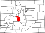 | |
| Towns | ||
| CDPs | ||
| Unincorporated communities | ||
| ||
38°44′N 106°11′W / 38.74°N 106.18°W
| International | |
|---|---|
| National | |