
Changbai Mountains
| Changbai Mountains | ||||||||
|---|---|---|---|---|---|---|---|---|
.jpg) Aerial View of Changbai Mountains | ||||||||
| Highest point | ||||||||
| Peak | Mount Paektu | |||||||
| Elevation | 2,744 m (9,003 ft) | |||||||
| Prominence | 2,593 m (8,507 ft) | |||||||
| Geography | ||||||||
  | ||||||||
| Countries | China and North Korea | |||||||
Chagang. They are also referred to as the Šanggiyan Mountains in the Manchu language, or the Great Paekdu in Korean. Most of its peaks exceed 2,000 m (6,600 ft) in height, with the tallest summit being Paektu Mountain at 2,744 m (9,003 ft), which contains the Heaven Lake, the highest volcanic crater lake in the world at an surface elevation of 2,189.1 m (7,182 ft). The protected area Longwanqun National Forest Park is located within the vicinity of the mountain range.
HistoryManchu Veritable Records The mountain was first recorded in the
| ||||||||
| Korean name | ||||||||
| Chosŏn'gŭl | 장백산맥 | |||||||
| Hancha | 長白山脈 | |||||||
| ||||||||
| Manchu name | ||||||||
| Manchu script | ᡤᠣᠯᠮᡳᠨ ᡧᠠᠩᡤᡳᠶᠠᠨ ᠠᠯᡳᠨ | |||||||
| Romanization | Golmin šanggiyan alin | |||||||
The range represents the mythical birthplace of
The Qing emperor
Geography and climate
The mountains are the source of the Songhua, Tumen, and Yalu Rivers.[10]
The Changbai Mountains are characterized by long, cold winters. Precipitation is low in winter, but higher in the summer and fall, with annual averages reaching as high as 1,400 millimeters (55 in).[11]
Flora and fauna
The vegetation of the mountain slopes is divided into several different zones. At the top, above 2,000 meters (6,562 ft),
There are five known species of plants in the lake on the peak, and some 168 have been counted along its shores. The forest on the Chinese side is ancient and almost unaltered by humans. Birch predominates near the tree line, and pine lower down, mixed with other species. There has been extensive deforestation on the lower slopes on the North Korean side of the mountain.[citation needed]The area is a known habitat for Siberian tigers, bears, wolves, and wild boars.[13] The Ussuri dholes may have been extirpated from the area. Deer in the mountain forests, which cover the mountain up to about 2,000 meters (6,600 ft), are of the Paekdusan roe deer kind. Many wild birds such as black grouse, owls, and woodpecker are known to inhabit the area. The mountain has been identified by BirdLife International as an Important Bird Area (IBA) because it supports a population of scaly-sided mergansers.[14]
Gallery
-
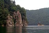 Sanjiaolong Crater Lake in the Longwanqun National Forest Park, Huinan County
 -
 Entrance gate to the forest park
 -
 Painting from the Manchu Veritable Records with the names of Mount Paektu in Manchu, Chinese and Mongolian


See also
- Baekdu Mountain
- Changbai Waterfall
- List of mountains in China
References
- Qisi Piyu and Goguryeoremnants, escaped to the east, crossed Liao River, guarded the northeast part of the Grand Old White Mountain, blocked Oulou River, built walls to protect themselves.)
- Khitan Empire". 《契丹國志》:"長白山在冷山東南千餘里......禽獸皆白。"(English translation: "Changbai Mountain is a thousand miles to the southeast of Cold Mountain...Birds and animals there are all white.")
- ^ "Canonical History Records of the Jurchen Jin Dynasty". 《金史.卷第三十五》:"長白山在興王之地,禮合尊崇,議封爵,建廟宇。""厥惟長白,載我金德,仰止其高,實惟我舊邦之鎮。" (English translation: "Changbai Mountain is in old Jurchen land, highly respectful, suitable for building temples. Only the Changbai Mountain can carry the Jin Dynasty's spirit; It is so high; It is a part of our old land.")
- ^ 愛新覺羅·瀛生《滿語口語音典》
- ISBN 9780520234246.
- ISBN 978-0-7748-1333-4.)
{{cite book}}: CS1 maint: others (link - ISBN 978-0-520-92884-8.
- JSTOR 2719229. Archived from the original on 2020-08-07. Retrieved 2020-11-05.)
{{cite journal}}: CS1 maint: bot: original URL status unknown (link - ^ Yabuli • Ski Holiday • Reviews • Skiing - Snow-Online
- ^ "Changbai Mountains -- Scenic Wonderland". China.org.cn. Retrieved 12 July 2014.
- ^ "Changbai Mountains mixed forests (PA0414)". WildWorld Ecoregion Profile, National Geographic Society. World Wildlife Fund. Archived from the original on 2010-03-08. Retrieved 9 February 2015.
- ^ Liu, Q.J., Takamura, T., Takeuchi, N., Shao, G. (2002). Mapping of boreal vegetation of a temperate mountain in China by multitemporal LANDSAT imagery. International Journal of Remote Sensing 23(17), p. 3388
- ^ Gomà Pinilla, D. (2004). Border Disputes between China and North Korea. China Perspectives 2004(52): 1−9.
- ^ "Mount Paekdu". Important Bird Areas factsheet. BirdLife International. 2013. Retrieved 2013-05-12.
External links
- Baekdu mountain at changbaimountain.com Archived 2018-10-03 at the Wayback Machine [dead link]
| Northwestern | |
|---|---|
Qinghai-Tibet and Southwestern | |
| Northeast | |
| North and East | |
| Central | |
| South | |