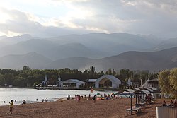
Cholpon-Ata
Cholpon-Ata
Kyrgyz: Чолпон-Ата | |
|---|---|
 Rukh Ordo complex at Cholpon-Ata | |
|
UTC+6 (KGT) |

Cholpon-Ata (
Lake Issyk-Kul in Kyrgyzstan with a population of 14,237 (2021).[1] It is the administrative center of the Issyk-Kul District of Issyk-Kul Region; this district occupies most of the lake's north shore. To the west along highway A363 is Tamchy and to the east, Bosteri
.
The town contains numerous large and small
petroglyphs dating from 800 BC to 1200AD.[2]
The first three World Nomad Games were held in Cholpon-Ata, in 2014, 2016, and 2018.[3]
Population
| Year | Pop. | ±% p.a. |
|---|---|---|
| 1970 | 4,805 | — |
| 1979 | 7,221 | +4.63% |
| 1989 | 9,669 | +2.96% |
| 1999 | 8,851 | −0.88% |
| 2009 | 10,525 | +1.75% |
| 2021 | 14,237 | +2.55% |
| Note: resident population; Sources:[4][1] | ||
Transportation
The city is served by Cholpon-Ata Airport, with flights on one commercial airline.
References
- ^ a b "Population of regions, districts, towns, urban-type settlements, rural communities and villages of Kyrgyz Republic" (XLS) (in Russian). National Statistics Committee of the Kyrgyz Republic. 2021. Archived from the original on 10 November 2021.
- ^ Luc Hermann, Les pétroglyphes de Tcholpon-Ata, Paris, 2010 http://www.bod.fr/index.php?id=1786&objk_id=429117
- ^ "The Ultimate Guide to the World Nomad Games in Kyrgyzstan". 21 January 2020.
- ^ "2009 population and housing census of the Kyrgyz Republic: Issyk-Kul Region" (PDF) (in Russian). National Statistics Committee of the Kyrgyz Republic. 2010. p. 207.
External links
Wikivoyage has a travel guide for Cholpon-Ata.
