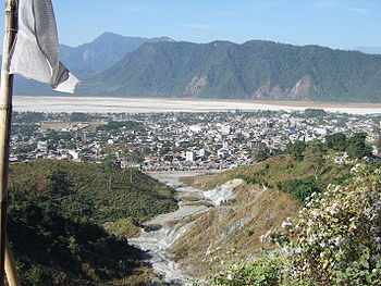
Chukha District
This article needs additional citations for verification. (July 2017) |
27°0′N 89°30′E / 27.000°N 89.500°E
Chukha district
ཆུ་ཁ་རྫོང་ཁག | |
|---|---|
District | |
UTC+6 (BTT) | |
| HDI (2019) | 0.684[1] medium · 4th |
| Website | www |


Chukha District (
GDP
of the country. Also located in Chukha district are some of the country's oldest industrial companies like the Bhutan Carbide Chemical Limited (BCCL) and the Bhutan Boards Products Limited (BBPL).
Languages
In Chukha, the main native languages are Dzongkha, the national language, and Nepali, spoken by the Lhotshampa in the south. The Bhutanese Lhokpu language, spoken by the Lhop minority, is also present in the southwest along the border with Samtse District.
Administrative divisions
Chukha District is divided into eleven village blocks (or gewogs):[3]
Environment
Chukha Dzongkhag covers 1,880 sq. km,
See also
References
- ^ "Sub-national HDI - Area Database - Global Data Lab". hdi.globaldatalab.org. Retrieved 2018-09-13.
- ^ official website of Chhukha Dzongkhag Administration http://www.chhukha.gov.bt/
- Government of Bhutan. 2011. Archived from the original(PDF) on 2011-10-02. Retrieved 2011-07-28.
- ISBN 978-99936-760-0-3.
- ^ "Parks of Bhutan". Bhutan Trust Fund for Environmental Conservation online. Bhutan Trust Fund. Archived from the original on 2011-07-02. Retrieved 2011-03-26.
- ^ "The Organisation". Bhutan Trust Fund for Environmental Conservation online. Bhutan Trust Fund. Archived from the original on 2010-03-29. Retrieved 2011-03-26.
External links
- Official Dzhongkha profile[permanent dead link] with a map of gewogs
- Five year plan (2002–2007)
- Travel diary from Phuentsholing
- Urban problems in Phuentsholing From RAO Online
