
Colby, Kansas
Colby, Kansas | ||
|---|---|---|
FIPS code 20-14650 | | |
| GNIS ID | 485557[1] | |
| Website | cityofcolby.com | |
Colby is a city in and the county seat of Thomas County, Kansas, United States.[1] As of the 2020 census, the population of the city was 5,570.[3][4]
History
In 1882, a
In 1941 the St. Thomas Hospital was built as part of the Works Progress Administration plan to build hospitals. This was one of 130 new hospitals to be built with these funds, it was one of two built in Kansas alone. Within the last couple of years, it was renovated to apartments under the name St. Thomas Historic Residences. [6]
Interstate 70 reached Colby in 1965, stimulating the growth of a local hospitality industry.[7]
Geography
Colby lies on the south side of Prairie Dog Creek, a tributary of the Republican River, in the High Plains region of the Great Plains.[8] A small tributary of the creek flows northeast through the town.[9] Located at the interchange of Interstate 70 and K-25 in northwestern Kansas, Colby is 212 mi (341 km) east-southeast of Denver, 232 mi (373 km) northwest of Wichita, and 347 mi (558 km) west of Kansas City.[8][10]
According to the United States Census Bureau, the city has a total area of 3.38 square miles (8.75 km2), all land.[11]
Climate
Colby has a transitional climate between a
| Climate data for Colby, Kansas, 1991–2020 normals, extremes 1893–present | |||||||||||||
|---|---|---|---|---|---|---|---|---|---|---|---|---|---|
| Month | Jan | Feb | Mar | Apr | May | Jun | Jul | Aug | Sep | Oct | Nov | Dec | Year |
| Record high °F (°C) | 83 (28) |
85 (29) |
94 (34) |
98 (37) |
103 (39) |
113 (45) |
113 (45) |
110 (43) |
108 (42) |
97 (36) |
91 (33) |
83 (28) |
113 (45) |
| Mean maximum °F (°C) | 67.0 (19.4) |
71.4 (21.9) |
81.8 (27.7) |
87.7 (30.9) |
94.2 (34.6) |
101.4 (38.6) |
102.8 (39.3) |
100.6 (38.1) |
97.3 (36.3) |
91.1 (32.8) |
77.6 (25.3) |
67.7 (19.8) |
104.4 (40.2) |
| Mean daily maximum °F (°C) | 43.0 (6.1) |
45.7 (7.6) |
56.2 (13.4) |
64.7 (18.2) |
74.3 (23.5) |
86.4 (30.2) |
91.0 (32.8) |
88.4 (31.3) |
81.3 (27.4) |
68.3 (20.2) |
54.3 (12.4) |
44.1 (6.7) |
66.5 (19.2) |
| Daily mean °F (°C) | 29.0 (−1.7) |
31.6 (−0.2) |
40.8 (4.9) |
49.5 (9.7) |
60.1 (15.6) |
71.8 (22.1) |
76.7 (24.8) |
74.1 (23.4) |
65.8 (18.8) |
52.2 (11.2) |
39.5 (4.2) |
30.2 (−1.0) |
51.8 (11.0) |
| Mean daily minimum °F (°C) | 15.1 (−9.4) |
17.4 (−8.1) |
25.5 (−3.6) |
34.4 (1.3) |
45.9 (7.7) |
57.2 (14.0) |
62.3 (16.8) |
59.8 (15.4) |
50.3 (10.2) |
36.2 (2.3) |
24.7 (−4.1) |
16.4 (−8.7) |
37.1 (2.8) |
| Mean minimum °F (°C) | −3.8 (−19.9) |
−0.7 (−18.2) |
6.8 (−14.0) |
18.5 (−7.5) |
30.3 (−0.9) |
43.5 (6.4) |
51.8 (11.0) |
49.6 (9.8) |
35.4 (1.9) |
19.7 (−6.8) |
7.7 (−13.5) |
−2.3 (−19.1) |
−9.4 (−23.0) |
| Record low °F (°C) | −28 (−33) |
−31 (−35) |
−22 (−30) |
−1 (−18) |
17 (−8) |
33 (1) |
38 (3) |
39 (4) |
21 (−6) |
1 (−17) |
−11 (−24) |
−32 (−36) |
−32 (−36) |
| Average precipitation inches (mm) | 0.41 (10) |
0.56 (14) |
0.92 (23) |
1.97 (50) |
2.92 (74) |
2.62 (67) |
3.81 (97) |
3.04 (77) |
1.44 (37) |
1.56 (40) |
0.63 (16) |
0.51 (13) |
20.39 (518) |
| Average snowfall inches (cm) | 5.1 (13) |
5.8 (15) |
4.2 (11) |
2.2 (5.6) |
0.7 (1.8) |
0.0 (0.0) |
0.0 (0.0) |
0.0 (0.0) |
0.2 (0.51) |
1.6 (4.1) |
3.5 (8.9) |
3.9 (9.9) |
27.2 (69.81) |
| Average precipitation days (≥ 0.01 in) | 3.0 | 4.1 | 4.9 | 6.8 | 10.3 | 8.6 | 9.3 | 8.3 | 5.5 | 5.8 | 3.7 | 3.2 | 73.5 |
| Average snowy days (≥ 0.1 in) | 2.7 | 3.3 | 2.1 | 1.2 | 0.1 | 0.0 | 0.0 | 0.0 | 0.0 | 0.7 | 1.9 | 2.6 | 14.6 |
| Source: NOAA[13][12][14] | |||||||||||||
Demographics
| Census | Pop. | Note | %± |
|---|---|---|---|
| 1890 | 516 | — | |
| 1900 | 641 | 24.2% | |
| 1910 | 1,130 | 76.3% | |
| 1920 | 1,114 | −1.4% | |
| 1930 | 2,153 | 93.3% | |
| 1940 | 2,458 | 14.2% | |
| 1950 | 3,859 | 57.0% | |
| 1960 | 4,210 | 9.1% | |
| 1970 | 4,658 | 10.6% | |
| 1980 | 5,544 | 19.0% | |
| 1990 | 5,396 | −2.7% | |
| 2000 | 5,450 | 1.0% | |
| 2010 | 5,387 | −1.2% | |
| 2020 | 5,570 | 3.4% | |
| U.S. Decennial Census 2010-2020[4] | |||
2020 census
The
Of the 2,199 households, 29.7% had children under the age of 18; 45.5% were married couples living together; 27.8% had a female householder with no spouse or partner present. 32.9% of households consisted of individuals and 12.2% had someone living alone who was 65 years of age or older.[16] The average household size was 2.2 and the average family size was 2.7.[20] The percent of those with a bachelor’s degree or higher was estimated to be 14.2% of the population.[21]
23.4% of the population was under the age of 18, 13.8% from 18 to 24, 24.4% from 25 to 44, 21.7% from 45 to 64, and 16.7% who were 65 years of age or older. The median age was 34.6 years. For every 100 females, there were 108.5 males.[16] For every 100 females ages 18 and older, there were 113.4 males.[16]
The 2016-2020 5-year
2010 census
As of the
There were 2,211 households, of which 28.6% had children under the age of 18 living with them, 46.0% were married couples living together, 9.2% had a female householder with no husband present, 4.5% had a male householder with no wife present, and 40.3% were non-families. 33.2% of all households were made up of individuals, and 12.2% had someone living alone who was 65 years of age or older. The average household size was 2.28 and the average family size was 2.89.
The median age in the city was 34.5 years. 22.2% of residents were under the age of 18; 16.3% were between the ages of 18 and 24; 21.5% were from 25 to 44; 24.2% were from 45 to 64; and 15.7% were 65 years of age or older. The gender makeup of the city was 48.0% male and 52.0% female.
2000 census
As of the
There were 2,223 households, out of which 30.2% had children under the age of 18 living with them, 50.3% were married couples living together, 8.3% had a female householder with no husband present, and 38.5% were non-families. 31.4% of all households were made up of individuals, and 12.6% had someone living alone who was 65 years of age or older. The average household size was 2.33 and the average family size was 2.96.
In the city, the population was spread out, with 24.1% under the age of 18, 16.4% from 18 to 24, 24.3% from 25 to 44, 19.7% from 45 to 64, and 15.4% who were 65 years of age or older. The median age was 34 years. For every 100 females, there were 88.9 males. For every 100 females age 18 and over, there were 84.6 males.
The median income for a household in the city was $34,615, and the median income for a family was $45,127. Males had a median income of $34,097 versus $21,706 for females. The
Government
Colby has a
Education
Colleges and universities
Primary and secondary education
The community is served by
- Colby High School (9-12).
- Colby Middle School (5-8).
- Colby Grade School (Grades K-4).
- Thomas County Academy (5-9), charter school.
There are also two private schools in Colby:
Transportation
Interstate 70 runs east–west immediately south of Colby. U.S. Route 24 runs east–west through the city, intersecting K-25 which runs north–south.
Colby Municipal Airport is located on K-25 approximately 2 miles (3 km) north of the city.
Kyle Railroad operates rail via the former Rock Island Railroad which runs east–west through Colby. A Union Pacific Railroad branch line ends in Colby, entering the city from the southeast.
Media
The Colby Free Press is Colby's local newspaper, published four days a week.[33] In addition, Colby Community College publishes a bi-weekly student newspaper, the Trojan Express.[34]
Colby is a center of broadcast media for northwestern Kansas. One AM and four FM stations are
Points of interest
The
Another feature of Colby is Villa High Lake. The city-made reservoir is situated on the South Side of Villa High Park, which was created in the 1960s by the Kansas Department of Wildlife and Parks. The park has playground equipment, picnic shelters, disc golf, and fishing.[42]
Fike Park is located just north of City Hall at the intersection of Franklin Avenue and Eighth Street. The park area was formerly known as Carp Lake. The park has gazebos, a volleyball area, horseshoe pitching pits, and tennis courts. In 1998 and 1999, over $100,000 was raised by civic groups and parents, with assistance from the Kansas Department of Wildlife and Parks and the City of Colby, for new playground equipment. In 2000, the tennis courts in this area were replaced and are used by Colby Community College and Unified School District #315. Colby Swimming Pool was located just south of the park, but has since been converted into a parking lot.[citation needed]
Pioneer Memorial Library is at 375 W. 4th St., named in honor of the pioneers who built the community.[43]
Colby Aquatic Park was opened in 2012 at 1610 S. Franklin, featuring a lazy river, lap pool, water slides and curly slides.[44]
The Colby Event Center opened in July 2021. The facility features two gyms, meeting room space and indoor playground. The Event Center is home to all Colby High School and Colby Community College basketball and volleyball games.[45]
Notable people
Notable individuals who were born in and/or have lived in Colby include:
|
|
|
References
- ^ a b c d U.S. Geological Survey Geographic Names Information System: Colby, Kansas
- ^ "2019 U.S. Gazetteer Files". United States Census Bureau. Retrieved July 24, 2020.
- ^ a b "Profile of Colby, Kansas in 2020". United States Census Bureau. Archived from the original on December 8, 2021. Retrieved December 8, 2021.
- ^ a b c "QuickFacts; Colby, Kansas; Population, Census, 2020 & 2010". United States Census Bureau. Archived from the original on August 28, 2021. Retrieved August 28, 2021.
- ^ "History". City of Colby, Kansas. Archived from the original on July 4, 2014. Retrieved June 27, 2014.
- ^ "National and State Registers of Historic Places - Kansas Historical Society". Retrieved December 28, 2016.
- ^ "Thomas County - History & Overview (County Info)". Colby Chamber of Commerce. Archived from the original on July 4, 2014. Retrieved November 19, 2009.
- ^ a b "2003-2004 Official Transportation Map" (PDF). Kansas Department of Transportation. 2003. Retrieved June 30, 2011.
- ^ "City of Colby" (PDF). Kansas Department of Transportation. August 1, 2010. Retrieved June 30, 2011.
- ^ "City Distance Tool". Geobytes. Archived from the original on October 5, 2010. Retrieved May 22, 2010.
- ^ "US Gazetteer files 2010". United States Census Bureau. Archived from the original on July 2, 2012. Retrieved July 6, 2012.
- ^ a b "NOAA Online Weather Data – NWS Goodland". National Weather Service. Retrieved November 27, 2023.
- ^ "U.S. Climate Normals Quick Access – Station: Colby 1SW, kS". National Oceanic and Atmospheric Administration. Retrieved November 27, 2023.
- ^ "xmACIS2". National Oceanic and Atmospheric Administration. Retrieved November 27, 2023.
- ^ "US Census Bureau, Table P16: HOUSEHOLD TYPE". data.census.gov. Retrieved January 2, 2024.
- ^ a b c d e "US Census Bureau, Table DP1: PROFILE OF GENERAL POPULATION AND HOUSING CHARACTERISTICS". data.census.gov. Retrieved January 2, 2024.
- ^ "Gazetteer Files". Census.gov. Retrieved December 30, 2023.
- ^ "US Census Bureau, Table P1: RACE". data.census.gov. Retrieved January 2, 2024.
- ^ "US Census Bureau, Table P2: HISPANIC OR LATINO, AND NOT HISPANIC OR LATINO BY RACE". data.census.gov. Retrieved January 2, 2024.
- ^ "US Census Bureau, Table S1101: HOUSEHOLDS AND FAMILIES". data.census.gov. Retrieved January 2, 2024.
- ^ "US Census Bureau, Table S1501: EDUCATIONAL ATTAINMENT". data.census.gov. Retrieved January 2, 2024.
- ^ "US Census Bureau, Table S1903: MEDIAN INCOME IN THE PAST 12 MONTHS (IN 2020 INFLATION-ADJUSTED DOLLARS)". data.census.gov. Retrieved January 2, 2024.
- ^ "US Census Bureau, Table S2001: EARNINGS IN THE PAST 12 MONTHS (IN 2020 INFLATION-ADJUSTED DOLLARS)". data.census.gov. Retrieved January 2, 2024.
- ^ "US Census Bureau, Table S1701: POVERTY STATUS IN THE PAST 12 MONTHS". data.census.gov. Retrieved January 2, 2024.
- ^ "US Census Bureau, Table S1702: POVERTY STATUS IN THE PAST 12 MONTHS OF FAMILIES". data.census.gov. Retrieved January 2, 2024.
- ^ "U.S. Census website". United States Census Bureau. Retrieved July 6, 2012.
- ^ "2010 City Population and Housing Occupancy Status". U.S. Census Bureau. Retrieved March 27, 2011.[dead link]
- ^ "U.S. Census website". United States Census Bureau. Retrieved January 31, 2008.
- ^ "Administration & Governing Body". Colby, KS - Official Website. City of Colby. Retrieved February 5, 2010.
- ^ "Colby Public Schools". Colby Public Schools. Retrieved December 12, 2009.
- ^ "Sacred Heart Catholic School". Sacred Heart Catholic Church. Retrieved July 10, 2015.
- ^ "Heartland Christian School History". Heartland Christian School. Retrieved July 10, 2015.
- ^ "Record Details - Colby Free Press". Kansas Press Association. Retrieved August 9, 2013.
- ^ "Record Details - Trojan Express". Kansas Press Association. Retrieved August 9, 2013.
- ^ "Radio Stations in Colby, Kansas". Radio-Locator. Retrieved August 9, 2013.
- ^ "TV Market Maps". EchoStar Knowledge Base. Archived from the original on August 20, 2008. Retrieved May 28, 2011.
- KAKE. Archived from the originalon August 17, 2011. Retrieved May 27, 2011.
- Smoky Hills Public Television. Archived from the originalon March 20, 2012. Retrieved May 27, 2011.
- ^ "Attractions". Colby Oasis on the Plains. Archived from the original on April 4, 2016. Retrieved September 6, 2016.
- ^ Colby Convention and Visitor's Bureau "Colby | Thomas County - Attractions & Recreation". Archived from the original on April 4, 2016. Retrieved September 6, 2016.
- ^ a b "National Register Information System". National Register of Historic Places. National Park Service. July 9, 2010.
- ^ "Parks Department | Colby, KS - Official Website". www.cityofcolby.com. Retrieved March 9, 2021.
- )
- ^ "Colby | Thomas County - Attractions & Recreation". Archived from the original on April 4, 2016. Retrieved September 6, 2016.
- ^ https://www.cityofcolby.com/299/Colby-Event-Center Colby Event Center; City of Colby.
- ^ "Former U.S. Mint Director Mary Brooks Dies". American Numismatic Association. February 16, 2002. Archived from the original on June 14, 2011. Retrieved June 29, 2011.
- ^ "Connelly, John Robert, (1870 - 1940)". Biographical Directory of the United States Congress. Retrieved June 29, 2011.
- ^ "Frahm, Sheila, (1945 - )". Biographical Directory of the United States Congress. Retrieved June 29, 2011.
- ^ Beatty, Bob (2009). Kansas History: A Journal of the Central Plains. Topeka, KS. p. 47.
{{cite book}}: CS1 maint: location missing publisher (link) - ^ Fox, Margalit (May 22, 2008). "Zelma Henderson, Who Aided Desegregation, Dies at 88". The New York Times. Retrieved June 29, 2011.
- ^ "Wrestler Profiles - Wayne Munn". Online World of Wrestling. Retrieved June 29, 2011.
- ^ "Biography". SamuelRamey.com. Archived from the original on July 9, 2011. Retrieved June 29, 2011.
- ^ "Bio". Mark Schultz. Retrieved June 29, 2011.
- ^ "Kenneth Guy Summers - Colorado - State House District 22 candidate". RockyMountainNews.com. Retrieved January 30, 2008.[permanent dead link]
- ^ "Thomas, John, (1874-1945)". Biographical Directory of the United States Congress. Retrieved June 29, 2011.
- ^ Hallmark, Allen (September 2006). "Carol Voisin: Candidate with a Conscience Seeking a Voice in Congress" (PDF). Jackson County Democrat. Democratic Party of Jackson County, Oregon. p. 9. Archived from the original (PDF) on October 9, 2007.
Further reading
External links
Municipalities and communities of Thomas County, Kansas, United States | ||
|---|---|---|
| Cities | 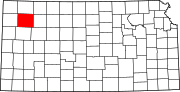 | |
| Unincorporated communities | ||
Ghost towns | ||
| Townships |
| |
| Footnotes | †This community is designated a Census-Designated Place (CDP) by the United States Census Bureau. ‡This community also has portions in an adjacent county or counties. | |
| ||
| International | |
|---|---|
| National | |
| Geographic | |
| Other | |