
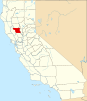
Colusa, California
Colusa, California | ||
|---|---|---|
| City of Colusa | ||
  Top: FIPS code 06-14946 | | |
| GNIS feature IDs | 277602, 2410204 | |
| Website | www | |
Colusa is a city and county seat of Colusa County, California, located in the Sacramento Valley region of the Central Valley. The population was 5,971 at the 2010 census, up from 5,402 at the 2000 census. Colusi originates from the local Coru Native American tribe, who in the 1840s lived on the opposite side of the Sacramento River.
History


In 1850, Charles D. Semple purchased the Rancho Colus Mexican land grant on which Colusa was founded and called the place Salmon Bend. The town was founded, under the name Colusi, by Semple in 1850. The first post office was established the following year, 1851. The California legislature changed the town's (and the county's) name to Colusa in 1854. The town flourished due to its location on the
Lynching of Hong Di
On July 10, 1887, convicted murderer Hong Di, an immigrant from China, was dragged from the Colusa jail and was forced by over a hundred and fifty men through the streets of Colusa's Chinatown, before he was hanged from the rafters of the locomotive turntable of the Colusa and Lake Railroad. Di, who had worked as a servant for the Billiou family of St. Johns, California, had shot and killed his employer Julie Billiou on April 7, 1887. He was captured on May 22, 1887, near Gridley, California.[5]
Geography
According to the United States Census Bureau, the city has a total area of 1.8 square miles (4.7 km2), all of it land. According to the United States Geological Survey, the city's location is at 39°12′52″N 122°00′34″W / 39.21444°N 122.00944°W.
Colusa is on the Sacramento River, which has a high levee so that the river is not clearly apparent from the city.
Colusa features a historic Chinatown, Carnegie Library building constructed in 1905, and an architecturally noteworthy courthouse built in a classical style, among its historically notable buildings.
Climate
According to the
| Climate data for Colusa, California, 1991–2020 normals, extremes 1948–present | |||||||||||||
|---|---|---|---|---|---|---|---|---|---|---|---|---|---|
| Month | Jan | Feb | Mar | Apr | May | Jun | Jul | Aug | Sep | Oct | Nov | Dec | Year |
| Record high °F (°C) | 78 (26) |
81 (27) |
89 (32) |
98 (37) |
106 (41) |
112 (44) |
112 (44) |
113 (45) |
112 (44) |
105 (41) |
89 (32) |
76 (24) |
113 (45) |
| Mean maximum °F (°C) | 66.1 (18.9) |
71.6 (22.0) |
79.3 (26.3) |
88.8 (31.6) |
95.6 (35.3) |
102.1 (38.9) |
104.7 (40.4) |
102.4 (39.1) |
100.8 (38.2) |
92.4 (33.6) |
76.7 (24.8) |
65.2 (18.4) |
105.9 (41.1) |
| Mean daily maximum °F (°C) | 54.6 (12.6) |
60.2 (15.7) |
66.5 (19.2) |
73.4 (23.0) |
81.1 (27.3) |
88.2 (31.2) |
92.4 (33.6) |
91.7 (33.2) |
89.1 (31.7) |
79.0 (26.1) |
64.1 (17.8) |
54.5 (12.5) |
74.6 (23.7) |
| Daily mean °F (°C) | 46.4 (8.0) |
50.7 (10.4) |
55.1 (12.8) |
59.7 (15.4) |
67.3 (19.6) |
73.4 (23.0) |
76.2 (24.6) |
74.9 (23.8) |
71.8 (22.1) |
63.5 (17.5) |
53.0 (11.7) |
46.1 (7.8) |
61.5 (16.4) |
| Mean daily minimum °F (°C) | 38.2 (3.4) |
41.1 (5.1) |
43.8 (6.6) |
46.1 (7.8) |
53.4 (11.9) |
58.7 (14.8) |
59.9 (15.5) |
58.1 (14.5) |
54.4 (12.4) |
47.9 (8.8) |
41.8 (5.4) |
37.7 (3.2) |
48.4 (9.1) |
| Mean minimum °F (°C) | 29.8 (−1.2) |
32.4 (0.2) |
34.9 (1.6) |
36.0 (2.2) |
43.8 (6.6) |
50.1 (10.1) |
52.8 (11.6) |
52.1 (11.2) |
47.4 (8.6) |
40.1 (4.5) |
31.7 (−0.2) |
28.8 (−1.8) |
26.3 (−3.2) |
| Record low °F (°C) | 20 (−7) |
20 (−7) |
25 (−4) |
26 (−3) |
31 (−1) |
36 (2) |
35 (2) |
42 (6) |
35 (2) |
31 (−1) |
22 (−6) |
15 (−9) |
15 (−9) |
| Average precipitation inches (mm) | 3.59 (91) |
2.97 (75) |
2.19 (56) |
1.00 (25) |
0.84 (21) |
0.51 (13) |
0.01 (0.25) |
0.03 (0.76) |
0.11 (2.8) |
0.87 (22) |
1.91 (49) |
3.17 (81) |
17.2 (436.81) |
| Average precipitation days | 10.6 | 8.6 | 8.2 | 5.0 | 3.0 | 1.0 | 0.1 | 0.2 | 0.5 | 2.6 | 5.8 | 9.3 | 54.9 |
| Source 1: NOAA[7] | |||||||||||||
| Source 2: WRCC[8] | |||||||||||||
Climate events
During December 1996 - January 1997, the nearby Colusa Weir Gage reached flood stage. This historic flooding event devastated the region by destroying thousands of crop acres (rice, tomatoes, alfalfa) and property. The Colusa Weir Gage reached flood stage 68.67 feet on 1/3/1997.[9]
Film production
The crime drama movie
Demographics
.jpg)
| Census | Pop. | Note | %± |
|---|---|---|---|
| 1870 | 1,051 | — | |
| 1880 | 1,779 | 69.3% | |
| 1890 | 1,336 | −24.9% | |
| 1900 | 1,441 | 7.9% | |
| 1910 | 1,582 | 9.8% | |
| 1920 | 1,846 | 16.7% | |
| 1930 | 2,116 | 14.6% | |
| 1940 | 2,285 | 8.0% | |
| 1950 | 3,031 | 32.6% | |
| 1960 | 3,518 | 16.1% | |
| 1970 | 3,842 | 9.2% | |
| 1980 | 4,075 | 6.1% | |
| 1990 | 4,934 | 21.1% | |
| 2000 | 5,402 | 9.5% | |
| 2010 | 5,971 | 10.5% | |
| 2020 | 6,411 | 7.4% | |
| U.S. Decennial Census[11] | |||
2010
At the
The census reported that 5,916 people (99.1% of the population) lived in households, 4 (0.1%) lived in non-institutionalized group quarters, and 51 (0.9%) were institutionalized.
There were 2,142 households, 890 (41.5%) had children under the age of 18 living in them, 1,080 (50.4%) were
The age distribution was 1,789 people (30.0%) under the age of 18, 484 people (8.1%) aged 18 to 24, 1,566 people (26.2%) aged 25 to 44, 1,435 people (24.0%) aged 45 to 64, and 697 people (11.7%) who were 65 or older. The median age was 33.5 years. For every 100 females, there were 100.1 males. For every 100 females age 18 and over, there were 96.2 males.
The median value of a home was $196,400.[13] There were 2,282 housing units at an average density of 1,244.1 per square mile (480.3/km2),of which 2,142 were occupied, 1,191 (55.6%) by the owners and 951 (44.4%) by renters. The homeowner vacancy rate was 1.4%; the rental vacancy rate was 2.3%. 3,233 people (54.1% of the population) lived in owner-occupied housing units and 2,683 people (44.9%) lived in rental housing units.
2000
At the
The age distribution was 30.2% under the age of 18, 10.2% from 18 to 24, 28.2% from 25 to 44, 20.0% from 45 to 64, and 11.4% 65 or older. The median age was 32 years. For every 100 females, there were 99.7 males. For every 100 females age 18 and over, there were 98.9 males.
The median
Economy
Major employers in Colusa include Colusa County and Colusa Unified School District. Sunsweet Growers has a plant just outside of city limits.[16]
Politics

In the
Education
Colusa is served by the Colusa Unified School District formed by three schools: Burchfield Primary School, Egling Middle School, and Colusa High School. The high school's mascot is the Redhawks. Starting in the 2011–12 academic year, the name of the high school mascot was changed from the Redskins to the Redhawks amid controversy over using names and insignia deemed derogatory toward Native Americans.
Notable people
- Bill Cunningham, Major League Baseball player
- Byron De La Beckwith, convicted assassin of civil rights activist Medgar Evers
- Mike Griffin, Major League Baseball pitcher
References
- ^ "California Cities by Incorporation Date". California Association of Local Agency Formation Commissions. Archived from the original (Word) on November 3, 2014. Retrieved March 27, 2013.
- ^ "2020 U.S. Gazetteer Files". United States Census Bureau. Retrieved October 30, 2021.
- ^ "Colusa". Geographic Names Information System. United States Geological Survey, United States Department of the Interior. Retrieved October 23, 2014.
- ISBN 1-884995-14-4.
- ISBN 1-884995-54-3
- ^ Climate Summary for Colusa, California
- ^ "U.S. Climate Normals Quick Access". National Oceanic and Atmospheric Administration. Retrieved September 3, 2022.
- ^ "Period of Record Monthly Climate Summary". Western Regional Climate Center. Retrieved September 3, 2022.
- ^ CNRFC, NOAA's National Weather Service -. "California Nevada River Forecast Center". www.cnrfc.noaa.gov. Retrieved March 2, 2016.
- ^ "...tick...tick...tick... (1970) - Overview - TCM.com". Turner Classic Movies. Retrieved March 2, 2016.
- ^ "Census of Population and Housing". Census.gov. Retrieved June 4, 2015.
- ^ "2010 Census Interactive Population Search: CA - Colusa city". U.S. Census Bureau. Archived from the original on July 15, 2014. Retrieved July 12, 2014.
- ^ "Colusa CA Housing data".
- ^ "U.S. Census website". United States Census Bureau. Retrieved January 31, 2008.
- ^ "Colusa County, CA - Official Website".
- ^ Search Results – Carmel, California – Data Axle Reference Solutions Current Businesses
- ^ "Senators". State of California. Retrieved March 21, 2013.
- ^ "Members Assembly". State of California. Retrieved March 21, 2013.
- ^ "California's 3rd Congressional District - Representatives & District Map". Civic Impulse, LLC. Retrieved March 1, 2013.
External links
 | ||||
| CDPs | ||||
| Unincorporated communities | ||||
| Indian reservations | ||||
| Ghost towns | ||||
| Footnotes | ‡This populated place also has portions in an adjacent county or counties | |||
| ||||