
Comerío, Puerto Rico
Comerío
Municipio Autónomo de Comerío | ||
|---|---|---|
Town and Municipality | ||
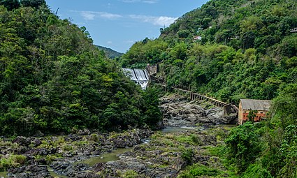
 View of Comerío from Lazos Hill | ||
|
Commonwealth | ||
| Founded | June 12, 1826 | |
| Barrios | ||
| Government | ||
| • Mayor | AST) | |
| ZIP Code | 00782 | |
| Area code | 787/939 | |
| Major routes | ||
| Website | www | |
Comerío (Spanish pronunciation:
History

Comerío was founded on June 12, 1826. Originally named Sabana del Palmar, but later changed to Comerío.[2]
In 1854, nearly 1000 acres (1000
Puerto Rico was ceded by Spain in the aftermath of the
Hurricane Maria on September 20, 2017, triggered numerous landslides in Comerío.[5][6] The flooded river went through the center of Comerío. A week later the hospital, trying to run via generator, was out of diesel but due to the landslides, travel and deliveries, into and out of Comerío was next to impossible.[7] Over 4,000 homes were affected, and of those 1,537 completely destroyed.[8] After the hurricane, the National Guard from Ohio were tasked with restoring water purification systems for the people of Comerío. Two months after the hurricane, the mayor of Comerío said no personnel had made it yet to attempt the restoration of electrical power to Comerío.[9] On October 9, another landslide happened blocking transit on PR-167.[10] On October 10, a group of doctors from New York announced they would travel to volunteer their services to Comerío and nearby mountain municipalities.[11]
Geography
The rivers located in Comerío are
Barrios

Like all municipalities of Puerto Rico, Comerío is subdivided into barrios. The municipal buildings, central square and large Catholic church are located in a small barrio referred to as "el pueblo", near the center of the municipality.[13][14][15][16]
Sectors
Barrios (which are, in contemporary times, roughly comparable to
Special Communities
Comunidades Especiales de Puerto Rico (Special Communities of Puerto Rico) are marginalized communities whose citizens are experiencing a certain amount of social exclusion. A map shows these communities occur in nearly every municipality of the commonwealth. Of the 742 places that were on the list in 2014, the following barrios, communities, sectors, or neighborhoods were in Comerio: Barriada Cielito, Sector Villa Brava in Piñas Abajo, El 26 in Palomas Abajo, El Higüero in Palomas Abajo, El Verde in Naranjo, La Juncia in Río Hondo II, La Pietra Cedrito, Río Hondo, and Vuelta del Dos.[22][23]
Tourism
To stimulate local tourism, the Puerto Rico Tourism Company launched the Voy Turistiendo ("I'm Touring") campaign, with a passport book and website. The Comerío page lists Las Pailas, Represa el Salto, and Media Luna, as places of interest.[24]
Landmarks and places of interest
Some of the landmarks of Comerío include:[25]
- La Tiza Peak
- La Mora Caves
- La Plata River
- Las Bocas Canyon
- Las Pailas
- Los Pilones
- Media Luna Recreation Park
- Tobacco Warehouse
- The main town square
- El Salto Hydroelectric Dams 1 and 2
Economy
Agriculture
- Tobacco (not as predominant in recent years). Comerío was known as "El Pueblo del Tabaco" (Tobacco Town), and its original flag had a tobacco plant in its center.[26]
Culture
Festivals and events
Comerío celebrates its patron saint festival in August. The Fiestas Patronales Santo Cristo de la Salud is a religious and cultural celebration that generally features parades, games, artisans, amusement rides, regional food, and live entertainment.[25]
Other festivals and events celebrated in Comerío include:
- Spring Carnival – April
- La Mora Cave Festival – June 1,2,3
- Jíbaro Festival – June
- El Jobo Festival – July
- San Andrés Apóstol Festivities – November
- El Seco Marathon – December
- Christmas Fantasy – December
Religion
First Methodist Church of Comerío was founded in 1904.
Demographics
| Census | Pop. | Note | %± |
|---|---|---|---|
| 1900 | 8,249 | — | |
| 1910 | 11,170 | 35.4% | |
| 1920 | 14,708 | 31.7% | |
| 1930 | 16,715 | 13.6% | |
| 1940 | 18,539 | 10.9% | |
| 1950 | 17,966 | −3.1% | |
| 1960 | 18,583 | 3.4% | |
| 1970 | 18,819 | 1.3% | |
| 1980 | 18,212 | −3.2% | |
| 1990 | 20,265 | 11.3% | |
| 2000 | 20,002 | −1.3% | |
| 2010 | 20,778 | 3.9% | |
| 2020 | 18,883 | −9.1% | |
| U.S. Decennial Census[27] 1899 (shown as 1900)[28] 1910–1930[29] 1930–1950[30] 1960–2000[31] 2010[15] 2020[32] | |||
Government
All municipalities in Puerto Rico are administered by a mayor, elected every four years. The current mayor of Comerío is
The city belongs to the
Symbols
The municipio has an official flag and coat of arms.[35]
Flag
Quartered in cross, of green and white, and superimposed the right superior quarter is an anchored yellow cross.[2][36]
Coat of arms
The Comerío coat of arms is made up quarters (4) bearing what is known as an
Transportation
Public bus from Bayamón to Comerío at Centro de Estacionamiento de Bayamón is the main public transportation.
There are 16 bridges in Comerío.[37]
Notable Comerieños
- Manuel A. Pérez (1890–1951) – Professor
- Enrique Pérez Santiago – Hematologist
Gallery
-
 View looking north from Vega Redonda barrio in Comerio
 -
 Old dam at El Salto, one of the oldest in Puerto Rico.

.jpeg)
See also
- List of Puerto Ricans
- History of Puerto Rico
- Did you know-Puerto Rico?
References
- ^ Bureau, US Census. "PUERTO RICO: 2020 Census". The United States Census Bureau. Retrieved August 25, 2021.
- ^ a b c "Comerío Municipality Founding and History". enciclopediapr.org. Archived from the original on February 14, 2019. Retrieved February 14, 2019.
- ^ Puerto Rico. Office of Historian (1949). Tesauro de datos historicos: indice compendioso de la literatura histórica de Puerto Rico, incluyendo algunos datos inéditos, periodísticos y cartográficos (in Spanish). Impr. del Gobierno de Puerto Rico. p. 191. Archived from the original on August 22, 2020. Retrieved January 4, 2020.
- ^ Joseph Prentiss Sanger; Henry Gannett; Walter Francis Willcox (1900). Informe sobre el censo de Puerto Rico, 1899, United States. War Dept. Porto Rico Census Office (in Spanish). Imprenta del gobierno. p. 161.
- ^ "Preliminary Locations of Landslide Impacts from Hurricane Maria, Puerto Rico". USGS Landslide Hazards Program. USGS. Archived from the original on March 3, 2019. Retrieved March 3, 2019.
- ^ "Preliminary Locations of Landslide Impacts from Hurricane Maria, Puerto Rico" (PDF). USGS Landslide Hazards Program. USGS. Archived (PDF) from the original on March 3, 2019. Retrieved March 3, 2019.
- ^ Ortiz Rivera, Joel (September 27, 2017). "Las cosas siguen igual en Comerío". El Nuevo Día (in Spanish). Retrieved September 19, 2021.
- ^ "María, un nombre que no vamos a olvidar. María embraveció al río La Plata y Comerío revivió una pesadilla" [Maria, a name we will never forget. María infuriated the La Plata River and Comerío relived a nightmare]. El Nuevo Día (in Spanish). June 13, 2019. Retrieved September 19, 2021.
- ^ Delgado, José A. (November 29, 2017). "Alcalde de Comerío alega que es lenta la recuperación tras María". El Nuevo Día (in Spanish). Retrieved September 19, 2021.
- ^ "Reportan deslizamiento de tierra en carretera que conduce a Comerío". El Nuevo Día (in Spanish). October 9, 2017. Retrieved September 19, 2021.
- ^ Ruiz Kuilan, Gloria (October 10, 2017). "Organización de médicos de Nueva York ofrece servicios a la montaña". El Nuevo Día (in Spanish). Retrieved September 19, 2021.
- ^ "Comerío Municipality General Information, Geography". enciclopediapr.org. Archived from the original on February 14, 2019. Retrieved February 14, 2019.
- ^ Picó, Rafael; Buitrago de Santiago, Zayda; Berrios, Hector H. Nueva geografía de Puerto Rico: física, económica, y social, por Rafael Picó. Con la colaboración de Zayda Buitrago de Santiago y Héctor H. Berrios. San Juan Editorial Universitaria, Universidad de Puerto Rico,1969. Archived from the original on December 26, 2018. Retrieved January 4, 2019.
- ISBN 978-1-4766-0447-3. Retrieved December 25, 2018.
- ^ a b Puerto Rico:2010:population and housing unit counts.pdf (PDF). U.S. Dept. of Commerce Economics and Statistics Administration U.S. Census Bureau. 2010. Archived (PDF) from the original on February 20, 2017. Retrieved January 4, 2019.
- ^ "Map of Comerío at the Wayback Machine" (PDF). Archived from the original (PDF) on March 24, 2018. Retrieved December 29, 2018.
- ^ a b "US Census Barrio-Pueblo definition". factfinder.com. US Census. Archived from the original on May 13, 2017. Retrieved January 5, 2019.
- ^ "P.L. 94-171 VTD/SLD Reference Map (2010 Census): Comerío Municipio, PR" (PDF). www2.census.gov. U.S. DEPARTMENT OF COMMERCE Economics and Statistics Administration U.S. Census Bureau. Archived (PDF) from the original on August 22, 2020. Retrieved August 22, 2020.
- ^ "Agencia: Oficina del Coordinador General para el Financiamiento Socioeconómico y la Autogestión (Proposed 2016 Budget)". Puerto Rico Budgets (in Spanish). Archived from the original on June 28, 2019. Retrieved June 28, 2019.
- ISBN 978-0-9820806-1-0
- ^ "Leyes del 2001". Lex Juris Puerto Rico (in Spanish). Archived from the original on September 14, 2018. Retrieved June 24, 2020.
- ISBN 978-0-9820806-1-0
- ^ "Comunidades Especiales de Puerto Rico" (in Spanish). August 8, 2011. Archived from the original on June 24, 2019. Retrieved June 24, 2019.
- ^ Pasaporte: Voy Turisteando (in Spanish). Compañia de Turismo de Puerto Rico. 2021.
- ^ a b "Comerío Municipality Places of Interest". enciclopediapr.org. Archived from the original on February 14, 2019. Retrieved February 14, 2019.
- ^ Comerio, Puerto Rico. Archived February 1, 2011, at the Wayback Machine Flags of the world. Retrieved July 8, 2012.
- ^ "U.S. Decennial Census". United States Census Bureau. Archived from the original on February 13, 2020. Retrieved September 21, 2017.
- ^ "Report of the Census of Porto Rico 1899". War Department Office Director Census of Porto Rico. Archived from the original on July 16, 2017. Retrieved September 21, 2017.
- ^ "Table 3-Population of Municipalities: 1930 1920 and 1910" (PDF). United States Census Bureau. Archived (PDF) from the original on August 17, 2017. Retrieved September 21, 2017.
- ^ "Table 4-Area and Population of Municipalities Urban and Rural: 1930 to 1950" (PDF). United States Census Bureau. Archived (PDF) from the original on August 30, 2015. Retrieved September 21, 2014.
- ^ "Table 2 Population and Housing Units: 1960 to 2000" (PDF). United States Census Bureau. Archived (PDF) from the original on July 24, 2017. Retrieved September 21, 2017.
- ^ Bureau, US Census. "PUERTO RICO: 2020 Census". The United States Census Bureau. Retrieved August 25, 2021.
- ^ "Population and Housing Unit Estimates". United States Census Bureau. Archived from the original on December 27, 1996. Retrieved September 21, 2017.
- ^ Elecciones Generales 2012: Escrutinio General Archived December 3, 2012, at the Wayback Machine on CEEPUR
- ^ "Ley Núm. 70 de 2006 -Ley para disponer la oficialidad de la bandera y el escudo de los setenta y ocho (78) municipios". LexJuris de Puerto Rico (in Spanish). Retrieved June 15, 2021.
- ^ a b "COMERIO". LexJuris (Leyes y Jurisprudencia) de Puerto Rico (in Spanish). February 19, 2020. Archived from the original on February 19, 2020. Retrieved September 16, 2020.
- ^ "Comerio Bridges". National Bridge Inventory Data. US Dept. of Transportation. Archived from the original on February 20, 2019. Retrieved February 19, 2019.
Further reading
- Levy, Teresita A. (2007). The History of Tobacco Cultivation in Puerto Rico, 1899—1940. ProQuest. ISBN 9780549267843.
- Mapa de municipios y barrios - Comerío - Memoria Núm. 41 (PDF). University of Puerto Rico: Estado Libre Asociado de Puerto Rico, Oficina del Gobernador, Junta de Planificacion, Santurce, Puerto Rico. 1955. Archived from the original (PDF) on April 9, 2023. Retrieved January 1, 2023.
External links
Places adjacent to Comerío, Puerto Rico | ||||||||||||||||
|---|---|---|---|---|---|---|---|---|---|---|---|---|---|---|---|---|
| ||||||||||||||||
| International | |
|---|---|
| National | |