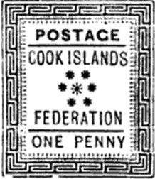
Cook Islands Federation
Cook Islands Federation | |||||||||
|---|---|---|---|---|---|---|---|---|---|
| 1891–1901 | |||||||||
| Anthem: God Save the Queen | |||||||||
 | |||||||||
| Status | British colony | ||||||||
| Capital | Avarua (presumed) | ||||||||
| Historical era | New Imperialism | ||||||||
• Established | 1891 | ||||||||
• Disestablished | 1901 | ||||||||
| ISO 3166 code | CK | ||||||||
| |||||||||
The Cook Islands Federation was created in 1891,[1] after the Kingdom of Rarotonga was given the island of Aitutaki. It lasted until 1901, when it was given to New Zealand.[2]
Geography
The Cook Islands Federation was made up of the islands of the southern group of the Cook Islands - Rarotonga, Mangaia, and Aitutaki - and the Nga-Pu-Toru - Atiu, Mauke, and Mitiaro.[3]

Law
The laws of the Cook Islands Federation were made by the local parliament, however, they had to receive approval from a
In 1899, the Parliament of Cook Islands ruled that the high court of the Cook Islands Federation could not give any punishment worse than those outlined by the Criminal Code Act of 1893, and The Summary Jurisdiction Act of 1894, which were both laws of New Zealand, and that both acts of New Zealand were to be adopted entirely.[5]
Penal colonies
In 1892, the island of Takutea was set up as a penal colony, but in 1899 its use ceased, and the island of Manuae was used instead.[5]
See also
Sources
- ^ "ISLAND FEDERATION". New Zealand Herald. 6 June 1891. p. 5. Retrieved 8 August 2023 – via Papers Past.
- OCLC 1760288.
- ^ a b "RARATONGAN PARLIAMENT". New Zealand Herald. 22 June 1891. p. 5. Retrieved 8 August 2023 – via Papers Past.
- ^ "PRIMITIVE LAND TENURE". New Zealand Mail. No. 1175. 7 September 1894. p. 33. Retrieved 8 August 2023 – via Papers Past.
- ^ ISBN 9781341057465.
21°12′S 159°46′W / 21.200°S 159.767°W


