Cyclone

| Part of a series on |
| Weather |
|---|
|
|
In
Upper level cyclones can exist without the presence of a surface low, and can pinch off from the base of the
Weather fronts mark the boundary between two masses of air of different
ahead of the cyclone path. Occluded fronts form late in the cyclone life cycle near the center of the cyclone and often wrap around the storm center.Nomenclature
Structure

There are a number of structural characteristics common to all cyclones. A cyclone is a
Because of the
Formation

Cyclogenesis is the development or strengthening of cyclonic circulation in the atmosphere.[9] Cyclogenesis is an umbrella term for several different processes that all result in the development of some sort of cyclone.[24] It can occur at various scales, from the microscale to the synoptic scale.
Extratropical cyclones begin as waves along
Tropical cyclones form as a result of significant convective activity, and are warm core.[11] Mesocyclones form as warm core cyclones over land, and can lead to tornado formation.[13] Waterspouts can also form from mesocyclones, but more often develop from environments of high instability and low vertical wind shear.[14] Cyclolysis is the opposite of cyclogenesis, and is the high-pressure system equivalent, which deals with the formation of high-pressure areas—Anticyclogenesis.[25]
A surface low can form in a variety of ways. Topography can create a surface low.
Tropical cyclogenesis is the development and strengthening of a tropical cyclone.[29] The mechanisms by which tropical cyclogenesis occurs are distinctly different from those that produce mid-latitude cyclones. Tropical cyclogenesis, the development of a warm-core cyclone, begins with significant convection in a favorable atmospheric environment. There are six main requirements for tropical cyclogenesis:
- sufficiently warm sea surface temperatures,[30]
- atmospheric instability,
- high humidity in the lower to middle levels of the troposphere
- enough Coriolis force to develop a low-pressure center
- a preexisting low-level focus or disturbance
- low vertical wind shear.[31]
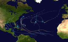
An average of 86 tropical cyclones of tropical storm intensity form annually worldwide,
Synoptic scale
The following types of cyclones are identifiable in synoptic charts.
Surface-based types
There are three main types of surface-based cyclones: Extratropical cyclones, Subtropical cyclones and Tropical cyclones
Extratropical cyclone
An extratropical cyclone is a
"
Although extratropical cyclones are almost always classified as
Polar low

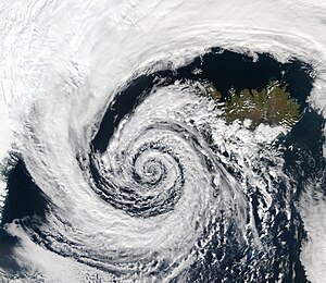
A polar low is a small-scale, short-lived atmospheric low-pressure system (depression) that is found over the ocean areas poleward of the main polar front in both the Northern and Southern Hemispheres. Polar lows were first identified on the meteorological satellite imagery that became available in the 1960s, which revealed many small-scale cloud vortices at high latitudes. The most active polar lows are found over certain ice-free maritime areas in or near the Arctic during the winter, such as the Norwegian Sea, Barents Sea, Labrador Sea and Gulf of Alaska. Polar lows dissipate rapidly when they make landfall. Antarctic systems tend to be weaker than their northern counterparts since the air-sea temperature differences around the continent are generally smaller [citation needed]. However, vigorous polar lows can be found over the Southern Ocean. During winter, when cold-core lows with temperatures in the mid-levels of the troposphere reach −45 °C (−49 °F) move over open waters, deep convection forms, which allows polar low development to become possible.[39] The systems usually have a horizontal length scale of less than 1,000 kilometres (620 mi) and exist for no more than a couple of days. They are part of the larger class of mesoscale weather systems. Polar lows can be difficult to detect using conventional weather reports and are a hazard to high-latitude operations, such as shipping and gas and oil platforms. Polar lows have been referred to by many other terms, such as polar mesoscale vortex, Arctic hurricane, Arctic low, and cold air depression. Today the term is usually reserved for the more vigorous systems that have near-surface winds of at least 17 m/s.[40]
Subtropical

A subtropical cyclone is a weather system that has some characteristics of a tropical cyclone and some characteristics of an extratropical cyclone. They can form between the equator and the 50th parallel.[41] As early as the 1950s, meteorologists were unclear whether they should be characterized as tropical cyclones or extratropical cyclones, and used terms such as quasi-tropical and semi-tropical to describe the cyclone hybrids.[42] By 1972, the National Hurricane Center officially recognized this cyclone category.[43] Subtropical cyclones began to receive names off the official tropical cyclone list in the Atlantic Basin in 2002.[41] They have broad wind patterns with maximum sustained winds located farther from the center than typical tropical cyclones, and exist in areas of weak to moderate temperature gradient.[41]
Since they form from extratropical cyclones, which have colder temperatures aloft than normally found in the tropics, the sea surface temperatures required is around 23 degrees Celsius (73 °F) for their formation, which is three degrees Celsius (5 °F) lower than for tropical cyclones.[44] This means that subtropical cyclones are more likely to form outside the traditional bounds of the hurricane season. Although subtropical storms rarely have hurricane-force winds, they may become tropical in nature as their cores warm.[45]
Tropical

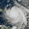
A tropical cyclone is a

The term "tropical" refers to both the geographic origin of these systems, which form almost exclusively in
While tropical cyclones can produce extremely powerful winds and torrential rain, they are also able to produce high waves and a damaging
Many tropical cyclones develop when the atmospheric conditions around a weak disturbance in the atmosphere are favorable.[47] Others form when other types of cyclones acquire tropical characteristics. Tropical systems are then moved by steering winds in the troposphere; if the conditions remain favorable, the tropical disturbance intensifies, and can even develop an eye. On the other end of the spectrum, if the conditions around the system deteriorate or the tropical cyclone makes landfall, the system weakens and eventually dissipates. A tropical cyclone can become extratropical as it moves toward higher latitudes if its energy source changes from heat released by condensation to differences in temperature between air masses.[11] A tropical cyclone is usually not considered to become subtropical during its extratropical transition.[52]
Upper level types
Polar cyclone
A polar, sub-polar, or Arctic cyclone (also known as a
TUTT cell
Under specific circumstances, upper level cold lows can break off from the base of the tropical upper tropospheric trough (TUTT), which is located mid-ocean in the Northern Hemisphere during the summer months. These upper tropospheric cyclonic vortices, also known as TUTT cells or TUTT lows, usually move slowly from east-northeast to west-southwest, and their bases generally do not extend below 20,000 feet (6,100 m) in altitude. A weak inverted surface trough within the
Mesoscale
The following types of cyclones are not identifiable in synoptic charts.
Mesocyclone
A mesocyclone is a vortex of air, 2.0 kilometres (1.2 mi) to 10 kilometres (6.2 mi) in diameter (the mesoscale of meteorology), within a convective storm.[60] Air rises and rotates around a vertical axis, usually in the same direction as low-pressure systems[61] in both northern and southern hemisphere. They are most often cyclonic, that is, associated with a localized low-pressure region within a supercell.[61][62] Such storms can feature strong surface winds and severe hail.[61] Mesocyclones often occur together with updrafts in supercells, where tornadoes may form.[61] About 1,700 mesocyclones form annually across the United States, but only half produce tornadoes.[13]
Tornado
A tornado is a violently rotating column of air that is in contact with both the surface of the earth and a cumulonimbus cloud or,[63] in rare cases, the base of a cumulus cloud. Also referred to as twisters, a colloquial term in America, or cyclones, although the word cyclone is used in meteorology, in a wider sense, to name any closed low-pressure circulation.
Dust devil
A dust devil is a strong, well-formed, and relatively long-lived whirlwind,[64] ranging from small (half a metre wide and a few metres tall) to large (more than 10 metres wide and more than 1000 metres tall).[64] The primary vertical motion is upward.[64] Dust devils are usually harmless, but can on rare occasions grow large enough to pose a threat to both people and property.[64]
Waterspout
A waterspout is a columnar vortex forming over water that is, in its most common form, a non-
Steam devil
A gentle vortex over calm water or wet land made visible by rising water vapour.
Fire whirl
A fire whirl – also colloquially known as a fire devil, fire tornado, firenado, or fire twister – is a whirlwind induced by a fire and often made up of flame or ash.
Other planets

Cyclones are not unique to Earth. Cyclonic storms are common on Jovian planets, such as the Small Dark Spot on Neptune.[65] It is about one third the diameter of the Great Dark Spot and received the nickname "Wizard's Eye" because it looks like an eye. This appearance is caused by a white cloud in the middle of the Wizard's Eye.[8] Mars has also exhibited cyclonic storms.[7] Jovian storms like the Great Red Spot are usually mistakenly named as giant hurricanes or cyclonic storms. However, this is inaccurate, as the Great Red Spot is, in fact, the inverse phenomenon, an anticyclone.[66]
See also
References
- ^ Glossary of Meteorology (June 2000). "Cyclonic circulation". American Meteorological Society. Archived from the original on 2018-12-25. Retrieved 2008-09-17.
- ^ Glossary of Meteorology (June 2000). "Cyclone". American Meteorological Society. Archived from the original on 2018-12-25. Retrieved 2008-09-17.
- ^ BBC Weather Glossary (July 2006). "Cyclone". BBC. Archived from the original on 2006-08-29. Retrieved 2006-10-24.
- ^ "UCAR Glossary — Cyclone". University Corporation for Atmospheric Research. Archived from the original on 2018-12-25. Retrieved 2006-10-24.
- ^ National Hurricane Center (2012). Glossary of NHC terms. Archived 2012-09-27 at the Wayback Machine Retrieved on 2012-08-13.
- .
- ^ a b David Brand (1999-05-19). "Colossal cyclone swirling near Martian north pole is observed by Cornell-led team on Hubble telescope". Cornell University. Archived from the original on June 13, 2007. Retrieved 2008-06-15.
- ^ a b Samantha Harvey (2006-10-02). "Historic Hurricanes". NASA. Archived from the original on 2008-04-15. Retrieved 2008-06-14.
- ^ a b Nina A. Zaitseva (2006). "Cyclogenesis". National Snow and Ice Data Center. Archived from the original on 2006-08-30. Retrieved 2006-12-04.
- ^ "Tropical cyclogenesis". www-das.uwyo.edu. Archived from the original on 17 May 2021. Retrieved 12 January 2021.
- ^ a b c d Stan Goldenberg (2004-08-13). "Frequently Asked Questions: What is an extra-tropical cyclone?". Atlantic Oceanographic and Meteorological Laboratory, Hurricane Research Division. Archived from the original on 2007-02-09. Retrieved 2007-03-23.
- S2CID 38114516. Retrieved 12 January 2021.
- ^ a b c Forces of Nature. Tornadoes : the mesocyclone. Archived 2008-06-16 at the Wayback Machine Retrieved on 2008-06-15.
- ^ a b National Weather Service Key West summary of waterspout types
- ^ "Frequently asked questions". Hurricane Research Division. Archived from the original on 2011-03-09. Retrieved 2006-04-08.
- (PDF) from the original on 2020-02-26. Retrieved 2019-12-07.
- (PDF) from the original on 2020-03-05. Retrieved 2019-12-07.
- ^ "Modern Meteorology". India Meteorological Department. Retrieved 2011-11-18.[permanent dead link]
- ^ Chris Landsea and Sim Aberson (August 13, 2004). "Subject: A11) What is the "eye"? How is it formed and maintained ? What is the "eyewall"? What are "spiral bands"?". Atlantic Oceanographic and Meteorological Laboratory. Archivedfrom the original on 2006-06-14. Retrieved 2009-12-28.
- ^ "The Atmosphere in Motion" (PDF). University of Aberdeen. Archived from the original (PDF) on 2012-10-18. Retrieved 2011-09-11.
- Chris Landsea (2009-02-06). "Subject: D3) Why do tropical cyclones' winds rotate counterclockwise (clockwise) in the Northern (Southern) Hemisphere?". Atlantic Oceanographic and Meteorological Laboratory. Archivedfrom the original on 2009-01-06. Retrieved 2009-12-28.
- ^ "Are the winds on one side of a hurricane faster than on the other side?". USA Today. Ask the Experts: Hurricanes. November 11, 2007. Archived from the original on October 12, 2011. Retrieved September 9, 2011.
- ^ Kerry Emanuel (January 2006). "Anthropogenic Effects on Tropical Cyclone Activity". Massachusetts Institute of Technology. Archived from the original on 2012-07-17. Retrieved 2008-02-25.
- ^ "Cyclogenesis | meteorology". Encyclopædia Britannica. Archived from the original on 14 January 2021. Retrieved 13 January 2021.
- ^ Glossary of Meteorology (June 2000). "Cyclogenesis". American Meteorological Society. Archived from the original on 2014-01-15. Retrieved 2009-12-28.
- .
- ^ Glenn Elert (2006). "Density of Air". The Physics Factbook. Archived from the original on 2010-01-02. Retrieved 2010-01-01.
- ^ St. Louis University (2004-09-06). "What is a trowal?". National Weather Association. Archived from the original on June 8, 2008. Retrieved 2010-01-01.
- ^ Nina A. Zaitseva (2006). "Definition for Cyclogenesis". National Snow and Ice Data Center. Archived from the original on 2006-08-30. Retrieved 2006-10-20.
- ^ Cyclon in a board Archived 2013-06-14 at the Wayback Machine. thethermograpiclibrary.org
- Chris Landsea (2009-02-06). "Subject: A15) How do tropical cyclones form ?". Atlantic Oceanographic and Meteorological Laboratory. Archived from the originalon 2009-08-27. Retrieved 2010-01-01.
- from the original on 14 January 2021. Retrieved 13 January 2021.
- Chris Landsea (2000-01-04). "Climate Variability table — Tropical Cyclones". Atlantic Oceanographic and Meteorological Laboratory. Archivedfrom the original on 2012-10-02. Retrieved 2006-10-19.
- ^ "Low Pressure System – an overview | ScienceDirect Topics". www.sciencedirect.com. Archived from the original on 15 January 2021. Retrieved 13 January 2021.
- ^ a b DeCaria (2005-12-07). "ESCI 241 – Meteorology; Lesson 16 – Extratropical Cyclones". Department of Earth Sciences, Millersville University, Millersville, Pennsylvania. Archived from the original on September 3, 2006. Retrieved 2006-10-21.
- ^ Robert Hart; Jenni Evans (2003). "Synoptic Composites of the Extratropical Transition Lifecycle of North Atlantic TCs as Defined Within Cyclone Phase Space" (PDF). American Meteorological Society. Archived (PDF) from the original on 2011-06-09. Retrieved 2006-10-03.
- ^ Ryan N. Maue (2008). "Chapter 3: Cyclone Paradigms and Extratropical Transition Conceptualizations". Florida State University. Archived from the original on 2008-05-10. Retrieved 2008-06-15.
- NOAA. Archivedfrom the original on 2007-02-09. Retrieved 2006-07-25.
- ISBN 978-0-521-62430-5. Retrieved 2011-01-27.
- ISBN 978-0-521-62430-5.
- ^ Chris Landsea (2009-02-06). "Subject: A6) What is a sub-tropical cyclone?". Atlantic Oceanographic and Meteorological Laboratory. Archivedfrom the original on 2011-10-11. Retrieved 2009-12-27.
- (PDF) from the original on 2022-10-09. Retrieved 2008-04-20.
- (PDF) from the original on 2022-10-09. Retrieved 2008-06-14.
- ^ David Mark Roth (2002-02-15). "A Fifty year History of Subtropical Cyclones" (PDF). Hydrometeorological Prediction Center. Archived (PDF) from the original on 2021-04-17. Retrieved 2006-10-04.
- NOAA. Archivedfrom the original on 2011-10-11. Retrieved 2009-12-27.
- ^ a b c "StackPath". www.laserfocusworld.com. 10 August 2011. Archived from the original on 14 April 2021. Retrieved 13 January 2021.
- ^ a b c d e f g h i "StackPath". www.laserfocusworld.com. 10 August 2011. Archived from the original on 14 April 2021. Retrieved 14 January 2021.
- (PDF) from the original on 2022-10-09.
- NOAA. Archived from the originalon 2009-08-27. Retrieved 2006-07-26.
- ^ Sim Aberson (2009-02-06). "Subject : C2) Doesn't the friction over land kill tropical cyclones?". National Hurricane Center. Archived from the original on 2012-07-31. Retrieved 2008-02-25.
- ^ National Oceanic and Atmospheric Administration. 2005 Tropical Eastern North Pacific Hurricane Outlook. Archived 2009-06-14 at the Wayback Machine Retrieved on 2006-05-02.
- ^ Padgett, Gary (2001). "Monthly Global Tropical Cyclone Summary for December 2000". Archived from the original on 2014-11-29. Retrieved 2006-03-31.
- ^ a b Glossary of Meteorology (June 2000). "Polar vortex". American Meteorological Society. Archived from the original on 2019-07-18. Retrieved 2008-06-15.
- ^ Halldór Björnsson (2005-01-19). "Global circulation". Veðurstofa Íslands. Archived from the original on 2011-08-07. Retrieved 2008-06-15.
- ^ Garima, Khera. "A vortex of winds-Cyclones – Geography and You". Archived from the original on 2 March 2021. Retrieved 14 January 2021.
- .
- University of Illinois at Urbana–Champaign via the Internet Wayback Machine. Archived from the originalon 2001-12-24. Retrieved 2009-12-27.
- ^ Clark Evans (January 5, 2006). "Favorable trough interactions on tropical cyclones". Flhurricane.com. Archived from the original on October 17, 2006. Retrieved 2006-10-20.
- .
- ^ Glossary of Meteorology (June 2000). "Mesocyclone". American Meteorological Society. Archived from the original on 2014-05-17. Retrieved 2006-12-07.
- ^ a b c d "Mesocyclone – SKYbrary Aviation Safety". www.skybrary.aero. Archived from the original on 14 January 2021. Retrieved 13 January 2021.
- ^ National Weather Service Forecast Office State College, Pennsylvania (2006-07-16). "Splitting Storm and Anti-cyclonic Rotating Mesocyclone in a Thunderstorm over Elk County July 10th, 2006". Archived from the original on 2009-01-14. Retrieved 2008-06-15.
- ^ "Tornado Basics". NOAA National Severe Storms Laboratory. Archived from the original on 31 August 2018. Retrieved 13 January 2021.
- ^ a b c d "Dust Devils". www.crystalinks.com. Archived from the original on 25 January 2021. Retrieved 13 January 2021.
- ^ "TCFAQ H6) Are there hurricanes on other planets ?". www.aoml.noaa.gov. Archived from the original on 19 March 2021. Retrieved 13 January 2021.
- ^ Ellen Cohen (2009). "Jupiter's Great Red Spot". Hayden Planetarium. Archived from the original on 2007-08-08. Retrieved 2007-11-16.


