Dalston has never been an administrative unit, and partly for this reason the boundaries are not formally defined. There are generally understood boundaries in the south and west, but less clarity to the north and east. There is an electoral ward of the same name which covers a part of the northwest of Dalston.
Dalston's boundaries (taking in Kingsland and Shacklewell, but not De Beauvoir Town, which is also sometimes associated with Dalston) are described with more or less precision below:
South: Dalston takes Hackney's southern border with Shoreditch. Albion Drive forms much of this boundary.
West: The originally Roman A10 road (under the names, south to north:
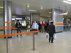
Dalston Kingsland Railway Station
. The western boundary corresponds with the western side of the E8 postal area with which Dalston is associated, though postcodes are not intended to define districts, and the postal area also takes in areas that are not ever described as part of Dalston.
North: There is not a tradition of a clear northern boundary with West Hackney. Dalston's association with the E8 postal area means that its 'sphere of self-identification' does not extend far, if at all, beyond the postcode boundary, and no further north than Farleigh Road.
East: Between Downs Road and Amhurst Road, the physical barrier of the railway embankment marks the postcode boundary with
Lower Clapton. There is little tradition of a boundary with the central Hackney area except that it is sometimes said that Dalston extends as far as the park at London Fields
.
History
The name Dalston is thought to have derived from Deorlaf's tun (farm)[2] in much the same way as nearby Hoxton was named after the farm of "Hoch". The first written record available is from 1294 when the name was written as Derleston.
John Rocque's map of 1746 shows the village of Kingsland centred on the crossroads at what is now Dalston Junction and the small village of Dalston further east along Dalston Lane. Another clear feature is Roman Ermine Street which now forms most of the western boundary of this area. Ermine Street now has the road number A10 and goes by a number of names, including Kingsland Road
as it travels through London.
Around 1280 CE a
leper hospital
was founded in Dalston by the citizens of London and in 1549 it was attached to the chapel of St Bartholomew as an outhouse.
During the 18th and 19th centuries the area changed from an agricultural and rural landscape to an urban one. By 1849, it was described as a recently increased suburban village, with some handsome old houses, and by 1859 the village had exceeded its neighbour and, with the railways and continuous building, the village of Kingsland disappeared.[3]
During the 1930s, 1940s[4][5][6] and 1960s[7][8][9] the area's large Jewish and other minority populations made it a target for provocative rallies by Oswald Mosley and the various organisations he founded. These were actively opposed by many local people, together with organisations such as the 43 Group in the 1940s and the 62 Group from 1962, and this led to a number of violent confrontations, notably in the Ridley Road and Hertford Road areas.[10] A 2014 novel, Ridley Road, and its BBC One TV adaptation uses the clashes as a backdrop to the narrative.[11]
In July 2017 a riot broke out on Dalston Road, which had originally started as a demonstration against police violence. Protesters barricaded the spot where a man, who later died at the Royal London Hospital, had been arrested. The rioters threw fire bombs at police and caused property damage.[12][13]
Notable buildings
St. Mark's is a large Victorian church primarily built in the period 1864–66 to a design by Chester Cheston. It is reputedly the largest parish church in London, larger than Southwark Cathedral, capable of hosting congregations of 1800–2000 people[14] and its great size has earned it the nickname, the "Cathedral of the East End".[15] The residential area around the church is also of high architectural quality and has accordingly been designated the "St. Mark's Conservation Area".[15]
The
Rio Cinema
is a Grade II listed independent Art Deco cinema. It is a popular single-screen cinema located on Kingsland High Street, with a history stretching back over 100 years.
The German Hospital, locally known as 'The German', is a group of attractive Victorian red brick buildings that were home to a hospital from 1845 to 1987. The hospital was initially founded to cater primarily for London's then large German-speaking community. It eventually became an ordinary NHS facility before its facilities were merged and moved to Homerton University Hospital.
Festivals
Dalston is known for music, events and its nightlife. Its biggest festival to date began in 2015, Dalston Music Festival. Centred on Gillett Square and 8 clubs in the surrounding area, it was founded by Andrew Bunsell of Dalston Studios.
Arts and entertainment
The Dalston Culture House now houses the Vortex Jazz Club. (October 2005)
Dalston hosts several art and entertainment venues, and has a history as an entertainment centre, with at one time hosting four or five cinemas within a radius of 1⁄3 mile (500 m), and the Dalston Theatre, a former hippodrome and music hall that later became the Four Aces blues club and the Labyrinth nightclub. The Dalston Theatre was demolished in February 2007, despite an active local campaign to save it. Dalston was also a hub for 1970s and 1980s pub rock venues but these are largely defunct.
The Dalston Rio Cinema
Shopping
Dalston's Ridley Road market, October 2005
Established in the 1880s, Ridley Road Market is opposite Dalston Kingsland railway station.[16] Fruit and vegetables, some fairly exotic, are available. Halal butchers cluster around the high street end of the market.
Ridley Road market is reputedly the basis for the one found in the BBC's EastEnders.[17] The Kingsland Shopping Centre (formerly Dalston Cross) is just south of Ridley Road Market.
Kingsland Road and the surrounding streets are home to an ever-growing number of boutiques, bars and cafés.
Area profile
Dalston, looking south towards The City. A major traffic nexus. (October 2005)
Contemporary Dalston is a lively neighbourhood with an ethnically varied population. Architecturally it is a mixture of 18th- and 19th-century
Games
.)
Dalston has attracted immigrants for over 100 years; at the turn of the century it was a popular area for newly arrived Jewish people from central Europe. In the 1950s and '60s, as the Jewish community became more affluent and moved out, they were replaced by a large Caribbean community, which accounts for the wide choice of Caribbean food available in Ridley Road. As the Caribbean community slowly drifted out of Dalston it then became popular with the Turkish, as well as the Vietnamese. Recent arrivals include Poles, judging by the numbers of Polish delicatessens now appearing and other stores catering to Polish tastes.
Albert Square) and Ridley Road Market (Walford Market) were rebuilt on the set in Elstree, near Borehamwood, to have a more controlled filming environment. The idea of Walford stems from Walford Road, and many of the houses on the show use the same exterior design. Coincidentally both Barbara Windsor and Tony Holland
, one of the original creators of the show, lived at different times on the street.
The Hackney Peace Carnival Mural created in 1985, depicts a group of people marching for peace against "the bomb" and has become an important cultural statement from that era. It can be found opposite Dalston Junction Overground station on Dalston Lane. It has also been used on the cover of an album by local group Rudimental.
In April 2009 The Guardian published an article on Dalston claiming that it was the "coolest" place to live in Britain.[18] In the same year however, sculpture park The Towers of Hackney was torn down to give way to new buildings.
Transport
Rail
Dalston is on the London Overground network, served by three stations:
Haggerston – partly in the district, served by London Overground trains between Highbury & Islington and West Croydon, Crystal Palace, New Cross or Clapham Junction.[19]
All stations are in
London fare zone 2, and Oyster Cards are valid for travel from Dalston to other destinations in London. Dalston Junction is the busiest station of the three, with 5.677 million passenger entries and exits at the station in 2017–2018.[19][20]
There is no direct rail link to
new station in Dalston has been proposed as part of the Crossrail 2 development.[21]
Buses
Dalston is served by London Buses on routes 30, 38, 56, 67, 76, 149, 236, 242, 243, 277, 488 and N38. Routes 76, 149, 242, 243 and 277 run 24-hours, daily.[22][23]
B108 (Queensbridge Road) – southbound to Haggerston.
Air Pollution
The London Borough of Hackney measures roadside air quality in Dalston, in particular the concentration of Nitrogen Dioxide (NO2) in the district. Diffusion tubes which measure the concentration of NO2 in roadside air show that across Dalston, the local roadside air quality failed to meet the UK National Objective of 40μg/m3 (micrograms per cubic metre) in 2017.[24]
In 2017, the average roadside NO2 levels in several key locations in Dalston were:
Dalston Lane (A104) – 63 μg/m3
Kingsland High Street (A10) – 62 μg/m3
Kingsland Road (A10) – 52 μg/m3
Dalston Library – 39 μg/m3 (which meets the UK National Air Quality objective)[24]
Several key routes pass through the district, including:
Cycle Superhighway 1 (CS1) – an unbroken, signposted route running on residential streets, north–south through Dalston. Northbound, the route carries cyclists to Stoke Newington, Seven Sisters and Tottenham. Southbound, the route passes through De Beauvior Town and Hoxtonen route to Moorgate in the City.[25]
Run Fat Boy Run (directed by David Schwimmer) was filmed in Dalston (St. Mark's Conservation Area). Dennis (Simon Pegg
) stays in a flat on Sandringham Road across the road from St. Mark's Church.
The second and third series of popular television show The Mighty Boosh takes place in Dalston.
Dalston Songs is a staged song cycle with seven singers created and composed by Helen Chadwick and choreographed by Steven Hoggett. It was based on interviews with people in East London about home and was performed in 2008 at the Royal Opera House.
Dalston is the second of 12 placenames associated with London mentioned in an overdubbed choral series on the Lily Allen song "LDN": "Angel, Dalston, Stockwell, Clapton, Soho, Ladbroke Grove...".
British indie rock band Razorlight recorded a song called "Don't go back to Dalston", featured on their debut album Up All Night.
Connan Mockasin's song "Forever Dolphin Love" mentions Dalston.
Dalston was featured in an episode of the 1990s Channel 4 comedy series Drop the Dead Donkey, in which the reconstruction of a fictitious post office robbery is staged, in a 'Crime Watch' type parody.
The poet Martina Evans lives in Dalston and has referenced it in some of her poems.[28]