
Daman, India
This article has multiple issues. Please help improve it or discuss these issues on the talk page. (Learn how and when to remove these template messages)
|
Daman | |
|---|---|
City | |
UTC+5:30 (IST) | |
| Vehicle registration | DD-03 |
| Sex ratio | 1.69 ♂/♀ |
| Website | dmcdaman |
Daman is a city and also the administrative capital of the Indian of territory of Dadra and Nagar Haveli and Daman and Diu. It is a municipal council situated in the Daman district of the union territory.
The Daman Ganga River divides Daman into: Nani-Daman (Little Daman) and Moti-Daman (Big Daman). Despite its name, Nani-Daman is the larger of the two parts, while the old city is mainly in Moti-Daman. This holds most of the important entities, like the major hospitals, supermarkets, and major residential areas. Vapi, Gujarat, is the nearest city to Daman.
Etymology
The name Daman is derived from the Daman Ganga River, while Diu is from the Sanskrit word dvipa, meaning “island.” From Mauryan times (4th–2nd century BCE), both were subject to various local and regional powers ruling in western India. In the 13th century Daman formed part of the Ramnagar state, which then became a tributary of the Gujarat sultans. Similarly, numerous dynasties in Kathiawar (Saurashtra) ruled Diu until it fell to the sultan of Gujarat in the early 15th century.[2]
History
The Portuguese Captain-Major
Daman was
Demographics
According to the
Climate
Daman has a tropical savanna climate (Köppen Aw) with two distinct seasons: a long, sunny dry season from October to May and a hot, very humid, and extremely wet monsoon season from June to September. Almost no rain falls during the dry season. With milder mornings and lower humidity especially up to the middle of March, this is by far the most comfortable time of the year.
The monsoon season, though relatively short, is extremely wet. Along with the very high humidity and heavy rain every afternoon, travel is difficult and uncomfortable.
| Climate data for Daman, Daman and Diu (1961 to 1990) | |||||||||||||
|---|---|---|---|---|---|---|---|---|---|---|---|---|---|
| Month | Jan | Feb | Mar | Apr | May | Jun | Jul | Aug | Sep | Oct | Nov | Dec | Year |
| Mean daily maximum °C (°F) | 29.1 (84.4) |
29.9 (85.8) |
32.8 (91.0) |
34.5 (94.1) |
34.9 (94.8) |
33.2 (91.8) |
30.3 (86.5) |
29.9 (85.8) |
30.7 (87.3) |
33 (91) |
32.6 (90.7) |
30.4 (86.7) |
31.8 (89.2) |
| Mean daily minimum °C (°F) | 15.7 (60.3) |
16.6 (61.9) |
20.3 (68.5) |
20.7 (69.3) |
26.5 (79.7) |
26.5 (79.7) |
25.3 (77.5) |
24.8 (76.6) |
24.3 (75.7) |
22.6 (72.7) |
19.2 (66.6) |
16.5 (61.7) |
21.6 (70.9) |
| Average rainfall mm (inches) | 0 (0) |
0 (0) |
1 (0.0) |
0 (0) |
5 (0.2) |
324 (12.8) |
766 (30.2) |
473 (18.6) |
288 (11.3) |
44 (1.7) |
6 (0.2) |
2 (0.1) |
1,909 (75.1) |
| Source: climate-data.org[8] | |||||||||||||
Places of interest
- Fort of St. Jerome (Jeronimo fort or Nani Daman Fort)
- Fort of Daman (Moti Daman Fort)
- Church of Bom Jesus
- Jain Temple: This 18th-century Jain temple is in the northern region of Nina Damon Fort and is dedicated to Mahavira Swami. It is built with white marble. The walls have glass covers with 18th-century murals that represent the life of Mahavira Swami.[9]
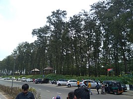
- Jampore Beach
- Devka Beach
- Daman Freedom Memorial
-
 Nani Daman Fort Entrance
 -
 Jain Temple, Daman
 -
 Harbour View from Moti Daman Fort
 -
 Jampore Beach in Daman
 -
 Jampore Beach in Daman
 -
 Sunset at Devka beach, Damao
 -
 Church in Nani Daman Fort
 -
 Church of Bom Jesus, Daman
 -
 Daman Freedom Memorial
 -
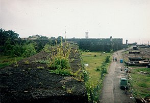 The Fort of Moti Daman

.jpg)


Indian Coast Guard

Indian Coast Guard Air Station, Daman is the premier air station of the Coast Guard with all the airfield facilities, air traffic control and other allied air traffic services. It is equipped with state-of-the-art airport surveillance radar (ASR), precision approach path indicator (PAPI), Doppler very high frequency omnidirectional radio range (DVOR) – distance measuring equipment (DME) and nondirectional beacon (NDB), as navigational aids. This air station provides ATC and parking facilities to defence as well as civil aircraft.[10]
Schools and colleges
- Coast Guard Public School, Nani Daman
- Swami vivekanad English & Hindi medium school, dalwada, daman
- Institute of our lady of Fatima, Convent, Moti Daman
- Podar Jumbo Kids, Daman (preschool)
- Sunrise Champs school, Mashal Chowk, Nani Daman
- Vaidik Dental college campus, Salwaar, Nani Daman
- Shrinathji School, Varkund, Nani Daman
- Divya Jyoti English High & Higher Secondary School, Dabhel, Daman
- Divya Jyoti Hindi Medium School, Dabhel, Daman
- MGM High School, Nani-Daman (Sarvajanik High School)
- Government Higher Secondary School, Nani Daman
- Government Higher Secondary School, Moti Daman
- Government Polytechnic Daman
- Shree Machchi Mahajan English Medium School, Nani Daman
- Stella Maris English Medium High School, Daman
- AIM English School, Moti Daman
- Government College, Nani Daman
- Government Primary School, Devka Mangelwad, Nani Daman
- Holy Trinity English medium high school, Dunetha, Daman
- Jawahar Navodaya Vidyalaya, Daman
References
- ^ "52nd Report of the Commissioner for Linguistic Minorities in India" (PDF). 29 March 2016. p. 87. Archived from the original (PDF) on 25 May 2017. Retrieved 15 January 2018.
- ^ "Daman and Diu | History, Government, Map, & Population | Britannica". www.britannica.com. Retrieved 24 April 2024.
- ISBN 9788171547616. Retrieved 18 December 2010.
- The Tribune. Retrieved 18 December 2010.
- ^ Chakravorty, Dr. B.C. (2008). "Operation Vijay" Archived 31 March 2014 at the Wayback Machine. Bharat Rakshak. Retrieved 12/18/2010.
- ^ a b c d e f "District Census 2011". Census2011.co.in. 2011. Retrieved 30 September 2011.
- ^ US Directorate of Intelligence. "Country Comparison: Population". Archived from the original on 13 June 2007. Retrieved 1 October 2011.
Samoa 193,161
- ^ Climate Daman
- ^ "Jain Temple Daman | Jain Temple in Daman Gujarat India | Religious Places of Daman | Religious Places of Gujarat | Nri Gujarati Tourism Places Jain Temple Daman".
- ^ "Indian Coast Guard". Archived from the original on 4 November 2012. Retrieved 4 November 2012.
External links
| Authority control databases: National |
|---|