
David, Chiriquí
David
Ciudad de David | |
|---|---|
| City of David | |
 Main square with church | |
|
UTC−5 (EDT) | |
| Climate | Am |
| Human Development Index = 0.890 | |
David (Spanish pronunciation: [daˈβið]), known as David City in colonial times, is a city and corregimiento in the west of Panama. It is the capital of the province of Chiriquí and has an estimated population of 82,907 inhabitants as confirmed in 2013.[1] It is a relatively affluent city with a firmly established, dominant middle class and a very low unemployment and poverty index. The Pan-American Highway is a popular route to David. It is named after the Biblical King David
The development of the banking sector, public construction works such as the expansion of the airport and the David-Boquete highway alongside the growth of commercial activity in the city have increased its prominence as one of the fastest-growing regions in the country. The city is the economic center of the Chiriqui province and produces more than half the
History
David was founded in 1602, by the governor Juan López de Siqueira. The city had been founded in the area where the Bolivar park is currently located. In those times, the city was divided into three regions, one fit for Spanish residence, and another two of lesser areas known as "San Antonio de Padra", "David" and "Nuestra Señora del Rosario". At the end of the 19th century, David had six streets, but only four were populated, making up the city center, in the sector currently known as Barrio Bolívar. The Ermita de San José (currently the San José Cathedral) was located in that area. In March 1900, the Bolívar Park was the scene of the first battle of the "Thousand Days' War", between liberals and conservatives who would later march on towards the capital to wage war against each other.
By 1726, the city was not recognized by the
From 1916 to 1949, the
According to ancient documents, the name of the city was the idea of the local natives.[citation needed] Also, it was the rest stop of the long trail that connected the rest of Central America with Panama City, known as the "Camino Real" or "Royal Trail".
The city's airport,
Education
University
- Universidad Autónoma de Chiriquí
- Universidad Santa Maria La Antigua
- Universidad Tecnologica de Chiriquí
- ULACIT Chiriquí
- Columbus University
International schools:
Commerce and industrialization
San José de David (official name) is Panama's third largest urban area. It functions as a hub for the province's commercial activities, mainly
-
 Carretera Panamericana- David
 -
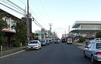 David street view
_-_Route_Panam%C3%A9ricaine.JPG)

Location and geography

David is located in a basin in south central
The city has little geographic variations within its boundaries. The main geographic landmarks in David are “Cerro San Cristobal” and “Cerro Pedregal”, located in the southern area of the city, in the Pedregal area. Mounts “Cerro Santa Cruz” and the “Pico de Loro” (literally: “Parrot’s Peak”) Sierra surround the north of David, being located in the San Carlos Area.
David's northeast region is surrounded by the Manjagua and David rivers, dividing David from the residential “Las Lomas” area. There are also smaller rivers running in a southernly direction and feeding the Pedregal estuary, which surrounds Pedregal and reaches its delta near the grounds of the Enrique Malek International Airport.
The ocean coast close to David is in part covered by extensive beaches and mangroves. The city's main port, Pedregal, is located in the south end of the city, near the mangrove-filled region. The port is closely connected by land to the city's airport. This port is the docking site for small private vessels and yachts owned by David's residents, and also serves as an attraction for fishers. It is also the departing place for tours that go to the numerous islands of the Chiriquí Gulf and the base of operations of many handicraft vendors.
The city is the seat of the Roman Catholic Diocese of David.
Climate
The city has one of the hottest climates in the Central American region, but the temperatures drop sharply near the outskirts. David's climate is classified as a tropical monsoon climate (Köppen Am) with a short, sweltering, dry season from mid-December to mid-April and a long, oppressive and hot wet season from mid-April to mid-December.
| Climate data for David, Chiriquí | |||||||||||||
|---|---|---|---|---|---|---|---|---|---|---|---|---|---|
| Month | Jan | Feb | Mar | Apr | May | Jun | Jul | Aug | Sep | Oct | Nov | Dec | Year |
| Mean daily maximum °C (°F) | 32.2 (90.0) |
33.3 (91.9) |
33.9 (93.0) |
33.3 (91.9) |
31.7 (89.1) |
31.1 (88.0) |
30.6 (87.1) |
30.6 (87.1) |
30.6 (87.1) |
30.0 (86.0) |
30.0 (86.0) |
31.1 (88.0) |
31.5 (88.7) |
| Mean daily minimum °C (°F) | 21.7 (71.1) |
22.2 (72.0) |
22.8 (73.0) |
23.3 (73.9) |
23.3 (73.9) |
23.3 (73.9) |
23.3 (73.9) |
22.8 (73.0) |
22.8 (73.0) |
22.8 (73.0) |
22.8 (73.0) |
22.2 (72.0) |
22.8 (73.0) |
| Average rainfall mm (inches) | 33.3 (1.31) |
19.3 (0.76) |
35.5 (1.40) |
102.5 (4.04) |
297.0 (11.69) |
322.6 (12.70) |
289.8 (11.41) |
340.3 (13.40) |
406.6 (16.01) |
400.5 (15.77) |
295.4 (11.63) |
77.4 (3.05) |
2,620.2 (103.17) |
| Average relative humidity (%)
|
67.7 | 62.6 | 62.4 | 69.6 | 79.5 | 81.1 | 80.4 | 81.1 | 82.1 | 83.8 | 82.8 | 75.5 | 75.7 |
| Mean monthly sunshine hours | 275.5 | 262.0 | 270.5 | 216.2 | 160.4 | 128.3 | 141.1 | 148.6 | 135.4 | 139.5 | 154.5 | 218.7 | 2,250.7 |
| Source 1: World Meteorological Organisation (UN) (30 yr record),[3]
| |||||||||||||
| Source 2: ETESA (humidity and sun values)[4] | |||||||||||||
Layout

Central David is mostly laid out in a grid with numbered streets; however, the streets on the outskirts of town are neither named nor numbered. David's population density is rather low, as most people live in detached single-family homes. Most buildings in town, including those in the central business district, are only one or two stories high. Only a few hotels, banks, casinos, and apartment buildings reach a height of two to five stories.
Most
David offers many lodging options. As Chiriquí province continues to gain popularity as a tourist destination, more hotels are being built to accommodate all budget ranges. Hotels in the city present the visitor with a wide variety of amenities and variety of prices. The hotels are located in the city center, near the banking and business district so they have the most central location of the city. Many backpackers and budget travelers have recently discovered David. There are two main backpacker hostels: Bambu Hostel and Purple House. The area is also home to the Miguel de Cervantes Saavedra Park. The central location makes the base from which Chiriqui's main chains and companies operate and serves as the headquarters and banking center of many banks in the province.
The Miguel de Cervantes Saavedra Park is located in the middle of the city. This new park works as a rest stop for visitors and locals traversing the city. It is known for offering shade from the city's usual sunny weather under its trees. It is the place of business for some ice cream, handicraft and lottery vendors, and is surrounded by banks, hotels and many shops.
Notable residents
- José Luis Lacunza Maestrojuán - Cardinal of Panama
- Carlos Ruiz - Baseball player, Philadelphia Phillies[5]
- Rosa Montezuma - fashion model and Señorita Panamá 2018
References
- ^ "Archived copy" (PDF). Archived from the original (PDF) on 2012-04-26. Retrieved 2011-12-02.
{{cite web}}: CS1 maint: archived copy as title (link) - ^ http://www.prensa.com/impreso/nacionales/economia-informal-no-baja-en-chiriqui-pero-resuelve/141379 [dead link]
- ^ "World Weather Information Service – David". World Meteorological Organization. Archived from the original on October 28, 2012. Retrieved October 9, 2012.
- ^ "Datos Historicos- Hidrometeorologica de ETESA". ETESA. Archived from the original on October 9, 2012. Retrieved October 9, 2012.
- ^ "Carlos Ruiz Stats, Height, Weight, Position, Rookie Status & More". Baseball-Reference.com. Retrieved 2022-09-19.
| International | |
|---|---|
| National | |
| Other | |