
Dawson Springs, Kentucky
Dawson Springs, Kentucky | ||
|---|---|---|
FIPS code 21-20224 | | |
| GNIS ID | 490696 | |
| Website | dawsonspringsky | |
Dawson Springs is a
History
Originally known as Tradewater Bend, the city was incorporated in 1832 under the name Dawson City by two Menser brothers.
From the late 1800s to the 1930s, Dawson Springs was well known as a spa and resort town. Visitors largely came in spring from Chicago, Louisville and points east for the curative waters, and several major hotels and boarding houses were constructed. Tourism peaked in 1901 when over 50,000 visitors came to the town of a few thousand people. The
Outwood Veterans Hospital was constructed here in 1922,
Dawson Springs is still a regional tourist destination because of the Pennyrile Forest State Resort Park, which began construction where a local river was dammed and a lake formed in the 1930s. The town was named Kentucky's first Trail Town due to hiking and horse riding trails in the area.
2021 tornado
In the late hours of December 10, 2021, a large swath of the city was destroyed by an EF4 tornado, and a tornado emergency was issued for Dawson Springs and the surrounding St. Charles as the storm moved through the area. As a result, 19 people died.[7][8]
Geography
Dawson Springs is located in southwestern Hopkins County at 37°10′18″N 87°41′21″W / 37.17167°N 87.68917°W (37.171799, -87.689190).[9] Its southern and western border is the Tradewater River, which is also the Hopkins/Caldwell County line. A small portion of Dawson Springs extends across the river into Caldwell County.
According to the United States Census Bureau, the city has a total area of 3.8 square miles (9.8 km2), of which 3.7 square miles (9.5 km2) is land and 0.077 square miles (0.2 km2), or 2.16%, is water.[10]
Climate
The climate in this area is characterized by hot, humid summers and generally mild to cool winters. According to the
Demographics
| Census | Pop. | Note | %± |
|---|---|---|---|
| 1890 | 525 | — | |
| 1900 | 935 | 78.1% | |
| 1910 | 1,350 | 44.4% | |
| 1920 | 1,762 | 30.5% | |
| 1930 | 2,311 | 31.2% | |
| 1940 | 2,560 | 10.8% | |
| 1950 | 2,374 | −7.3% | |
| 1960 | 3,002 | 26.5% | |
| 1970 | 3,009 | 0.2% | |
| 1980 | 3,275 | 8.8% | |
| 1990 | 3,129 | −4.5% | |
| 2000 | 2,980 | −4.8% | |
| 2010 | 2,764 | −7.2% | |
| 2020 | 2,452 | −11.3% | |
| 2022 (est.) | 2,420 | [12] | −1.3% |
| U.S. Decennial Census | |||
As of the
There were 1,214 households, of which 28.9% had children under the age of 18 living with them, 48.4% were married couples living together, 14.8% had a female householder with no husband present, and 34.0% were non-families. 31.2% of all households were made up of individuals, and 17.1% had someone living alone who was 65 years of age or older. The average household size was 2.31 and the average family size was 2.90.
In the city, the population was spread out, with 23.1% under the age of 18, 8.4% from 18 to 24, 25.4% from 25 to 44, 21.1% from 45 to 64, and 22.0% who were 65 years of age or older. The median age was 40 years. For every 100 females, there were 84.3 males. For every 100 females age 18 and over, there were 78.7 males.
The median income for a household in the city was $22,670, and the median income for a family was $27,872. Males had a median income of $29,545 versus $18,875 for females. The
Education
Dawson Springs has a lending library, a branch of the Hopkins County-Madisonville Public Library.[14] Dawson Springs also rejected the countywide school consolidation of the 1970s and maintains its own K-12 school district, which is now the town's main employer.
Notable people
- Steve Beshear, 61st Governor of Kentucky
- Scott Jennings, political strategist
- Mila Mason, country music artist
- Dottie Rambo, gospel music artist
References
- ^ "Subcounty population estimates: Kentucky 2000-2008" (CSV). United States Census Bureau, Population Division. March 18, 2009. Retrieved April 4, 2009.
- ^ "2020 U.S. Gazetteer Files". United States Census Bureau. Retrieved March 18, 2022.
- ^ "Annual Estimates of the Resident Population for Incorporated Places in Kentucky: April 1, 2020 to July 1, 2022". United States Census Bureau. Retrieved May 26, 2023.
- ^ "Summary and Reference Guide to House Bill 331 City Classification Reform" (PDF). Kentucky League of Cities. Retrieved December 30, 2014.
- ^ "Profile of Dawson Springs, Kansas in 2020". United States Census Bureau. Archived from the original on December 13, 2021. Retrieved December 13, 2021.
- ^ Outwood Veterans Hospital, Dawson Springs, Kentucky, 1922., accessed February 2018.
- ^ Settle, Jimmy. "'The whole place was gone': Dawson Springs works to come to grips with tornado's wrath". The Courier-Journal.
- ^ 13 dead, more than 100 unaccounted for after tornado rips through Dawson Springs, Ky., accessed December 12th, 2021.
- ^ "US Gazetteer files: 2010, 2000, and 1990". United States Census Bureau. February 12, 2011. Retrieved April 23, 2011.
- ^ "Geographic Identifiers: 2010 Demographic Profile Data (G001): Dawson Springs city, Kentucky". U.S. Census Bureau, American Factfinder. Archived from the original on February 12, 2020. Retrieved August 5, 2014.
- ^ "Dawson Springs, Kentucky Köppen Climate Classification (Weatherbase)". Weatherbase.
- ^ "Annual Estimates of the Resident Population for Incorporated Places in Kentucky: April 1, 2020 to July 1, 2022". United States Census Bureau. Retrieved May 26, 2023.
- ^ "U.S. Census website". United States Census Bureau. Retrieved January 31, 2008.
- ^ "Kentucky Public Library Directory". Kentucky Department for Libraries and Archives. Archived from the original on January 11, 2019. Retrieved June 5, 2019.
External links
Municipalities and communities of Caldwell County, Kentucky, United States | ||
|---|---|---|
| Cities |  | |
| Unincorporated communities | ||
| Footnotes | ‡This populated place also has portions in an adjacent county or counties | |
| ||
Municipalities and communities of Hopkins County, Kentucky, United States | ||
|---|---|---|
| Cities | 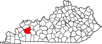 | |
| CDP | ||
| Other unincorporated communities | ||
| Footnotes | ‡This populated place also has portions in an adjacent county or counties | |
| ||
| International | |
|---|---|
| National | |