
DeLisle, Mississippi
DeLisle, Mississippi | ||
|---|---|---|
FIPS code 28-18420 | | |
DeLisle (
Geography
DeLisle is located at 30°22′44″N 89°16′5″W / 30.37889°N 89.26806°W.[3] It is located on the north side of DeLisle Bayou and the Wolf River, which separate the community from the city of Pass Christian.
According to the United States Census Bureau, the CDP has a total area of 5.3 square miles (13.8 km2), of which 5.2 square miles (13.5 km2) is land and 0.12 square miles (0.3 km2), or 2.13%, is water.[4]
Settlement
A post office operated under the name DeLisle from 1884 to 1974.[6]
DuPont opened a titanium dioxide plant in DeLisle in 1979. This plant, now operated by Chemours, is the second-largest producer of titanium dioxide in the world.[7]
Demographics
| Census | Pop. | Note | %± |
|---|---|---|---|
| 2020 | 1,275 | — | |
| U.S. Decennial Census[8] | |||
2020 census
| Race | Num. | Perc. |
|---|---|---|
White (non-Hispanic)
|
690 | 54.12% |
Black or African American (non-Hispanic)
|
478 | 37.49% |
Native American
|
5 | 0.39% |
Asian
|
7 | 0.55% |
Other/Mixed
|
60 | 4.71% |
Latino
|
35 | 2.75% |
As of the 2020 United States census, there were 1,275 people, 440 households, and 304 families residing in the CDP.
Notable people
- Beulah Mae Donald, Civil Rights activist
- Matteo Martinolich, shipbuilder
- Jesmyn Ward, author; recipient of the 2011 and the 2017 National Book Awards for Fiction.[10]
References
- ^ "2020 U.S. Gazetteer Files". United States Census Bureau. Retrieved July 24, 2022.
- ^ "Profile of General Population and Housing Characteristics: 2010 Demographic Profile Data (DP-1): DeLisle CDP, Mississippi". United States Census Bureau. Retrieved May 16, 2012.
- ^ U.S. Geological Survey 7.5-minute topographic map series
- ^ "Geographic Identifiers: 2010 Demographic Profile Data (G001): DeLisle CDP, Mississippi". United States Census Bureau. Retrieved May 16, 2012.
- ^ "DeLisle". delisle.passchristian.net. Archived from the original on July 9, 2004. Retrieved April 12, 2021.
- ^ "Harrison County". Jim Forte Postal History. Retrieved March 14, 2021.
- ^ "Draft Community Plan for DeLisle" (PDF). Harrison County, Mississippi. Harrison County, Mississippi. Archived from the original (PDF) on November 4, 2021. Retrieved March 14, 2021.
- ^ "Census of Population and Housing". Census.gov. Retrieved June 4, 2016.
- ^ "Explore Census Data". data.census.gov. Retrieved December 16, 2021.
- ^ Jones, Tayari (September 13, 2013). "In Their Prime". New York Times.
Municipalities and communities of Harrison County, Mississippi, United States | ||
|---|---|---|
| Cities | 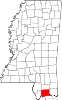 | |
| CDPs | ||
| Unincorporated communities | ||
| ||